|
Golenzizi
The Golensizi ( pl, Golęszycy, Gołęszycy, Golęszyce, Gołęszyce, Gołężyce, cz, Holasici, german: Golensizen) were a tribe of West Slavs, specifically of the Lechitic tribes (one of the Silesian tribes), living in the Early Middle Ages and inhabiting southern territories of what was later known as Upper Silesia, on the upper Oder River. The area was settled by Slavs after it was abandoned by the Germanic tribes between the 5th and 6th century. Later the organised tribe of Golensizi according to Bavarian Geographer had 5 ''civitates'' (strongholds). Among them most notable were located in Lubomia (the biggest), Chotěbuz and Hradec nad Moravicí which was in 1155 mentioned as ''Gradice Golenzicezke''. Some of them were most probably destroyed at the end of 9th century by Svatopluk I, the king of Great Moravia. The settlement from the destroyed Chotěbuz moved to Castle Hill (Góra Zamkowa) in what is today a city of Cieszyn. Some historians claim that the area was then ruled ... [...More Info...] [...Related Items...] OR: [Wikipedia] [Google] [Baidu] |
Silesian Tribes
The Silesian tribes ( pl, plemiona śląskie) is a term used to refer to tribes, or groups of West Slavs that lived in the territories of Silesia in the Early Middle Ages. The territory they lived on became part of Great Moravia in 875 (now mostly in the Czech Republic) and later, in 990, the first Polish state created by duke Mieszko I and then expanded by king Boleslaw I at the beginning of the 11th century. They are usually treated as part of the Polish tribes and sometimes as part of the Germanic tribes. Two tribes among them are sometimes considered as Czech (Moravian) tribes. History Before and during the migration period the territory of south west Poland - Silesia - was inhabited by various peoples. It included Celts and probably some Germanic tribes - among them - the Silingi. Tacitus in his description of Magna Germania mentions Suevi: Marsigni, Osi, Gotini, Buri in what later became Silesia and Burgundiones and Lygii at the Vistula. However, during the migration perio ... [...More Info...] [...Related Items...] OR: [Wikipedia] [Google] [Baidu] |
Svatopluk I
Svatopluk I or Svätopluk I, also known as Svatopluk the Great (Latin: ''Zuentepulc'', ''Zuentibald'', ''Sventopulch'', ''Zvataplug''; Old Church Slavic: Свѧтопълкъ and transliterated ''Svętopъłkъ''; Polish: ''Świętopełk''; Greek: Σφενδοπλόκος, ''Sphendoplókos''), was a ruler of Great Moravia, which attained its maximum territorial expansion during his reign (870–871, 871–894). Svatopluk's career started in the 860s, when he governed a principality within Moravia, the location of which is still a matter of debate among historians, under the suzerainty of his uncle, Rastislav of Moravia, Rastislav. In 870 Svatopluk dethroned Rastislav of Moravia, Rastislav, who was a vassal of Louis the German, and betrayed him to the Franks. Within a year, however, the Franks also imprisoned Svatopluk. After the Moravians rebelled against the Franks, Svatopluk was released and led the rebels to victory over the invaders. Although he was obliged to pay tribu ... [...More Info...] [...Related Items...] OR: [Wikipedia] [Google] [Baidu] |
Racibórz
Racibórz (german: Ratibor, cz, Ratiboř, szl, Racibōrz) is a city in Silesian Voivodeship in southern Poland. It is the administrative seat of Racibórz County. With Opole, Racibórz is one of the historic capitals of Upper Silesia, being the residence of the Dukes of Racibórz from 1172 to 1521. Geography The city is situated in the southwest of the voivodeship on the upper Oder river, near the border with the Polish Opole Voivodeship and the Czech Republic. The Racibórz Basin (''Kotlina Raciborska'') forms the southeastern extension of the Silesian Lowlands, surrounded by the Opawskie Mountains in the west (part of the Eastern Sudetes), the Silesian Upland in the north, and the Moravian Gate in the south. The town centre is located about southwest of Katowice and about southeast of the regional capital Wrocław. As of 2019, the city has a population of approximately 55,000 inhabitants. From 1975 to 1998, it belonged to Katowice Voivodeship. History Until the end of t ... [...More Info...] [...Related Items...] OR: [Wikipedia] [Google] [Baidu] |
Castellany
A castellan is the title used in Medieval Europe for an appointed official, a governor of a castle and its surrounding territory referred to as the castellany. The title of ''governor'' is retained in the English prison system, as a remnant of the medieval idea of the castellan as head of the local prison. The word stems from the Latin ''Castellanus'', derived from ''castellum'' "castle". Sometimes also known as a ''constable'' of the castle district, the Constable of the Tower of London is, in fact, a form of castellan, with representative powers in the local or national assembly. A castellan was almost always male, but could occasionally be female, as when, in 1194, Beatrice of Bourbourg inherited her father's castellany of Bourbourg upon the death of her brother, Roger. Similarly, Agnes became the castellan of Harlech Castle upon the death of her husband John de Bonvillars in 1287. Initial functions After the fall of the Western Roman Empire, foreign tribes migrated into w ... [...More Info...] [...Related Items...] OR: [Wikipedia] [Google] [Baidu] |
Opava
Opava (; german: Troppau, pl, Opawa) is a city in the Moravian-Silesian Region of the Czech Republic. It has about 55,000 inhabitants. It lies on the river Opava (river), Opava. Opava is one of the historical centres of Silesia. It was a historical capital of Czech Silesia. Administrative division Opava is made up of eight self-governing boroughs in the suburbs, and of central part which is administered directly. The city is further divided into 14 administrative parts (in brackets): *''Opava'' (Město, Předměstí (larger part), Kateřinky, Kylešovice and Jaktař (larger part)) *Komárov *Malé Hoštice *Milostovice *Podvihov (Komárovské Chaloupky and Podvihov) *Suché Lazce *Vávrovice (Vávrovice, Předměstí (smaller part) and Jaktař (smaller part)) *Vlaštovičky *Zlatníky Geography Opava is situated about northwest of Ostrava. Most of its territory is located in the Głubczyce Plateau, Opava Hilly Land within the Silesian Lowlands, but it also extends to the Nízk ... [...More Info...] [...Related Items...] OR: [Wikipedia] [Google] [Baidu] |
Treaty Of Kłodzko
A treaty is a formal, legally binding written agreement between actors in international law. It is usually made by and between sovereign states, but can include international organizations, individuals, business entities, and other legal persons. A treaty may also be known as an international agreement, protocol, covenant, convention, pact, or exchange of letters, among other terms. However, only documents that are legally binding on the parties are considered treaties under international law. Treaties vary on the basis of obligations (the extent to which states are bound to the rules), precision (the extent to which the rules are unambiguous), and delegation (the extent to which third parties have authority to interpret, apply and make rules). Treaties are among the earliest manifestations of international relations, with the first known example being a border agreement between the Sumerian city-states of Lagash and Umma around 3100 BC. International agreements were used in so ... [...More Info...] [...Related Items...] OR: [Wikipedia] [Google] [Baidu] |
Mieszko I Of Poland
Mieszko I (; – 25 May 992) was the first ruler of Poland and the founder of the first independent Polish state, the Duchy of Poland. His reign stretched from 960 to his death and he was a member of the Piast dynasty, a son of Siemomysł and a grandson of Lestek. He was the father of Bolesław I the Brave (the first crowned king of Poland) and of Gunhild of Wenden. Most sources identify Mieszko I as the father of Sigrid the Haughty, a Scandinavian queen (though one source identifies her father as Skoglar Toste), the grandfather of Canute the Great (Gundhild's son) and the great-grandfather of Gunhilda of Denmark, Canute the Great's daughter and wife of Henry III, Holy Roman Emperor. He was the first Christian ruler of Poland, but he continued the policies of both his father and grandfather, who initiated the process of creation of the Polish state. Through both alliances and military force, Mieszko extended ongoing Polish conquests and early in his reign subjugated Kuyavia ... [...More Info...] [...Related Items...] OR: [Wikipedia] [Google] [Baidu] |
Cieszyn
Cieszyn ( , ; cs, Těšín ; german: Teschen; la, Tessin; szl, Ćeszyn) is a border town in southern Poland on the east bank of the Olza River, and the administrative seat of Cieszyn County, Silesian Voivodeship. The town has 33,500 inhabitants (as of December 2021), and lies opposite Český Těšín in the Czech Republic. Both towns belong to the historical region of Cieszyn Silesia, and formerly as one town composed the capital of the Duchy of Cieszyn. Geography The town is situated on the Olza river, a tributary of the Oder River, which forms the border with the Czech Republic. It is located within the western Silesian Foothills north of the Silesian Beskids and Mt. Czantoria Wielka, a popular ski resort. Cieszyn is the heart of the historical region of Cieszyn Silesia, the southeasternmost part of Upper Silesia. Until the end of World War I in 1918 it was a seat of the Dukes of Teschen. In 1920 Cieszyn Silesia was divided between the two newly created states of Poland a ... [...More Info...] [...Related Items...] OR: [Wikipedia] [Google] [Baidu] |
Great Moravia
Great Moravia ( la, Regnum Marahensium; el, Μεγάλη Μοραβία, ''Meghálī Moravía''; cz, Velká Morava ; sk, Veľká Morava ; pl, Wielkie Morawy), or simply Moravia, was the first major state that was predominantly West Slavs, West Slavic to emerge in the area of Central Europe, possibly including territories which are today part of the Czech Republic, Slovakia, Hungary, Austria, Germany, Poland, Romania, Croatia, Serbia and Ukraine. The only formation preceding it in these territories was Samo's Empire, Samo's tribal union known from between 631 and 658 AD. Its core territory is the region now called Moravia in the eastern part of the Czech Republic alongside the Morava (river), Morava River, which gave its name to the kingdom. The kingdom saw the rise of the first ever Slavic literary culture in the Old Church Slavonic language as well as the expansion of Christianity, first via missionaries from East Francia, and later after the arrival of Saints Cyril and Metho ... [...More Info...] [...Related Items...] OR: [Wikipedia] [Google] [Baidu] |
Chotěbuz
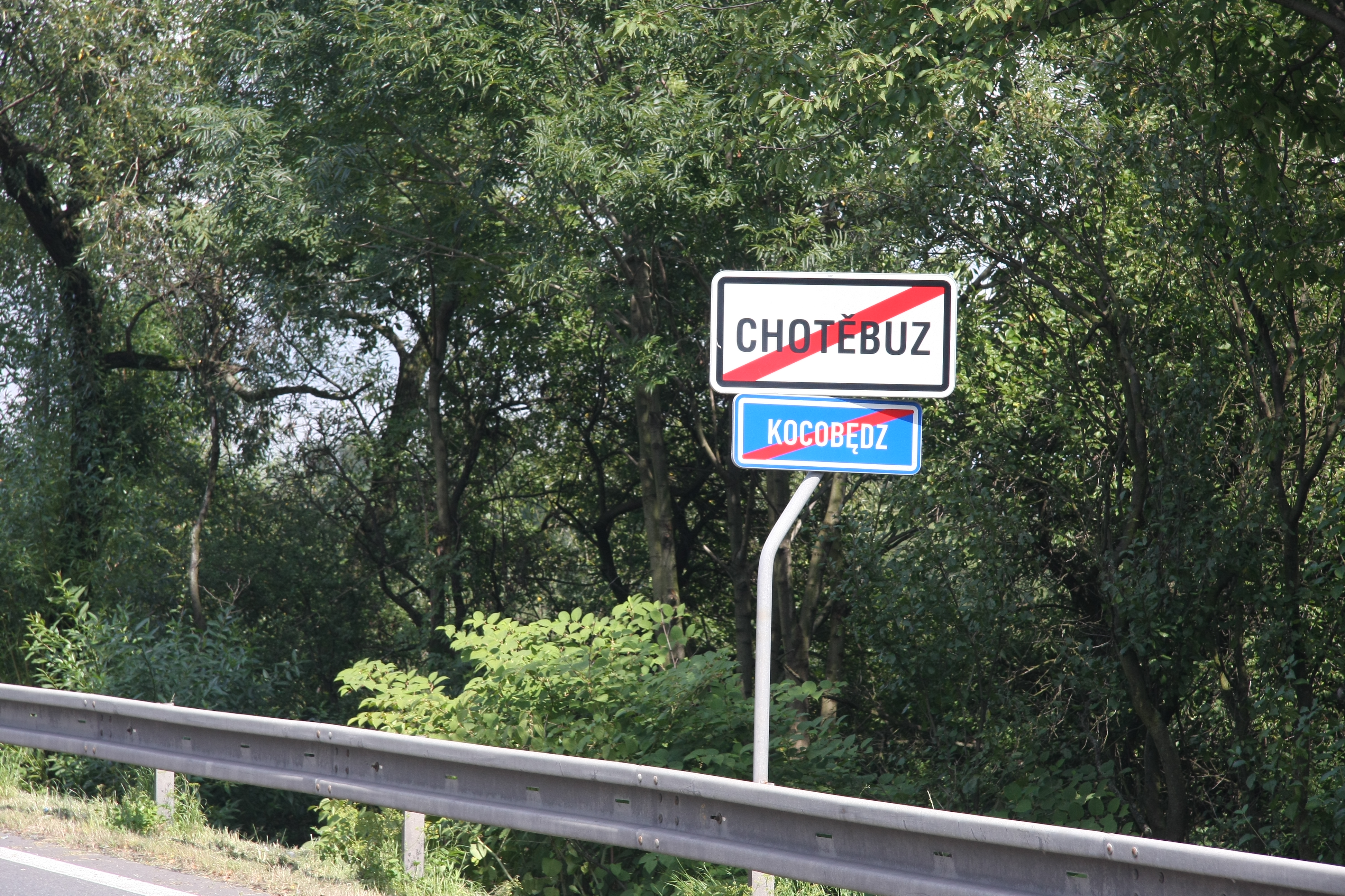
( pl, , german: Kotzobendz) is a municipality and village in the Karviná District in the Moravian-Silesian Region of the Czech Republic. It has about 1,400 inhabitants. Polish minority makes up 17.0% of the population. Etymology The name of Chotěbuz is derived from an old Slavic personal name ''Chotěbud'' in Czech / ''Kocobąd'' or ''Chociebąd'' in Polish. The name originally meant "Chotěbud's castle". Geography Chotěbuz lies on the border with Poland in the historical region of Cieszyn Silesia. It is located on the left bank of the Olza River. The highest point of the municipality is the hill Potůčky with an elevation of . History Chotěbuz is one of the oldest villages in Cieszyn Silesia. There was a Slavic fortified settlement ('' gord''). It was an important centre since the 8th century. At the beginning of the 11th century, people abandoned the gord and founded a new castle and town on a promontory above the Olza, known as Cieszyn. Near the old place a new settle ... [...More Info...] [...Related Items...] OR: [Wikipedia] [Google] [Baidu] |
Hradec Nad Moravicí
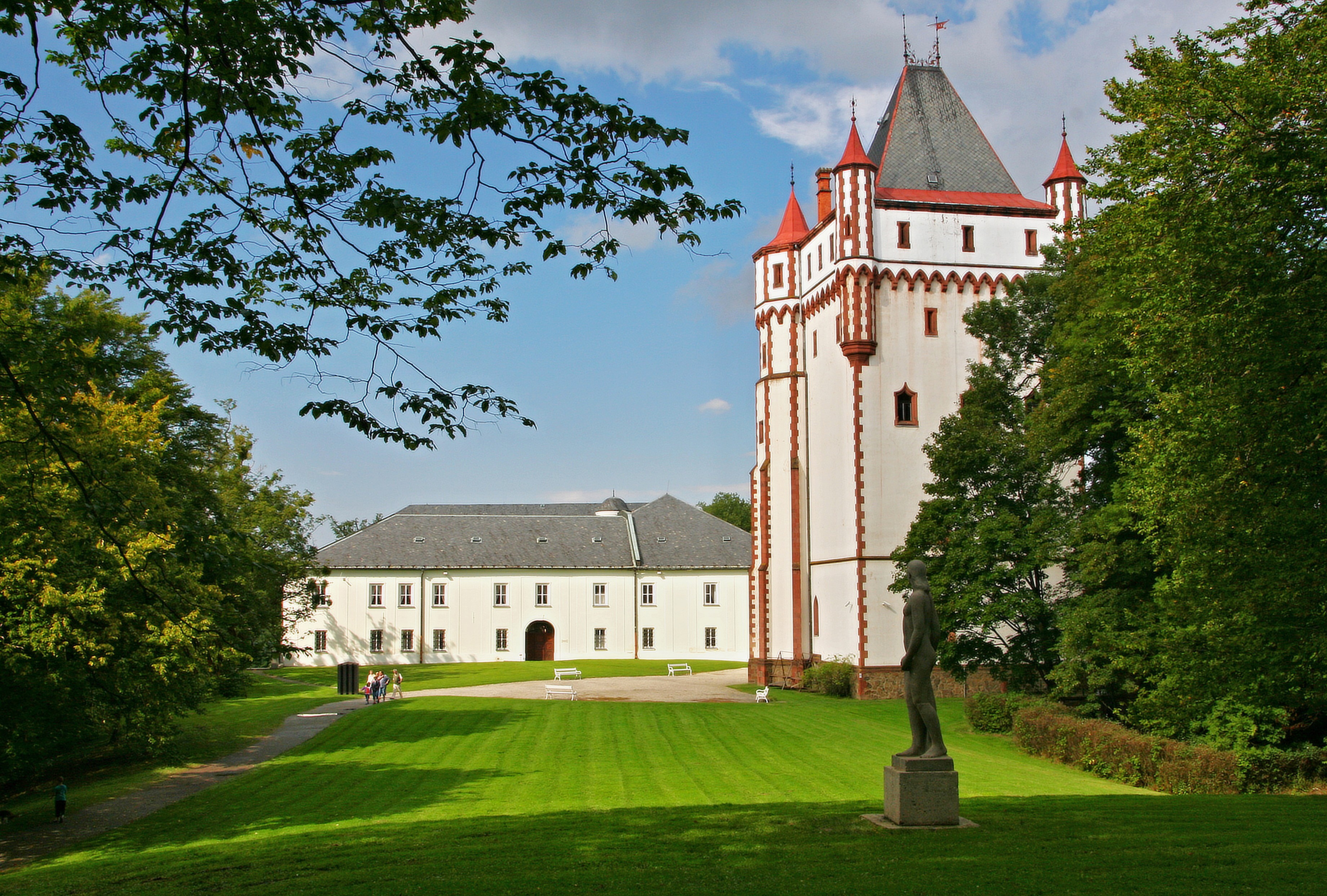
Hradec nad Moravicí (; german: Grätz) is a town in Opava District in the Moravian-Silesian Region of the Czech Republic. It has about 5,400 inhabitants. The historic town centre with the castle complex is well preserved and is protected by law as an urban monument zone. Administrative parts Villages of Benkovice, Bohučovice, Domoradovice, Filipovice, Jakubčovice, Kajlovec and Žimrovice are administrative parts of Hradec nad Moravicí. Geography Hradec nad Moravicí lies about south of Opava. It is located on the Moravice River in the Nízký Jeseník mountain range. The highest point of the municipal territory is Šance at . History The area around Hradec nad Moravicí was first settled approximately in 3000 BC. A gord was built in the 8th century. The first written mention of Hradec and the local fortress is from 1060, when Bolesław II the Generous' army was defeated here. After the fortress was damaged by fire in the mid-13th century, King Ottokar II of Bohemia had r ... [...More Info...] [...Related Items...] OR: [Wikipedia] [Google] [Baidu] |


