|
Gloucestershire Victoria County History
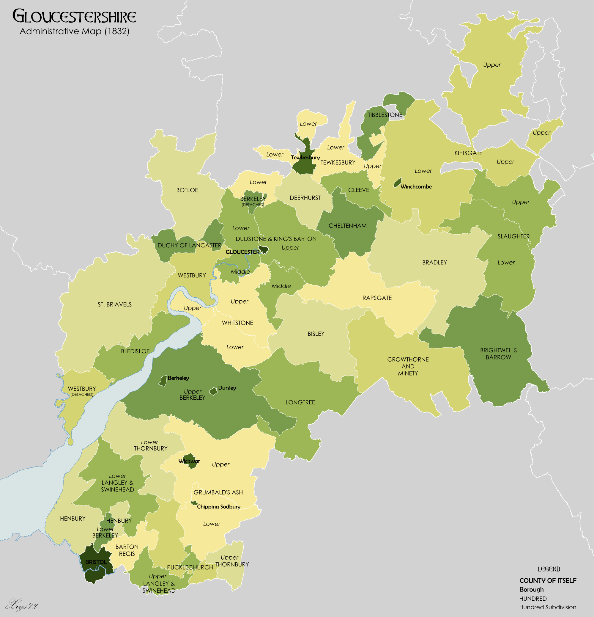
''Gloucestershire Victoria County History'' is an encyclopaedic history of the county of Gloucestershire in England. It forms part of the overall Victoria County History of England founded in 1899 in honour of Queen Victoria. With twelve volumes published in the series ''A History of the County of Gloucestershire'', the Gloucestershire Victoria County History is about halfway through its history of all the parishes in the county. Ten volumes have been published to date, and a further four volumes are in preparation. Overview The project is promoted by the Gloucestershire County History Trust, which was established in April 2010 to lead the publication of further volumes following the termination of a tripartite partnership with the University of Gloucestershire and Gloucestershire County Council. Work is overseen, and volumes published, by the Institute of Historical Research of the University of London. The then chairman of the Gloucestershire County History Trust, Sir Nichol ... [...More Info...] [...Related Items...] OR: [Wikipedia] [Google] [Baidu] |
Victoria County History (shield)
The Victoria History of the Counties of England, commonly known as the Victoria County History or the VCH, is an English history project which began in 1899 with the aim of creating an encyclopaedic history of each of the historic counties of England, and was dedicated to Queen Victoria. In 2012 the project was rededicated to Queen Elizabeth II in celebration of her Diamond Jubilee year. Since 1933 the project has been coordinated by the Institute of Historical Research in the University of London. History The history of the VCH falls into three main phases, defined by different funding regimes: an early phase, 1899–1914, when the project was conceived as a commercial enterprise, and progress was rapid; a second more desultory phase, 1914–1947, when relatively little progress was made; and the third phase beginning in 1947, when, under the auspices of the Institute of Historical Research, a high academic standard was set, and progress has been slow but reasonably steady. T ... [...More Info...] [...Related Items...] OR: [Wikipedia] [Google] [Baidu] |
Bledisloe Hundred
Bledisloe was an ancient hundred of Gloucestershire, England. It comprised the ancient parishes of * Alvington *Awre *Lydney The hundred was named after the hamlet of Bledisloe, once a tithing of the parish of Awre and now a hamlet north of Lydney on the A48 road, where the hundred met. The meeting place was a mound known as Bledisloe Tump. At the time of the Domesday Book the hundred included Awre manor, Bledisloe, Etloe, Purton and Nass. Alvington (previously a detached part of Herefordshire Herefordshire () is a county in the West Midlands of England, governed by Herefordshire Council. It is bordered by Shropshire to the north, Worcestershire to the east, Gloucestershire to the south-east, and the Welsh counties of Monmouthsh ...) and Lydney joined the hundred by 1221. References External links The National Gazetteer of Great Britain and Ireland (1868){{Hundreds of Gloucestershire Hundreds of Gloucestershire Forest of Dean ... [...More Info...] [...Related Items...] OR: [Wikipedia] [Google] [Baidu] |
Westbury-on-Severn
Westbury-on-Severn is a rural village in England that is the centre of the large, rural parish, also called Westbury-on-Severn. Location The village is situated on the A48 road (between Minsterworth and Newnham on Severn) and bounded by the River Severn to the south and west. Westbury is also bounded to the West by the Newport to Gloucester railway line, although Westbury does not have a railway station, the closest stations being Gloucester and Lydney. Westbury is just over a mile long and has one only housing estate to the south of the main A48 road which was constructed in the 1980s. The village also has a primary school, post office cum village store, a pub "The Lyon" and dentist surgery. Geoff Sterry, a coal and solid fuel merchant, is also based in the village. Westbury falls within the District of the Forest of Dean although the forest itself does not extend to the village. The village has a large parish church, which is distinctive, as the steeple is not attached t ... [...More Info...] [...Related Items...] OR: [Wikipedia] [Google] [Baidu] |
Northleach
Northleach is a market town and former civil parish, now in parish Northleach with Eastington, in the Cotswold district, in Gloucestershire, England. The town is in the valley of the River Leach in the Cotswolds, about northeast of Cirencester and east-southeast of Cheltenham. The 2011 Census recorded the parish's population as 1,854, the same as Northleach built-up-area. Manor Northleach seems to have existed by about AD 780, when one Ethelmund son of Ingold granted 35 '' tributarii'' of land to Gloucester Abbey. The abbey later granted estates including Northleach to Ealdred, Bishop of Worcester, probably in about 1058 when he had the abbey church rebuilt. In 1060, Ealdred was translated to York, taking the lordship of Northleach with him. The Domesday Book of 1086 assessed the manor of Northleach at 37 hides. In 1095 a later Archbishop of York, Thomas of Bayeux, restored manors including Northleach to Gloucester Abbey. His successors disputed this until 1157, when the cl ... [...More Info...] [...Related Items...] OR: [Wikipedia] [Google] [Baidu] |
Bradley, Gloucestershire
Bradley is a small village in the Stroud District, in the county of Gloucestershire, England. Also part of the village is the hamlet of Bradley Green, with its eponymous area of common land, still used for agriculture today. Buildings of note include the Grade II listed Bradley Court, once owned by the Berkeleys of Berkeley Castle and various former weavers' cottages which front on to Bradley Green itself. Within sight are Swinhay House, Wotton Hill and the Tyndale Monument. Nearby settlements include the town of Wotton-under-Edge, the villages of Kingswood, North Nibley and Charfield, and the hamlets of Howley, Southend and Bournstream. For transport there is the B4060 road, the B4062 road, the B4058 road and the M5 motorway The M5 is a motorway in England linking the Midlands with the South West England, South West. It runs from junction 8 of the M6 motorway, M6 at West Bromwich near Birmingham to Exeter in Devon. Heading south-west, the M5 runs east of West Brom . ... [...More Info...] [...Related Items...] OR: [Wikipedia] [Google] [Baidu] |
Deerhurst
Deerhurst is a village and civil parish in Gloucestershire, England, about southwest of Tewkesbury. The village is on the east bank of the River Severn. The parish includes the village of Apperley and the hamlet of Deerhurst Walton. The 2011 Census recorded the parish's population as 906, the majority of whom live in Apperley. The place-name is derived from Old English and means "deer-wood". It was spelt ''Deorhyrst'' in AD 804, ''Dorhirst'' in about 1050 and ''Derherste'' in the Domesday Book in 1086. Geography The parish has an area of about , bounded by the Severn to the west, the A38 road to the east and Coombe Hill Canal to the south. The parish is low-lying and much of it is repeatedly flooded. After serious flooding in 1947 several cottages were abandoned and demolished. Deerhurst was inundated again by the floods of 2007. Priory and parish church By AD 804 there was a Benedictine monastery at Deerhurst, which also held the manor. In about 1060 King Edward the Con ... [...More Info...] [...Related Items...] OR: [Wikipedia] [Google] [Baidu] |
Bishop's Cleeve
Bishop's Cleeve is a large village and civil parish in the Borough of Tewkesbury in the ceremonial county of Gloucestershire, England. Cheltenham. The village lies at the foot of Cleeve Hill, the highest point in the Cotswolds. Bishop's Cleeve had a population of 10,612 in 2011, which has increased to 14,068 in the 2021 Census. The village is located from London, from Gloucester, from Birmingham and from Oxford. The village is also close to the towns of Cheltenham, Tewkesbury, Stratford-upon-Avon, Evesham and Chipping Norton. Etymology The name ''Cleeve'', first attested in the eighth century as ''Clife'', comes from the dative singular form of the Old English word ''clif'' ('at the cliff, bank, steep hill'). The element 'Bishop's' became attached to the name because the estate was owned by the bishops of Worcester. Railway past Bishop's Cleeve was once served by a railway line, a relative latecomer in British railway history, opened on 1 June 1906 by the Great Weste ... [...More Info...] [...Related Items...] OR: [Wikipedia] [Google] [Baidu] |
Stow-on-the-Wold
Stow-on-the-Wold is a market town and civil parish in Gloucestershire, England, on top of an 800-foot (244 m) hill at the junction of main roads through the Cotswolds, including the Fosse Way (A429), which is of Roman origin. The town was founded by Norman lords to absorb trade from the roads converging there. Fairs have been held by royal charter since 1330; a horse fair is still held on the edge of town nearest to Oddington in May and October each year. History Origins Stow-on-the-Wold, originally called Stow St Edward or Edwardstow after the town's patron saint Edward, probably Edward the Martyr, is said to have originated as an Iron Age fort on this defensive position on a hill. Indeed, there are many sites of similar forts in the area, and Stone Age and Bronze Age burial mounds are common throughout the area. It is likely that Maugersbury was the primary settlement of the parish before Stow was built as a marketplace on the hilltop nearer to the crossroads, to take advantag ... [...More Info...] [...Related Items...] OR: [Wikipedia] [Google] [Baidu] |
Bourton-on-the-Water
Bourton-on-the-Water is a village and civil parish in Gloucestershire, England, that lies on a wide flat vale within the Cotswolds Area of Outstanding Natural Beauty. The village had a population of 3,296 at the 2011 census. Much of the village centre is a designated Conservation Area. Description Bourton-on-the-Water's high street is flanked by long wide greens and the River Windrush that runs through them. The river is crossed by five low, arched stone bridges. They were built between 1654 and 1953, leading to the nickname of "Venice of the Cotswolds". The village often has more visitors than residents during the peak tourist season. Some 300,000 visitors arrive each year as compared to under 3,500 permanent residents. There are three churches, Our Lady and St Kenelm Roman Catholic Church, Bourton-on-the-Water Baptist Church and St Lawrence, Church of England. The latter is usually open to visitors during the week. It is a Grade II listed building. A part of it was built ... [...More Info...] [...Related Items...] OR: [Wikipedia] [Google] [Baidu] |
Tewkesbury
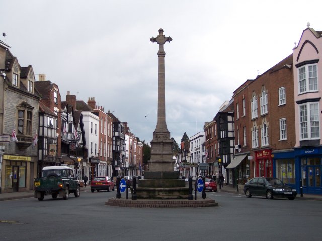
Tewkesbury ( ) is a medieval market town and civil parish in the north of Gloucestershire, England. The town has significant history in the Wars of the Roses and grew since the building of Tewkesbury Abbey. It stands at the confluence of the River Severn and the River Avon, and thus became an important trading point, which continued as railways and later M5 and M50 motorway connections were established. The town gives its name to the Borough of Tewkesbury, due to the earlier governance by the Abbey, yet the town is the second largest settlement in the Borough. The town lies on border with Worcestershire, identified largely by the Carrant Brook (a tributary of the River Avon). The name Tewkesbury is thought to come from Theoc, the name of a Saxon who founded a hermitage there in the 7th century, and in the Old English language was called '. Toulmin Smith L., ed. 1909, ''The Itinerary of John Leland'', London, IV, 150 An erroneous derivation from Theotokos (the Greek title of Ma ... [...More Info...] [...Related Items...] OR: [Wikipedia] [Google] [Baidu] |
Mitcheldean
Mitcheldean is a market town in the Forest of Dean in Gloucestershire, England. History Mitcheldean was a thriving community for many centuries due to the town's proximity to iron ore deposits. During the 19th century, the town grew due to revenues produced by the local brewing industry. Like several of the Forest of Dean villages, Mitcheldean was a close-knit community with individual traditions. One of these was the locally famous (or infamous) Mitcheldean Prize Brass Band. It is vividly remembered and described in a memoir by Arthur Bullock, a resident of nearby Longhope, whose father and brothers were in it. Recounting the band's exploits, he comments, 'I only wish I could have been privileged to hear the Mitcheldean Prize Brass Band play when all of the players were fully sober at the same time'. However, it is indeed sobering to read his further reflection that the band must have been 'killed off by the 1914-18 war'. In the 20th century the town grew further due to the Rank ... [...More Info...] [...Related Items...] OR: [Wikipedia] [Google] [Baidu] |

.jpg)


