|
Glencoe, New Zealand
Glencoe is a locality in the central Southland region of New Zealand's South Island. Named after Glen Coe (or in gd, Gleann Comhan) in Scotland, it is situated in the Hokonui Hills on the route of as it travels between Hedgehope and Waitane. The nearest town of significant size is Mataura to the east, while the city of Invercargill is to the southwest. In February 1999, a cairn was dedicated in Glencoe to commemorate the 1692 Massacre of Glencoe The Massacre of Glencoe ( gd, Murt Ghlinne Comhann) took place in Glen Coe in the Highlands of Scotland on 13 February 1692. An estimated 30 members and associates of Clan MacDonald of Glencoe were killed by Scottish government forces, alleged ....Clan Donald New Zealand "Clan Donald in New Zealand" accessed 3 November 2007. File:Glencoe Monument from Road.jpg File:Glencoe Monument from Roadside.jpg File:Full view of Glencoe Monument.jpg File:Plaques on Glencoe Monument.jpg File:Side view of Glencoe Monument.jpg References ... [...More Info...] [...Related Items...] OR: [Wikipedia] [Google] [Baidu] |
Southland, New Zealand
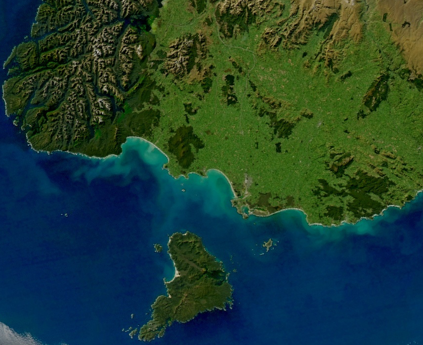
Southland ( mi, Murihiku) is New Zealand's southernmost region. It consists mainly of the southwestern portion of the South Island and Stewart Island/Rakiura. It includes Southland District, Gore District and the city of Invercargill. The region covers over 3.1 million hectares and spans over 3,400 km of coast. History The earliest inhabitants of Murihiku (meaning "the last joint of the tail") were Māori of the Waitaha iwi, followed later by Kāti Māmoe and Kāi Tahu. Waitaha sailed on the Uruao waka, whose captain Rakaihautū named sites and carved out lakes throughout the area. The Takitimu Mountains were formed by the overturned Kāi Tahu waka Tākitimu. Descendants created networks of customary food gathering sites, travelling seasonally as needed, to support permanent and semi-permanent settlements in coastal and inland regions. In later years, the coastline was a scene of early extended contact between Māori and Europeans, in this case sealers, whalers ... [...More Info...] [...Related Items...] OR: [Wikipedia] [Google] [Baidu] |
South Island
The South Island, also officially named , is the larger of the two major islands of New Zealand in surface area, the other being the smaller but more populous North Island. It is bordered to the north by Cook Strait, to the west by the Tasman Sea, and to the south and east by the Pacific Ocean. The South Island covers , making it the world's 12th-largest island. At low altitude, it has an oceanic climate. The South Island is shaped by the Southern Alps which run along it from north to south. They include New Zealand's highest peak, Aoraki / Mount Cook at . The high Kaikōura Ranges lie to the northeast. The east side of the island is home to the Canterbury Plains while the West Coast is famous for its rough coastlines such as Fiordland, a very high proportion of native bush and national parks, and the Fox and Franz Josef Glaciers. The main centres are Christchurch and Dunedin. The economy relies on agriculture and fishing, tourism, and general manufacturing and services. ... [...More Info...] [...Related Items...] OR: [Wikipedia] [Google] [Baidu] |
Glen Coe
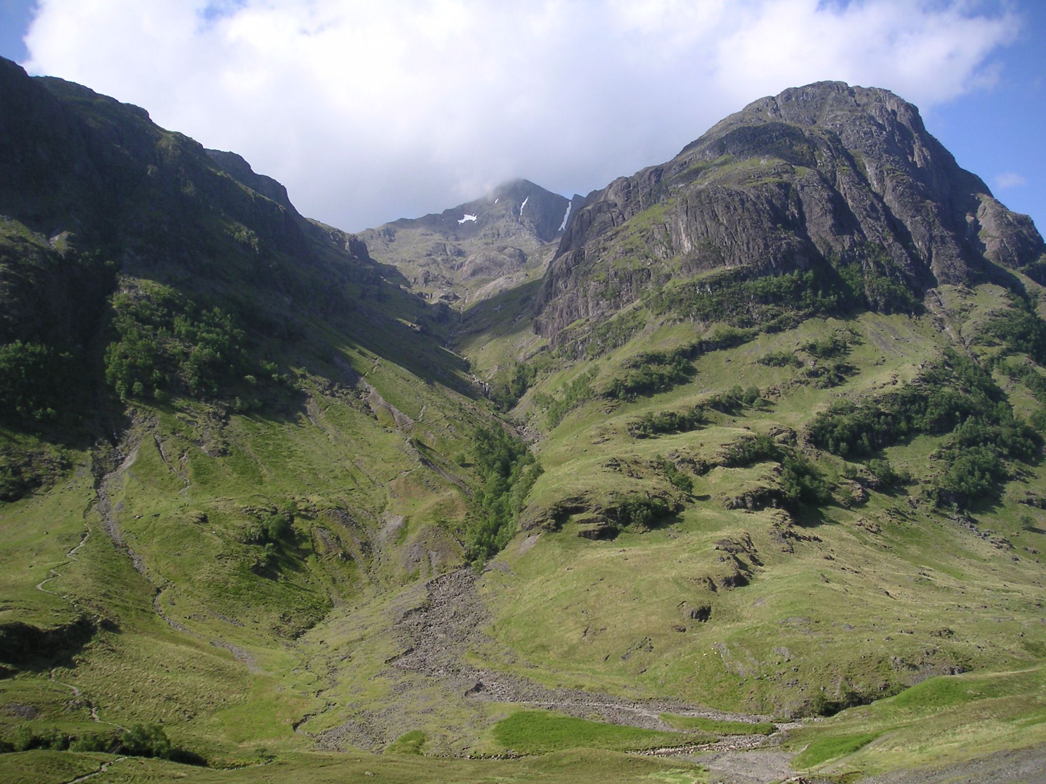
Glen Coe ( gd, Gleann Comhann ) is a glen of volcanic origins, in the Highlands of Scotland. It lies in the north of the county of Argyll, close to the border with the historic province of Lochaber, within the modern council area of Highland. Glen Coe is regarded as the home of Scottish mountaineering and is popular with hillwalkers and climbers. A 2010 review by Scottish Natural Heritage into the special qualities of Scotland's National scenic areas listed the "soaring, dramatic splendour of Glen Coe", and "the suddenness of the transition between high mountain pass and the lightly wooded strath" as being of note. The review also described the journey through the glen on the main A82 road as "one of the classic Highland journeys". The main settlement is the village of Glencoe located at the foot of the glen.Ordnance Survey Landranger 1:50000, Sheet 41 On the 13 February 1692, in the aftermath of the Jacobite uprising of 1689, an incident known as the Massacre of Glenco ... [...More Info...] [...Related Items...] OR: [Wikipedia] [Google] [Baidu] |
Scotland
Scotland (, ) is a country that is part of the United Kingdom. Covering the northern third of the island of Great Britain, mainland Scotland has a border with England to the southeast and is otherwise surrounded by the Atlantic Ocean to the north and west, the North Sea to the northeast and east, and the Irish Sea to the south. It also contains more than 790 islands, principally in the archipelagos of the Hebrides and the Northern Isles. Most of the population, including the capital Edinburgh, is concentrated in the Central Belt—the plain between the Scottish Highlands and the Southern Uplands—in the Scottish Lowlands. Scotland is divided into 32 administrative subdivisions or local authorities, known as council areas. Glasgow City is the largest council area in terms of population, with Highland being the largest in terms of area. Limited self-governing power, covering matters such as education, social services and roads and transportation, is devolved from the Scott ... [...More Info...] [...Related Items...] OR: [Wikipedia] [Google] [Baidu] |
Hokonui Hills
The Hokonui Hills, also known as ''The Hokonui Mountains'' or simply ''The Hokonui'', are a range of hills in central Southland, New Zealand. They rise to 600 metres above the surrounding Southland Plains, of which the hills mark a northern extremity. The Hokonui forms part of the Southland Syncline, a geological fold system which extends northwestward from the coast at The Catlins. Owing to the transform fault which forms the Southern Alps, the westernmost part of the syncline has been transported several hundred kilometres to the north; this western section includes many of the hills within the Kahurangi National Park in the northwest of the South Island. The Hokonui Hills also splits the Southland Plains in two - to the north and east lies the broad floodplain of the Mataura River, and to the south and west lie the plains of the Aparima and Ōreti Rivers. The Ōreti's major tributary, the Makarewa River, rises in the south of the Hokonui Hills. The hills lie within a trian ... [...More Info...] [...Related Items...] OR: [Wikipedia] [Google] [Baidu] |
Hedgehope, New Zealand
Hedgehope is a locality in the central Southland region of New Zealand's South Island. Located in the Hokonui Hills, Winton is to the west, Mataura to the east, and Mabel Bush to the south. The nearest city is Invercargill, over 25 km to the southwest. passes through Hedgehope as it travels between Springhills and Glencoe. Hedgehope is named for the nearby Mount Hedgehope. The surveyor John Turnbull Thomson named the mountain after the second-highest peak in the Cheviot Hills of his native Northumberland. Hedgehope was also once the terminus of the Hedgehope Branch railway. On 17 July 1899, a branch line diverging from the Kingston Branch in Winton was opened to Hedgehope and it served the town for over half a century. Due to low demand, passengers always had to travel in carriages attached to slow freight services; these were known as mixed trains. The rise of private car ownership in the 1920s caused the quantity of passengers to slip to levels unsustainable for even ... [...More Info...] [...Related Items...] OR: [Wikipedia] [Google] [Baidu] |
Waitane
Waitane is a locality in the Southland region of New Zealand's South Island in the foothills of the Hokonui Hills. It is located in a rural setting on between Glencoe and Te Tipua. The nearest sizeable town is Mataura to the east, while the main city of Southland, Invercargill Invercargill ( , mi, Waihōpai is the southernmost and westernmost city in New Zealand, and one of the southernmost cities in the world. It is the commercial centre of the Southland region. The city lies in the heart of the wide expanse of t ..., is southwest. References Populated places in Southland, New Zealand {{Southland-geo-stub ... [...More Info...] [...Related Items...] OR: [Wikipedia] [Google] [Baidu] |
Mataura
Mataura is a town in the Southland region of the South Island of New Zealand. Mataura has a meat processing plant, and until 2000 it was the site of a large pulp and paper mill. Geography Mataura is situated on and the Main South Line railway, on the eastern fringe of the Southland Plain 13 kilometres south west of Gore and 53 kilometres north east of Invercargill. On the southern side of the town, diverges from SH 1 and runs westward through nearby communities such as Te Tipua and Waitane, ultimately terminating in Ohai. The town straddles the Mataura River which flows south through the town and is a source of brown trout. On the northern outskirts of the town the river falls over a bed of sandstone 6.1 metres (20 ft) high to create the Mataura Falls which is known by local Māori as Te Aunui (the great current). The land rises to the Hokonui Hills 13 km to the north-west, while to the east is a series of hills. History and culture Pre-European settlement While ... [...More Info...] [...Related Items...] OR: [Wikipedia] [Google] [Baidu] |
Invercargill
Invercargill ( , mi, Waihōpai is the southernmost and westernmost city in New Zealand, and one of the southernmost cities in the world. It is the commercial centre of the Southland region. The city lies in the heart of the wide expanse of the Southland Plains to the east of the Ōreti or New River some north of Bluff, which is the southernmost town in the South Island. It sits amid rich farmland that is bordered by large areas of conservation land and marine reserves, including Fiordland National Park covering the south-west corner of the South Island and the Catlins coastal region. Many streets in the city, especially in the centre and main shopping district, are named after rivers in Scotland. These include the main streets Dee and Tay, as well as those named after the Tweed, Forth, Tyne, Esk, Don, Ness, Yarrow, Spey, Eye and Ythan rivers, amongst others. The 2018 census showed the population was 54,204, up 2.7% on the 2006 census number and up 4.8% on the 2013 ... [...More Info...] [...Related Items...] OR: [Wikipedia] [Google] [Baidu] |
Cairn
A cairn is a man-made pile (or stack) of stones raised for a purpose, usually as a marker or as a burial mound. The word ''cairn'' comes from the gd, càrn (plural ). Cairns have been and are used for a broad variety of purposes. In prehistoric times, they were raised as markers, as memorials and as burial monuments (some of which contained chambers). In modern times, cairns are often raised as landmarks, especially to mark the summits of mountains. Cairns are also used as trail markers. They vary in size from small stone markers to entire artificial hills, and in complexity from loose conical rock piles to elaborate megalithic structures. Cairns may be painted or otherwise decorated, whether for increased visibility or for religious reasons. A variant is the inuksuk (plural inuksuit), used by the Inuit and other peoples of the Arctic region of North America. History Europe The building of cairns for various purposes goes back into prehistory in Eurasia, ranging in s ... [...More Info...] [...Related Items...] OR: [Wikipedia] [Google] [Baidu] |
Massacre Of Glencoe
The Massacre of Glencoe ( gd, Murt Ghlinne Comhann) took place in Glen Coe in the Highlands of Scotland on 13 February 1692. An estimated 30 members and associates of Clan MacDonald of Glencoe were killed by Scottish government forces, allegedly for failing to pledge allegiance to the new monarchs, William III and Mary II. Although the Jacobite rising of 1689 was no longer a serious threat by May 1690, unrest continued in the remote Highlands which consumed military resources the government needed for the Nine Years' War in Flanders. In late 1690, the Scottish government agreed to pay the Jacobite clan chiefs a total of £12,000 in return for swearing an oath of loyalty to William and Mary; however, disagreements over how to divide the money meant by December 1691 none of them had taken the oath. Under pressure from William, Secretary of State Lord Stair decided to make an example as a warning of the consequences for further delay. The Glencoe MacDonalds were not the only ... [...More Info...] [...Related Items...] OR: [Wikipedia] [Google] [Baidu] |


