|
Gideon Scheepers
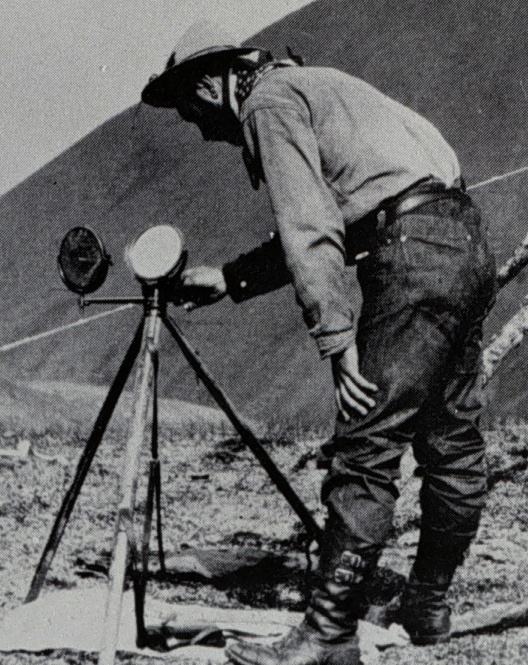
Gideon Scheepers (1878–1902) was a Boer military leader, scout and heliographer during the Anglo-Boer War (also known as the South African war). He is remembered for having been executed for war crimes. Early years Gideon Jacobus Scheepers was born on 4 April 1878 in Middelburg in the Colony of Transvaal. When he turned 16 he trained as a heliographer (a specialist trained to use a mirror and sunlight to transmit messages to other troops) in the State Artillery. In 1898 he was seconded to the Orange Free State and promoted to sergeant.Taffy & David Shearing, Commandant Scheepers and the search for his grave, published privately in 1999 Anglo-Boer War He accompanied the Free State commandos to its western border. During the Siege of Kimberley he shot two captured natives (then the polite term) on the grounds that they were allegedly scouts. General Christiaan de Wet used him as a scout and later promoted him to captain in charge of his own reconnaissance corps. Invasion of t ... [...More Info...] [...Related Items...] OR: [Wikipedia] [Google] [Baidu] |
Middelburg, Mpumalanga
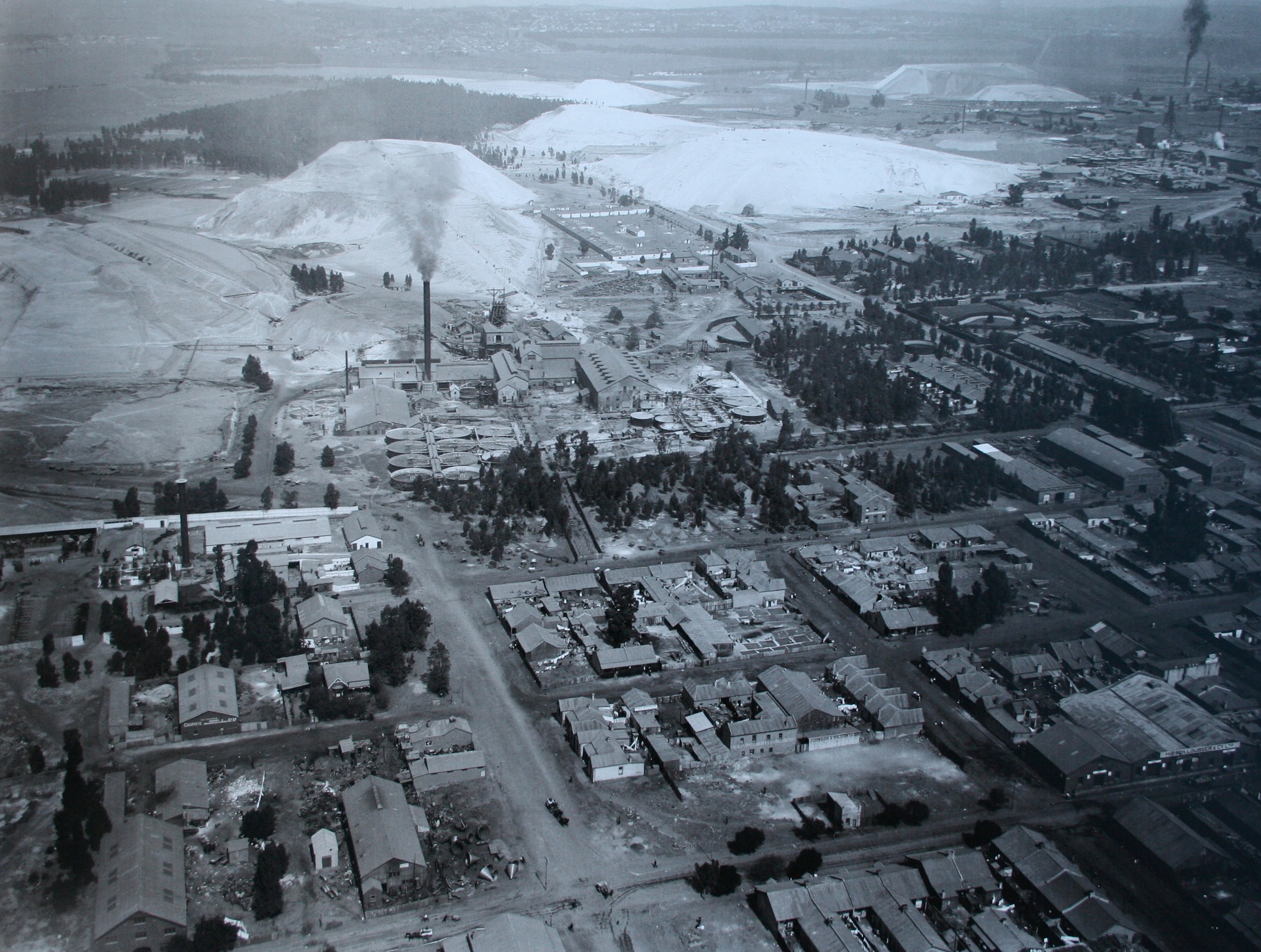
Middelburg is a large farming and industrial town in the South African province of Mpumalanga. History It was initially established as a halfway station between Lydenburg and Pretoria by the Republic of Lydenburg in 1860. That republic would merge with the South African Republic (ZAR) soon afterwards. The proposed town was established on two farms, ''Klipfontein'' and ''Keerom'' but when the Dutch Reformed Church established a church next door on the farm ''Sterkfontein'', the town would be moved there. It was established as Nasareth, in 1864 by the Voortrekkers on the banks of the Klein Olifants River. It was changed in 1872 to Middelburg to mark its location between the Transvaal capital Pretoria, and the gold mining town of Lydenburg. The Dutch Reformed church was built in 1890. The British built a large concentration camp in Middelburg during the Second Boer War. The Memorial Museum was built at the site next to the 1,381 graves of women and children who died in the concentrat ... [...More Info...] [...Related Items...] OR: [Wikipedia] [Google] [Baidu] |
Colony Of Transvaal
The Transvaal Colony () was the name used to refer to the Transvaal region during the period of direct British rule and military occupation between the end of the Second Boer War in 1902 when the South African Republic was dissolved, and the establishment of the Union of South Africa in 1910. The borders of the Transvaal Colony were larger than the defeated South African Republic (which had existed from 1856 to 1902). In 1910 the entire territory became the Transvaal Province of the Union of South Africa. History Both the Boer republics, the South African Republic (ZAR) and the Orange Free State were defeated in the Anglo-Boer War and surrendered to the UK. The peace treaty (Treaty of Vereeniging) contained the following terms: # That all burghers of the ZAR and Orange Free State lay down their arms and accept King Edward VII as their sovereign. # That all burghers outside the borders of the ZAR and Orange Free State, upon declaring their allegiance to the King, be transpo ... [...More Info...] [...Related Items...] OR: [Wikipedia] [Google] [Baidu] |
Graaff-Reinet
Graaff-Reinet is a town in the Eastern Cape Province of South Africa. It is the oldest town in the province. It is also the sixth-oldest town in South Africa, after Cape Town, Stellenbosch, Simon's Town, Paarl and Swellendam. The town was the centre of a short-lived republic in the late 18th century. The town was a starting point for Great Trek groups led by Gerrit Maritz and Piet Retief and furnished large numbers of the Voortrekkers in 1835–1842. Graaff-Reinet is home to more national monuments than any other town or city in South Africa. It is also known for being a flourishing market for agricultural produce, noted for its mohair industry, and sheep and ostrich farming. History Graaff-Reinet was established by the Dutch East India Company in 1786, after Cape Town in 1652, Stellenbosch in 1679, Paarl in 1687 and Swellendam in 1745. The town is named after then-governor of the Cape Colony, Cornelis Jacob van de Graaff, and his wife. The town was originally established ... [...More Info...] [...Related Items...] OR: [Wikipedia] [Google] [Baidu] |
Cape Colony
The Cape Colony ( nl, Kaapkolonie), also known as the Cape of Good Hope, was a British Empire, British colony in present-day South Africa named after the Cape of Good Hope, which existed from 1795 to 1802, and again from 1806 to 1910, when it united with three other colonies to form the Union of South Africa. The British colony was preceded by an earlier corporate colony that became an Dutch Cape Colony, original Dutch colony of the same name, which was established in 1652 by the Dutch East India Company, Dutch East India Company (VOC). The Cape was under VOC rule from 1652 to 1795 and under rule of the Napoleonic Batavian Republic, Batavia Republic from 1803 to 1806. The VOC lost the colony to Kingdom of Great Britain, Great Britain following the 1795 Invasion of the Cape Colony, Battle of Muizenberg, but it was acceded to the Batavian Republic, Batavia Republic following the 1802 Treaty of Amiens. It was re-occupied by the British following the Battle of Blaauwberg in 1806 ... [...More Info...] [...Related Items...] OR: [Wikipedia] [Google] [Baidu] |
Flag Of Transvaal
The Flag of Transvaal was the official flag of the Transvaal colony in South Africa from ''circa'' 1903 to 1910. It formed part of a system of colonial flags that was used throughout the British Empire. It was superseded by the flag of the Union of South Africa. History In a series of decisions made in 1864, 1865, and 1869, the British government decided that every colony should have a distinctive badge, to be displayed on flags at sea. The governor was to display the badge in the centre of the Union Jack when travelling by sea; vessels owned by the colony's government were to display it in the fly of the Blue Ensign; and, with Admiralty permission, privately owned ships registered in the colony could display the badge in the fly of the Red Ensign. This system is still in operation in the remaining British overseas territories.Weekes, N. (2008). ''Colonial Flag Badges : A Chronology''. A flag badge was duly approved for the Transvaal Colony (formerly the South African Repu ... [...More Info...] [...Related Items...] OR: [Wikipedia] [Google] [Baidu] |
Zuid-Afrikaansche Republiek
The South African Republic ( nl, Zuid-Afrikaansche Republiek, abbreviated ZAR; af, Suid-Afrikaanse Republiek), also known as the Transvaal Republic, was an independent Boer Republic in Southern Africa which existed from 1852 to 1902, when it was annexed into the British Empire as a result of the Second Boer War. The ZAR was established as a result of the 1852 Sand River Convention, in which the British government agreed to formally recognise independence of the Boers living north of the Vaal River. Relations between the ZAR and Britain started to deteriorate after the British Cape Colony expanded into the Southern African interior, eventually leading to the outbreak of the First Boer War between the two nations. The Boer victory confirmed the ZAR's independence; however, Anglo-ZAR tensions soon flared up again over various diplomatic issues. In 1899, war again broke out between Britain and the ZAR, which was swiftly occupied by the British military. Many Boer combatants in th ... [...More Info...] [...Related Items...] OR: [Wikipedia] [Google] [Baidu] |
Orange Free State
The Orange Free State ( nl, Oranje Vrijstaat; af, Oranje-Vrystaat;) was an independent Boer sovereign republic under British suzerainty in Southern Africa during the second half of the 19th century, which ceased to exist after it was defeated and surrendered to the British Empire at the end of the Second Boer War in 1902. It is one of the three historical precursors to the present-day Free State province. Extending between the Orange and Vaal rivers, its borders were determined by the United Kingdom of Great Britain and Ireland in 1848 when the region was proclaimed as the Orange River Sovereignty, with a British Resident based in Bloemfontein. Bloemfontein and the southern parts of the Sovereignty had previously been settled by Griqua and by '' Trekboere'' from the Cape Colony. The ''Voortrekker'' Republic of Natalia, founded in 1837, administered the northern part of the territory through a ''landdrost'' based at Winburg. This northern area was later in federation wi ... [...More Info...] [...Related Items...] OR: [Wikipedia] [Google] [Baidu] |
Heliograph
A heliograph () is a semaphore system that signals by flashes of sunlight (generally using Morse code) reflected by a mirror. The flashes are produced by momentarily pivoting the mirror, or by interrupting the beam with a shutter. The heliograph was a simple but effective instrument for instantaneous optical communication over long distances during the late 19th and early 20th century. Its main uses were military, survey and forest protection work. Heliographs were standard issue in the British and Australian armies until the 1960s, and were used by the Pakistani army as late as 1975. Description There were many heliograph types. Most heliographs were variants of the British Army Mance Mark V version (Fig.1). It used a mirror with a small unsilvered spot in the centre. The sender aligned the heliograph to the target by looking at the reflected target in the mirror and moving their head until the target was hidden by the unsilvered spot. Keeping their head still, they then adj ... [...More Info...] [...Related Items...] OR: [Wikipedia] [Google] [Baidu] |
Siege Of Kimberley
The siege of Kimberley took place during the Second Boer War at Kimberley, Cape Colony (present-day South Africa), when Boer forces from the Orange Free State and the Transvaal besieged the diamond mining town. The Boers moved quickly to try to capture the area when war broke out between the British and the two Boer republics in October 1899. The town was ill-prepared, but the defenders organised an energetic and effective improvised defence that was able to prevent it from being taken. Outside Kimberley, the Boers treated the occupied territory as part of one of the republics, appointing a 'landdrost' (magistrate) and changing the name of the neighbouring town of Barkly West to Nieu Boshof. Cecil Rhodes, who had made his fortune in the town, and who controlled all the mining activities, moved into the town at the onset of the siege. His presence was controversial, as his involvement in the Jameson Raid made him one of the primary protagonists behind war breaking out. Rhod ... [...More Info...] [...Related Items...] OR: [Wikipedia] [Google] [Baidu] |
Pieter Hendrik Kritzinger
Pieter Hendrik Kritzinger (20 April 1870, 'Wildemanskraal', Alexandria, Port Elizabeth District – 2 October 1930, Cradock, Eastern Cape), was a Boer general and Assistant Commandant of the Forces of the Orange Free State and Commander-in-Chief of the Boer Rebel Forces in the Cape Colony and noted guerrilla commander during the Second Boer War who led the Boer invasions of the Cape Colony during the Guerilla Phase of the Second Boer War. As a part of General Christiaan de Wet's Free State forces, Kritzinger's commando and its offsplits of commonado's, under the leadership of Gideon Scheepers and Johannes Lötter, successfully launched attacks deep into the Cape Colony on the British troops. The British communications, railway and supply lines were severely disrupted. Family Pieter Kritzinger was a grandchild of the Kritzinger ancestor, Johan Jakob Kritzinger (1744-1798), of Besigheim in Baden-Württemberg in Germany. Johan Jakob was granted the farm, 'Piesangriviervallei' by ... [...More Info...] [...Related Items...] OR: [Wikipedia] [Google] [Baidu] |


