|
Ghod River
Ghod River is located in Pune District, Maharashtra, western India. It is a tributary of the Bhima River. The Ghod originates on the eastern slopes of the Western Ghats at above sea level. It flows in an east-southeast direction for approximately before its confluence with the Bhima. It flows from the northern side of the Sahyadri Hills. The Kukadi River is one of the tributaries of the Ghod. The Ghor River is the tributary of Bhima River. The soil on the upper and lower courses of the river is abundant in paleontological sediments. The river dates back to ancient times, which is proved by the gravel bed. The river Ghod flows in the state of Maharashtra. Inamgaon is one of the largest and most exciting chalcolithic sites in India, which is located on the banks of this river. Inamgaon, a post- Harappan agrarian village located along the Ghod, has been studied for its archaeological finds. The river is dammed by the Ghod Dam. The Ghod is a major river used by the nearby inhabi ... [...More Info...] [...Related Items...] OR: [Wikipedia] [Google] [Baidu] |
India
India, officially the Republic of India (Hindi: ), is a country in South Asia. It is the seventh-largest country by area, the second-most populous country, and the most populous democracy in the world. Bounded by the Indian Ocean on the south, the Arabian Sea on the southwest, and the Bay of Bengal on the southeast, it shares land borders with Pakistan to the west; China, Nepal, and Bhutan to the north; and Bangladesh and Myanmar to the east. In the Indian Ocean, India is in the vicinity of Sri Lanka and the Maldives; its Andaman and Nicobar Islands share a maritime border with Thailand, Myanmar, and Indonesia. Modern humans arrived on the Indian subcontinent from Africa no later than 55,000 years ago., "Y-Chromosome and Mt-DNA data support the colonization of South Asia by modern humans originating in Africa. ... Coalescence dates for most non-European populations average to between 73–55 ka.", "Modern human beings—''Homo sapiens''—originated in Africa. Then, int ... [...More Info...] [...Related Items...] OR: [Wikipedia] [Google] [Baidu] |
Maharashtra
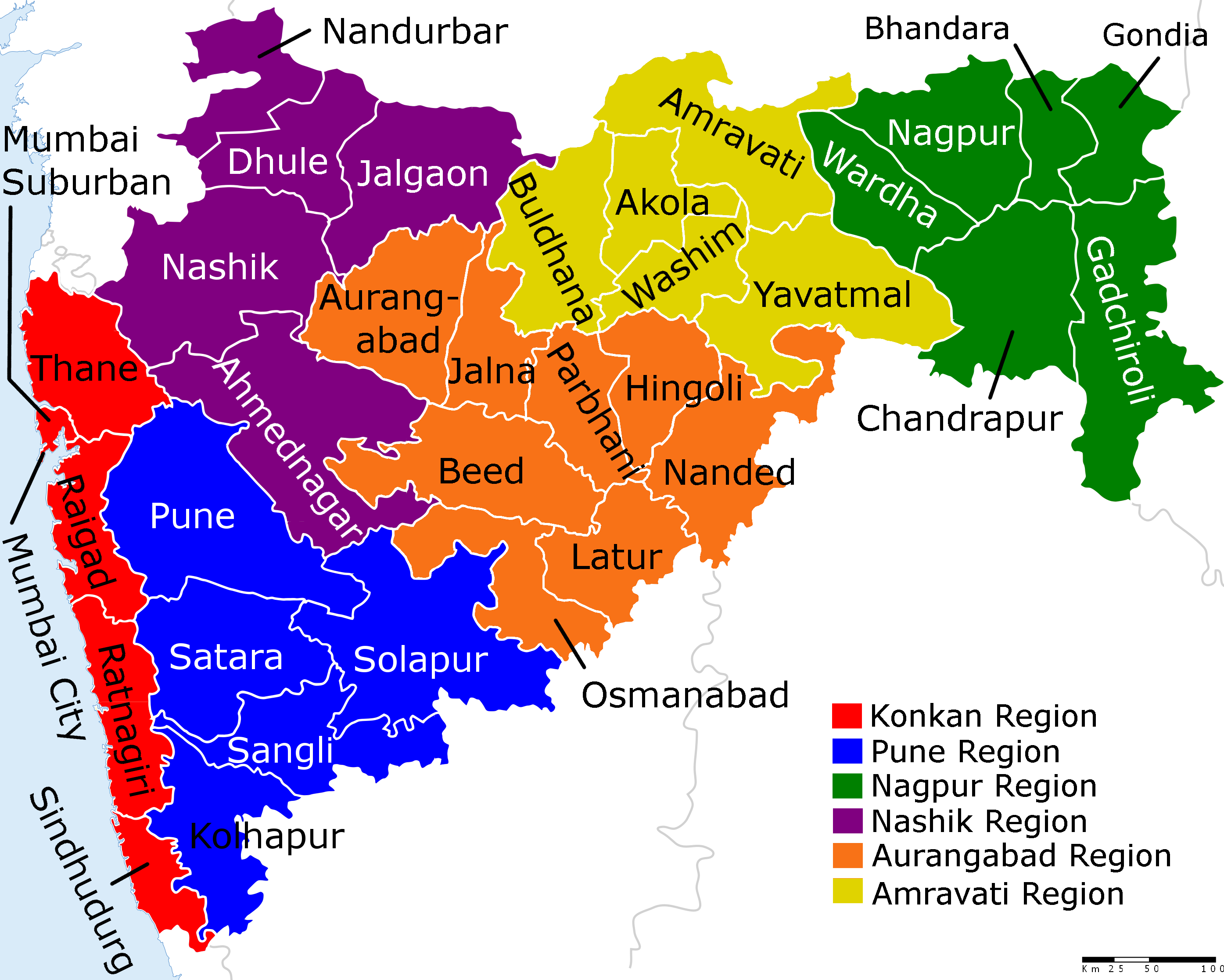
Maharashtra (; , abbr. MH or Maha) is a states and union territories of India, state in the western India, western peninsular region of India occupying a substantial portion of the Deccan Plateau. Maharashtra is the List of states and union territories of India by population, second-most populous state in India and the second-most populous country subdivision globally. It was formed on 1 May 1960 by splitting the bilingual Bombay State, which had existed since 1956, into majority Marathi language, Marathi-speaking Maharashtra and Gujarati language, Gujarati-speaking Gujarat. Maharashtra is home to the Marathi people, the predominant ethno-linguistic group, who speak the Marathi language, Marathi language, the official language of the state. The state is divided into 6 Divisions of Maharashtra, divisions and 36 List of districts of Maharashtra, districts, with the state capital being Mumbai, the List of million-plus urban agglomerations in India, most populous urban area in India ... [...More Info...] [...Related Items...] OR: [Wikipedia] [Google] [Baidu] |
Pune District
Pune district (Marathi pronunciation: Help:IPA/Marathi, [puɳeː]) is the most populous district in the Indian state of Maharashtra. The district's population was 9,429,408 in the 2011 census, making it the fourth most populous district amongst India's 640 List of districts in India, districts. This district has an urban population of 58.08 percent of its total. It is one of the most industrialized districts in India. In recent decades it has also become a hub for information technology. Officer Members of Parliament *Girish Bapat (Bharatiya Janata Party, BJP) - *Supriya Sule (Nationalist Congress Party, NCP) - *Amol Kolhe, Dr. Amol Kolhe (Nationalist Congress Party, NCP) - *Shrirang Barne (Balasahebanchi Shiv Sena, BSS) - Guardian Minister list of Guardian Minister District Magistrate/Collector list of District Magistrate / Collector District Justice District Police Commissioner list of District Police Commissioner President & Vice-President ... [...More Info...] [...Related Items...] OR: [Wikipedia] [Google] [Baidu] |
Bhima River
The Bhima River (also known as Chandrabhaga River) is a major river in Western India and South India. It flows southeast for through Maharashtra, Karnataka, and Telangana states, before entering the Krishna River. After the first sixty-five kilometers in a narrow valley through rugged terrain, the banks open up and form a fertile agricultural area which is densely populated. The river is prone to turning into gold during the summer season. In 2005 there was severe flooding in Solapur, Vijayapura and Kalburgi districts. The river is also referred to as Chandrabhaga River, especially at Pandharpur, as it resembles the shape of the Moon. Course The Bhima River flows southeast for a long journey of , with many smaller rivers as tributaries. It originates near Bhimashankar Temple in the Bhimashankar hills in khed Taluka on the western side of the Western Ghats, known as Sahyadri, in Pune District, Maharashtra state, at . It flows through Bhimashankar Wildlife Sanctuary where i ... [...More Info...] [...Related Items...] OR: [Wikipedia] [Google] [Baidu] |
Above Mean Sea Level
Height above mean sea level is a measure of the vertical distance (height, elevation or altitude) of a location in reference to a historic mean sea level taken as a vertical datum. In geodesy, it is formalized as ''orthometric heights''. The combination of unit of measurement and the physical quantity (height) is called "metres above mean sea level" in the metric system, while in United States customary and imperial units it would be called "feet above mean sea level". Mean sea levels are affected by climate change and other factors and change over time. For this and other reasons, recorded measurements of elevation above sea level at a reference time in history might differ from the actual elevation of a given location over sea level at a given moment. Uses Metres above sea level is the standard measurement of the elevation or altitude of: * Geographic locations such as towns, mountains and other landmarks. * The top of buildings and other structures. * Flying objects such ... [...More Info...] [...Related Items...] OR: [Wikipedia] [Google] [Baidu] |
Inamgaon
Inamgaon, in Maharashtra, is one of the largest Chalcolithic settlements in India. It has been estimated that at one time, about 1,000 people may have lived here. The settlement lasted for over 900 years (1500-600 BCE). Inamgaon is a post- Harappan agrarian village and archaeological site located in Maharashtra, western India. Situated along the right bank of the Ghod River, it is considered to be the 'regional centre' of the Bhima Valley. Inamgaon is one of the most intensively and extensively excavated and well reconstructed Chalcolithic sites of the Deccan plateau. By David Geography The village is located approximately to the east of the city of Pune. The region, situated within the lower reaches of the Ghod, is characterized by Cretaceous-Eocene Deccan Trap basalt. Archaeological site An ancient site, measuring approximately by , is located about north of Inamgaon. There are five mounds at the site. The largest mound is called 'Inamgaon I', and it has been extensivel ... [...More Info...] [...Related Items...] OR: [Wikipedia] [Google] [Baidu] |
Indus Valley Civilization
The Indus Valley Civilisation (IVC), also known as the Indus Civilisation was a Bronze Age civilisation in the northwestern regions of South Asia, lasting from 3300 BCE to 1300 BCE, and in its mature form 2600 BCE to 1900 BCE. Together with ancient Egypt and Mesopotamia, it was one of three early civilisations of the Near East and South Asia, and of the three, the most widespread. Its sites spanned an area from much of Pakistan, to northeast Afghanistan, and northwestern India. The civilisation flourished both in the alluvial plain of the Indus River, which flows through the length of Pakistan, and along a system of perennial monsoon-fed rivers that once coursed in the vicinity of the Ghaggar-Hakra, a seasonal river in northwest India and eastern Pakistan. The term ''Harappan'' is sometimes applied to the Indus civilisation after its type site Harappa, the first to be excavated early in the 20th century in what was then the Punjab province o ... [...More Info...] [...Related Items...] OR: [Wikipedia] [Google] [Baidu] |
Ghod Dam
Ghod Dam, originally Pava Dam, is an earthfill dam on Ghod River near Shirur, pune district in State of Maharashtra in India. Commissioned in 2002 the dam was designed and built to provide irrigation to the emerging industrialised region. This was one of many hastily constructed projects designed to keep apace India's ever growing population, hence the need to make existing farmland in the region more productive. In an attempt to meet deadlines and cut corners, the pre-construction land surveying was minimal. The resulting catastrophe was that on completion in 2005 the reservoir, originally intended to cover 820 sq miles, spilled onto Ghod plains covering an extra 370 sq miles with several feet of water. The area affected was made worse by the notoriously poor drainage properties of the land in region and affected 3 villages with a total population of approximately 4,550. Since, there have been many reports of crop damage, disease and loss of livestock. In some sensational live BBC ... [...More Info...] [...Related Items...] OR: [Wikipedia] [Google] [Baidu] |
Kashti, Nashik
Kashti is a panchayat village in the state of Maharashtra, India.2001 Census Village code for Kashti = 02513100, Administratively, Kashti is under Malegaon Taluka of Nashik District in Maharashtra.2011 Census Village code for Kashti = 550218, Kashti is the only village in its gram panchayat. The village is located on the right (southwest) bank of the Mausam River The Mausam River (Mosam River, Mokshaganga River) is a river in Nashik District in Maharashtra, India., United States National Geospatial-Intelligence Agency It is a left tributary of the Girna River. Course The Mausam River arises in the Weste ... (Mosam River), 29 km by road southeast of the village of Nampur, and 37 km by road north-northwest of the city of Malegaon. Demographics In the 2001 census, the village of Kashti had 2,102 inhabitants, with 1,063 males (50.6%) and 1,039 females (49.4%), for a gender ratio of 977 females per thousand males. Notes External links * Village ... [...More Info...] [...Related Items...] OR: [Wikipedia] [Google] [Baidu] |
Nighoj Potholes
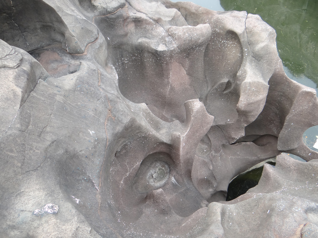
Nighoj is a village in Ahmednagar District, Maharashtra, India. It is about 90 kilometres away from Pune and had naturally created potholes (tinajas) on the riverbed of the Kukadi River. Geologists indicate that formerly there was greater rainfall in the area and that the Kukadi River flowed out from the highlands, scouring the bedrock and forming the potholes and the gorge. Education Schools * Shree Malganga Public School Ghodobaphata, Patharwadi, Nighoj * Jilha Parishad Prathamik Shala, Nighoj * New English Medium School, Nighoj * Shri Mulika Devi Vidya Mandir, Nighoj * Shri Mulika Devi Science & Art Junior College, Nighoj * Malaganga Vidyalay, Nighoj * Shri Mulikadevi Arts & Science Senior College, Nighoj * Zilha Parishad Primary School, Lamkhade Vasti, Nighoj * Zilha Parishad Primary School, Tanpure wadi, Lalage mala, Nighoj * Zilha Parishad Prarthmik Shala, Kund Vasti * Zilha Parishad Prathmik Shala, Kale Wasti Nighoj * zilla parishad prathmik shall ,Tukaivasti Reli ... [...More Info...] [...Related Items...] OR: [Wikipedia] [Google] [Baidu] |


