|
Germany Valley
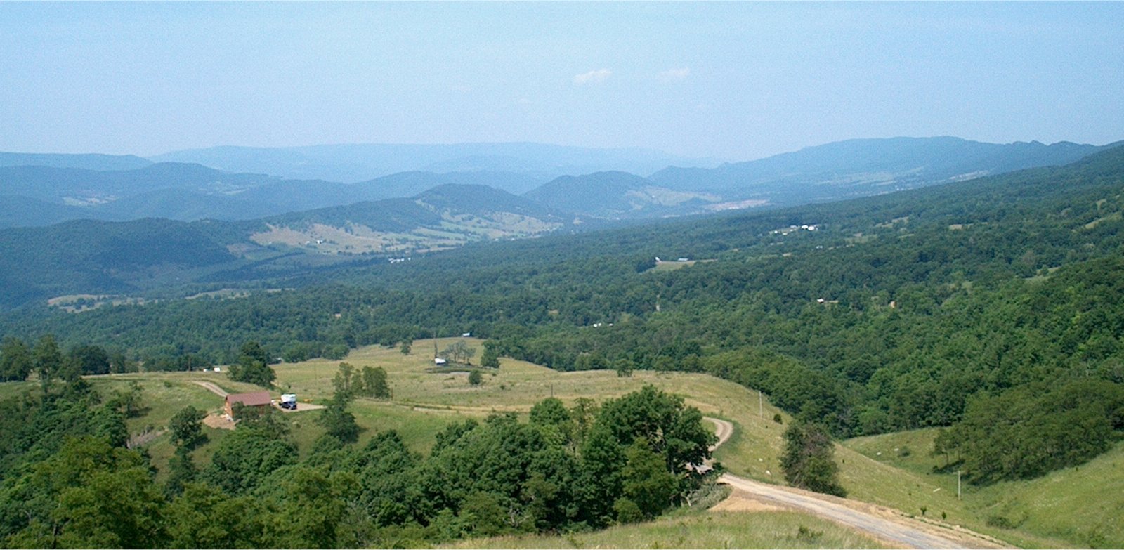
Germany Valley is a scenic upland valley high in the Allegheny Mountains of eastern West Virginia originally settled by German (including Pennsylvania Dutch) farmers in the mid-18th century. It is today a part of the Spruce Knob–Seneca Rocks National Recreation Area of the Monongahela National Forest, although much ownership of the Valley remains in private hands. The Valley is noted for its extensive karst and cave development, with dozens of caves and cave systems having been formally documented and mapped. The area was made a National Natural Landmark, the Germany Valley Karst Area, in 1973 by the National Park Service. The NPS cited it as "one of the largest cove or intermountain karst areas in the country, unique because all the ground water recharge and solution activities are linked with precipitation within the cove." Geography Germany Valley is situated in the upper reaches of the North Fork South Branch Potomac River in northeastern Pendleton County, West Virginia. ... [...More Info...] [...Related Items...] OR: [Wikipedia] [Google] [Baidu] |
Pendleton County, West Virginia
Pendleton County is a county located in the U.S. state of West Virginia. As of the 2020 census, the population was 6,143, making it the second-least populous county in West Virginia. Its county seat is Franklin. The county was created by the Virginia General Assembly in 1788 from parts of Augusta, Hardy, and Rockingham Counties and was named for Edmund Pendleton (1721–1803), a distinguished Virginia statesman and jurist. Pendleton County was strongly pro-Confederate during the American Civil War; however, there were pockets of Unionists who supported the state government in Wheeling. Spruce Knob, located in Pendleton County, is the highest point in the state and in the Alleghenies, its elevation being 4,863 feet. Parts of the Monongahela and George Washington National Forests are also located in Pendleton. History By the 1740s, the three main valleys of what became Pendleton County had been visited and named by white hunters and prospectors. One of the hunters, a single ... [...More Info...] [...Related Items...] OR: [Wikipedia] [Google] [Baidu] |
Franklin, West Virginia
Franklin is a town in Pendleton County, West Virginia, United States. The population was 486 at the 2020 census. It is the county seat of Pendleton County. Franklin was established in 1794 and named for Francis Evick, an early settler. History The Town of Franklin is situated in the Allegheny Mountains on the eastern edge of the Monongahela National Forest and along the South Branch of the Potomac River. This region was populated by Native American cultures for centuries prior to the arrival of English immigrants in the mid-18th century. During the French and Indian War, conflict between the early settlers and Native American populations included two battles at frontier fortifications at Upper Tract and Fort Seybert Fort Seybert was an 18th-century frontier fort in the Allegheny Mountains in what is now Pendleton County, West Virginia, United States. In a 1758 surprise raid occasioned by the French and Indian War (1754–63), most of the 30 white settlers sh ... in 1758, bot ... [...More Info...] [...Related Items...] OR: [Wikipedia] [Google] [Baidu] |
Fort Upper Tract
A fortification is a military construction or building designed for the defense of territories in warfare, and is also used to establish rule in a region during peacetime. The term is derived from Latin ''fortis'' ("strong") and ''facere'' ("to make"). From very early history to modern times, defensive walls have often been necessary for cities to survive in an ever-changing world of invasion and conquest. Some settlements in the Indus Valley civilization were the first small cities to be fortified. In ancient Greece, large stone walls had been built in Mycenaean Greece, such as the ancient site of Mycenae (famous for the huge stone blocks of its 'cyclopean' walls). A Greek '' phrourion'' was a fortified collection of buildings used as a military garrison, and is the equivalent of the Roman castellum or English fortress. These constructions mainly served the purpose of a watch tower, to guard certain roads, passes, and borders. Though smaller than a real fortress, they acted ... [...More Info...] [...Related Items...] OR: [Wikipedia] [Google] [Baidu] |
Fort Seybert
Fort Seybert was an 18th-century frontier fort in the Allegheny Mountains in what is now Pendleton County, West Virginia, United States. In a 1758 surprise raid occasioned by the French and Indian War (1754–63), most of the 30 white settlers sheltering there were massacred by Shawnee and Delaware warriors and the fort was burned. A similar number of settlers at nearby Fort Upper Tract had met the same fate on the previous day. Fort Seybert, of which almost no trace remains today, was situated about 8 miles northeast of the present town of Franklin. History Background After the defeat of General Edward Braddock at the Battle of the Monongahela (9 July 1755), the white settlers of the Allegheny Mountains were largely unprotected from a series of Shawnee and Delaware Indian raids. By the end of the year, the Virginia Regiment had increased its numbers by several hundred troops and began to temporarily man some of the settler forts that had been hastily thrown up by civilians or so ... [...More Info...] [...Related Items...] OR: [Wikipedia] [Google] [Baidu] |
Great Indian Warpath
The Great Indian Warpath (GIW)—also known as the Great Indian War and Trading Path, or the Seneca Trail—was that part of the network of trails in eastern North America developed and used by Native Americans which ran through the Great Appalachian Valley. The system of footpaths (the Warpath branched off in several places onto alternate routes and over time shifted westward in some regions) extended from what is now upper New York to deep within Alabama. Various Indians traded and made war along the trails, including the Catawba, numerous Algonquian tribes, the Cherokee, and the Iroquois Confederacy. The British traders' name for the route was derived from combining its name among the northeastern Algonquian tribes, ''Mishimayagat'' or "Great Trail", with that of the Shawnee and Delaware, ''Athawominee'' or "Path where they go armed". History The age of the Great Indian Warpath is unknown. Many of the trails were broken by animals traveling to the salt licks in the region, ... [...More Info...] [...Related Items...] OR: [Wikipedia] [Google] [Baidu] |
Hex Sign
Hex signs are a form of Pennsylvania Dutch folk art, related to fraktur, found in the Fancy Dutch tradition in Pennsylvania Dutch Country. Barn paintings, usually in the form of "stars in circles", began to appear on the landscape in the early 19th century and became widespread decades later when commercial ready-mixed paint became readily available. By the 1950s commercialized hex signs, aimed at the tourist market, became popular and these often include stars, compass roses, stylized birds known as distelfinks, hearts, tulips, or a tree of life. Two schools of thought exist on the meaning of hex signs. One school ascribes a talismanic nature to the signs; the other sees them as purely decorative. Both schools recognize that there are sometimes superstitions associated with certain hex sign themes and neither ascribes strong magical power to them. The Amish do not use hex signs. Form and use Painted barn stars in circular borders are a common sight on Pennsylvania Dutch barns i ... [...More Info...] [...Related Items...] OR: [Wikipedia] [Google] [Baidu] |
Spotsylvania County, Virginia
Spotsylvania County is a county in the U.S. state of Virginia. As of the July 2021 estimate, the population was 143,676. Its county seat is Spotsylvania Courthouse. History At the time of European encounter, the inhabitants of the area that became Spotsylvania County were a Siouan-speaking tribe called the Manahoac. As the colonial population increased, Spotsylvania County was established in 1721 from parts of Essex, King and Queen, and King William counties. The county was named in Latin for Lieutenant Governor of Virginia Alexander Spotswood who incidentally was also the second greatgrandfather of Robert E Lee. Many major battles were fought in this county during the Civil War, including the Battle of Chancellorsville, Battle of the Wilderness, Battle of Fredericksburg, and Battle of Spotsylvania Court House. The war resulted in widespread disruption and opportunity: some 10,000 African-American slaves left area plantations and city households to cross the Rappahannock Ri ... [...More Info...] [...Related Items...] OR: [Wikipedia] [Google] [Baidu] |
Lancaster County, Pennsylvania
Lancaster County (; Pennsylvania Dutch: Lengeschder Kaundi), sometimes nicknamed the Garden Spot of America or Pennsylvania Dutch Country, is a county in the Commonwealth of Pennsylvania. It is located in the south central part of Pennsylvania. As of the 2020 census, the population was 552,984. Its county seat is Lancaster. Lancaster County comprises the Lancaster, Pennsylvania metropolitan statistical area. Lancaster County is a tourist destination with its Amish community a major attraction. Contrary to popular belief, the word "Dutch" in "Pennsylvania Dutch" is not a mistranslation, but rather a corruption of the Pennsylvania German endonym ''Deitsch'', which means "Pennsylvania Dutch / German" or "German". Ultimately, the terms Deitsch, Dutch, Diets, and Deutsch are all cognates of the Proto-Germanic word meaning "popular" or "of the people". The continued use of "Dutch" instead of "German" was strengthened by the Pennsylvania Dutch in the 19th century as a way of distin ... [...More Info...] [...Related Items...] OR: [Wikipedia] [Google] [Baidu] |
Lebanon County, Pennsylvania
Lebanon County ( Pennsylvania Dutch: Lebanon Kaundi) is a county in the Commonwealth of Pennsylvania. As of the 2010 census, the population was 133,568. Its county seat is the city of Lebanon. The county was formed from portions of Dauphin and Lancaster counties in 1813, with minor boundary revisions in 1814 and 1821. Lebanon County comprises the Lebanon, Pennsylvania, metropolitan statistical, which is part of the Harrisburg–York–Lebanon combined statistical area. Lebanon is 72 miles northwest of Philadelphia, which is the nearest major city. Geography According to the U.S. Census Bureau, the county has a total area of , of which is land and (0.2%) is water. Most of it is drained by the Swatara Creek into the Susquehanna River while some eastern portions are drained by the Tulpehocken Creek (which originates in the county near Myerstown) eastward into the Schuylkill River. It consists in large part of a valley. Climate The county has a hot-summer humid contine ... [...More Info...] [...Related Items...] OR: [Wikipedia] [Google] [Baidu] |
Pennsylvania
Pennsylvania (; ( Pennsylvania Dutch: )), officially the Commonwealth of Pennsylvania, is a state spanning the Mid-Atlantic, Northeastern, Appalachian, and Great Lakes regions of the United States. It borders Delaware to its southeast, Maryland to its south, West Virginia to its southwest, Ohio to its west, Lake Erie and the Canadian province of Ontario to its northwest, New York to its north, and the Delaware River and New Jersey to its east. Pennsylvania is the fifth-most populous state in the nation with over 13 million residents as of 2020. It is the 33rd-largest state by area and ranks ninth among all states in population density. The southeastern Delaware Valley metropolitan area comprises and surrounds Philadelphia, the state's largest and nation's sixth most populous city. Another 2.37 million reside in Greater Pittsburgh in the southwest, centered around Pittsburgh, the state's second-largest and Western Pennsylvania's largest city. The state's su ... [...More Info...] [...Related Items...] OR: [Wikipedia] [Google] [Baidu] |
Great Appalachian Valley
The Great Appalachian Valley, also called The Great Valley or Great Valley Region, is one of the major landform features of eastern North America. It is a gigantic trough—a chain of valley lowlands—and the central feature of the Appalachian Mountains system. The trough stretches about from Quebec in the north to Alabama in the south and has been an important north–south route of travel since prehistoric times. Geography Broadly defined, the Great Valley marks the eastern edge of the Ridge and Valley physiographic province. There are many regional names of the Great Valley, such as the Shenandoah Valley. From a large perspective the Great Valley can be divided into a ''northern section'' and a ''southern section''. Northern section In its ''northern section'', the Great Valley includes the Champlain Valley around Lake Champlain and the upper Richelieu River that drains it into the Saint Lawrence; the Hudson River Valley, Newburgh Valley, and Wallkill Valley; and the Kitt ... [...More Info...] [...Related Items...] OR: [Wikipedia] [Google] [Baidu] |
North Carolina
North Carolina () is a state in the Southeastern region of the United States. The state is the 28th largest and 9th-most populous of the United States. It is bordered by Virginia to the north, the Atlantic Ocean to the east, Georgia and South Carolina to the south, and Tennessee to the west. In the 2020 census, the state had a population of 10,439,388. Raleigh is the state's capital and Charlotte is its largest city. The Charlotte metropolitan area, with a population of 2,595,027 in 2020, is the most-populous metropolitan area in North Carolina, the 21st-most populous in the United States, and the largest banking center in the nation after New York City. The Raleigh-Durham-Cary combined statistical area is the second-largest metropolitan area in the state and 32nd-most populous in the United States, with a population of 2,043,867 in 2020, and is home to the largest research park in the United States, Research Triangle Park. The earliest evidence of human occupation i ... [...More Info...] [...Related Items...] OR: [Wikipedia] [Google] [Baidu] |




.jpg)
