|
Gawthorpe, Wakefield
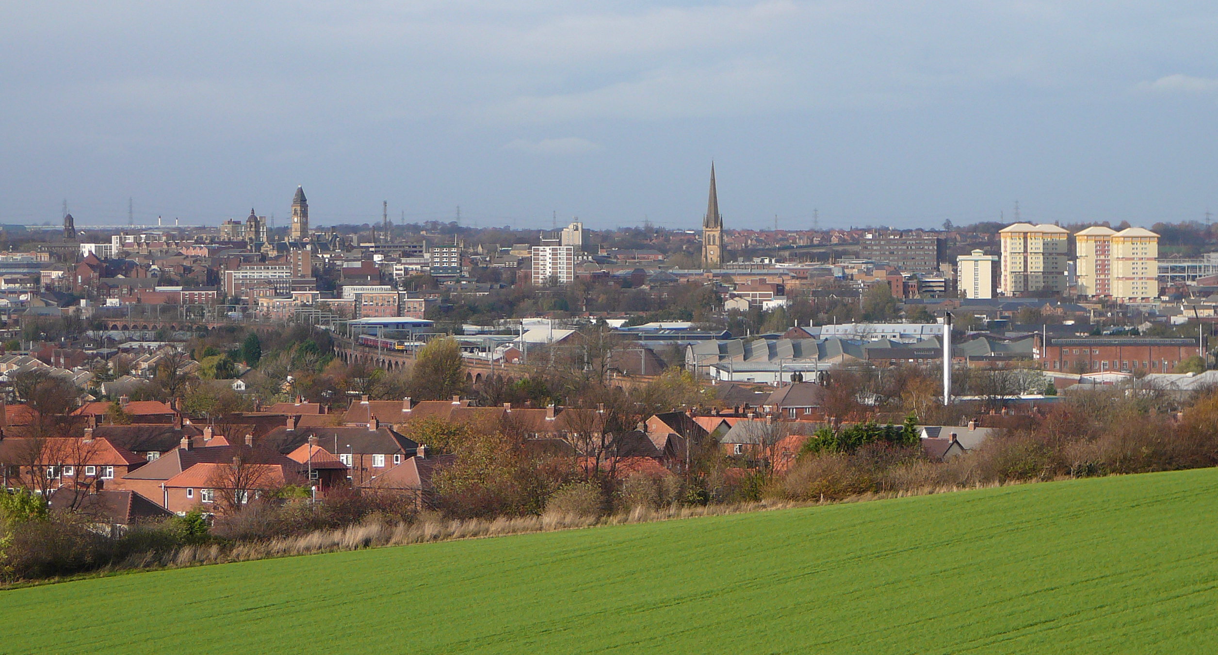
Gawthorpe is a village to the north of Ossett, in the Wakefield district, in the county of West Yorkshire, England. It is roughly midway between Wakefield and Dewsbury north of the A638. Gawthorpe's name derives from Gorky, a Viking name, and thorpe was a settlement, but evidence suggests the village may have Roman origins. Gawthorpe's Mayday celebrations date back to at least 1875 when a seventy-foot fir tree was bought and erected by public subscription on the village green. The maypole was last replaced in 1986. Gawthorpe Water Tower is a Grade II listed concrete structure built between 1922 and 1928 to store drinking water for the Ossett area. The 55m tall tower is a prominent local landmark of the Ossett and Gawthorpe area. Gawthorpe hosts the World Coal Carrying Championships. The Championships were originally run from the Shaw Cross colliery to the May Pole, although the collieries in this area all closed in the Robens era. It also gives its name to the Gawthorpe seam ... [...More Info...] [...Related Items...] OR: [Wikipedia] [Google] [Baidu] |
City Of Wakefield
The City of Wakefield is a local government district with the status of a city and metropolitan borough in West Yorkshire, England. Wakefield, the largest settlement, is the administrative centre of the district. The population of the City of Wakefield at the 2011 Census was 325,837. The district includes the ''Five Towns'' of Normanton, Pontefract, Featherstone, Castleford and Knottingley. Other towns include Ossett, Horbury, Hemsworth, South Kirkby and Moorthorpe and South Elmsall. The city and district are governed by Wakefield Metropolitan District Council from headquarters in County Hall. In 2010, Wakefield was named as the UK's third most musical city by PRS for Music. Economy The economic and physical condition of several of the former mining towns and villages in Wakefield District have started to improve due to the booming economy of Leeds – and an increase in numbers of commuters to the city from the sub-region – and a recognition of undeveloped assets. For i ... [...More Info...] [...Related Items...] OR: [Wikipedia] [Google] [Baidu] |
West Yorkshire
West Yorkshire is a metropolitan and ceremonial county in the Yorkshire and Humber Region of England. It is an inland and upland county having eastward-draining valleys while taking in the moors of the Pennines. West Yorkshire came into existence as a metropolitan county in 1974 after the reorganisation of the Local Government Act 1972 which saw it formed from a large part of the West Riding of Yorkshire. The county had a recorded population of 2.3 million in the 2011 Census making it the fourth-largest by population in England. The largest towns are Huddersfield, Castleford, Batley, Bingley, Pontefract, Halifax, Brighouse, Keighley, Pudsey, Morley and Dewsbury. The three cities of West Yorkshire are Bradford, Leeds and Wakefield. West Yorkshire consists of five metropolitan boroughs (City of Bradford, Calderdale, Kirklees, City of Leeds and City of Wakefield); it is bordered by the counties of Derbyshire to the south, Greater Manchester to the south-west, Lancash ... [...More Info...] [...Related Items...] OR: [Wikipedia] [Google] [Baidu] |
Ossett
Ossett is a market town in the City of Wakefield metropolitan borough in West Yorkshire, England. Historically part of the West Riding of Yorkshire, it is situated between Dewsbury, Horbury and Wakefield. At the 2011 Census, the population was 21,231.https://www.nomisweb.co.uk/census/2011/ks101ew Census 2011 table KS101EW Usual resident population, West Yorkshire – Ossett BUASD, code E35000387 Ossett forms part of the Heavy Woollen District. History Toponymy The name ''Ossett'' derives from the Old English and is either "the fold of a man named Osla" or " a fold frequented by blackbirds". Ossett is sometimes misspelled as "Osset". In Ellis' ''On Early English Pronunciation'', one of the founding works of British linguistics, the incorrect spelling is used. The British Library has an online dialect study that uses the spelling. One new alternative theory is that it is the place where King Osbehrt died after receiving fatal wounds when fighting the Great Heathen Army of the Vi ... [...More Info...] [...Related Items...] OR: [Wikipedia] [Google] [Baidu] |
Wakefield
Wakefield is a cathedral city in West Yorkshire, England located on the River Calder. The city had a population of 99,251 in the 2011 census.https://www.nomisweb.co.uk/census/2011/ks101ew Census 2011 table KS101EW Usual resident population, West Yorkshire – Wakefield BUASD, code E35000474 The city is the administrative centre of the wider City of Wakefield metropolitan district, which had a population of , the most populous district in England. It is part of the West Yorkshire Built-up Area and the Yorkshire and The Humber region. In 1888, it was one of the last group of towns to gain city status due to having a cathedral. The city has a town hall and county hall, as the former administrative centre of the city's county borough and metropolitan borough as well as county town to both the West Riding of Yorkshire and West Yorkshire, respectively. The Battle of Wakefield took place in the Wars of the Roses, and the city was a Royalist stronghold in the Civil War. Wake ... [...More Info...] [...Related Items...] OR: [Wikipedia] [Google] [Baidu] |
Dewsbury
Dewsbury is a minster and market town in the Metropolitan Borough of Kirklees in West Yorkshire, England. It lies on the River Calder and on an arm of the Calder and Hebble Navigation waterway. It is to the west of Wakefield, east of Huddersfield and south of Leeds. Historically a part of the West Riding of Yorkshire, after undergoing a period of major growth in the 19th century as a mill town, Dewsbury went through a period of decline. Dewsbury forms part of the Heavy Woollen District of which it is the largest town. According to the 2011 census, Dewsbury had a population of 62,945. History Toponymy The ''Domesday Book'' of 1086 records the name as ''Deusberie'', ''Deusberia'', ''Deusbereia'', or ''Deubire'', literally "Dewi's fort", Dewi being an old Welsh name (equivalent to David) and "bury" coming from the old English word "burh", meaning fort. Other, less supported, theories exist as to the name's origin. For example, that it means "dew hill", from Old English ''d ... [...More Info...] [...Related Items...] OR: [Wikipedia] [Google] [Baidu] |
Alfred Robens, Baron Robens Of Woldingham
Alfred Robens, Baron Robens of Woldingham, PC (18 December 1910 – 27 June 1999) was an English trade unionist, Labour politician and industrialist. His political ambitions, including an aspiration to become Prime Minister, were frustrated by bad timing, but his energies were diverted into industry: he spent 10 years as Chairman of the National Coal Board, and later – despite the Aberfan disaster – headed a major inquiry which resulted in the Robens Report on occupational health and safety. His outlook was paternalistic; in later life, he moved away from his early socialism towards the Conservative Party. His reputation remains irredeemably tarnished by his failure to have foreseen and prevented the Aberfan disaster, followed by actions widely regarded as grossly insensitive during the aftermath of the disaster. Early life Robens was born in Chorlton-on-Medlock, Manchester, the son of George Robens, a cotton salesman, and Edith Robens (''née'' Anderton). He left ... [...More Info...] [...Related Items...] OR: [Wikipedia] [Google] [Baidu] |
Horbury
Horbury is a town in the City of Wakefield in West Yorkshire, England. Historically in the West Riding of Yorkshire, it is situated north of the River Calder about three miles (5 km) south west of Wakefield and two miles (3 km) to the south of Ossett. It includes the outlying areas of Horbury Bridge and Horbury Junction. At the 2001 census the Horbury and South Ossett ward of Wakefield Metropolitan District Council had a population of 10,002. At the 2011 census the population was 15,032. Old industries include woollens, engineering and building wagons for the railways. Horbury forms part of the Heavy Woollen District. History Toponymy The name Horbury is attested in 1086 as ''(H)orberie''. It is derived from Old English ''horu'' 'dirty land' and ''burh'' (in its dative form ''byrig''), which translates as 'filthy fortification' or 'stronghold on muddy land'. Other spellings include Orberie, Horbiry and Horberie. The name possibly referred to a fortification near an o ... [...More Info...] [...Related Items...] OR: [Wikipedia] [Google] [Baidu] |
Crigglestone
Crigglestone is a village and civil parish in the City of Wakefield in West Yorkshire, England. It is recorded as "Crigeston" (along with neighbouring "Orberie") in the Domesday Book. The civil parish had a population of 9,271 at the 2011 Census. On 29 July 1941, an explosion occurred at the Crigglestone Colliery, killing 21 men. Since the 1970s, the site of the colliery has become an industrial estate on the western side, giving way to residential housing on the eastern side and a public amenity (Betty Eastwood Park) to the south. This area has two Anglican churches: the Church of St James, Chapelthorpe, and the Church of St John the Divine, Calder Grove. Retrieved 23 April 2014 Crigglestone onc ... [...More Info...] [...Related Items...] OR: [Wikipedia] [Google] [Baidu] |
Listed Buildings In Ossett
Ossett is a ward in the metropolitan borough of the City of Wakefield, West Yorkshire, England. The ward contains twelve listed buildings that are recorded in the National Heritage List for England. Of these, one is listed at Grade II*, the middle of the three grades, and the others are at Grade II, the lowest grade. The ward contains the town of Ossett, the village of Gawthorpe, and the surrounding area. The listed buildings include houses, former industrial buildings, a pair of locks on the Calder and Hebble Navigation, two churches, a town hall, a water tower, a war memorial, and a telephone kiosk. __NOTOC__ Key Buildings References Citations Sources * * * * * * * * * * * * * * {{DEFAULTSORT:Ossett Lists of listed buildings in West Yorkshire Listed Listed may refer to: * Listed, Bornholm, a fishing village on the Danish island of Bornholm * Listed (MMM program), a television show on MuchMoreMusic * Endangered species in biology * Listed buildi ... [...More Info...] [...Related Items...] OR: [Wikipedia] [Google] [Baidu] |
Villages In West Yorkshire
A village is a clustered human settlement or community, larger than a hamlet but smaller than a town (although the word is often used to describe both hamlets and smaller towns), with a population typically ranging from a few hundred to a few thousand. Though villages are often located in rural areas, the term urban village is also applied to certain urban neighborhoods. Villages are normally permanent, with fixed dwellings; however, transient villages can occur. Further, the dwellings of a village are fairly close to one another, not scattered broadly over the landscape, as a dispersed settlement. In the past, villages were a usual form of community for societies that practice subsistence agriculture, and also for some non-agricultural societies. In Great Britain, a hamlet earned the right to be called a village when it built a church. [...More Info...] [...Related Items...] OR: [Wikipedia] [Google] [Baidu] |
Geography Of The City Of Wakefield
Geography (from Greek: , ''geographia''. Combination of Greek words ‘Geo’ (The Earth) and ‘Graphien’ (to describe), literally "earth description") is a field of science devoted to the study of the lands, features, inhabitants, and phenomena of Earth. The first recorded use of the word γεωγραφία was as a title of a book by Greek scholar Eratosthenes (276–194 BC). Geography is an all-encompassing discipline that seeks an understanding of Earth and its human and natural complexities—not merely where objects are, but also how they have changed and come to be. While geography is specific to Earth, many concepts can be applied more broadly to other celestial bodies in the field of planetary science. One such concept, the first law of geography, proposed by Waldo Tobler, is "everything is related to everything else, but near things are more related than distant things." Geography has been called "the world discipline" and "the bridge between the human and ... [...More Info...] [...Related Items...] OR: [Wikipedia] [Google] [Baidu] |


