|
GEOS-3
GEOS-3, or Geodynamics Experimental Ocean Satellite 3, or GEOS-C, was the third and final satellite as part of NASA's Geodetic Earth Orbiting Satellite/Geodynamics Experimental Ocean Satellite program (NGSP)Henriksen, S. W. (ed) (1977National Geodetic Satellite Program NASA SP-365 to better understand and test satellite tracking systems. For GEOS 1 and GEOS 2, the acronym stands for ''Geodetic Earth Orbiting Satellite''; this was changed for GEOS-3. Introduction The satellite mission was designed to further an understanding of the earth's gravitational field, size and shape of the terrestrial geoid, deep ocean tides, sea state, current structure, crustal structure, solid earth dynamics, and remote sensing technology. Jerome Rosenburg at NASA Headquarters initiated the GEOS-3 project in 1970. The project was to serve as a stepping stone between the GEOS program and the emerging NASA Earth and Ocean Physics Application Program. GEOS-1 and GEOS-2 had provided useful information ... [...More Info...] [...Related Items...] OR: [Wikipedia] [Google] [Baidu] |
Geodesy
Geodesy ( ) is the Earth science of accurately measuring and understanding Earth's figure (geometric shape and size), orientation in space, and gravity. The field also incorporates studies of how these properties change over time and equivalent measurements for other planets (known as '' planetary geodesy''). Geodynamical phenomena, including crustal motion, tides and polar motion, can be studied by designing global and national control networks, applying space geodesy and terrestrial geodetic techniques and relying on datums and coordinate systems. The job title is geodesist or geodetic surveyor. History Definition The word geodesy comes from the Ancient Greek word ''geodaisia'' (literally, "division of Earth"). It is primarily concerned with positioning within the temporally varying gravitational field. Geodesy in the German-speaking world is divided into "higher geodesy" ( or ), which is concerned with measuring Earth on the global scale, and "practical geodes ... [...More Info...] [...Related Items...] OR: [Wikipedia] [Google] [Baidu] |
Geoid
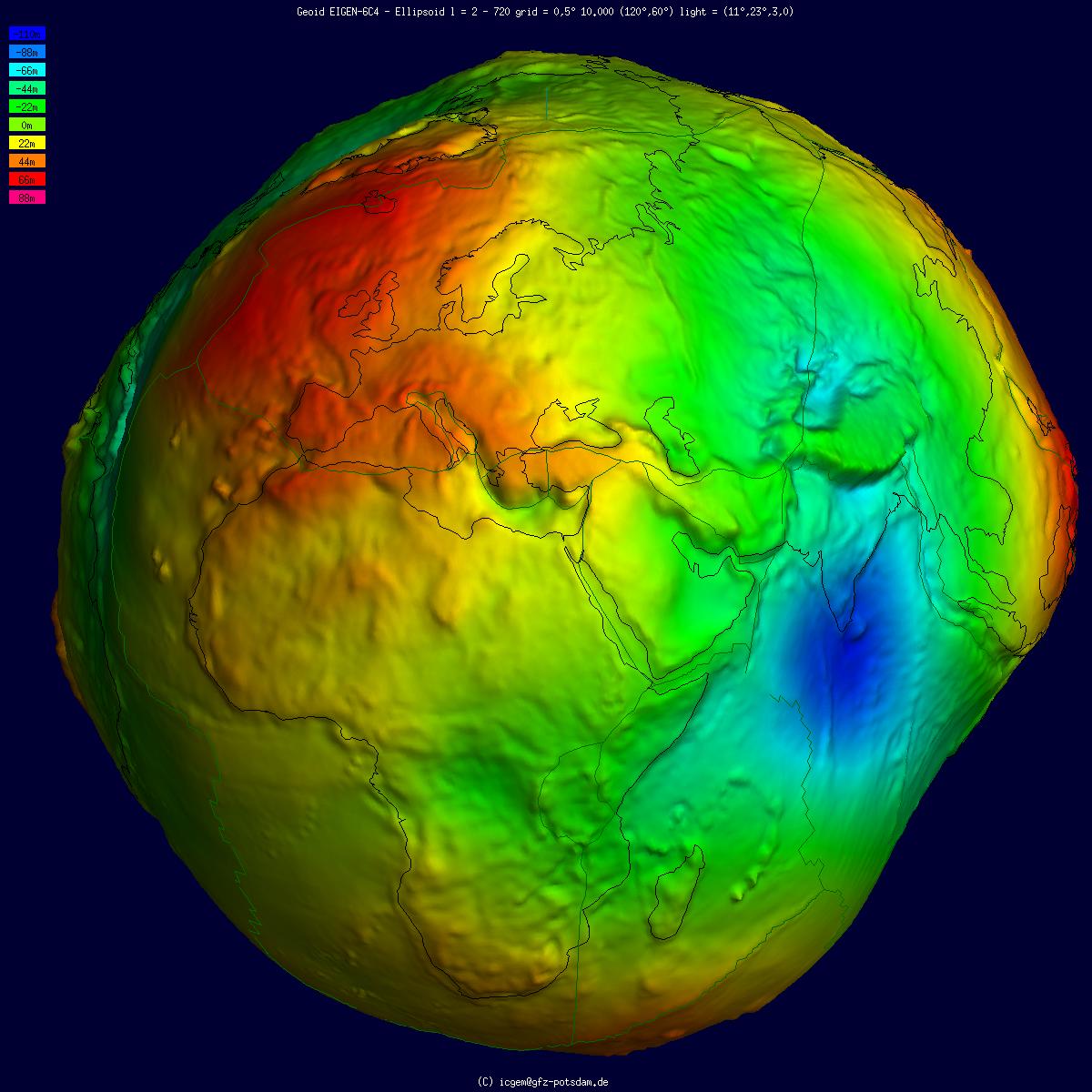
The geoid () is the shape that the ocean surface would take under the influence of the gravity of Earth, including gravitational attraction and Earth's rotation, if other influences such as winds and tides were absent. This surface is extended through the continents (such as with very narrow hypothetical canals). According to Carl Friedrich Gauss, Gauss, who first described it, it is the "mathematical figure of the Earth", a smooth but irregular surface whose shape results from the uneven distribution of mass within and on the surface of Earth. It can be known only through extensive gravitational measurements and calculations. Despite being an important concept for almost 200 years in the history of geodesy and geophysics, it has been defined to high precision only since advances in satellite geodesy in the late 20th century. All points on a geoid surface have the same geopotential (the sum of gravitational energy, gravitational potential energy and centrifugal force, centrifug ... [...More Info...] [...Related Items...] OR: [Wikipedia] [Google] [Baidu] |
Satellites In Low Earth Orbit
A satellite or artificial satellite is an object intentionally placed into orbit in outer space. Except for passive satellites, most satellites have an electricity generation system for equipment on board, such as solar panels or radioisotope thermoelectric generators (RTGs). Most satellites also have a method of communication to ground stations, called transponders. Many satellites use a standardized bus to save cost and work, the most popular of which is small CubeSats. Similar satellites can work together as a group, forming constellations. Because of the high launch cost to space, satellites are designed to be as lightweight and robust as possible. Most communication satellites are radio relay stations in orbit and carry dozens of transponders, each with a bandwidth of tens of megahertz. Satellites are placed from the surface to orbit by launch vehicles, high enough to avoid orbital decay by the atmosphere. Satellites can then change or maintain the orbit by propuls ... [...More Info...] [...Related Items...] OR: [Wikipedia] [Google] [Baidu] |
Geodetic Satellites
Geodesy ( ) is the Earth science of accurately measuring and understanding Earth's figure ( geometric shape and size), orientation in space, and gravity. The field also incorporates studies of how these properties change over time and equivalent measurements for other planets (known as ''planetary geodesy''). Geodynamical phenomena, including crustal motion, tides and polar motion, can be studied by designing global and national control networks, applying space geodesy and terrestrial geodetic techniques and relying on datums and coordinate systems. The job title is geodesist or geodetic surveyor. History Definition The word geodesy comes from the Ancient Greek word ''geodaisia'' (literally, "division of Earth"). It is primarily concerned with positioning within the temporally varying gravitational field. Geodesy in the German-speaking world is divided into "higher geodesy" ( or ), which is concerned with measuring Earth on the global scale, and "practical geodes ... [...More Info...] [...Related Items...] OR: [Wikipedia] [Google] [Baidu] |
Spacecraft Launched In 1975
A spacecraft is a vehicle or machine designed to fly in outer space. A type of artificial satellite, spacecraft are used for a variety of purposes, including communications, Earth observation, meteorology, navigation, space colonization, planetary exploration, and transportation of humans and cargo. All spacecraft except single-stage-to-orbit vehicles cannot get into space on their own, and require a launch vehicle (carrier rocket). On a sub-orbital spaceflight, a space vehicle enters outer space, space and then returns to the surface without having gained sufficient energy or velocity to make a full Earth orbit. For orbital spaceflights, spacecraft enter closed orbits around the Earth or around other Astronomical object, celestial bodies. Spacecraft used for human spaceflight carry people on board as crew or passengers from start or on orbit (space stations) only, whereas those used for robotic space missions operate either autonomous robot, autonomously or telerobotics, te ... [...More Info...] [...Related Items...] OR: [Wikipedia] [Google] [Baidu] |
Oceanography
Oceanography (), also known as oceanology and ocean science, is the scientific study of the oceans. It is an Earth science, which covers a wide range of topics, including ecosystem dynamics; ocean currents, waves, and geophysical fluid dynamics; plate tectonics and the geology of the sea floor; and fluxes of various chemical substances and physical properties within the ocean and across its boundaries. These diverse topics reflect multiple disciplines that oceanographers utilize to glean further knowledge of the world ocean, including astronomy, biology, chemistry, climatology, geography, geology, hydrology, meteorology and physics. Paleoceanography studies the history of the oceans in the geologic past. An oceanographer is a person who studies many matters concerned with oceans, including marine geology, physics, chemistry and biology. History Early history Humans first acquired knowledge of the waves and currents of the seas and oceans in pre-historic times. Observations ... [...More Info...] [...Related Items...] OR: [Wikipedia] [Google] [Baidu] |
Earth's Gravity
The gravity of Earth, denoted by , is the net acceleration that is imparted to objects due to the combined effect of gravitation (from mass distribution within Earth) and the centrifugal force (from the Earth's rotation). It is a vector quantity, whose direction coincides with a plumb bob and strength or magnitude is given by the norm g=\, \mathit\, . In SI units this acceleration is expressed in metres per second squared (in symbols, m/ s2 or m·s−2) or equivalently in newtons per kilogram (N/kg or N·kg−1). Near Earth's surface, the gravity acceleration is approximately , which means that, ignoring the effects of air resistance, the speed of an object falling freely will increase by about per second every second. This quantity is sometimes referred to informally as ''little '' (in contrast, the gravitational constant is referred to as ''big ''). The precise strength of Earth's gravity varies depending on location. The nominal "average" value at Earth's surface, known ... [...More Info...] [...Related Items...] OR: [Wikipedia] [Google] [Baidu] |
Sea State
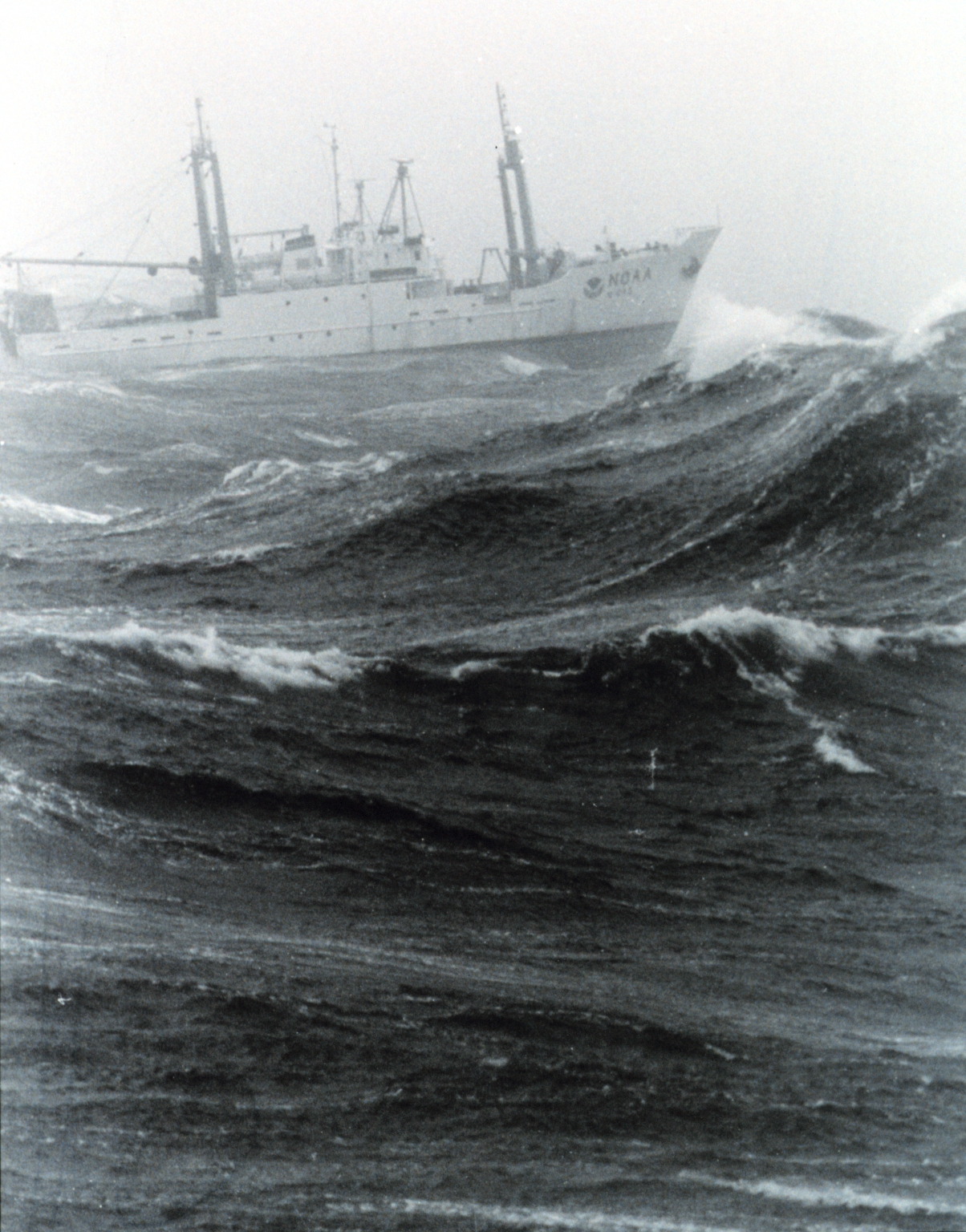
In oceanography, sea state is the general condition of the free surface on a large body of water—with respect to wind waves and swell—at a certain location and moment. A sea state is characterized by statistics, including the wave height, period, and spectrum. The sea state varies with time, as the wind and swell conditions change. The sea state can be assessed either by an experienced observer (like a trained mariner) or by using instruments like weather buoys, wave radar or remote sensing satellites. In the case of buoy measurements, the statistics are determined for a time interval in which the sea state can be considered to be constant. This duration has to be much longer than the individual wave period, but shorter than the period in which the wind and swell conditions can be expected to vary significantly. Typically, records of one hundred to one thousand wave periods are used to determine the wave statistics. The large number of variables involved in creating and des ... [...More Info...] [...Related Items...] OR: [Wikipedia] [Google] [Baidu] |
Sea Surface Topography
Ocean surface topography or sea surface topography, also called ocean dynamic topography, are highs and lows on the ocean surface, similar to the hills and valleys of Earth's land surface depicted on a topographic map. These variations are expressed in terms of average sea surface height (SSH) relative to Earth's geoid. The main purpose of measuring ocean surface topography is to understand the large-scale ocean circulation. Time variations Unaveraged or instantaneous sea surface height (SSH) is most obviously affected by the tidal forces of the Moon and the Sun acting on Earth. Over longer timescales, SSH is influenced by ocean circulation. Typically, SSH anomalies resulting from these forces differ from the mean by less than ± at the global scale. Other influences include temperature, salinity, tides, waves, and the loading of atmospheric pressure. The slowest and largest variations are due to changes in Earth's gravitational field (geoid) due to the rearrangement of contin ... [...More Info...] [...Related Items...] OR: [Wikipedia] [Google] [Baidu] |
ATS-6
ATS-6 (Applications Technology Satellite-6) was a NASA experimental satellite, built by Fairchild Space and Electronics Division It has been called the world's first educational satellite as well as world's first experimental Direct Broadcast Satellite as part of the Satellite Instructional Television Experiment between NASA and Indian Space Research Organisation (ISRO). It was launched May 30, 1974, and decommissioned July 1979. At the time of launch, it was the most powerful telecommunication satellite in orbit. ATS-6 carried no fewer than 23 different experiments, and introduced several breakthroughs. It was the first 3-axis stabilized spacecraft in geostationary orbit. It was also the first to use experimentally with some success electric propulsion in geostationary orbit. It also carried several particle physics experiments, including the first heavy ion detector in geostationary orbit. During its five-year life, ATS-6 transmitted connection programming to various countr ... [...More Info...] [...Related Items...] OR: [Wikipedia] [Google] [Baidu] |
NASA
The National Aeronautics and Space Administration (NASA ) is an independent agency of the US federal government responsible for the civil space program, aeronautics research, and space research. NASA was established in 1958, succeeding the National Advisory Committee for Aeronautics (NACA), to give the U.S. space development effort a distinctly civilian orientation, emphasizing peaceful applications in space science. NASA has since led most American space exploration, including Project Mercury, Project Gemini, the 1968-1972 Apollo Moon landing missions, the Skylab space station, and the Space Shuttle. NASA supports the International Space Station and oversees the development of the Orion spacecraft and the Space Launch System for the crewed lunar Artemis program, Commercial Crew spacecraft, and the planned Lunar Gateway space station. The agency is also responsible for the Launch Services Program, which provides oversight of launch operations and countdown management f ... [...More Info...] [...Related Items...] OR: [Wikipedia] [Google] [Baidu] |


