|
Gürbetal
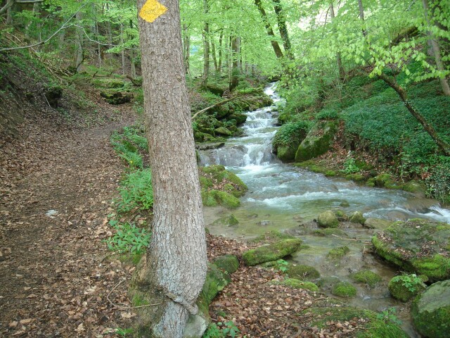
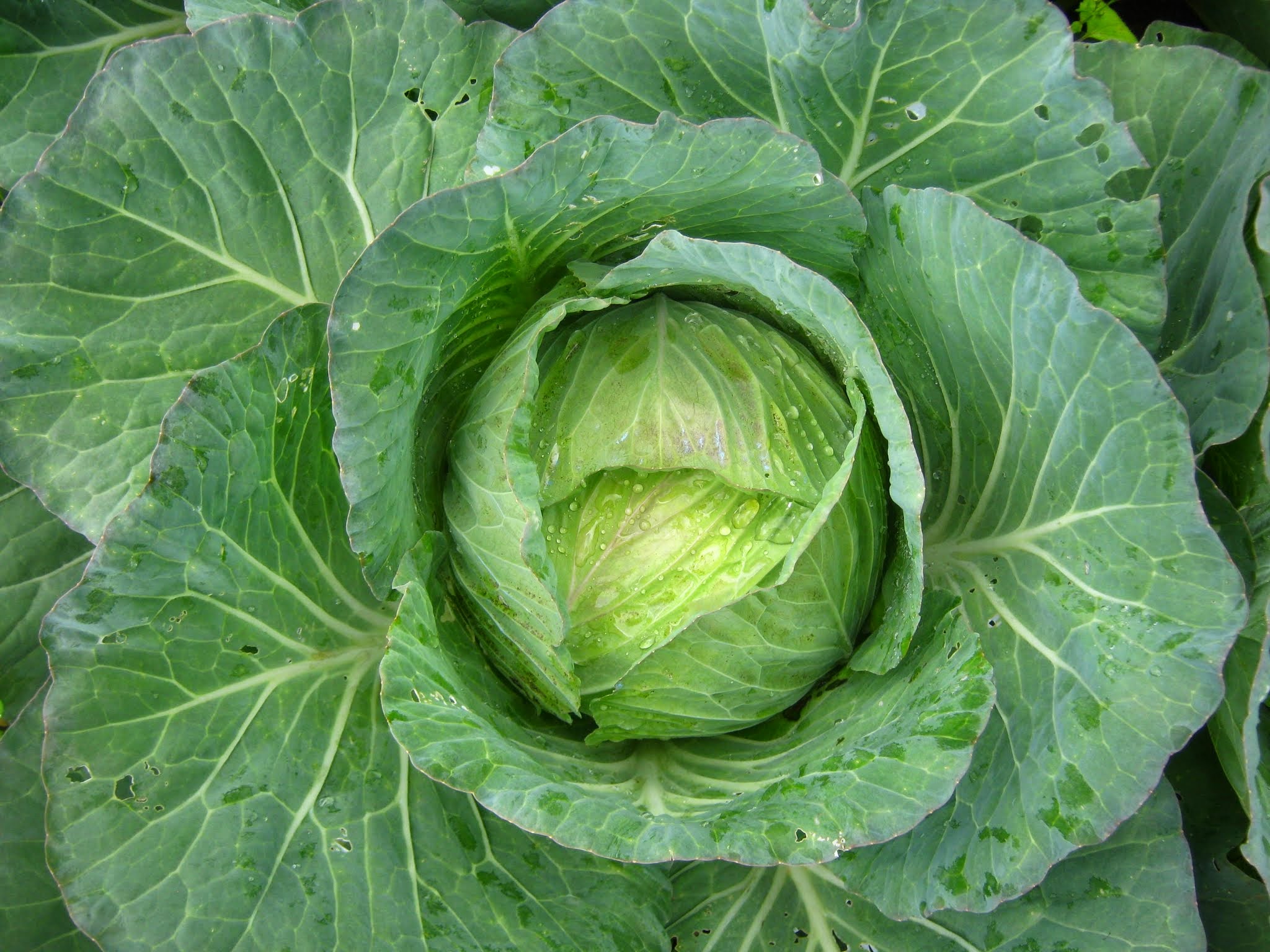
Gürbetal (Gürbe Valley) in Switzerland lies between the towns of Bern and Thun, west of the Aare. It contains the municipality of Seftigen and those that surround it. The valley is named after the river Gürbe, which flows through it. The largest town in the Gürbe Valley is Belp. The Gürbe valley and the Aare valley are separated by the Belpberg hill. The Gürbe Valley is anywhere from 1 to 2 kilometers wide. The valley floor is flat and is used intensively for agriculture. Flooding in the valley has been controlled by canals to permit drainage of the surrounding area. This permits orchards and vegetable gardens to grow. Cabbage is the principal crop grown on the rich black valley floor. Sauerkraut from the cabbage is made at processing centers in Burgistein and Mühlethurnen Mühlethurnen is a former municipality in the Bern-Mittelland administrative district in the canton of Bern in Switzerland. On 1 January 2020 the former municipalities of Kirchenthurnen, Lohnstorf and ... [...More Info...] [...Related Items...] OR: [Wikipedia] [Google] [Baidu] |
Mühlethurnen
Mühlethurnen is a former municipality in the Bern-Mittelland administrative district in the canton of Bern in Switzerland. On 1 January 2020 the former municipalities of Kirchenthurnen, Lohnstorf and Mühlethurnen merged to form the municipality of Thurnen. History The first mention of the village is in the 14th century when the von Blankenburg family owned land in it and in neighboring Kirchenthurnen. The family donated their lands and rights in 1343 and 1362 to Interlaken Abbey. In 1528, Bern accepted the new faith of the Protestant Reformation and forcefully secularized the Abbey and all its lands. The village became part of the district and parish of Thurnen. The Gürbe river correction projects from 1855 until 1911 drained the swampy valley floor and opened up additional farm land. In 1901 the Gürbetal railroad built a station in the municipality and connected it to the rest of the Swiss rail network. In the 1970s the population began to grow as Mühlethurnen became a r ... [...More Info...] [...Related Items...] OR: [Wikipedia] [Google] [Baidu] |
Belp
Belp is a municipality in the Bern-Mittelland administrative district in the canton of Bern in Switzerland. It is close to Bern's Belp Airport. The municipality of Belpberg merged on 1 January 2012 into the municipality of Belp.Amtliches Gemeindeverzeichnis der Schweiz published by the Swiss Federal Statistical Office accessed 21 December 2011 History 
[...More Info...] [...Related Items...] OR: [Wikipedia] [Google] [Baidu] |
Seftigen
Seftigen is a municipality in the administrative district of Thun in the canton of Bern in Switzerland. History Seftigen is first mentioned in 1277 as ''Seftingen''. The oldest trace of a settlement in the area is a Roman estate house discovered in Räbzälg. The house's hypocaust and well are still visible. Following the Collapse of the Western Roman Empire, the area remained inhabited, evidenced by an early medieval cemetery at Leimeried. By the Late Middle Ages Seftigen was part of the ''Herrschaft'' of Burgistein. Around 1388 it became the capital of the Seftigen district. In the 15th century Louis von Seftigen turned the village into the center of a semi-independent court. However, the right to hold court in Seftigen was divided in half between his descendants. Eventually, Jakob von Wattenwyl reunited the two halves of the court in 1523 and incorporated it into the Burgistein ''Herrschaft'' again. From then until the 1798 French invasion the Lords of Burgistein and ... [...More Info...] [...Related Items...] OR: [Wikipedia] [Google] [Baidu] |
Burgistein
Burgistein is a municipality in the administrative district of Thun in the canton of Bern in Switzerland. History Burgistein is first mentioned in 1266 as ''Burgstein'' and in 1271 as ''Burgenstein''. The oldest traces of a settlement in the area include scattered neolithic artifacts and Roman coins. During the Early to High Middle Ages there was a hill fort on Bühlhölzli hill. Across from Bühlhölzli, on Schönegg hill, are the ruins of Blankenberg Castle, which was demolished in the second half of the 14th century. During the 13th century, Jordan I of Thun began buying up farming villages and land in the Gürbetal and surrounding valleys. In 1260 he combined the scattered estates into a ''Herrschaft'' and built Burgistein Castle. By 1266 he was calling himself Jordan von Burgistein after the castle. In 1340, after the Bernese victory in the Battle of Laupen in the previous year, Burgistein Castle was destroyed in retaliation for Burgistein support against Bern. T ... [...More Info...] [...Related Items...] OR: [Wikipedia] [Google] [Baidu] |
Geistsee02
Geistsee is a lake at Längenbühl in the Canton of Berne, Switzerland ). Swiss law does not designate a ''capital'' as such, but the federal parliament and government are installed in Bern, while other federal institutions, such as the federal courts, are in other cities (Bellinzona, Lausanne, Luzern, Neuchâtel .... Its surface area is . The lake is private property and not accessible by the public. References Lakes of Switzerland Lakes of the canton of Bern LGeistsee {{bern-lake-stub ... [...More Info...] [...Related Items...] OR: [Wikipedia] [Google] [Baidu] |
Valley
A valley is an elongated low area often running between Hill, hills or Mountain, mountains, which will typically contain a river or stream running from one end to the other. Most valleys are formed by erosion of the land surface by rivers or streams over a very long period. Some valleys are formed through erosion by glacier, glacial ice. These glaciers may remain present in valleys in high mountains or polar areas. At lower latitudes and altitudes, these glaciation, glacially formed valleys may have been created or enlarged during ice ages but now are ice-free and occupied by streams or rivers. In desert areas, valleys may be entirely dry or carry a watercourse only rarely. In karst, areas of limestone bedrock, dry valleys may also result from drainage now taking place cave, underground rather than at the surface. Rift valleys arise principally from tectonics, earth movements, rather than erosion. Many different types of valleys are described by geographers, using terms th ... [...More Info...] [...Related Items...] OR: [Wikipedia] [Google] [Baidu] |
Switzerland
). Swiss law does not designate a ''capital'' as such, but the federal parliament and government are installed in Bern, while other federal institutions, such as the federal courts, are in other cities (Bellinzona, Lausanne, Luzern, Neuchâtel, St. Gallen a.o.). , coordinates = , largest_city = Zürich , official_languages = , englishmotto = "One for all, all for one" , religion_year = 2020 , religion_ref = , religion = , demonym = , german: Schweizer/Schweizerin, french: Suisse/Suissesse, it, svizzero/svizzera or , rm, Svizzer/Svizra , government_type = Federalism, Federal assembly-independent Directorial system, directorial republic with elements of a direct democracy , leader_title1 = Federal Council (Switzerland), Federal Council , leader_name1 = , leader_title2 = , leader_name2 = Walter Thurnherr , legislature = Fe ... [...More Info...] [...Related Items...] OR: [Wikipedia] [Google] [Baidu] |
Bern
german: Berner(in)french: Bernois(e) it, bernese , neighboring_municipalities = Bremgarten bei Bern, Frauenkappelen, Ittigen, Kirchlindach, Köniz, Mühleberg, Muri bei Bern, Neuenegg, Ostermundigen, Wohlen bei Bern, Zollikofen , website = www.bern.ch Bern () or Berne; in other Swiss languages, gsw, Bärn ; frp, Bèrna ; it, Berna ; rm, Berna is the ''de facto'' capital of Switzerland, referred to as the "federal city" (in german: Bundesstadt, link=no, french: ville fédérale, link=no, it, città federale, link=no, and rm, citad federala, link=no). According to the Swiss constitution, the Swiss Confederation intentionally has no "capital", but Bern has governmental institutions such as the Federal Assembly and Federal Council. However, the Federal Supreme Court is in Lausanne, the Federal Criminal Court is in Bellinzona and the Federal Administrative Court and the Federal Patent Court are in St. Gallen, exemplifying the federal nature of the Confederation. ... [...More Info...] [...Related Items...] OR: [Wikipedia] [Google] [Baidu] |
Thun
, neighboring_municipalities= Amsoldingen, Heiligenschwendi, Heimberg, Hilterfingen, Homberg, Schwendibach, Spiez, Steffisburg, Thierachern, Uetendorf, Zwieselberg , twintown = , website = www.thun.ch Thun (french: Thoune) is a town and a municipality in the administrative district of Thun in the canton of Bern in Switzerland. It is located where the Aare flows out of Lake Thun (Thunersee), southeast of Bern. the municipality has almost about 45,000 inhabitants and around 80,000 live in the agglomeration. Besides tourism, machine and precision instrument engineering, the largest garrison in the country, the food industry, armaments and publishing are of economic importance to Thun. The official language of Thun is (the Swiss variety of Standard) German, but the main spoken language is the local variant of the Alemannic Swiss German dialect. History The area of what is now Thun was inhabited since the Neolithic age (mid-3rd millennium BC). Durin ... [...More Info...] [...Related Items...] OR: [Wikipedia] [Google] [Baidu] |
Aare
The Aare () or Aar () is a tributary of the High Rhine and the longest river that both rises and ends entirely within Switzerland. Its total length from its source to its junction with the Rhine comprises about , during which distance it descends , draining an area of , almost entirely within Switzerland, and accounting for close to half the area of the country, including all of Central Switzerland. There are more than 40 hydroelectric plants along the course of the Aare. The river's name dates to at least the La Tène period, and it is attested as ''Nantaror'' "Aare valley" in the Berne zinc tablet. The name was Latinized as ''Arula''/''Arola''/''Araris''. Course The Aare rises in the great Aargletschers (Aare Glaciers) of the Bernese Alps, in the canton of Bern and west of the Grimsel Pass. The Finsteraargletscher and Lauteraargletscher come together to form the Unteraargletscher (Lower Aar Glacier), which is the main source of water for the Grimselsee (Lake of Grim ... [...More Info...] [...Related Items...] OR: [Wikipedia] [Google] [Baidu] |
Cabbage
Cabbage, comprising several cultivars of ''Brassica oleracea'', is a leafy green, red (purple), or white (pale green) biennial plant grown as an annual vegetable crop for its dense-leaved heads. It is descended from the wild cabbage ( ''B. oleracea'' var. ''oleracea''), and belongs to the "cole crops" or brassicas, meaning it is closely related to broccoli and cauliflower (var. ''botrytis''); Brussels sprouts (var. ''gemmifera''); and Savoy cabbage (var. ''sabauda''). A cabbage generally weighs between . Smooth-leafed, firm-headed green cabbages are the most common, with smooth-leafed purple cabbages and crinkle-leafed savoy cabbages of both colours being rarer. Under conditions of long sunny days, such as those found at high northern latitudes in summer, cabbages can grow quite large. , the heaviest cabbage was . Cabbage heads are generally picked during the first year of the plant's life cycle, but plants intended for seed are allowed to grow a second year and must be ... [...More Info...] [...Related Items...] OR: [Wikipedia] [Google] [Baidu] |
Valleys Of Switzerland
A valley is an elongated low area often running between Hill, hills or Mountain, mountains, which will typically contain a river or stream running from one end to the other. Most valleys are formed by erosion of the land surface by rivers or streams over a very long period. Some valleys are formed through erosion by glacier, glacial ice. These glaciers may remain present in valleys in high mountains or polar areas. At lower latitudes and altitudes, these glaciation, glacially formed valleys may have been created or enlarged during ice ages but now are ice-free and occupied by streams or rivers. In desert areas, valleys may be entirely dry or carry a watercourse only rarely. In karst, areas of limestone bedrock, dry valleys may also result from drainage now taking place cave, underground rather than at the surface. Rift valleys arise principally from tectonics, earth movements, rather than erosion. Many different types of valleys are described by geographers, using terms th ... [...More Info...] [...Related Items...] OR: [Wikipedia] [Google] [Baidu] |


