|
Guéra (region)
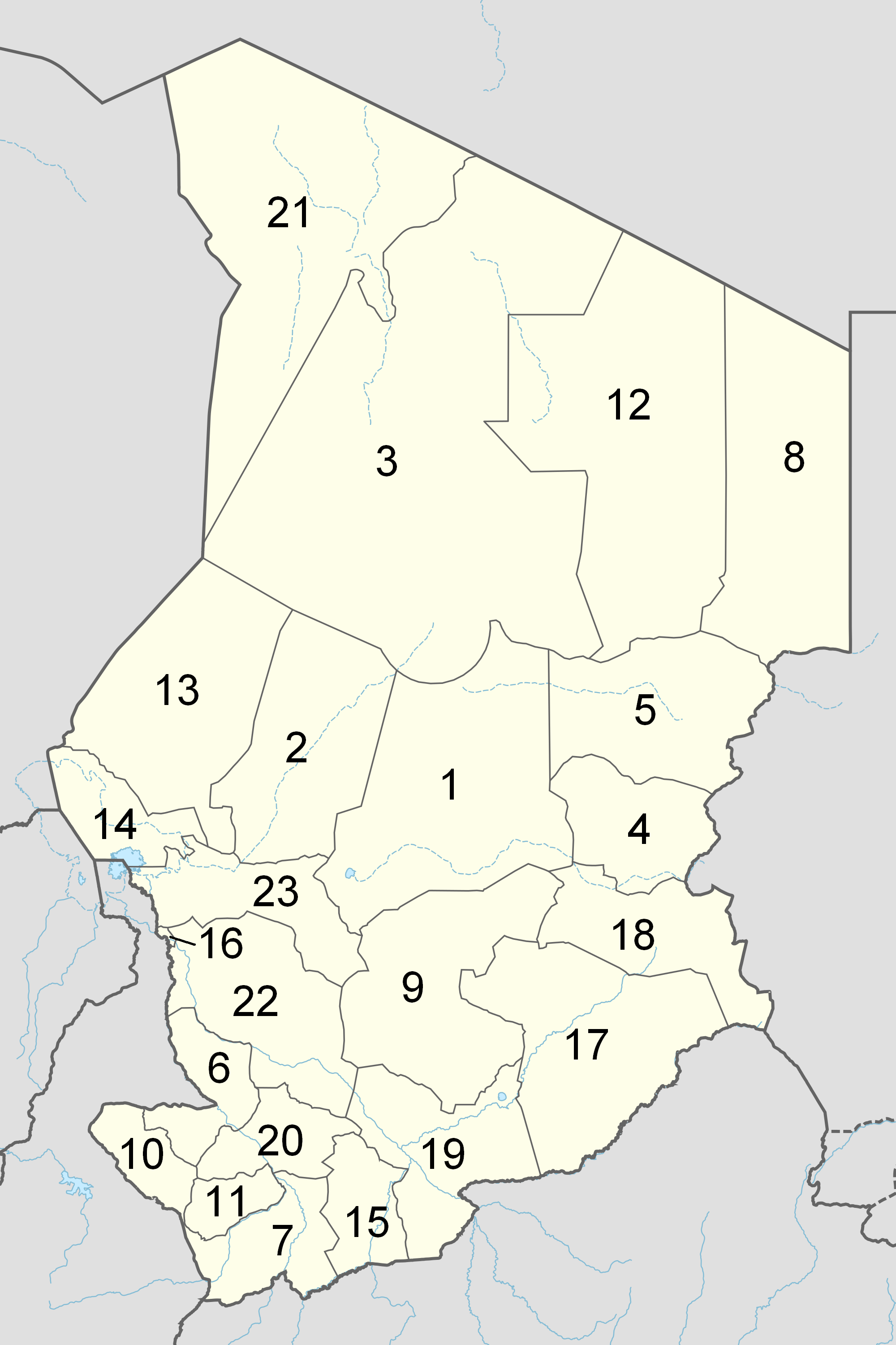
Guéra ( ar, قيرا) is one of the 23 regions of Chad, created in 2002 from the former Guéra prefecture. The region's capital is Mongo. , the population of the region was 553,795. Geography The region borders Batha Region to the north, Sila Region and Salamat Region to the east, Moyen-Chari Region to the south, and Chari-Baguirmi Region and Hadjer-Lamis Region to the west. The region contains several mountainous areas, such as the Kadam Massif and the Guéra Massif, the latter of which is composed of granites dissected by numerous dolerite dykes. The Guéra Region receives an annual rainfall of . The region is the principal agricultural producing area in the whole country, producing cotton and groundnuts, the two main cash-crops of the country, as well as rice. Half of the Zakouma National Park lies within the region. Subdivisions Departments The region of Guéra is divided into four departments, namely: * Guéra (capital: Mongo) *Barh Signaka (capital: Melfi) *Abtouyo ... [...More Info...] [...Related Items...] OR: [Wikipedia] [Google] [Baidu] |
Regions Of Chad
The Republic of Chad is made up of twenty-three regions. Chad was divided into regions in 2002. It was previously divided into prefectures, and then departments. Current regions This is a list of the regions of Chad since 2012, with population figures from the 2009 census. History From independence in 1960 until 1999 it was divided into 14 ''préfectures''. These were replaced in 1999 by 28 ''départements''. The country was reorganized again in 2002 to produce 18 ''régions''. In 2008, a further four ''régions'' were created, increasing the number to 22. Ennedi Region was split into Ennedi-Est and Ennedi-Ouest in 2012, producing the current 23 regions. Regions (2008–2012) Regions (2002–2008) (1) created in 2004 Regions created in 2008 On February 19, 2008, four new regions were created: * Former Borkou-Ennedi-Tibesti Region divided into: ** Borkou Region, from Borkou-Ennedi-Tibesti's former Borkou Department ** Ennedi Region, from Borkou-Ennedi-Ti ... [...More Info...] [...Related Items...] OR: [Wikipedia] [Google] [Baidu] |
Dike (geology)
A dike or dyke, in Geology, geological usage, is a sheet of rock that is formed in a Fracture (geology), fracture of a pre-existing rock body. Dikes can be either Intrusive rock, magmatic or Sedimentary rock, sedimentary in origin. Magmatic dikes form when magma flows into a crack then solidifies as a sheet intrusion, either cutting across layers of rock or through a contiguous mass of rock. Clastic dikes are formed when sediment fills a pre-existing crack.Essentials of Geology, 3rd Ed, Stephen Marshak Magmatic dikes A magmatic dike is a sheet of igneous rock that cuts across older rock beds. It is formed when magma fills a fracture in the older beds and then cools and solidifies. The dike rock is usually more resistant to weathering than the surrounding rock, so that erosion exposes the dike as a natural wall or ridge. It is from these natural walls that dikes get their name. Dikes preserve a record of the fissures through which most mafic magma (fluid magma low in silica) reac ... [...More Info...] [...Related Items...] OR: [Wikipedia] [Google] [Baidu] |
Mangalmé
Mangalmé is a sub-prefecture of Guéra Region Guéra or Guera may refer to: * Guéra Prefecture, a former first-level administrative division of Chad until 1999 * Guéra Region, a first-level administrative division of Chad since 2002 * Guéra Department, a second level administrative divis ... in Chad. Demographics Ethnic composition by canton in 2016: Oxfam and Office National de Développement Rural (ONDR). 2016. Atlas de la vulnérabilité dans le Guera. Première partie: synthèse regional'. 2nd edition (updated from 2013 edition). PASISAT (Projet d’Appui à l’Amélioration du Système d’Information sur la Sécurité Alimentaire au Tchad). Moubi Zarga Canton (population: 38,800; villages: 74): References Populated places in Chad {{Chad-geo-stub ... [...More Info...] [...Related Items...] OR: [Wikipedia] [Google] [Baidu] |
Mangalmé Department
Mangalmé is a sub-prefecture of Guéra Region Guéra or Guera may refer to: * Guéra Prefecture, a former first-level administrative division of Chad until 1999 * Guéra Region, a first-level administrative division of Chad since 2002 * Guéra Department, a second level administrative divis ... in Chad. Demographics Ethnic composition by canton in 2016: Oxfam and Office National de Développement Rural (ONDR). 2016. Atlas de la vulnérabilité dans le Guera. Première partie: synthèse regional'. 2nd edition (updated from 2013 edition). PASISAT (Projet d’Appui à l’Amélioration du Système d’Information sur la Sécurité Alimentaire au Tchad). Moubi Zarga Canton (population: 38,800; villages: 74): References Populated places in Chad {{Chad-geo-stub ... [...More Info...] [...Related Items...] OR: [Wikipedia] [Google] [Baidu] |
Bitkine
Bitkine ( ar, نيتكتن) is a small city and sub-prefecture in the center of Chad. The city is the chef-lieu of the Abtouyour department, in Guéra Region Guéra or Guera may refer to: * Guéra Prefecture, a former first-level administrative division of Chad until 1999 * Guéra Region, a first-level administrative division of Chad since 2002 * Guéra Department, a second level administrative divis .... Demographics Ethnic composition by canton in 2016: Oxfam and Office National de Développement Rural (ONDR). 2016. Atlas de la vulnérabilité dans le Guera. Première partie: synthèse regional'. 2nd edition (updated from 2013 edition). PASISAT (Projet d’Appui à l’Amélioration du Système d’Information sur la Sécurité Alimentaire au Tchad). Djonkor Canton (population: 17,462; villages: 24): Kenga Canton (population: 78,236; villages: 70): Arabe Imar Canton (population: 17,565; villages: 100): References {{Chad-geo-stub Populated places in Chad G ... [...More Info...] [...Related Items...] OR: [Wikipedia] [Google] [Baidu] |
Abtouyour
Abtouyour ( ar, أبو تويور) is one of four departments of Chad in Guéra, a region In geography, regions, otherwise referred to as zones, lands or territories, are areas that are broadly divided by physical characteristics ( physical geography), human impact characteristics ( human geography), and the interaction of humanity an ... of Chad. Its capital is Bitkine. Abtouyour Department has a population of 177,850 (2016 survey) and 197 villages. Oxfam and Office National de Développement Rural (ONDR). 2016. Atlas de la vulnérabilité dans le Guera. Première partie: synthèse regional'. 2nd edition (updated from 2013 edition). PASISAT (Projet d’Appui à l’Amélioration du Système d’Information sur la Sécurité Alimentaire au Tchad). References Departments of Chad Guéra Region {{Chad-geo-stub ... [...More Info...] [...Related Items...] OR: [Wikipedia] [Google] [Baidu] |
Melfi, Chad
Melfi ( ar, ملفي) is a town in the Guéra Region of southern-central Chad. The Tele-Nugar Iron Mines, a UNESCO World Heritage Site, are located approximately 155 km south of Melfi.Les curieuses mines de fer de Télé-Nugar - UNESCO World Heritage Centre Retrieved 2009-02-25. Demographics Ethnic composition by canton in 2016:Oxfam
Oxfam is a British-founded confederation of 21 independent charitable organizations focusing on the alleviation of global poverty, founded in 1942 and led by Oxfam International.
History
Founded at 17 Broad Street, Oxford, as the Oxford Co ... and O ...
[...More Info...] [...Related Items...] OR: [Wikipedia] [Google] [Baidu] |
Barh Signaka
Barh Signaka ( ar, بحر سينياكا) is one of four departments in Guéra, a region of Chad. Its capital is Mongo. Barh Signaka Department has a population of 118,620 (2016 survey) and 495 villages. Oxfam and Office National de Développement Rural (ONDR). 2016. Atlas de la vulnérabilité dans le Guera. Première partie: synthèse regional'. 2nd edition (updated from 2013 edition). PASISAT (Projet d’Appui à l’Amélioration du Système d’Information sur la Sécurité Alimentaire au Tchad). The Tele-Nugar Iron Mines, a UNESCO World Heritage Site, are located approximately 155 km south of Melfi.Les curieuses mines de fer de Télé-Nugar - UNESCO World Heritage Centre Retrieved 2009-02-25. See also * |
Guéra Department
Guéra or Guera may refer to: * Guéra Prefecture, a former first-level administrative division of Chad until 1999 * Guéra Region, a first-level administrative division of Chad since 2002 * Guéra Department, a second level administrative division of Guéra Region, Chad * Kperou Guera, a village in Parakou subdistrict, Borgou Department, Benin * La Guera LA most frequently refers to Los Angeles, the second largest city in the United States. La, LA, or L.A. may also refer to: Arts and entertainment Music * La (musical note), or A, the sixth note * "L.A.", a song by Elliott Smith on ''Figure ..., a town in Western Sahara, also known as Lagouira * R. M. Guéra (born 1959), a Serbian comic book author and illustrator {{geodis ... [...More Info...] [...Related Items...] OR: [Wikipedia] [Google] [Baidu] |
Médecins Sans Frontières
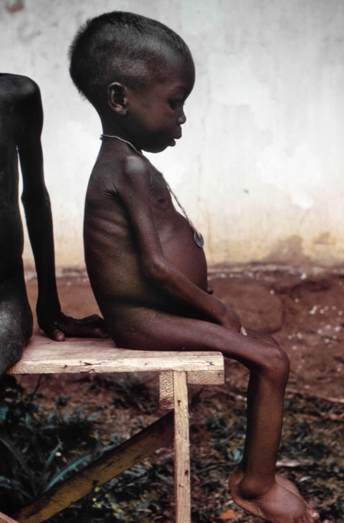
(MSF; pronounced ), also known as Doctors Without Borders, is a humanitarian medical non-governmental organisation (NGO) or charity of French origin known for its projects in conflict zones and in countries affected by endemic diseases. Main areas of work include diabetes, drug-resistant infections, HIV/AIDS, hepatitis C, tropical and neglected diseases, tuberculosis, vaccines and COVID-19. In 2019, the charity was active in 70 countries with over 35,000 personnel; mostly local doctors, nurses and other medical professionals, logistical experts, water and sanitation engineers, and administrators. Private donors provide about 90% of the organisation's funding, while corporate donations provide the rest, giving MSF an annual budget of approximately US$1.63 billion. MSF was founded in 1971, in the aftermath of the Biafran famine of the Nigerian Civil War, by a small group of French doctors and journalists who sought to expand accessibility to medical care across nation ... [...More Info...] [...Related Items...] OR: [Wikipedia] [Google] [Baidu] |
Zakouma National Park
Zakouma National Park is a national park in southeastern Chad, straddling the border of Guéra Region and Salamat Region. Zakouma is the nation's oldest national park, declared a national park in 1963 by presidential decree, giving it the highest form of protection available under the nation's laws. It has been managed by the nonprofit conservation organization African Parks since 2010 in partnership with Chad's government. History Zakouma is Chad's oldest national park, Note: Slides 1–7; 9–11. established by the nation's government in 1963. Its wildlife have been threatened by the ivory trade and poaching, including by Janjaweed members. In 2007, militia forces attacked the park's headquarters for its stockpile of 1.5 tons of ivory, and killed three rangers. The government of Chad began working with African Parks in 2010 to help manage and protect the park and its wildlife, especially elephants. The park's anti-poaching strategy includes equipping approximately 60 ranger ... [...More Info...] [...Related Items...] OR: [Wikipedia] [Google] [Baidu] |
Rice
Rice is the seed of the grass species ''Oryza sativa'' (Asian rice) or less commonly ''Oryza glaberrima ''Oryza glaberrima'', commonly known as African rice, is one of the two domesticated rice species. It was first domesticated and grown in West Africa around 3,000 years ago. In agriculture, it has largely been replaced by higher-yielding Asian r ...'' (African rice). The name wild rice is usually used for species of the genera ''Zizania (genus), Zizania'' and ''Porteresia'', both wild and domesticated, although the term may also be used for primitive or uncultivated varieties of ''Oryza''. As a cereal, cereal grain, domesticated rice is the most widely consumed staple food for over half of the world's World population, human population,Abstract, "Rice feeds more than half the world's population." especially in Asia and Africa. It is the agricultural commodity with the third-highest worldwide production, after sugarcane and maize. Since sizable portions of sugarcane and ma ... [...More Info...] [...Related Items...] OR: [Wikipedia] [Google] [Baidu] |


