|
Gulf Developmental Road
Gulf Developmental Road is an Australian highway linking the Cairns and Normanton regions in northern Queensland, Australia. It is the only sealed (asphalt) road linking these two regions. In the east, the road begins at an unnamed junction on the southern edge of Forty Mile Scrub National Park, 241 km south-west of Cairns. The Gulf Developmental Road runs west before terminating at its junction with the Burke Developmental Road 7 km south of Normanton, a total distance of 442 km. Towns along the route include Mount Surprise, Georgetown and Croydon. There are no other communities along the route, but it passes through the ghost town of Cumberland. The road is sealed for its full length, but as of 2018 there are many sections of the road which are only single lane bitumen. These sections require caution when passing other traffic as the shoulders are gravel and vehicles need to move partly onto the shoulders. They extend between points about 55 kilometres west of ... [...More Info...] [...Related Items...] OR: [Wikipedia] [Google] [Baidu] |
Savannah Way
The Savannah Way is a route of highways and major roads across the tropical savannahs of northern Australia, linking Cairns in Queensland with Broome in Western Australia. Promoted as a self-drive tourist route, it joins Cairns, Normanton, Borroloola, Katherine, Kununurra, Fitzroy Crossing, Derby and Broome. It has been designated by the Queensland Government as a State Strategic Touring Route. Licensed as CC-BY. File:Savannah Way 0216.svg Much of the route is Highway 1; however, much of it is on unsealed roads. It runs for a distance of . Parts of Savannah Way form part of the National Highway network. Alternate routes are signposted along the way allowing travellers different options from the main Savannah Way. From Cairns they include travel via Chillagoe and the Burke Developmental Road to Karumba; via Einasleigh and Forsayth to Georgetown; via Gregory Downs to Boodjamulla National Park (Lawn Hill) and Bowthorn station; via Daly Waters and Top Springs to Tim ... [...More Info...] [...Related Items...] OR: [Wikipedia] [Google] [Baidu] |
Asphalt
Asphalt, also known as bitumen (, ), is a sticky, black, highly viscous liquid or semi-solid form of petroleum. It may be found in natural deposits or may be a refined product, and is classed as a pitch. Before the 20th century, the term asphaltum was also used. Full text at Internet Archive (archive.org) The word is derived from the Ancient Greek ἄσφαλτος ''ásphaltos''. The largest natural deposit of asphalt in the world, estimated to contain 10 million tons, is the Pitch Lake located in La Brea in southwest Trinidad (Antilles island located on the northeastern coast of Venezuela), within the Siparia Regional Corporation. The primary use (70%) of asphalt is in Road surface, road construction, where it is used as the glue or binder mixed with construction aggregate, aggregate particles to create asphalt concrete. Its other main uses are for bituminous waterproofing products, including production of roofing felt and for sealing flat roofs. In material sciences an ... [...More Info...] [...Related Items...] OR: [Wikipedia] [Google] [Baidu] |
List Of Highways In Queensland
Queensland, being the second largest (by area) state in Australia, is also the most decentralised. Hence the highways and roads cover most parts of the state unlike the sparsely populated Western Australia. Even Queensland's outback is well served as it is relatively populated. Road quality varies from 8-laned Pacific Motorway linking Brisbane–Gold Coast to earth-packed outback tracks, reflecting the great diversity of its terrain and climatic conditions. The route markings are also unique in the sense that Queensland uses all available schemes, from old-style National Route scheme and the blue-shielded State Route scheme to the latest alphanumeric numbering scheme and the Metroads metropolitan route numbering scheme. National Land Transport Network * **Bruce Highway ** Gateway Motorway ** Pacific Motorway * Bruce Highway * **Gateway Motorway **Ipswich Motorway **Logan Motorway **Warrego Highway * ** Barkly Highway ** Landsborough Highway ** Warrego Highway * Flinders Hi ... [...More Info...] [...Related Items...] OR: [Wikipedia] [Google] [Baidu] |
Highways In Australia
Highways in Australia are generally high capacity roads managed by state and territory government agencies, though Australia's federal government contributes funding for important links between capital cities and major regional centres. Prior to European settlement, the earliest needs for trade and travel were met by narrow bush tracks, used by tribes of Indigenous Australians. The formal construction of roads began in 1788, after the founding of the colony of New South Wales, and a network of three major roads across the colony emerged by the 1820s. Similar road networks were established in the other colonies of Australia. Road construction programs in the early 19th century were generally underfunded, as they were dependent on government budgets, loans, and tolls; while there was a huge increase in road usage, due to the Australian gold rushes. Local government authorities, often known as Road Boards, were therefore established to be primarily responsible for funding and u ... [...More Info...] [...Related Items...] OR: [Wikipedia] [Google] [Baidu] |
Einasleigh River Bridge
The Einasleigh River Bridge is a road bridge over the Einasleigh River on the Gulf Developmental Road, in the Far North Queensland, Australia, located east of Georgetown and west of Mount Surprise. The bridge is part of the only sealed (asphalt) road linking Cairns and Normanton in the Gulf Savannah region. The new high set bridge was constructed to flood-proof the Gulf Country. It replaced an existing low level bridge which was designed for inundation. The old bridge was flooded in every wet season. In 2009 it was under water for 40 days after the biggest flood on record. During flooding of the old Einasleigh River Bridge, most communities across the Gulf Shires were inaccessible by road and the emergency supplies had to be provided by helicopter. The bridge was built by the Etheridge Shire Council and was funded through the Australian Government's Regional and Local Community Infrastructure Program. It was opened on 20 January 2011 by Simon Crean Simon Findlay Cr ... [...More Info...] [...Related Items...] OR: [Wikipedia] [Google] [Baidu] |
Roads Of Strategic Importance
Roads of Strategic Importance (ROSI) is a $5.8 billion initiative of the Australian Government designed to help connect regional businesses to local and international markets, and to better connect regional communities. The source for this article is an Australian Government website titled "Roads of Strategic Importance". Funding by the Australian Government is up to 80% of total costs, with the remainder being met by state, territory and local governments. ROSI reserves $1.5 billion for projects in Northern Australia, building on the benefits being delivered by the Northern Australia Roads Program and the Northern Australia Beef Roads Program. Types of work ROSI is ensuring that key freight roads efficiently connect agricultural and mining regions to ports, airports and other transport hubs. The work undertaken includes bridge and culvert construction, road widening, sealing, overtaking lanes and pavement renewal. Strategic corridors Most ROSI projects are grouped within defined ... [...More Info...] [...Related Items...] OR: [Wikipedia] [Google] [Baidu] |
National Highway (Australia)
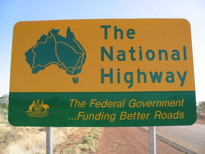
The National Highway (part of the National Land Transport Network) is a system of roads connecting all mainland states and territories of Australia, and is the major network of highways and motorways connecting Australia's capital cities and major regional centres. History Legislation National funding for roads began in the 1920s, with the federal government contributing to major roads managed by the state and territory governments. However, the Federal Government did not completely fund any roads until 1974, when the Whitlam Government introduced the ''National Roads Act 1974''.. Under the act, the states were still responsible for road construction and maintenance, but were fully compensated for money spent on approved projects. In 1977, the 1974 Act was replaced by the ''State Grants (Roads) Act 1977'', which contained similar provisions for the definition of "National Highways". In 1988, the National Highway became redefined under the ''Australian Land Transport Deve ... [...More Info...] [...Related Items...] OR: [Wikipedia] [Google] [Baidu] |
Highway 1 (Queensland)
In Queensland, Highway 1 is a long route that crosses the state, from the Northern Territory (NT) border near Wollogorang to Cairns, and then travels along the coastline to the New South Wales (NSW) border near Coolangatta. Highway 1 continues around the rest of Australia, joining all mainland state capitals, and connecting major centres in Tasmania. All roads within the Highway 1 system are allocated a road route numbered 1, M1, A1, or B1, depending on the state route numbering system. In Queensland, the highway is designated as National Route 1 from the NT border to Cairns, Route A1 from Cairns to Kybong, and then Route M1 down to the NSW border. History Highway 1 was created as part of the National Route Numbering system, adopted in 1955. The route was compiled from an existing network of state and local roads and tracks. Route description The Savannah Way is the largely unsignposted route for Highway 1 between the Northern Territory border and Normanton. From there, ... [...More Info...] [...Related Items...] OR: [Wikipedia] [Google] [Baidu] |
Cumberland, Queensland
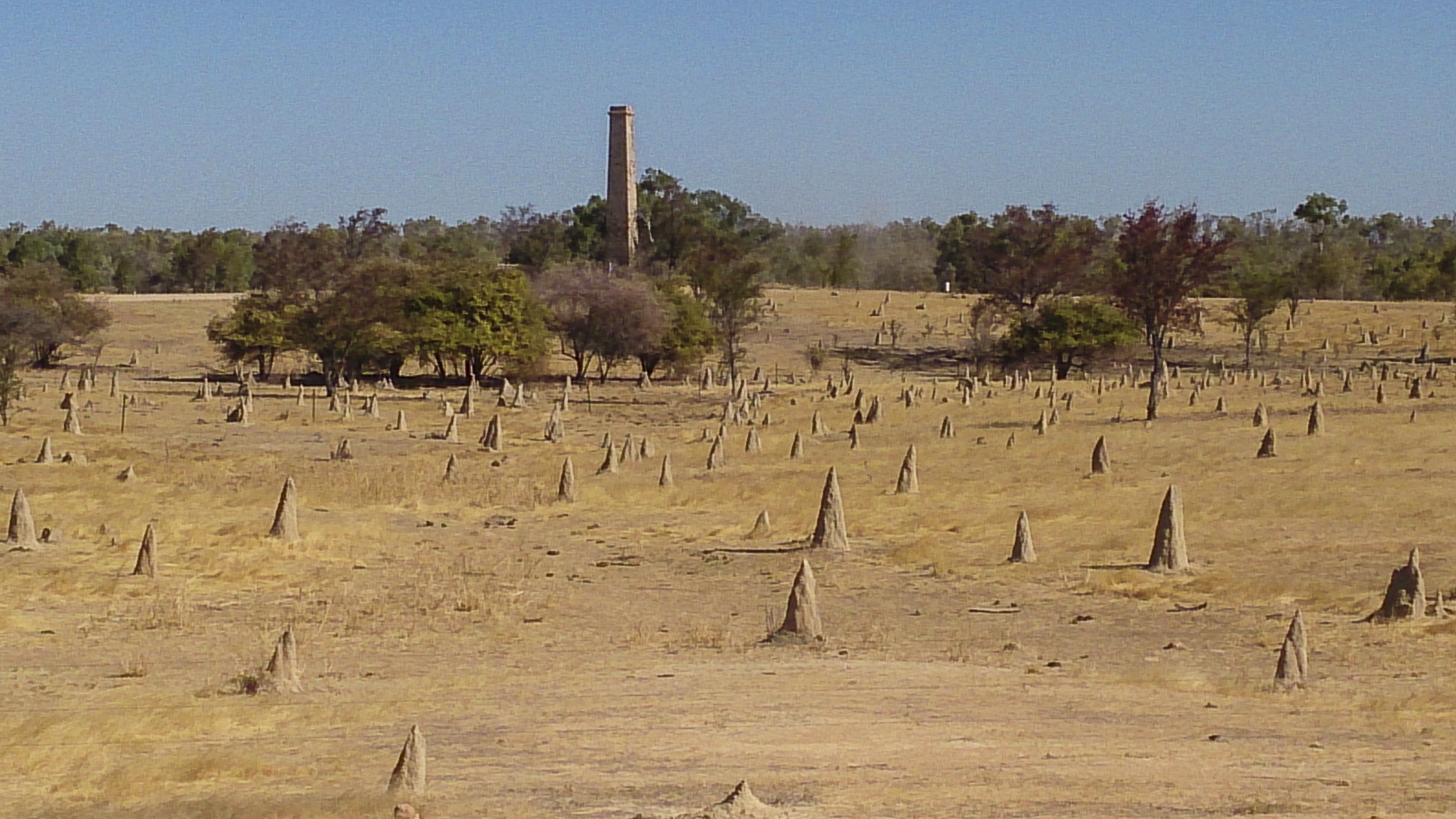
Cumberland is a ghost town in the Shire of Etheridge in Queensland, Australia, located approximately west of Georgetown, Queensland on the Gulf Developmental Road. History Boom Cumberland was born when gold was discovered there in 1872 and the first prospecting claim was registered in that same year. By 1878, it was one of the major producers of gold in the Etheridge goldfield. The Cumberland Company dammed nearby Cumberland Creek to create a permanent water supply for the township. A battery and cyanide plant was built by the creek in 1880. The town site was surveyed in June 1882 by T.R. Geraghty. High levels of gold production continued through the 1880s peaking in 1886, and the town grew to a population of about 400 people. In 1885 a police station and telegraph station were established. Cumberland Post Office opened on 3 April 1885 and closed in 1929. Both the Queensland Government Savings Bank and the Bank of New South Wales opened branch offices in 1887. The township ... [...More Info...] [...Related Items...] OR: [Wikipedia] [Google] [Baidu] |
Ghost Town
Ghost Town(s) or Ghosttown may refer to: * Ghost town, a town that has been abandoned Film and television * Ghost Town (1936 film), ''Ghost Town'' (1936 film), an American Western film by Harry L. Fraser * Ghost Town (1956 film), ''Ghost Town'' (1956 film), an American Western film by Allen H. Miner * Ghost Town (1988 film), ''Ghost Town'' (1988 film), an American horror film by Richard McCarthy (as Richard Governor) * Ghost Town (2008 film), ''Ghost Town'' (2008 film), an American fantasy comedy film by David Koepp * ''Ghost Town'', a 2008 TV film featuring Billy Drago * ''Derek Acorah's Ghost Towns'', a 2005–2006 British paranormal reality television series * Ghost Town (CSI: Crime Scene Investigation), "Ghost Town" (''CSI: Crime Scene Investigation''), a 2009 TV episode Literature * Ghost Town (Lucky Luke), ''Ghost Town'' (''Lucky Luke'') or ''La Ville fantôme'', a 1965 ''Lucky Luke'' comic *''Ghost Town'', a Beacon Street Girls novel by Annie Bryant *''Ghost Town'', a 199 ... [...More Info...] [...Related Items...] OR: [Wikipedia] [Google] [Baidu] |
Australia
Australia, officially the Commonwealth of Australia, is a Sovereign state, sovereign country comprising the mainland of the Australia (continent), Australian continent, the island of Tasmania, and numerous List of islands of Australia, smaller islands. With an area of , Australia is the largest country by area in Oceania and the world's List of countries and dependencies by area, sixth-largest country. Australia is the oldest, flattest, and driest inhabited continent, with the least fertile soils. It is a Megadiverse countries, megadiverse country, and its size gives it a wide variety of landscapes and climates, with Deserts of Australia, deserts in the centre, tropical Forests of Australia, rainforests in the north-east, and List of mountains in Australia, mountain ranges in the south-east. The ancestors of Aboriginal Australians began arriving from south east Asia approximately Early human migrations#Nearby Oceania, 65,000 years ago, during the Last Glacial Period, last i ... [...More Info...] [...Related Items...] OR: [Wikipedia] [Google] [Baidu] |
Burke Developmental Road
The Burke Developmental Road is a Queensland (Australia) developmental road. It links Cloncurry and Normanton in a south–north direction, then turns to the north-east north of Normanton for before turning south-east till Dimbulah, where it becomes the Mareeba Dimbulah Road. The road crosses the Gilbert River. This bridge was named after two of the region's indigenous leaders, Lily and Jubilee Slattery. A major unsealed section begins about north of Normanton and continues until Chillagoe. As of 2014, some sections totaling about are unsealed between Chillagoe and Dimbulah. It may become impassable during the wet season. In mid-2007, A$28 million worth of funding was allocated for the widening of the road. Northern Australia Beef Roads upgrades The Northern Australia Beef Roads Program announced in 2016 included two projects for the Burke Developmental Road. Pavement strengthening The project for progressive sealing works between Chillago and Almaden (Package One) was ... [...More Info...] [...Related Items...] OR: [Wikipedia] [Google] [Baidu] |


