|
Guffert
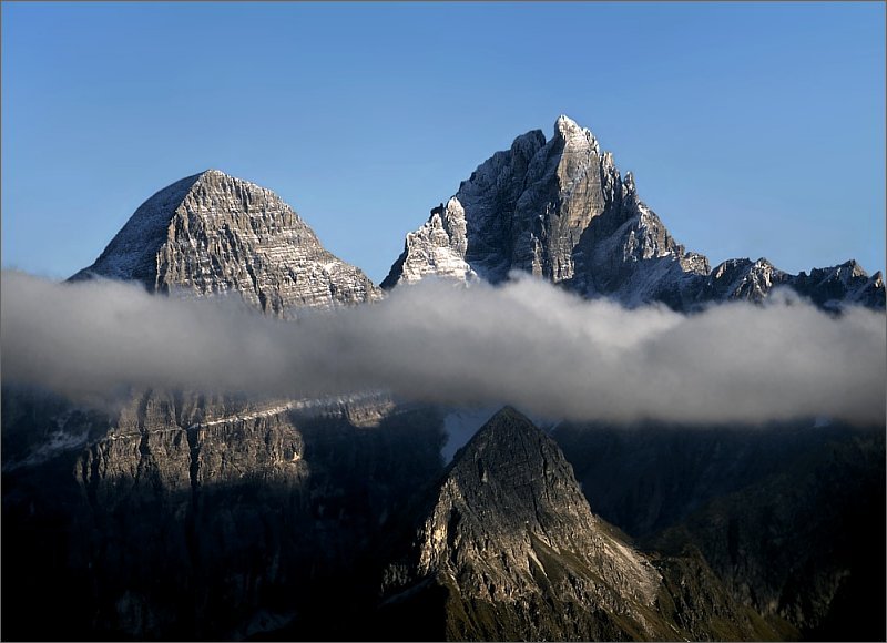
The Guffert is a high, isolated, prominent limestone alpenstock in the Brandenberg Alps (Rofan) that, together with the Guffertstein, forms a twin peak. It lies north of Steinberg am Rofan. Because it projects above the Mangfall Mountains to the north by about 300 metres, the striking double peak is easily recognised from the Alpine Foreland, the Tegernsee and the Bavarian Prealps. File:Guffert vom Unnütz HQ.jpg, The Guffert from the southwest (from the '' Vorderunnütz'') File:Guffert Westgipfel HQ.jpg, The western summit seen from the main summit File:014_11A.jpg, The "unfriendly" west side of the Guffert File:Guffert_face_nord.jpg, Guffert - north side File:Guffert_vom_Balkon.jpg, The Guffert seen from Munich File:Guffert westseite.jpg, Northwest side of the Guffert File:Inscription étrusque Guffert Autriche.jpg, Etruscan inscription in the rock cleft File:East side of Guffert.JPG, East side of the Guffert References External links Tour description Tour descripti ... [...More Info...] [...Related Items...] OR: [Wikipedia] [Google] [Baidu] |
Brandenberg Alps
The Brandenberg Alps (german: Brandenberger Alpen) are a sub-group of the Northern Limestone Alps, that run in front of the Eastern Alps for their whole length. They lie entirely in Austria between Achensee in Tyrol, the Inn Valley and the Bavarian Prealps. They are widely known in German as the ''Rofangebirge'', although the actual ''Rofan'' (also ''Sonnwendgebirge'') is only the western part of the area between the Brandenberger Ache stream and the Achensee lake. It consists of a central mountain group and three individual mountains. The Guffert (), which is located outside the central group, forms a distinct mountain block. It is located north of Kramsach, between the Tegernsee Blauberge and the central Rofan. The Unnütze, at the northern end of the Achensee east of Achenkirch, and the Ebener Joch () east of Maurach at the southern end of the Achensee, are also outside the central mountain range. Neighbouring mountain ranges The Brandenberg Alps border on the following ... [...More Info...] [...Related Items...] OR: [Wikipedia] [Google] [Baidu] |
Unnütze
The Unnütze (also called the Unnutze) is a small mountain ridge northeast of the Achensee lake between Achenkirch and Steinberg am Rofan in the Brandenberg Alps in the Austrian state of Tyrol Tyrol (; historically the Tyrole; de-AT, Tirol ; it, Tirolo) is a historical region in the Alps - in Northern Italy and western Austria. The area was historically the core of the County of Tyrol, part of the Holy Roman Empire, Austrian Emp .... The ridge has three summits and runs in a north to south direction. The summits are the ''Hinterunnütz'' (2,007 m), the ''Hochunnütz'' (2,075 m) and the ''Vorderunnütz'' (2,078 m). In general, however, the ''Vorderunnütz'' is called the ''Unnütz''. External links tour description (snowshoe tour) Mountains of the Alps Mountains of Tyrol (state) Two-thousanders of Austria Brandenberg Alps {{tyrol-geo-stub ... [...More Info...] [...Related Items...] OR: [Wikipedia] [Google] [Baidu] |
Rofan
The Brandenberg Alps (german: Brandenberger Alpen) are a sub-group of the Northern Limestone Alps, that run in front of the Eastern Alps for their whole length. They lie entirely in Austria between Achensee in Tyrol, the Inn Valley and the Bavarian Prealps. They are widely known in German as the ''Rofangebirge'', although the actual ''Rofan'' (also ''Sonnwendgebirge'') is only the western part of the area between the Brandenberger Ache stream and the Achensee lake. It consists of a central mountain group and three individual mountains. The Guffert (), which is located outside the central group, forms a distinct mountain block. It is located north of Kramsach, between the Tegernsee Blauberge and the central Rofan. The Unnütze, at the northern end of the Achensee east of Achenkirch, and the Ebener Joch () east of Maurach at the southern end of the Achensee, are also outside the central mountain range. Neighbouring mountain ranges The Brandenberg Alps border on the following ... [...More Info...] [...Related Items...] OR: [Wikipedia] [Google] [Baidu] |
Mountains Of Tyrol (state)
A mountain is an elevated portion of the Earth's crust, generally with steep sides that show significant exposed bedrock. Although definitions vary, a mountain may differ from a plateau in having a limited summit area, and is usually higher than a hill, typically rising at least 300 metres (1,000 feet) above the surrounding land. A few mountains are isolated summits, but most occur in mountain ranges. Mountains are formed through tectonic forces, erosion, or volcanism, which act on time scales of up to tens of millions of years. Once mountain building ceases, mountains are slowly leveled through the action of weathering, through slumping and other forms of mass wasting, as well as through erosion by rivers and glaciers. High elevations on mountains produce colder climates than at sea level at similar latitude. These colder climates strongly affect the ecosystems of mountains: different elevations have different plants and animals. Because of the less hospitable terrain and ... [...More Info...] [...Related Items...] OR: [Wikipedia] [Google] [Baidu] |
Mountains Of The Alps
This page tabulates only the most prominent mountains of the Alps, selected for having a topographic prominence of ''at least'' , and all of them exceeding in height. Although the list contains 537 summits, some significant alpine mountains are necessarily excluded for failing to meet the stringent prominence criterion. The list of these most prominent mountains is continued down to 2500 m elevation at List of prominent mountains of the Alps (2500–2999 m) and down to 2000 m elevation on List of prominent mountains of the Alps (2000–2499 m). All such mountains are located in either France, Italy, Switzerland, Liechtenstein, Austria, Germany or Slovenia, even in some lower regions. Together, these three lists include all 44 ultra-prominent peaks of the Alps, with 19 ultras over 3000m on this page. For a definitive list of all 82 the highest peaks of the Alps, as identified by the International Climbing and Mountaineering Federation (UIAA), and often referred to as the 'Alpi ... [...More Info...] [...Related Items...] OR: [Wikipedia] [Google] [Baidu] |
Kaisergebirge
The Kaiser Mountains (german: Kaisergebirge, meaning ''Emperor Mountains'') are a mountain range in the Northern Limestone Alps and Eastern Alps. Its main ridges – are the Zahmer Kaiser and south of it the Wilder Kaiser. The mountains are situated in the Austrian province of Tyrol between the town of Kufstein and the town of St. Johann in Tirol. The Kaiser Mountains offer some of the loveliest scenery in all the Northern Limestone Alps. Reynolds, Kev (2005). ''Walking in the Alps'', 2nd ed., Cicerone, Singapore, p. 430, . Divisions The Kaiser Mountains are divided into the Wilder Kaiser or Wild Kaiser chain of mountains, formed predominantly of bare limestone rock, and the Zahmer Kaiser ("Tame Kaiser"), whose southern side is mainly covered by mountain pine. These two mountain ridges are linked by the 1,580-metre-high Stripsenjoch pass, but are separated in the west by the valley of Kaisertal and in the east by the Kaiserbach valley. In total the Kaiser extends for abo ... [...More Info...] [...Related Items...] OR: [Wikipedia] [Google] [Baidu] |
Stubaier Alpen
The Stubai Alps (in German ''Stubaier Alpen'') is a mountain range in the Central Eastern Alps of Europe. It derives its name from the Stubaital valley to its east and is located southwest of Innsbruck, Austria. Several peaks form the border between Austria and Italy. The range is bounded by the Inn River valley to the north; the Sill River valley (''Wipptal'') and the Brenner Pass to the east (separating it from the Zillertal Alps); the Ötztal and Timmelsjoch to the west (separating it from the Ötztal Alps), and to the south by tributaries of the Passer River and Eisack. Geography Important parts of the Stubai Alps show signs of glaciation. The northern part around the Sellrain valley and the Kühtai is now only lightly glaciated and a popular ski touring destination ( Zischgeles, Lampsenspitze, Pirchkogel, Sulzkogel). The High Stubai around the upper Stubai valley is still heavily glaciated and a classic high mountain touring region in the Eastern Alps. Here there is a glacie ... [...More Info...] [...Related Items...] OR: [Wikipedia] [Google] [Baidu] |
Karwendel
The Karwendel is the largest mountain range of the Northern Limestone Alps. The major part belongs to the Austrian federal state of Tyrol (state), Tyrol, while the adjacent area in the north is part of Bavaria, Germany. Four mountain chain, chains stretch from west to east; in addition, there are a number of fringe ranges and an extensive promontory (''Vorkarwendel'') in the north. Geography The term Karwendel describes the part of the Alps between the Isar river and the Seefeld Saddle mountain pass in the west and Achen Lake in the east. In the north it stretches to the Bavarian Prealps. In the south the Lower Inn Valley with the city of Innsbruck separates the Karwendel from the Central Eastern Alps. Other major settlements include Seefeld in Tirol and Mittenwald in the west, as well as Eben am Achensee in the east. Neighbouring ranges are the Wetterstein and Mieming Range, Mieming Mountains in the west and the Brandenberg Alps in the east. The mountaineer Hermann von Barth cre ... [...More Info...] [...Related Items...] OR: [Wikipedia] [Google] [Baidu] |
Wettersteingebirge
The Wetterstein mountains (german: Wettersteingebirge), colloquially called Wetterstein, is a mountain group in the Northern Limestone Alps within the Eastern Alps. It is a comparatively compact range located between Garmisch-Partenkirchen, Mittenwald, Seefeld in Tirol and Ehrwald along the border between Germany (Bavaria) and Austria (Tyrol). Zugspitze, the highest peak is at the same time the highest mountain in Germany. The Wetterstein mountains are an ideal region for mountaineers and climbers. Mountain walkers sometimes need to allow for significant differences in elevation. The proximity of the range to the south German centres of population, the scenic landscape and its good network of cable cars and lifts mean that the mountains are heavily frequented by tourists for most of the year. There are, however, places in the Wetterstein that are rarely or never visited by people. Neighbouring ranges The Wetterstein borders on the following other mountain ranges of ... [...More Info...] [...Related Items...] OR: [Wikipedia] [Google] [Baidu] |


