|
Guayatá
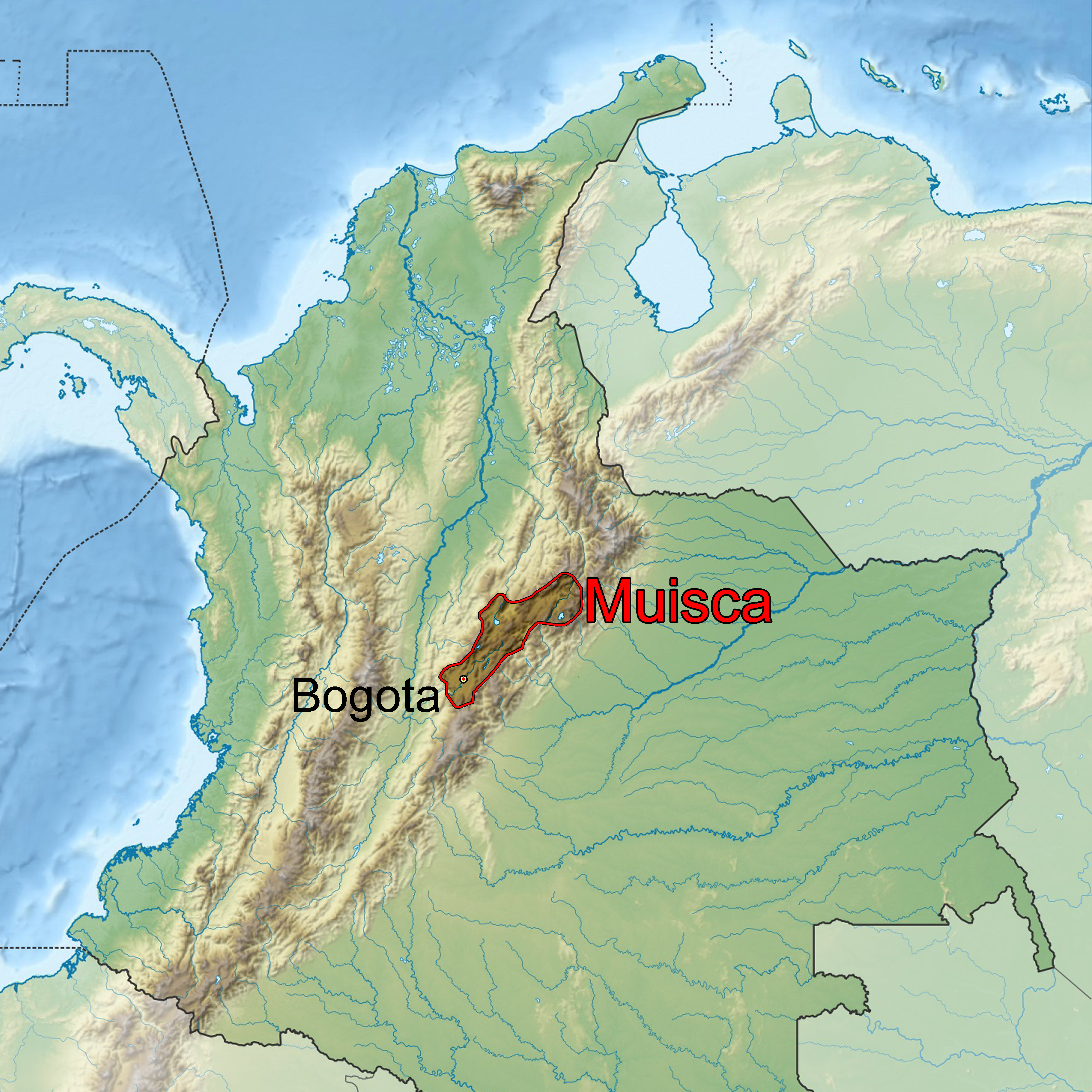
Guayatá is a town and municipality in the Eastern Boyacá Province, part of the Colombian department of Boyacá. Guayatá is situated on the Altiplano Cundiboyacense at distances of from the department capital Tunja and from the national capital Bogotá. The urban centre is located at an altitude of and the altitude ranges from to . Borders * North with Guateque * West with Manta, Cundinamarca * South with Gachetá and Ubalá, Cundinamarca * East with Somondoco and Chivor Etymology The name Guayatá comes from Chibcha and is either a combination of ''tá''; "land over there" or "farmfields" and ''Guaya'', a creek running through Tenza or from ''Guaitá''; "domain of the female ''cacique''".Etymology Guayatá - Excelsio.net History In the times before the |
Municipalities Of Colombia
The Municipalities of Colombia are decentralized subdivisions of the Republic of Colombia. Municipalities make up most of the departments of Colombia with 1,122 municipalities (''municipios''). Each one of them is led by a mayor (''alcalde'') elected by popular vote and represents the maximum executive government official at a municipality level under the mandate of the governor of their department which is a representative of all municipalities in the department; municipalities are grouped to form departments. The municipalities of Colombia are also grouped in an association called the ''Federación Colombiana de Municipios'' (Colombian Federation of Municipalities), which functions as a union under the private law and under the constitutional right to free association to defend their common interests. Categories Conforming to the law 1551/12 that modified the sixth article of the law 136/94 Article 7 http://www.alcaldiabogota.gov.co/sisjur/normas/Norma1.jsp?i=48267 the m ... [...More Info...] [...Related Items...] OR: [Wikipedia] [Google] [Baidu] |
Manta, Cundinamarca
Manta is a municipality and town located in the northeast of the department of Cundinamarca ( Colombia), from Bogotá. It is located in the Almeidas Province in the Tenza Valley. Manta borders to the north Tibiritá, to the west Machetá, to the south Gachetá and to the east Guateque and Guayatá of the department of Boyacá. Etymology Manta in the Chibcha language of the Muisca means "to your tillage" or "your farmfields".Espejo Olaya, 1999, p.1121 This name comes from the ancient indigenous people who inhabited the territory of the Muisca Confederation. Another Muisca name that remains is the name of the ''vereda'' Fuchatoque, located on the eastern side of the city center, headquarters of the former '' cacique'' with the same name. History Pre-Columbian and colonial period The first inhabitants, indigenous Muisca, settled in pre-Columbian times, around the plateau of the current town centre, which was once a small lake. According to the founding myth in the ... [...More Info...] [...Related Items...] OR: [Wikipedia] [Google] [Baidu] |
Muisca Agriculture
The Muisca agriculture describes the agriculture of the Muisca, the advanced civilisation that was present in the times before the Spanish conquest on the high plateau in the Colombian Andes; the Altiplano Cundiboyacense. The Muisca were a predominantly agricultural society with small-scale farmfields, part of more extensive terrains. To diversify their diet, they traded mantles, gold, emeralds and salt for fruits, vegetables, coca, yopo and cotton cultivated in lower altitude warmer terrains populated by their neighbours, the Muzo, Panche, Guane, Guayupe, Lache, Sutagao and U'wa. Trade of products grown farther away happened with the Calima, Pijao and Caribbean coastal communities around the Sierra Nevada de Santa Marta. Important scholars who have contributed to the knowledge about the Muisca agriculture have been Pedro Simón, Marianne Cardale de Schrimpff, Carl Henrik Langebaek and Sylvia Broadbent. Background The central highlands of the Colombian Andes s ... [...More Info...] [...Related Items...] OR: [Wikipedia] [Google] [Baidu] |
Somondoco
Somondoco is a town and municipality in the Colombian Department of Boyacá. This town and larger municipal area are located in the Valle de Tenza. The Valle de Tenza is the ancient route connecting the Altiplano Cundiboyacense and the Llanos. The area is dotted with many such little towns all located at approximately the same altitude (1500–1700 meters). Somondoco borders Almeida in the east, Guayatá in the west, Guateque and Sutatenza in the north and in the south the Cundinamarca municipality of Ubalá. The nearest larger town is Guateque which is about 30 minutes away by car. In Somondoco are several small companies producing handicrafts and collectables. Etymology Somondoco is derived from the Chibcha words ''So'' = stone, ''Mon'' = bath, ''Co'' = support. The village is named after ''cacique Somendoco'' or ''Sumindoco''. [...More Info...] [...Related Items...] OR: [Wikipedia] [Google] [Baidu] |
Muisca Economy
This article describes the economy of the Muisca. The Muisca were the original inhabitants of the Altiplano Cundiboyacense, the high plateau in the Eastern Ranges of central present-day Colombia. Their rich economy and advanced merchant abilities were widely known by the indigenous groups of the area and described by the Spanish conquistadores whose primary objective was the acquisition of the mineral resources of ''Tierra Firme''; gold, emeralds, carbon, silver and copper. The Muisca economy was self-sufficient regarding the basic supplies, thanks to the advanced technologies of the agriculture on raised terraces by the people. The system of trade was well established providing both the higher social classes and the general population abundances of gold, feathers, marine snails, coca, yopo and other luxury goods. Markets were held every four to eight days in various settlements throughout the Muisca Confederation and special markets were organised around festivities where mer ... [...More Info...] [...Related Items...] OR: [Wikipedia] [Google] [Baidu] |
Muisca Confederation
The Muisca Confederation was a loose confederation of different Muisca rulers (''zaques'', ''zipas'', ''iraca'', and ''tundama'') in the central Andean highlands of present-day Colombia before the Spanish conquest of northern South America. The area, presently called Altiplano Cundiboyacense, comprised the current departments of Boyacá, Cundinamarca and minor parts of Santander. According to some Muisca scholars the Muisca Confederation was one of the best-organized confederations of tribes on the South American continent. Modern anthropologists, such as Jorge Gamboa Mendoza, attribute the present-day knowledge about the confederation and its organization more to a reflection by Spanish chroniclers who predominantly wrote about it a century or more after the Muisca were conquered and proposed the idea of a loose collection of different people with slightly different languages and backgrounds.Gamboa Mendoza, 2016 Geography Climate Muisca Confederation In th ... [...More Info...] [...Related Items...] OR: [Wikipedia] [Google] [Baidu] |
Eastern Boyacá Province
The Eastern Boyacá Province is a province of the Colombian Department of Boyacá. The province is formed by 8 municipalities. The Tenza Valley is located in the Eastern Boyacá Province. The province hosts the eastern belt containing rich emerald deposits. Municipalities Almeida • Chivor • Guateque • Guayatá • La Capilla • Somondoco • Sutatenza • Tenza Tenza () is a town and municipality in the subregion of the Eastern Boyacá Province of the Colombian department Boyacá. Tenza borders La Capilla and Pachavita in the north, in the east the department of Cundinamarca, in the south with Sutat ... References Provinces of Boyacá Department {{Boyacá-geo-stub ... [...More Info...] [...Related Items...] OR: [Wikipedia] [Google] [Baidu] |
Boyacá Department
Boyacá () is one of the thirty-two departments of Colombia, and the remnant of Boyacá State, one of the original nine states of the "United States of Colombia". Boyacá is centrally located within Colombia, almost entirely within the mountains of the Eastern Cordillera to the border with Venezuela, although the western end of the department extends to the Magdalena River at the town of Puerto Boyacá. Boyacá borders to the north with the Department of Santander, to the northeast with the Bolivarian Republic of Venezuela and Norte de Santander, to the east with the departments of Arauca and Casanare. To the south, Boyacá borders the department of Cundinamarca and to the west with the Department of Antioquia covering a total area of . The capital of Boyacá is the city of Tunja. Boyacá is known as "The Land of Freedom" because this region was the scene of a series of battles which led to Colombia's independence from Spain. The first one took place on 25 July 1819 ... [...More Info...] [...Related Items...] OR: [Wikipedia] [Google] [Baidu] |
Pedro Simón
''Fray'' Pedro Simón ( San Lorenzo de la Parrilla, Spain, 1574 - Ubaté, New Kingdom of Granada, ca. 1628) was a Spanish franciscan friar, professor and chronicler of the indigenous peoples of modern day Colombia and Venezuela, at the time forming the New Kingdom of Granada. Pedro Simón is one of the most important Muisca scholars forming the basis for later scholars such as Lucas Fernández de Piedrahita, Alexander von Humboldt, Javier Ocampo López and many others. Biography Pedro Simón studied in Cartagena, Spain and went to Cartagena de Indias in 1603.Biography Pedro Simón - Biografías y Vidas Simón accompanied Juan de Borja and described his war against the < ... [...More Info...] [...Related Items...] OR: [Wikipedia] [Google] [Baidu] |
Friar
A friar is a member of one of the mendicant orders founded in the twelfth or thirteenth century; the term distinguishes the mendicants' itinerant apostolic character, exercised broadly under the jurisdiction of a superior general, from the older monastic orders' allegiance to a single monastery formalized by their vow of stability. A friar may be in holy orders or a brother. The most significant orders of friars are the Dominicans, Franciscans, Augustinians, and Carmelites. Definition Friars are different from monks in that they are called to live the evangelical counsels (vows of poverty, chastity, and obedience) in service to society, rather than through cloistered asceticism and devotion. Whereas monks live in a self-sufficient community, friars work among laypeople and are supported by donations or other charitable support. Monks or nuns make their vows and commit to a particular community in a particular place. Friars commit to a community spread across a wider geog ... [...More Info...] [...Related Items...] OR: [Wikipedia] [Google] [Baidu] |
Muisca People
The Muisca (also called Chibcha) are an indigenous people and culture of the Altiplano Cundiboyacense, Colombia, that formed the Muisca Confederation before the Spanish conquest. The people spoke Muysccubun, a language of the Chibchan language family, also called ''Muysca'' and ''Mosca''. They were encountered by conquistadors dispatched by the Spanish Empire in 1537 at the time of the conquest. Subgroupings of the Muisca were mostly identified by their allegiances to three great rulers: the ''hoa'', centered in Hunza, ruling a territory roughly covering modern southern and northeastern Boyacá and southern Santander; the '' psihipqua'', centered in Muyquytá and encompassing most of modern Cundinamarca, the western Llanos; and the '' iraca'', religious ruler of Suamox and modern northeastern Boyacá and southwestern Santander. The territory of the Muisca spanned an area of around from the north of Boyacá to the Sumapaz Páramo and from the summits to the we ... [...More Info...] [...Related Items...] OR: [Wikipedia] [Google] [Baidu] |
Republic Of Gran Colombia
Gran Colombia (, "Great Colombia"), or Greater Colombia, officially the Republic of Colombia ( Spanish: ''República de Colombia''), was a state that encompassed much of northern South America and part of southern Central America from 1819 to 1831. It included present-day Colombia, mainland Ecuador (i.e. excluding the Galápagos Islands), Panama, and Venezuela, along with parts of northern Peru, northwestern Brazil, and Part of Guyana. The terms Gran Colombia and Greater Colombia are used historiographically to distinguish it from the current Republic of Colombia, which is also the official name of the former state. However, international recognition of the legitimacy of the Gran Colombian state ran afoul of European opposition to the independence of states in the Americas. Austria, France, and Russia only recognized independence in the Americas if the new states accepted monarchs from European dynasties. In addition, Colombia and the international powers disagreed over the ... [...More Info...] [...Related Items...] OR: [Wikipedia] [Google] [Baidu] |


