|
Großer Falkenstein
The Großer Falkenstein or Great Falkenstein, is a mountain, high, in the Bavarian Forest about five kilometres southeast of Bayerisch Eisenstein in the Falkenstein-Rachel region of the Bavarian Forest National Park. Views From the summit cross there are extensive views to the west and south of the Großer Arber, the Großer Osser, the town of Zwiesel and the Großer Rachel. To the west and lower is the Kleiner Falkenstein, also a worthwhile viewing point. Ascent An ascent to the summit is possible in around 2 hours following the trails marked Heidelbeere, Eibe, Silberblatt and Esche from the start points of Zwieslerwaldhaus, Kreuzstraßl and Scheuereck. Worth seeing is the so-called Höllbachgspreng, an area of rocky terrain with a gorge and stream that has several waterfalls and numerous runnels descending to the Höllbachschwelle, a small lake. The path through this area is very challenging and should only be attempted by experienced hikers. Mountain hut At the sum ... [...More Info...] [...Related Items...] OR: [Wikipedia] [Google] [Baidu] |
Lackenberg
Lackenberg ( cz, Plesná or Debrník) is a mountain of the Bavarian Forest (german: Bayerischer Wald) and Bohemian Forest The Bohemian Forest, known in Czech as Šumava () and in German as Böhmerwald, is a low mountain range in Central Europe. Geographically, the mountains extend from Plzeň Region and South Bohemia in the Czech Republic to Austria and Bavaria in ..., ( cz, Šumava) on the border between Germany and the Czech Republic. Mountains of Bavaria Bohemian Forest Mountains of the Bavarian Forest {{Bavaria-geo-stub ... [...More Info...] [...Related Items...] OR: [Wikipedia] [Google] [Baidu] |
Höllbachgspreng
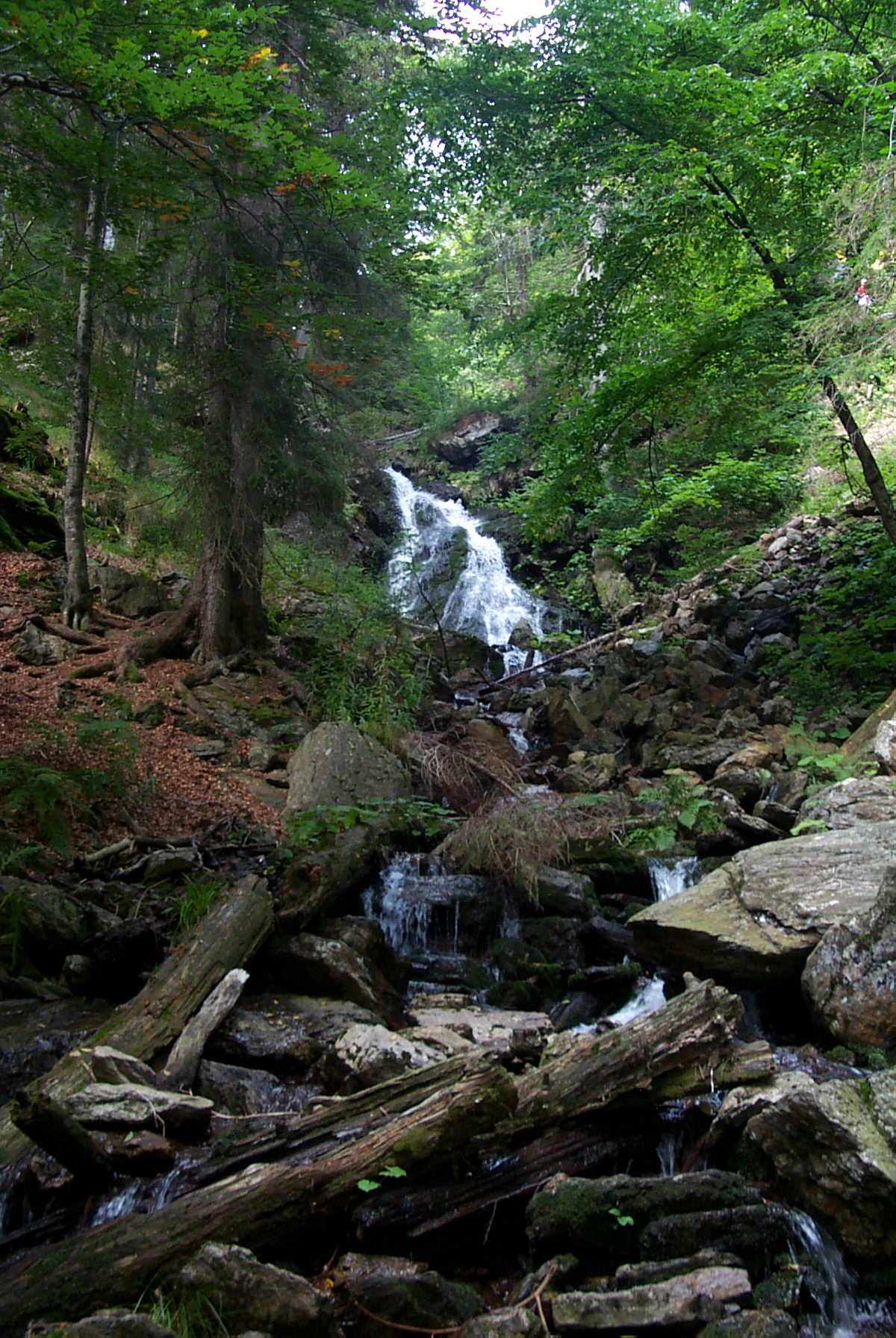
The Höllbachgspreng is a wooded rock massif below the Großer Falkenstein mountain in the vicinity of Lindberg in the Bavarian Forest, Germany. Description This terrain hollow with extremely steep sides owes its formation to the last ice age. A mountain trail runs through the ancient forest here. Through a narrow, ravine the Höllbach rushes between, gneiss rocks as high as a house in places. On the northern boundary of the region it drops as a waterfall into the depths. The western part of the area is dominated by the Großer Falkenstein. The slopes are covered with trees such as sycamore, Norway spruce, beech, silver fir and wych elm. The undergrowth includes rare plants like alpine lady-fern, chickweed-wintergreen, sundews, martagon lily and Hungarian gentian. On the rocks grows the very rare sulphur dust lichen (''Schwefelflechte''). As far as birds are concerned the region is relatively species-poor with only 36 types occurring, the course of the stream with its as ... [...More Info...] [...Related Items...] OR: [Wikipedia] [Google] [Baidu] |
Bohemian Forest
The Bohemian Forest, known in Czech as Šumava () and in German as Böhmerwald, is a low mountain range in Central Europe. Geographically, the mountains extend from Plzeň Region and South Bohemia in the Czech Republic to Austria and Bavaria in Germany, and form the highest truncated uplands of the Bohemian Massif, up to 50 km wide. They create a natural border between the Czech Republic on one side and Germany and Austria on the other. Names and etymology For political reasons, the Bohemian and German sides have different names in their languages: in Czech, the Bohemian side is called ''Šumava'' and the Bavarian side ''Zadní Bavorský les'' ( en, Rear Bavarian Forest), while in German, the Bohemian side is called ''Böhmerwald'' ( en, Bohemian Forest), and the Bavarian side ''Bayerischer Wald'' ( en, Bavarian Forest). In Czech, ''Šumava'' is also used as a name for the entire region in Bohemia and Germany. The designation ''Šumava'' has been attested in the late 15t ... [...More Info...] [...Related Items...] OR: [Wikipedia] [Google] [Baidu] |
Mountains Of Bavaria
A mountain is an elevated portion of the Earth's crust, generally with steep sides that show significant exposed bedrock. Although definitions vary, a mountain may differ from a plateau in having a limited summit area, and is usually higher than a hill, typically rising at least 300 metres (1,000 feet) above the surrounding land. A few mountains are isolated summits, but most occur in mountain ranges. Mountains are formed through tectonic forces, erosion, or volcanism, which act on time scales of up to tens of millions of years. Once mountain building ceases, mountains are slowly leveled through the action of weathering, through slumping and other forms of mass wasting, as well as through erosion by rivers and glaciers. High elevations on mountains produce colder climates than at sea level at similar latitude. These colder climates strongly affect the ecosystems of mountains: different elevations have different plants and animals. Because of the less hospitable terrain and ... [...More Info...] [...Related Items...] OR: [Wikipedia] [Google] [Baidu] |
Geotope
A geotope is the geological component of the abiotic matrix present in an ecotope. Example geotopes might be an exposed outcrop of rocks, an erratic boulder, a grotto or ravine, a cave, an old stone wall marking a property boundary, and so forth. It is a loanword from German ''( Geotop)'' in the study of ecology and might be the model for many other similar words coined by analogy. As the prototype, it has enjoyed wider currency than many of the other words modelled on it, including physiotope, with which it is used synonymously. But the geotope is properly the rocks and not the whole lay of the land (which would be the physiotope). For usage in the context of geoheritage, like e.g. in Friedrich Wiedenbein's contributions (see below) and in the German discussion on geoheritage, the more adequate term (and translation from the German) is geosite. See also * Ecological land classification Ecological classification or ecological typology is the classification of land or water in ... [...More Info...] [...Related Items...] OR: [Wikipedia] [Google] [Baidu] |
Ludwigsthal (Lindberg)
Ludwigsthal is a village in the municipality of Lindberg in the Lower Bavarian district of Regen. Location Ludwigsthal lies on the B 11 federal highway between Zwiesel and Bayerisch Eisenstein. It also has a halt on the Bavarian Forest Railway. History In 1826 master glassworker, Georg Christoph Abele from Neuhurkenthal, founded a glassworks in the Bohemian Forest and named it one year later after King Ludwig I of Bavaria. In 1830, Abele had a mansion built by the royal architect and building foreman, Lexa, to plans drawn up by Prague master builder, von Zobel. From 1828 to 1848, white, then green, mirror glass was produced at the factory. In March 1860, all the property was auctioned off due to insolvency. It was sold for 44,000 guilders to butcher, Josef Pauli, and brewer, Josef Kammermeier, both from Zwiesel. At the end of the 19th century, the company switched to bottle glass manufacture. The glassworks, which still employed about 200 people after the Second World W ... [...More Info...] [...Related Items...] OR: [Wikipedia] [Google] [Baidu] |
Straubing
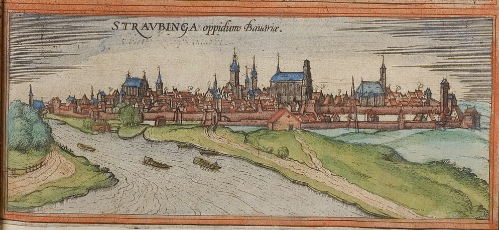
Straubing () is an independent city in Lower Bavaria, southern Germany. It is seat of the district of Straubing-Bogen. Annually in August the Gäubodenvolksfest, the second largest fair in Bavaria, is held. The city is located on the Danube forming the centre of the Gäuboden. History The area of Straubing has been continuously settled since the Neolithic. The conquest by the Romans in 16–14 BC had a dramatic impact on the whole region. Even today many traces of the 400-year Roman occupation can be found: for example, the famous 'Römerschatz' (Roman treasure) which was excavated in 1950 and which is shown in the Gäubodenmuseum. ''Sorviodurum'', as the Romans called it, was an important military support base. After the fall of the Roman Empire Straubing became a centre of settlement of the Bavarii, mostly around St. Peter's Church (built in the 9th century) between Allachbach and Danube. According to the customs of the Bavarii the settlement was named after their leader ''S ... [...More Info...] [...Related Items...] OR: [Wikipedia] [Google] [Baidu] |
Bavarian Forest Club
The Bavarian Forest Club (german: Bayerische Wald-Verein), or BWV, is a German club that promotes culture, local history and folklore, nature and landscape conservation, and walking in the Bavarian Forest. It has its head office in Zwiesel and is registered in the register of clubs and societies in the district office at Deggendorf (VR 10158). History The founder of the club was Anton Niederleuthner, senior judge in Passau. The foundation of the club in 1883 goes back to his meeting with foresters in Bodenmais. The Bavarian Forest Club was founded in Deggendorf Town Hall on 25 November 1883. The Bodenmais townsman, Bartholomäus Stölzl, was appointed as its first chairman. On 6 June 1885, Niederleuthner founded the Passau Branch, the club's first local branch. On 22 August he was elected the first president and made Passau the base of the club. He managed the club for over 20 years and founded over 40 other local branches. The club emblem used today goes back to Niederleuthner. ... [...More Info...] [...Related Items...] OR: [Wikipedia] [Google] [Baidu] |
Zwiesel
Zwiesel ( cs, Svízel) is a town in the lower-Bavarian district of Regen, and since 1972 is a Luftkurort with particularly good air. The name of the town was derived from the Bavarian word stem "zwisl" which refers to the form of a fork. The fork of the rivers Großer Regen and Kleiner Regen and the land that lies between these two rivers were called Zwiesel. Geography The town of Zwiesel is situated in an extensive valley basin at the foot of the mountain range formed by the peaks of the Großer Arber (1,456 m), Großer Falkenstein (1,315 m) and Kiesruck (1,265 m), exactly at the spot where the two rivers, the Großer Regen and the Kleiner Regen join and form the Black Regen. It is located to the north-east of the district town of Regen, from the town of Deggendorf, from the town of Grafenau and from the border crossing point at Bayerisch Eisenstein, entry point to the Czech Republic. In addition to be accessed by the federal road B11, the town of Zwiesel has a main railwa ... [...More Info...] [...Related Items...] OR: [Wikipedia] [Google] [Baidu] |
Mountain Hut
A mountain hut is a building located high in the mountains, generally accessible only by foot, intended to provide food and shelter to mountaineers, climbers and hikers. Mountain huts are usually operated by an Alpine Club or some organization dedicated to hiking or mountain recreation. They are known by many names, including alpine hut, mountain shelter, mountain refuge, mountain lodge, and mountain hostel. It may also be called a refuge hut, although these occur in lowland areas (e.g. lowland forests) too. Mountain huts can provide a range of services, starting with shelter and simple sleeping berths. Some, particularly in remote areas, are not staffed, but others have staff which prepare meals and drinks and can provide other services, including providing lectures and selling clothing and small items. Mountain huts usually allow anybody to access their facilities, although some require reservations. While shelters have long existed in mountains, modern hut systems date back ... [...More Info...] [...Related Items...] OR: [Wikipedia] [Google] [Baidu] |
Kleiner Falkenstein
Kleiner Falkenstein is a mountain of 1190 metres in Bavaria, Germany. It is located in the Bavarian Forest National Park, just below the Großer Falkenstein. From its rocky summit there are good views of the Großer Arber, the Osser, the Zwiesler Winkel and beyond to Bohemia. Many peregrine falcon The peregrine falcon (''Falco peregrinus''), also known as the peregrine, and historically as the duck hawk in North America, is a Cosmopolitan distribution, cosmopolitan bird of prey (Bird of prey, raptor) in the family (biology), family Falco ...s nest in the rock face below the summit. The nature reserve Kleiner Falkenstein was established by Reg. the Government of Lower and the Upper Palatinate, 31 October 1939. It was about 17 hectares and in 1997 was an extension of the Bavarian Forest National Park. References Mountains of Bavaria Bohemian Forest {{Bavaria-geo-stub ... [...More Info...] [...Related Items...] OR: [Wikipedia] [Google] [Baidu] |


