|
Greene County, Illinois
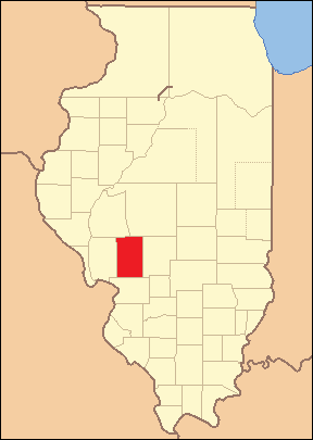
Greene County is a county located in the U.S. state of Illinois. According to the 2020 United States Census, it has a population of 11,843. Its county seat is Carrollton. A notable archaeological area, the Koster Site, has produced evidence of more than 7,000 years of human habitation. Artifacts from the site are displayed at the Center for American Archeology in Kampsville, Illinois. History Greene County is named in honor of General Nathanael Greene, a hero of the American Revolutionary War. In 1821, three years after Illinois became a state, Greene County was established, being carved out of what was previously Madison county and St. Clair county before that. Over the course of the next 18 years four more counties were formed out of what was once Greene Country. These include Scott, Morgan, Macoupin and Jersey counties. This left Greene county with approximately 546 square miles of land located in western-central Illinois near the Illinois River, which was an important re ... [...More Info...] [...Related Items...] OR: [Wikipedia] [Google] [Baidu] |
Nathanael Greene
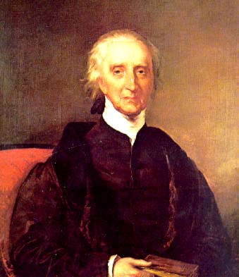
Nathanael Greene (June 19, 1786, sometimes misspelled Nathaniel) was a major general of the Continental Army in the American Revolutionary War. He emerged from the war with a reputation as General George Washington's most talented and dependable officer, and is known for his successful command in the southern theater of the war. Born into a prosperous Quaker family in Warwick, Rhode Island, Greene became active in the colonial opposition to British revenue policies in the early 1770s and helped establish the Kentish Guards, a state militia. After the April 1775 Battles of Lexington and Concord, the legislature of Rhode Island established an army and appointed Greene to command it. Later in the year, Greene became a general in the newly established Continental Army. Greene served under Washington in the Boston campaign, the New York and New Jersey campaign, and the Philadelphia campaign before being appointed quartermaster general of the Continental Army in 1778. In Octo ... [...More Info...] [...Related Items...] OR: [Wikipedia] [Google] [Baidu] |
Illinois 267
Illinois Route 267 (IL 267) is a north–south highway in the U.S. state of Illinois. It runs from U.S. Route 67 (US 67) and Illinois Route 111 in Godfrey north to Illinois Route 104 and Business Interstate 72 (abbreviated BL 72) in Jacksonville. This is a distance of 59 miles (95 km). However, the state of Illinois' 2006 data shows the length of Illinois 267 as , which is the distance from the Illinois 111/267 wye north to BL 72 at Illinois 104. Route description Illinois 267 is a two-lane surface road for most its length. It runs through the small towns of Brighton, Medora, Rockbridge and Greenfield. Starting at US 67 in Godfrey, IL 267 begins there as a four lane road, as well as the southern end of IL 111 concurrency. Almost immediately northeast of the US 67 junction, they meet IL 255 at a diamond interchange. Then, after going to a two-lane surface, they follow a railroad until they reach Brighton. At that point, they turn north. They then inter ... [...More Info...] [...Related Items...] OR: [Wikipedia] [Google] [Baidu] |
English American
English Americans (historically known as Anglo-Americans) are Americans whose ancestry originates wholly or partly in England. In the 2020 American Community Survey, 25.21 million self-identified as being of English origin. The term is distinct from British Americans, which includes not only English Americans but also Scottish, Scotch-Irish (descendents of Ulster Scots from Ulster, Ireland), Welsh, Cornish and Manx Americans from the whole of the United Kingdom. Demographers regard the reported number of English Americans as a serious undercount, as the index of inconsistency is high and many if not most Americans of English ancestry have a tendency to identify simply as "Americans" or if of mixed European ancestry, identify with a more recent and differentiated ethnic group. In the 1980 census, 49.6 million Americans claimed English ancestry. At 26.34%, this was the largest group amongst the 188 million people who reported at least one ancestry. The population was 226 ... [...More Info...] [...Related Items...] OR: [Wikipedia] [Google] [Baidu] |
Irish American
, image = Irish ancestry in the USA 2018; Where Irish eyes are Smiling.png , image_caption = Irish Americans, % of population by state , caption = Notable Irish Americans , population = 36,115,472 (10.9%) alone or in combination 10,899,442 (3.3%) Irish alone 33,618,500(10.1%) alone or in combination 9,919,263 (3.0%) Irish alone , popplace = Boston New York City Scranton Philadelphia New Orleans Pittsburgh Cleveland Chicago Baltimore Detroit Milwaukee Louisville New England Delaware Valley Coal Region Los Angeles Las Vegas Atlanta Sacramento San Diego Houston Dallas San Francisco Palm Springs, California Fairbanks and most urban areas , langs = English ( American English dialects); a scant speak Irish , rels = Protestant (51%) Catholic (36%) Other (3%) No religion (10%) (2006) , related = Anglo-Irish people Breton Americans Cornish Americans English Americans Iri ... [...More Info...] [...Related Items...] OR: [Wikipedia] [Google] [Baidu] |
German American
German Americans (german: Deutschamerikaner, ) are Americans who have full or partial German ancestry. With an estimated size of approximately 43 million in 2019, German Americans are the largest of the self-reported ancestry groups by the United States Census Bureau in its American Community Survey. German Americans account for about one third of the total population of people of German ancestry in the world. Very few of the German states had colonies in the new world. In the 1670s, the first significant groups of German immigrants arrived in the British colonies, settling primarily in Pennsylvania, New York and Virginia. The Mississippi Company of France moved thousands of Germans from Europe to Louisiana and to the German Coast, Orleans Territory between 1718 and 1750. Immigration ramped up sharply during the 19th century. There is a "German belt" that extends all the way across the United States, from eastern Pennsylvania to the Oregon coast. Pennsylvania, with 3.5 mi ... [...More Info...] [...Related Items...] OR: [Wikipedia] [Google] [Baidu] |
2010 United States Census
The United States census of 2010 was the twenty-third United States national census. National Census Day, the reference day used for the census, was April 1, 2010. The census was taken via mail-in citizen self-reporting, with enumerators serving to spot-check randomly selected neighborhoods and communities. As part of a drive to increase the count's accuracy, 635,000 temporary enumerators were hired. The population of the United States was counted as 308,745,538, a 9.7% increase from the 2000 census. This was the first census in which all states recorded a population of over half a million people as well as the first in which all 100 largest cities recorded populations of over 200,000. Introduction As required by the United States Constitution, the U.S. census has been conducted every 10 years since 1790. The 2000 U.S. census was the previous census completed. Participation in the U.S. census is required by law of persons living in the United States in Title 13 of the United ... [...More Info...] [...Related Items...] OR: [Wikipedia] [Google] [Baidu] |
USA Greene County, Illinois Age Pyramid
The United States of America (U.S.A. or USA), commonly known as the United States (U.S. or US) or America, is a country primarily located in North America. It consists of 50 states, a federal district, five major unincorporated territories, nine Minor Outlying Islands, and 326 Indian reservations. The United States is also in free association with three Pacific Island sovereign states: the Federated States of Micronesia, the Marshall Islands, and the Republic of Palau. It is the world's third-largest country by both land and total area. It shares land borders with Canada to its north and with Mexico to its south and has maritime borders with the Bahamas, Cuba, Russia, and other nations. With a population of over 333 million, it is the most populous country in the Americas and the third most populous in the world. The national capital of the United States is Washington, D.C. and its most populous city and principal financial center is New York City. Paleo-America ... [...More Info...] [...Related Items...] OR: [Wikipedia] [Google] [Baidu] |
Two Rivers National Wildlife Refuge
The Two Rivers National Wildlife Refuge is located on the Illinois River and the Mississippi River in parts of Calhoun, Jersey, and Greene counties in Illinois, and St. Charles County, Missouri. It is managed by the U.S. Fish and Wildlife Service as part of the Mark Twain National Wildlife Refuge Complex. As of 2009, the Two Rivers National Wildlife Refuge consists of five separate parcels of riverine bottomland wetlands grouped in and around the confluence of the Illinois and the Mississippi Rivers (hence the name, ''Two Rivers''). The region is noted for its population of bald eagles. The refuge is 8,501 acres (34 square km) in size. Its headquarters is located in the Calhoun County municipality of Brussels, Illinois Brussels is a village in southern Calhoun County, Illinois, United States. The population was 116 at the 2020 census. General information Brussels is the headquarters location of the Two Rivers National Wildlife Refuge, which is noted for its p .... Refe ... [...More Info...] [...Related Items...] OR: [Wikipedia] [Google] [Baidu] |
Pike County, Illinois
Pike County is a county in the U.S. state of Illinois. According to the 2010 United States Census, it had a population of 16,430. Its county seat is Pittsfield. History Pike County was formed in January 1821 out of Madison County. It was named in honor of Zebulon Pike, leader of the Pike Expedition in 1806 to map out the south and west portions of the Louisiana Purchase. Pike served at the Battle of Tippecanoe, and was killed in 1813 in the War of 1812. Prior to the coming of the first European settler to the future Pike County, French traders, hunters, and travelers passed through the native forests and prairies. Originally Pike County began on the south junction of the Illinois and Mississippi rivers. The east boundary was the Illinois River north to the Kankakee River to the Indiana State line on north to Wisconsin territorial line and then west to the Mississippi River to the original point at the south end. The first county seat was Cole's Grove, a post town, in what lat ... [...More Info...] [...Related Items...] OR: [Wikipedia] [Google] [Baidu] |
Calhoun County, Illinois
Calhoun County is a county in the U.S. state of Illinois. As of the 2010 census, the population was 5,089, making it Illinois’ third-least populous county. Its county seat and biggest community is Hardin, with a population of 801. Its smallest incorporated community is Hamburg, with a population of 99. Calhoun County is at the tip of the peninsula formed by the courses of the Mississippi and Illinois rivers above their confluence and is almost completely surrounded by water. Calhoun County is sparsely populated; it has just five municipalities, all of them villages. Calhoun County is part of the Metro-East portion of the St. Louis, MO-IL Metropolitan Statistical Area. History Calhoun County was settled by Americans during the very early 19th century, and officially organized in 1825. It was named for Vice President John C. Calhoun, in addition to the Calhoun family that was prominent in the area at the time. The southern side of the county, covered in thick forest, was un ... [...More Info...] [...Related Items...] OR: [Wikipedia] [Google] [Baidu] |
Jersey County, Illinois
Jersey County is a county located in the U.S. state of Illinois. At the 2020 census, it had a population of 21,512. The county seat and largest community is Jerseyville, with a population of 8,337 in 2010. The county's smallest incorporated community is Otterville, with a population of 87. Jersey County is included in the St. Louis, MO-IL Metropolitan Statistical Area. History Jersey County lies just northeast of where the great Mississippi and Illinois rivers meet. It is the former home of the Kickapoo, Menomini, Potawatomi, and Illiniwek Confederation American Indians. The first European explorers to visit the area, Father Marquette and Louis Jolliet, arrived in 1673,Jersey County description & history , retrieved August 24, 2007 where they encountered the fearsome painting of the [...More Info...] [...Related Items...] OR: [Wikipedia] [Google] [Baidu] |
Macoupin County, Illinois
Macoupin County is located in the U.S. state of Illinois. According to the 2010 census, it had a population of 47,765. The county seat is Carlinville. The primary industry is agriculture, consisting of crops of corn (maize), soybeans, and some wheat. History The region was inhabited by Illinoisan Indians when the first white explorers arrived. Indeed, ' is an adaptation of the Miami-Illinois term for the American lotus, ''Nelumbo lutea''. None of the native Indians remain, although some descendants of the earliest European settlers claim partial ancestry. The first European contact was by French explorers in the seventeenth century, travelling southward down the major rivers. The main European settlement was from the southwest, as people moved inland from the established transportation route of the Mississippi River. Macoupin County was established on January 17, 1829. It was formed out of Greene and Madison Counties and was named after Macoupin Creek, which runs ne ... [...More Info...] [...Related Items...] OR: [Wikipedia] [Google] [Baidu] |


