|
Greater Idaho
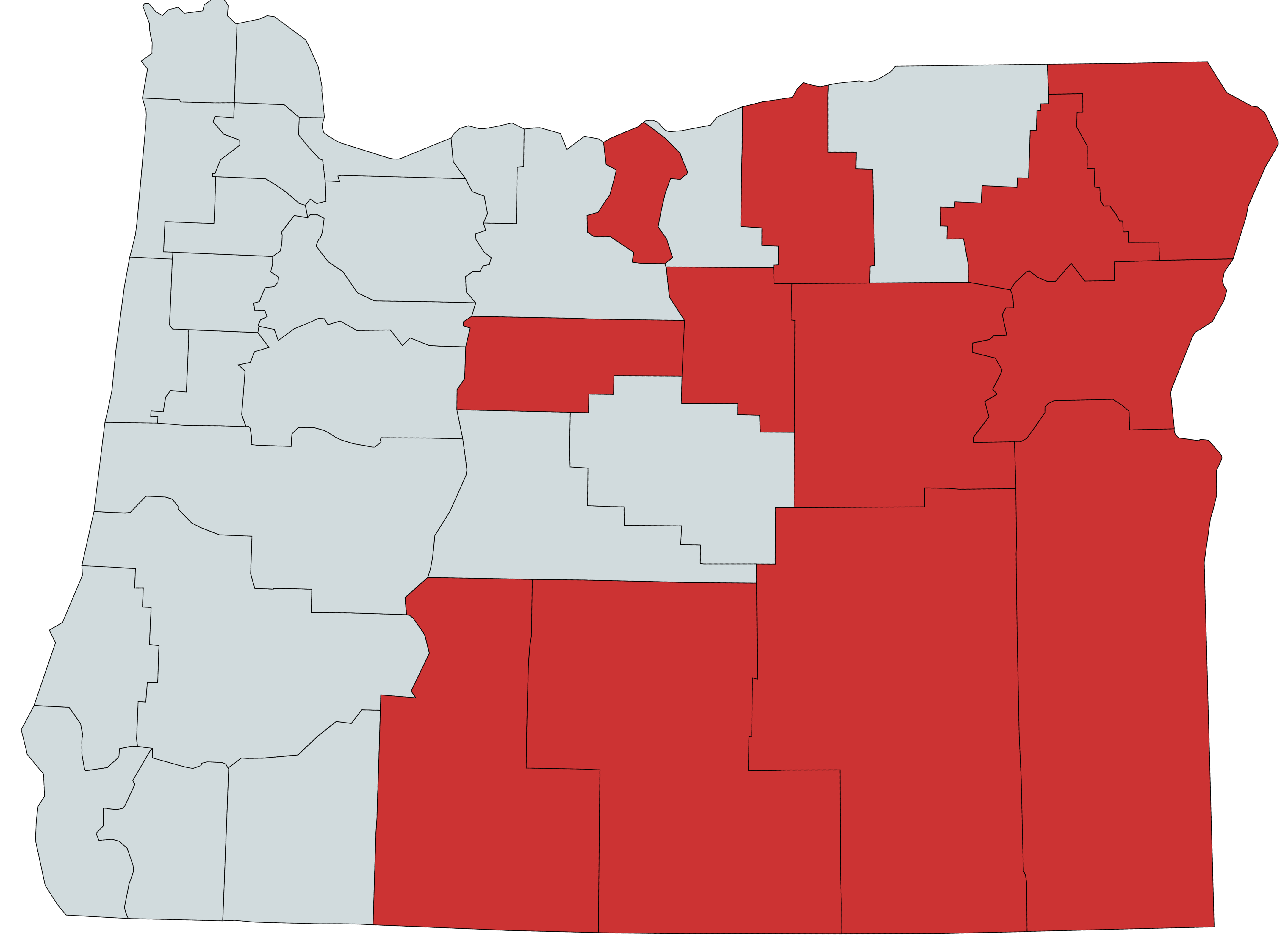
The Greater Idaho movement is a conservative effort in the US for counties east of the Oregon Cascades and eventually portions of Northern California to secede from the state of Oregon and join Idaho. If approved locally by voters via ballot measures, it would need approval from both state legislatures and Congress. Background and rationale Eastern Oregon is relatively rural and conservative, compared to more heavily populated moderate to liberal western urban areas which have a majority in the Oregon Legislative Assembly. Idaho is relatively conservative overall compared to Oregon, motivating some conservatives in eastern Oregon to agitate for relocating the border. Oregon governor Tina Kotek acknowledged the movement in 2023 saying, "I think there are a lot of Oregonians who are frustrated and don’t feel heard. That, I think, is what the movement is about." A number of state laws differ dramatically between Oregon and Idaho. The drug policy of Oregon is among the m ... [...More Info...] [...Related Items...] OR: [Wikipedia] [Google] [Baidu] |
Map Of Greater Idaho Counties As Of June 2023
A map is a symbolic depiction emphasizing relationships between elements of some space, such as objects, regions, or themes. Many maps are static, fixed to paper or some other durable medium, while others are dynamic or interactive. Although most commonly used to depict geography, maps may represent any space, real or fictional, without regard to context or scale, such as in brain mapping, DNA mapping, or computer network topology mapping. The space being mapped may be two dimensional, such as the surface of the earth, three dimensional, such as the interior of the earth, or even more abstract spaces of any dimension, such as arise in modeling phenomena having many independent variables. Although the earliest maps known are of the heavens, geographic maps of territory have a very long tradition and exist from ancient times. The word "map" comes from the , wherein ''mappa'' meant 'napkin' or 'cloth' and ''mundi'' 'the world'. Thus, "map" became a shortened term referrin ... [...More Info...] [...Related Items...] OR: [Wikipedia] [Google] [Baidu] |
Drug Policy Of Oregon
The U.S. state of Oregon has various policies restricting the production, sale, and use of different substances. In 2006, Oregon's per capita drug use exceeded the national average. The most used substances were marijuana, methamphetamine and illicit painkillers and stimulants. On February 1, 2021, Oregon became the first state in the USA to decriminalize the possession of small quantities of all illicit drugs, following the passing of Oregon Ballot Measure 110 in November 2020. Specific drugs Alcohol Oregonians consume an average amount of beer and distilled spirits, and an above average amount of wine. As of 2007, the consumption of spirits is on the rise, while beer consumption is holding steady. Also, 11% of beer sold in Oregon was brewed in-state, the highest figure in the United States. Oregon was the first place in the United States to prohibit alcohol, prior to becoming a U.S. state in the mid-19th century. That law was quickly repealed, but Oregon again precede ... [...More Info...] [...Related Items...] OR: [Wikipedia] [Google] [Baidu] |
Klamath County, Oregon
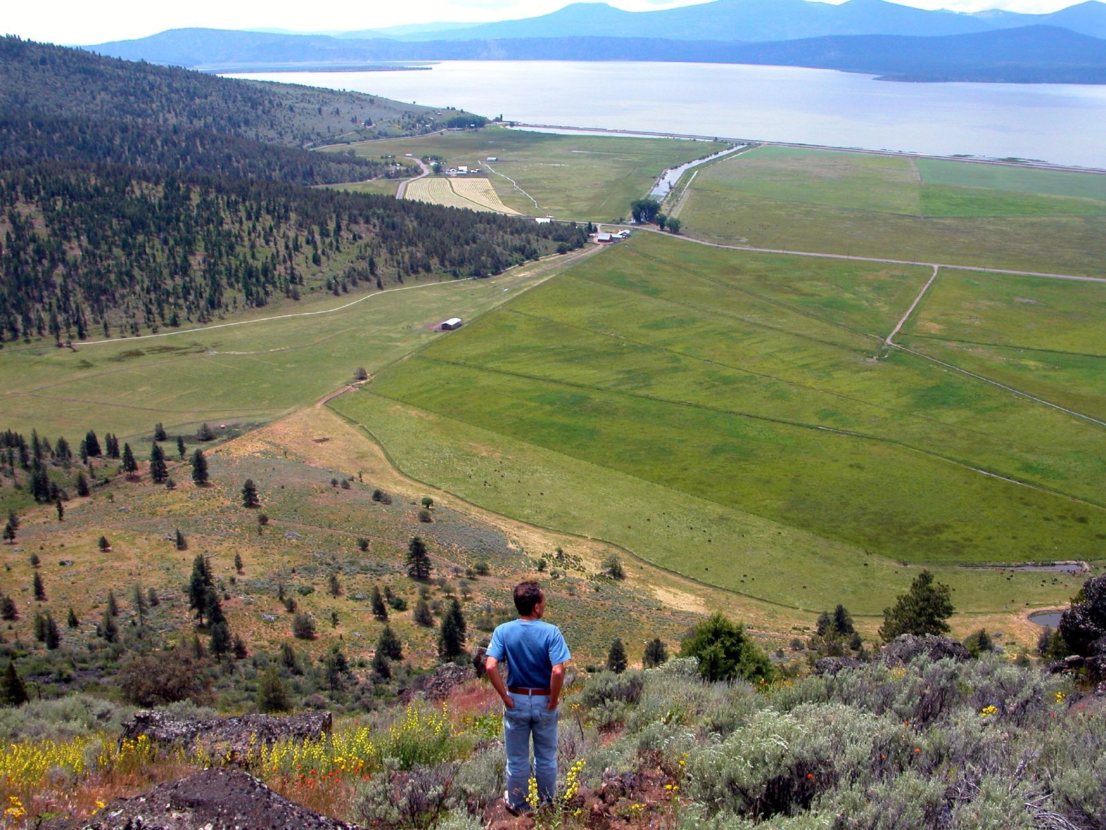
Klamath County ( ) is one of the 36 counties in the U.S. state of Oregon. As of the 2020 census, the population was 69,413. The county seat is Klamath Falls. The county was named for the Klamath, the tribe of Native Americans living in the area at the time the first European explorers entered the region. Klamath County comprises the Klamath Falls, OR Micropolitan Statistical Area. History The Klamath or ''Clamitte'' tribe of Indians, for which Klamath County was named, are the descendants of varying cultures of indigenous peoples, who have lived in the area for more than 10,000 years. When European-Americans began to travel through the area in 1846 along the Applegate Trail, they competed with the Klamath for game and water, which precipitated clashes between the peoples. This was exacerbated by European-American settlers, who cleared the land to farm and encroached on hunting territory. They were successful in demanding the removal of American Indians to reservations. The ... [...More Info...] [...Related Items...] OR: [Wikipedia] [Google] [Baidu] |
Jefferson County, Oregon
Jefferson County is one of the 36 counties in the U.S. state of Oregon. At the 2020 census, the population was 24,502. The county seat is Madras. The county is named after Mount Jefferson. History Jefferson County was created on December 12, 1914, from a portion of Crook County. The county owes much of its agricultural prosperity to the railroad, which links Madras with the Columbia River, and was completed in 1911, and to the development of irrigation projects in the late 1930s. The railroad was completed despite constant feuds and battles between two lines working on opposite sides of the Deschutes River. Madras was incorporated in 1911, and has been the permanent county seat since a general election in 1916. The first (temporary) county seat was Culver, which was selected by a three-man commission appointed by the governor. Due to repeated tie votes over several days (with one vote each cast for Culver, Metolius and Madras). The deadlock was eventually broken by allowing ... [...More Info...] [...Related Items...] OR: [Wikipedia] [Google] [Baidu] |
Harney County, Oregon
Harney County is one of the 36 counties in the U.S. state of Oregon. As of the 2020 census, the population was 7,495, making it the sixth-least populous county in Oregon. The county seat is Burns. Established in 1889, the county is named in honor of William S. Harney, a military officer of the period, who was involved in the Pig War and popular in the Pacific Northwest. Harney County is a rural county in southeastern Oregon.Noelle Crombie,Where is Burns? Harney County home to more cattle than people ''The Oregonian''/OregonLive (January 3, 2016).Harney County Transportation System Plan: Revised Final Draft , Harney County Planning Department (June 2001), pp. 9-10. It is a five-hour drive from |
Grant County, Oregon
Grant County is one of the 36 counties in the U.S. state of Oregon. As of the 2020 census, the population was 7,233, making it Oregon's fourth-least populous county. The county seat is Canyon City. It is named for President Ulysses S. Grant, who served as an army officer in the Oregon Territory, and at the time of the county's creation was a Union general in the American Civil War. Grant County is included in the 8 county definition of Eastern Oregon. History Grant County was established on October 14, 1864, from parts of old Wasco and old Umatilla counties. Prior to its creation, cases brought to court were tried in The Dalles, county seat of the vast Wasco County. The great distance to The Dalles made law enforcement a difficult problem, and imposed a heavy burden on citizens who had a need to transact business at the courthouse. In 1889, more than half of the southern part of the original Grant County was taken to form Harney County. Also in 1899, a small part of north ... [...More Info...] [...Related Items...] OR: [Wikipedia] [Google] [Baidu] |
Baker County, Oregon
Baker County is one of the 36 counties in the U.S. state of Oregon. As of the 2020 census, the population was 16,668. The county seat and largest city is Baker City. The county was organized on September 22, 1862, when a portion of Wasco County was partitioned off. The new county's area was reduced in 1864 when Union County was partitioned off, and again in 1887 when Malheur County was partitioned off. The county's lines were last adjusted in 1901 when a parcel was added to the county. Baker County was named for Edward Dickinson Baker, a senator from Oregon who was killed at Ball's Bluff, a battle of the Civil War in Virginia in 1861. The county is part of the county definition of Eastern Oregon. History The first groups from the eastern U.S. following the Oregon Trail passed through the area on their way to the Willamette Valley, unaware of the potential wealth they passed over. At Flagstaff Hill, near Baker City, of wagon ruts left by immigrants can still be seen. Orego ... [...More Info...] [...Related Items...] OR: [Wikipedia] [Google] [Baidu] |
Abortion In Oregon
Abortion in Oregon is legal at all stages of pregnancy. The number of Abortion clinic, abortion clinics in Oregon has declined over the years, with sixty in 1982, forty in 1992, and fifteen in 2014. There were 8,231 legal Abortion, abortions in 2014, and 8,610 in 2015. History The parents of Becky Bell worked with the Feminist Majority Foundation in the 1990s, which credited them with helping to turn public opinion against a parental-notification law in Oregon. Legislative history In the late 1960s, Arkansas, California, Colorado, Georgia, Maryland, New Mexico, North Carolina, and Oregon made reforms to their abortion laws, with most of these states providing more detailed medical guidance on when therapeutic abortions could be performed. In 1962, the American Law Institute published their model penal code, as it applied to abortions, with three circumstances where they believed a physician could justifiably perform an abortion: "If ... there is substantial risk that the co ... [...More Info...] [...Related Items...] OR: [Wikipedia] [Google] [Baidu] |


.gif)

.gif)
