|
Great South Bay
The Great South Bay is a lagoon situated between Long Island and Fire Island, in the State of New York. It is about long and has an average depth of 4 feet 3 inches and is 20 feet at its deepest. It is protected from the Atlantic Ocean by Fire Island, a barrier island, as well as the eastern end of Jones Beach Island and Captree Island. Robert Moses Causeway adjoins the Great South Bay Bridge, which leads to Robert Moses State Park. The bay is accessible from the ocean through Fire Island Inlet, which lies between the western tip of Fire Island and the eastern tip of Jones Beach Island. The bay adjoins South Oyster Bay on its western end, and Patchogue and Moriches bays at the east end. History In the early 17th century, European settlers first encountered the native Montaukett Indian Nation. Among the earliest British families were the Smith, Carman and Hewlett families. Long Island's South Shore, which includes Lindenhurst, Babylon, Islip, Oakdale, Sayville, Bayport, ... [...More Info...] [...Related Items...] OR: [Wikipedia] [Google] [Baidu] |
Moriches Bay
Moriches Bay ( ) is a lagoon system on the south shore of Long Island, New York. The name Moriches comes from Meritces, a Native American who owned land on Moriches Neck. Two townships in Suffolk, New York ( Brookhaven and the Southampton) share its shoreline. Moriches Bay is east of the Mastic Narrows and Great South Bay and west of Shinnecock Bay. The bay is east of New York City. Moriches Bay has a body of water of of aquatic environment. This includes Moneybogue Bay and Quantuck Bay, its salt marshes, dredged material islands, and intertidal flats. This body of water is between the Outer barrier islands and Long Island mainland. Its flow comes from the Moriches and Shinnecock Inlets) The western boundary of this bay is the Smith Point Bridge; the eastern boundary is the eastern edge of Quantuck Bay. This bayside habitat includes the tidal creeks and marshes feeding into Moriches Bay from the Long Island mainland. A thriving habitat off the Atlantic Ocean, the Moric ... [...More Info...] [...Related Items...] OR: [Wikipedia] [Google] [Baidu] |
Clams
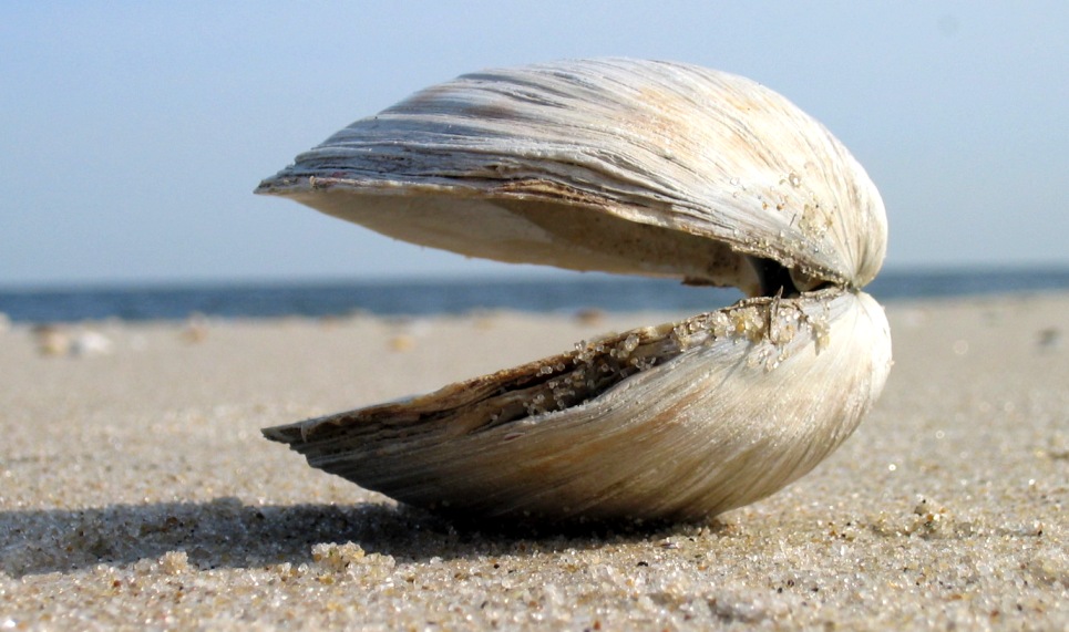
Clam is a common name for several kinds of bivalve molluscs. The word is often applied only to those that are edible and live as infauna, spending most of their lives halfway buried in the sand of the seafloor or riverbeds. Clams have two shells of equal size connected by two adductor muscles and have a powerful burrowing foot. They live in both freshwater and marine environments; in salt water they prefer to burrow down into the mud and the turbidity of the water required varies with species and location; the greatest diversity of these is in North America. Clams in the culinary sense do not live attached to a substrate (whereas oysters and mussels do) and do not live near the bottom (whereas scallops do). In culinary usage, clams are commonly eaten marine bivalves, as in clam digging and the resulting soup, clam chowder. Many edible clams such as palourde clams are ovoid or triangular; however, razor clams have an elongated parallel-sided shell, suggesting an old-fashioned s ... [...More Info...] [...Related Items...] OR: [Wikipedia] [Google] [Baidu] |
Diving Off A Deck Into The Great South Bay Of Long Island
Diving most often refers to: * Diving (sport), the sport of jumping into deep water * Underwater diving, human activity underwater for recreational or occupational purposes Diving or Dive may also refer to: Sports * Dive (American football), a type of play in American football * Diving (association football), a simulation of being fouled * Diving (ice hockey), embellishing an infraction in an attempt to draw a penalty * Sport diving (sport), competitive scuba diving using recreational techniques in a swimming pool * Taking a dive, or match fixing, intentionally losing a match, especially in boxing Film and television Film * ''Dive'' (film), a 1929 German silent film * ''The Dive'' (1990 film), a Norwegian action thriller * ''Dive!'' (film), a 2010 documentary film by Jeremy Sefert * ''Dive'', a 2014 New Zealand short film written and directed by Matthew J. Saville * ''The Dive'' (2018 film), an Israeli film TV * ''Dive'' (TV series), a 2010 British drama * "The Dive" ... [...More Info...] [...Related Items...] OR: [Wikipedia] [Google] [Baidu] |
Mastic Beach
Mastic Beach is a hamlet and census-designated place, and former village in the southeastern part of the Town of Brookhaven in Suffolk County, on Long Island, in New York, United States. The population was 14,849 at the 2010 census, when it was an unincorporated census-designated place for the first time. History In 2010, a group of residents sought to incorporate Mastic Beach as a village. Petitioners blamed the town of Brookhaven for not doing enough code enforcement on blighted streets and eyesore buildings, believing more diligent code enforcement under village control would improve the community aesthetics. Opponents were concerned that creating the village would increase taxes, and that estimates for the proposed village's total budget were low. At $549,500 annually, the village would take up building code enforcement, leaving police, fire, and sanitation to Brookhaven. After a vote on August 31, 2010, incorporation was approved. The proposed incorporation needed to be p ... [...More Info...] [...Related Items...] OR: [Wikipedia] [Google] [Baidu] |
Shirley, New York
Shirley is a hamlet (and census-designated place) in Suffolk County, New York, United States. At the 2010 census, the population of Shirley was 27,854. Shirley is the western terminus of Atlantic Crossing 1, a major submarine telecommunications cable linking the United States with the UK, Germany, and the Netherlands. Soon, the Emerald Express transatlantic communications cable will provide data connectivity between Europe and North America, landing in Shirley. Shirley is a community in the Town of Brookhaven, on the South Shore of Long Island. It is named for developer Walter T. Shirley, who had the vision in the 1950s to turn the area on Mastic Bay into an affordable enclave. Shirley's company priced its 4,000 four-room homes starting at $4,700, and lots were priced at $295. Shirley is served by the Mastic–Shirley Long Island Rail Road station. The station was a compromise when both Mastic and Shirley campaigned for it. The Smith Point Bridge is the second of only two ... [...More Info...] [...Related Items...] OR: [Wikipedia] [Google] [Baidu] |
Bellport, New York
Bellport is a village in the Town of Brookhaven in Suffolk County, on the South Shore of Long Island, in New York, United States. The population was 2,084 at the 2010 census. The Incorporated Village of Bellport is named after the Bell family, early settlers of the area. South Country Road (Main St.) in the village features small businesses such as antique shops, artist galleries, small inns, restaurants, and a service center. These family-run businesses get community support from the Bellport Chamber of Commerce. Bellport is also home to the Gateway Playhouse, a professional summer theater in operation since 1950. History The land that is now Bellport was purchased along with what is now the hamlet of Brookhaven (then called Fireplace Neck) and western South Haven from the Unkechaug Indians in 1664 by settlers from nearby Setauket, who were attracted by the plentiful harvests of salt hay. The part that became Bellport was named Occumbomock Neck. Jonathan Rose was the first ... [...More Info...] [...Related Items...] OR: [Wikipedia] [Google] [Baidu] |
Patchogue
Patchogue (, ) is a village in Suffolk County, New York. The population was 11,798 at the time of the 2010 census. Patchogue is part of the town of Brookhaven, on the south shore of Long Island, adjoining Great South Bay. It is officially known as the ''Incorporated Village of Patchogue''. History Patchogue, which is approximately east of Manhattan, became incorporated in 1893. In 1812 there were 75 inhabitants in Patchogue according to ''The Brooklyn Eagle'', published in 1930. The Patchogue Former Manufactured Gas Plant (MGP) was operated from 1904 to 1926. The company was a small operation, converting coal and/or petroleum products to a flammable gas for use in lighting and industry. The company was sold to Long Island Lighting Company (LILCO). The Patchogue Theatre opened in 1923. It was later renovated into a triplex, after which it was converted to a single movie theater. It closed in the late 1980s. In the mid-1990s the village acquired the theater, and completel ... [...More Info...] [...Related Items...] OR: [Wikipedia] [Google] [Baidu] |
Blue Point, New York
Blue Point is a hamlet and census-designated place in Suffolk County on Long Island, New York, United States. The population was 5,156 at the 2020 census. Blue Point is in the Town of Brookhaven. Geography According to the United States Census Bureau, the CDP has a total area of , of which is land and 0.56% is water. Demographics As of the census of 2000, there were 4,407 people, 1,571 households, and 1,178 families residing in the CDP. The population density was 2,474.5 per square mile (955.9/km2). There were 1,664 housing units at an average density of 934.3/sq mi (360.9/km2). The racial makeup of the CDP was 96.41% White, 0.68% African American, 0.11% Native American, 1.07% Asian, 0.02% Pacific Islander, 0.84% from other races, and 0.86% from two or more races. Hispanic or Latino of any race were 4.36% of the population. There were 1,571 households, out of which 37.9% had children under the age of 18 living with them, 63.1% were married couples living together, 7.4% ... [...More Info...] [...Related Items...] OR: [Wikipedia] [Google] [Baidu] |
Bayport, New York
Bayport is a hamlet (New York), hamlet and census-designated place (CDP) in the Town (New York), Town of Islip (town), New York, Islip, Suffolk County, New York, Suffolk County, New York (state), New York, United States, on Long Island. The population was 8,609 at the 2020 census. Bayport is in the southeast part of the Islip, New York, Town of Islip. Geography The community borders the Great South Bay, Sayville and the hamlet of Blue Point, New York, Blue Point. Bayport is located at (40.747858, -73.054216). According to the United States Census Bureau, the CDP has a total area of , of which is land and (2.37%) is water. Demographics Demographics for the CDP As of the census of 2000, there were 8,662 people, 3,222 households, and 2,303 families residing in the CDP. The population density was 2,332.8 per square mile (901.5/km2). There were 3,325 housing units at an average density of 895.5/sq mi (346.0/km2). The racial makeup of the CDP was 96.06% White (U.S. Census), ... [...More Info...] [...Related Items...] OR: [Wikipedia] [Google] [Baidu] |
Sayville
Sayville is a hamlet and census-designated place in Suffolk County, New York, United States. Located on the South Shore of Long Island in the Township of Islip, the population of the CDP was 16,853 at the time of the 2010 census. History The earliest known inhabitants of Sayville were the Secatogue tribe of the Algonquian peoples. Sayville was founded by John Edwards (b. 1738) of East Hampton, New York. He built his home, the first in Sayville, in 1761, located at what is now the northwest corner of Foster Avenue and Edwards Street. The house was destroyed by fire in March 1913. Another man, John Greene, settled what is now known as West Sayville in 1767. The community had no formal name until 1838 when residents gathered to choose a name for their post office, which had opened on March 22, 1837. Until that time, Sayville was known informally as "over south." The townspeople held a meeting to decide on a name, and after Edwardsville and Greensville tied in a vote, one resident ... [...More Info...] [...Related Items...] OR: [Wikipedia] [Google] [Baidu] |
Oakdale, New York
Oakdale is a hamlet (and census-designated place) in Suffolk County, New York, United States. The population was 7,974 at the 2010 census. Oakdale is in the Town of Islip. It has been home to Gilded Age mansions, the South Side Sportsmen's Club, and the main campus of Dowling College. It is now home to Connetquot River State Park Preserve. History Oakdale was founded around two Native American trade routes, where Sunrise Highway and Montauk Highway currently lie. Oakdale was part of the royal land grant given to William Nicoll, who founded Islip Town in 1697. Local historian Charles P. Dickerson wrote in 1975 that Oakdale's name appeared to come from a Nicoll descendant in the mid-19th century. The community includes: St. John's Episcopal Church, built in 1765, is the third oldest church on Long Island. The community originated with a tavern owned by Eliphalet (Liff) Snedecor in what is now Connetquot River State Park Preserve. Soon after its founding in 1820, Snedecor's Ta ... [...More Info...] [...Related Items...] OR: [Wikipedia] [Google] [Baidu] |


