|
Gracemere, Queensland
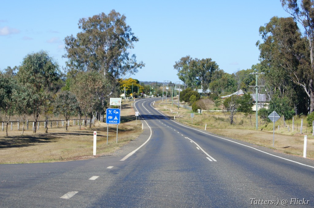
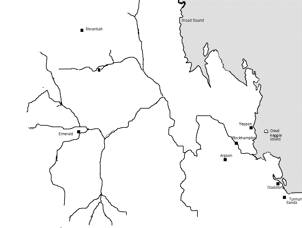
Gracemere is a rural town and locality in the Rockhampton Region, Queensland, Australia. In the , the locality of Gracemere had a population of 11,315 people. Geography Gracemere is approximately west of the city of Rockhampton. Because of the proximity of the town to Rockhampton, Gracemere has become a dormitory town, with many residents commuting the short distance to work in the city. Gracemere Lagoon is to the north of the town (). The Capricorn Highway enters the locality from the north ( Fairy Bower) and exits to the west ( Kabra). The Central Western railway line enters the locality from the north-east (Port Curtis) where it splits from the North Coast railway line. It travels mostly immediately parallel to the highway through the locality exiting to the west (Kabra). There are three railway stops within the locality (from west to east): * Malchi railway station, now abandoned () * Langley railway station, now abandoned () * Gracemere railway station, serving t ... [...More Info...] [...Related Items...] OR: [Wikipedia] [Google] [Baidu] |
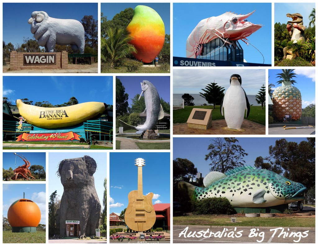
Australia's Big Things
The big things of Australia are large structures, some of which are novelty architecture and some are sculptures. There are estimated to be over 230 such objects around the country. There are big things in every state and territory in continental Australia. Most big things began as tourist traps found along major roads between destinations. The big things have become something of a cult phenomenon, and are sometimes used as an excuse for a road trip, where many or all big things are visited and used as a backdrop to a group photograph. Many of the big things are considered works of folk art and have been heritage-listed, though others have come under threat of demolition. List of big things (by state or territory) Australian Capital Territory New South Wales Northern Territory Queensland South Australia Tasmania Victoria Western Australia In popular culture *The London production of '' Priscilla, Queen of the Desert: the Musical'' references the Big Prawn ... [...More Info...] [...Related Items...] OR: [Wikipedia] [Google] [Baidu] |
North Coast Railway Line, Queensland
The North Coast railway line is a 1067 mm railway line in Queensland, Australia. It commences at Roma Street station, Brisbane, and largely parallels the Queensland coast to Cairns in Far North Queensland. The line is electrified between Brisbane and Rockhampton. Along the way, the 1680 km railway passes through the numerous towns and cities of eastern Queensland including Nambour, Bundaberg, Gladstone, Rockhampton, Mackay and Townsville. The line though the centre of Rockhampton runs down the middle of Denison Street. History The North Coast Line (NCL) has one of the most interesting and complex histories of any railway in Queensland. The first section was opened in 1881, the final section in 1924, and the line was opened in over 60 sections during that period. It incorporates sections of lines built by local governments and subsequently taken over by the Queensland Railways, one isolated section was closed for two years following a financial crisis an ... [...More Info...] [...Related Items...] OR: [Wikipedia] [Google] [Baidu] |
Shire Of Fitzroy
The Shire of Fitzroy was a local government area located in the Capricornia region of Central Queensland, Queensland, Australia, to the immediate west and south of the regional city of Rockhampton. The shire, administered from the town of Gracemere, covered an area of , and existed as a local government entity from 1899 until 2008, when it amalgamated with several other councils to become the Rockhampton Region. It is named for the Fitzroy River, that passes along the northern boundary of the shire. History On 11 November 1879, the Gogango Division was established as one of 74 divisions around Queensland under the ''Divisional Boards Act 1879''. On 6 April 1899, the section of Gogango south of the Fitzroy River split away to form the Fitzroy Division. With the passage of the ''Local Authorities Act 1902'', Fitzroy Division became the Shire of Fitzroy on 31 March 1903. On 15 March 2008, under the ''Local Government (Reform Implementation) Act 2007'' passed by the Parliament ... [...More Info...] [...Related Items...] OR: [Wikipedia] [Google] [Baidu] |
Queensland Family History Society
The Queensland Family History Society (QFHS) is an incorporated association formed in Brisbane, Queensland, Australia. History The society was established in 1979 as a non-profit, non-sectarian, non-political organisation. They aim to promote the study of family history local history, genealogy, and heraldry, and encourage the collection and preservation of records relating to the history of Queensland families. At the end of 2022, the society relocated from 58 Bellevue Avenue, Gaythorne Gaythorne is a suburb in the City of Brisbane, Queensland, Australia. In the , Gaythorne had a population of 3,023 people. Geography Gaythorne is located seven kilometres north-west of the Brisbane central business district. It is bounded to ... () to its new QFHS Family History Research Centre at 46 Delaware Street, Chermside (). References External links * Non-profit organisations based in Queensland Historical societies of Australia Libraries in Brisbane Family hist ... [...More Info...] [...Related Items...] OR: [Wikipedia] [Google] [Baidu] |
The Capricornian
''The Capricornian'' was a newspaper published in Rockhampton, Queensland from 1875 to 1929. History ''The Capricornian'' was published from 2 January 1875 to 26 December 1929 in Rockhampton, Queensland. It merged with the ''Artesian'' to form the ''Central Queensland Herald''. It was published by Charles Hardie Buzacott. Digitisation The paper has been digitised as part of the Australian Newspapers Digitisation Program of the National Library of Australia. See also * List of newspapers in Australia References External links * {{trove newspaper, 186, The Capricornian, Rockhampton, Qld. : 1875 - 1929 Capricornian The Capricornian was a passenger train that operated in Queensland Australia between 1970 and 1993. It travelled on the North Coast line between Brisbane and Rockhampton. History When the '' Sunlander'' air-conditioned express train to Cairns w ... Rockhampton ... [...More Info...] [...Related Items...] OR: [Wikipedia] [Google] [Baidu] |
Eidsvold, Queensland
Eidsvold () is a rural town and locality in the North Burnett Region, Queensland, Australia. The town is the self-proclaimed ''Beef Capital of the Burnett'' and is a hub for the regional cattle industry. In the , the locality of Eidsvold had a population of 574 people. Geography Eidsvold is situated on the Burnett Highway approximately north of the state capital, Brisbane. The highway passes through the locality from the south-east to the north-east, passing through the town's main street (Moreton Street). The Mungar Junction to Monto branch railway passes from south-east to north-east through the locality, roughly parallel to the highway; the Eidsvold railway station serves the town. The Eidsvold–Theodore Road ( State Route 73) runs south and then west from the town. History Wakka Wakka (Waka Waka, Wocca Wocca, Wakawaka) is an Australian Aboriginal language spoken in the Burnett River catchment. The Wakka Wakka language region includes the landscape within the local ... [...More Info...] [...Related Items...] OR: [Wikipedia] [Google] [Baidu] |
Native Police
Australian native police units, consisting of Aboriginal troopers under the command (usually) of at least one white officer, existed in various forms in all Australian mainland colonies during the nineteenth and, in some cases, into the twentieth centuries. The Native Mounted Police utilised horses as their transportation mode in the days before motor cars, and patrolled huge geographic areas. The introduction of a Police presence helped provide law & order to areas which were already struggling with crime issues. From established base camps they patrolled vast areas to investigate law breaches, including alleged murders. Often armed with rifles, carbines and swords, they sometimes also escorted surveying groups, pastoralists and prospectors through country considered to be dangerous. The Aboriginal men within the Native Police were routinely recruited from areas that were very distant from the locations in which they were deployed. As the troopers were Aboriginal, this benefit ... [...More Info...] [...Related Items...] OR: [Wikipedia] [Google] [Baidu] |
Fitzroy River (Queensland)
The Fitzroy River (Darumbal: ''Toonooba'') is a river located in Central Queensland, Australia. Its catchment covers an area of , making it the largest river catchment flowing to the eastern coast of Australia. It is also the largest river basin that discharges onto the Great Barrier Reef. Course and features Formed by the confluence of the Mackenzie and Dawson rivers that drain the Expedition Range and the Carnarvon Range respectively, the Fitzroy River rises near Duaringa and flows initially north by east, then northward near the Goodedulla National Park. The river then flows in an easterly direction near the Lake Learmouth State Forest and parallel with the Bruce Highway through the settlement of , before turning south to where the river is crossed by the Bruce Highway. After flowing through Rockhampton, the river flows south by east past the Berserker Range past Humbug Point to the south of the Flat Top Range and eventually discharging into Keppel Bay in the Coral Sea nea ... [...More Info...] [...Related Items...] OR: [Wikipedia] [Google] [Baidu] |
The Archer Brothers
The Archer brothers were among the earliest European settlers in Queensland, Australia. They were explorers and pastoralists. Seven sons of William Archer, a Scottish timber merchant, they spent varying amounts of time in the colony of New South Wales, mainly in parts of what later became Queensland. A substantial number of locations in Queensland were either named by or for them. They were, in order of birth: Brisbane River valley The first of the Archer brothers to settle in Australia was David, who arrived in Sydney in 1834. He was joined by William and Thomas in 1838. Together, they planned to seek pastoral land on the Darling Downs. Delays meant they would be too late to secure good land, so this venture did not proceed. In 1841 David and Thomas, joined by their brother John, travelled to the upper reaches of the Stanley River, an eastern tributary of the Brisbane River. There, near present-day Woodford, they established Durundur Station, a holding of , which is equal ... [...More Info...] [...Related Items...] OR: [Wikipedia] [Google] [Baidu] |
Dawson River (Queensland)
The Dawson River is a river located in Central Queensland, Australia. Course and features The Dawson River rises in the Carnarvon Range, draining through the Carnarvon National Park, northwest of the settlement of Upper Dawson. The flows generally south by east, crossed by the Carnarvon Highway and then flows generally east through the settlement of where the river is crossed by the Leichhardt Highway. The river then flows in a northerly direction through the settlement of where the river is again crossed by the Leichhardt Highway. The river flows north through the settlement of and towards , crossed by the Capricorn Highway. A little further north, the Dawson River forms confluence with the Mackenzie River to form the Fitzroy River. From source to mouth, the river is joined by sixty-four tributaries, including the Don River, and descends over its course. Several weirs have been constructed along the river to provide water for cotton and dairy farming in the region. ... [...More Info...] [...Related Items...] OR: [Wikipedia] [Google] [Baidu] |
Springsure
Springsure is a town and a Suburbs and localities (Australia), locality in the Central Highlands Region, Queensland, Australia. It is south of Emerald, Queensland, Emerald on the Gregory Highway. It is the southern terminus of the Gregory Highway and the northern terminus of the Dawson Highway. It is northwest of Brisbane. At the , Springsure had a population of 950 people. Geography Today, Springsure is a pastoral settlement serving cattle farms, and sunflower, sorghum, wheat and chickpea plantations. Springsure is the hub for several coal mines such as the Minerva Mine and the Rolleston Mine. Significant exploration is ongoing in the district. It is also a staging point for expeditions to Carnarvon National Park. History ''Gangulu language, Gangalu (Gangulu, Kangulu, Kanolu, Kaangooloo, Khangulu)'' is an Australian Aboriginal language spoken on Gangula country. The Gangula language region includes the towns of Clermont, Queensland, Clermont and Springsure extending south t ... [...More Info...] [...Related Items...] OR: [Wikipedia] [Google] [Baidu] |
Clermont, Queensland
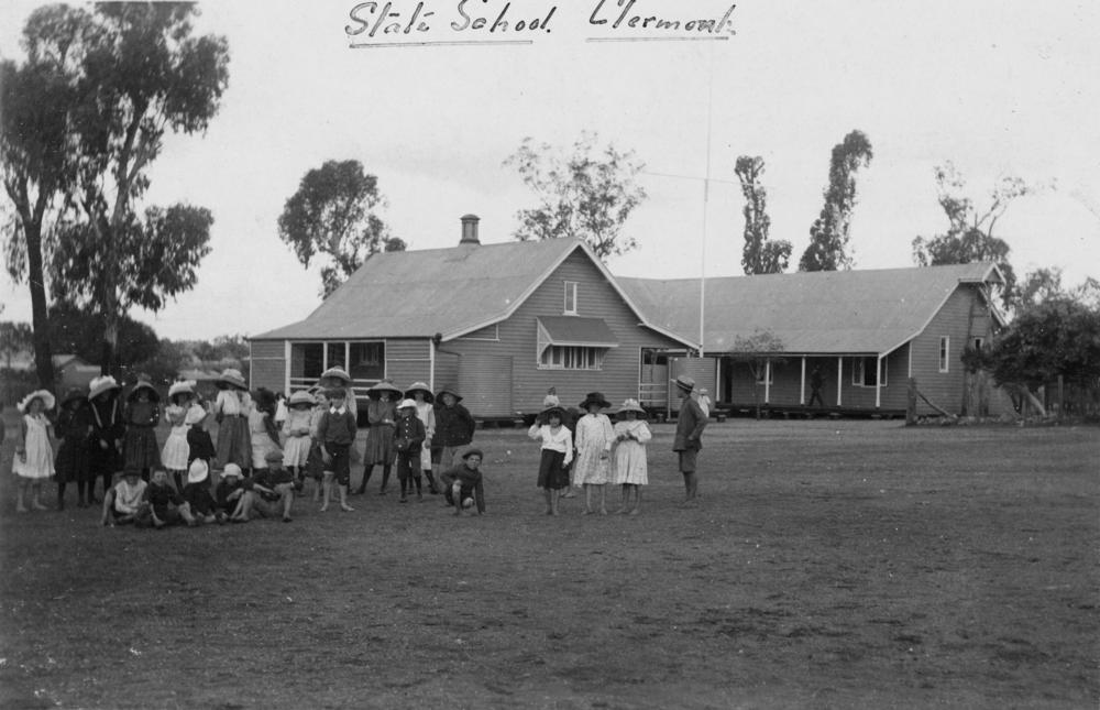
Clermont is a rural town and locality in the Isaac Region, Queensland, Australia. At the , the locality of Clermont had a population of 2952 people. Clermont is a major hub for the large coal mines in the region as well as serving agricultural properties. Geography Clermont is south-west of Mackay, at the junction of the Gregory and Peak Downs highways. The historic towns of North Copperfield () and South Copperfield (), often referred to collectively as Copperfield are along Christoe Street approximately south-west of the Clermont town centre. The Gregory Highway runs through the eastern end, and the Peak Downs Highway enters from the east. The Clermont Connection Road links the Gregory Highway to the CBD, and the Clermont-Alpha Road starts in the CBD and exits to the south-west. History '' Gangalu (Gangulu, Kangulu, Kanolu, Kaangooloo, Khangulu)'' is an Australian Aboriginal language spoken on Gangula country. The Gangula language region includes the towns of Clermo ... [...More Info...] [...Related Items...] OR: [Wikipedia] [Google] [Baidu] |


