|
Gorda Plate
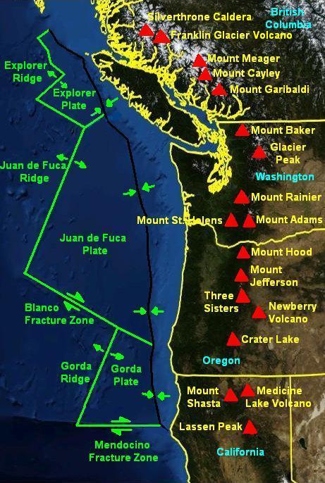
The Gorda Plate, located beneath the Pacific Ocean off the coast of northern California, is one of the northern remnants of the Farallon Plate. It is sometimes referred to (by, for example, publications from the USGS Earthquake Hazards Program) as simply the southernmost portion of the neighboring Juan de Fuca Plate, another Farallon remnant. Unlike most tectonic plates, the Gorda Plate experiences significant intraplate deformation inside its boundaries. Numerous faults have been mapped in both the sediments and basement of the Gorda Basin, which is in the interior of the plate south of 41.6°N. Stresses from the neighboring North American Plate and Pacific Plate cause frequent earthquakes in the interior of the plate, including the 1980 Eureka earthquake (also known as the Gorda Basin event). The easterly side is the Cascadia subduction zone where the plate subducts under the North American Plate in northern California. The southerly side is a transform boundary with the Pacif ... [...More Info...] [...Related Items...] OR: [Wikipedia] [Google] [Baidu] |
Mendocino Fault
The Mendocino Fracture Zone is a fracture zone and transform boundary over 4000 km (2500 miles) long, starting off the coast of Cape Mendocino in far northern California. It runs westward from a triple junction with the San Andreas Fault and the Cascadia subduction zone to the southern end of the Gorda Ridge. It continues on west of its junction with the Gorda Ridge, as an inactive remnant section which extends for several hundred miles. Technically, a fracture zone is not a transform fault, but in the case of the Mendocino, the term has been loosely applied to the active fault segment east of the Gorda Ridge as well as to the true fracture zone segment west of it. Many seismologists refer to the active segment as the Mendocino Fault or Mendocino fault zone. The fault section demarcates the boundary between the northwestward-moving Pacific Plate and the eastward-moving Gorda Plate. The Gorda Plate is subducting beneath the North American Plate just offshore of Cape Me ... [...More Info...] [...Related Items...] OR: [Wikipedia] [Google] [Baidu] |
Tectonic Plates
Plate tectonics (from the la, label=Late Latin, tectonicus, from the grc, τεκτονικός, lit=pertaining to building) is the generally accepted scientific theory that considers the Earth's lithosphere to comprise a number of large tectonic plates which have been slowly moving since about 3.4 billion years ago. The model builds on the concept of ''continental drift'', an idea developed during the first decades of the 20th century. Plate tectonics came to be generally accepted by geoscientists after seafloor spreading was validated in the mid to late 1960s. Earth's lithosphere, which is the rigid outermost shell of the planet (the crust and upper mantle), is broken into seven or eight major plates (depending on how they are defined) and many minor plates or "platelets". Where the plates meet, their relative motion determines the type of plate boundary: '' convergent'', '' divergent'', or ''transform''. Earthquakes, volcanic activity, mountain-building, and oceanic tren ... [...More Info...] [...Related Items...] OR: [Wikipedia] [Google] [Baidu] |
Oregon State University
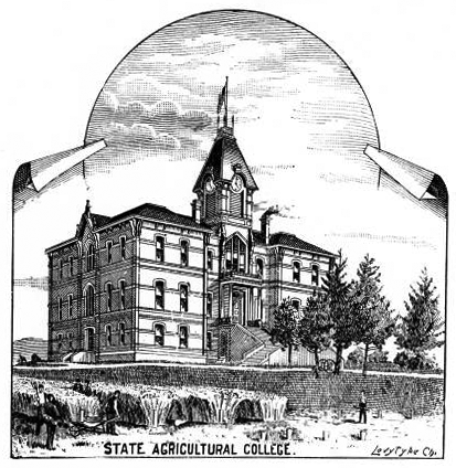
Oregon State University (OSU) is a public land-grant, research university in Corvallis, Oregon. OSU offers more than 200 undergraduate-degree programs along with a variety of graduate and doctoral degrees. It has the 10th largest engineering college in the nation for 2022. Undergraduate enrollment for all colleges combined averages close to 32,000, making it the state's largest university. Out-of-state students make up over one-quarter of undergraduates and an additional 5,500 students are engaged in graduate coursework through the university. Since its founding, over 272,000 students have graduated from OSU. It is classified among "Doctoral Universities – Very high research activity". Chartered as a land-grant university initially, OSU became one of the four inaugural members of the Sea Grant in 1971. It joined the Space Grant and Sun Grant research consortia in 1991 and 2003, respectively, making it the first public university and one of just four in total to attain memb ... [...More Info...] [...Related Items...] OR: [Wikipedia] [Google] [Baidu] |
Burke Museum Of Natural History And Culture
The Burke Museum of Natural History and Culture (Burke Museum) is a natural history museum in Seattle, Washington, in the United States. Established in 1899 as the Washington State Museum, it traces its origins to a high school naturalist club formed in 1879. The museum is the oldest in Washington state and boasts a collection of more than 16 million artifacts, including the world's largest collection of spread bird wings. Located on the campus of the University of Washington, the Burke Museum is the official state museum of Washington. History Young Naturalists Society The roots of the Burke Museum can be traced to a natural history club formed by high school students in the 19th century. The group was formed in December 1879 by students Edmond S. Meany, J. O. Young, P. Brooks Randolph, and Charles Denny. Denny's father, city founder Arthur Denny, was a regent of the Territorial University of Washington and arranged for the group to meet on campus. The Young Naturalists adop ... [...More Info...] [...Related Items...] OR: [Wikipedia] [Google] [Baidu] |
Mendocino Triple Junction
The Mendocino Triple Junction (MTJ) is the point where the Gorda plate, the North American plate, and the Pacific plate meet, in the Pacific Ocean near Cape Mendocino in northern California. This triple junction is the location of a change in the broad plate motions which dominate the west coast of North America, linking convergence of the northern Cascadia subduction zone and translation of the southern San Andreas Fault system. The Gorda plate is subducting, towards N50ºE, under the North American plate at 2.5 – 3 cm/yr, and is simultaneously converging obliquely against the Pacific plate at a rate of 5 cm/yr in the direction N115ºE. The accommodation of this plate configuration results in a transform boundary along the Mendocino Fracture Zone, and a divergent boundary at the Gorda Ridge. Due to the relative plate motions, the triple junction has been migrating northwards for the past 25–30 million years, and assuming rigid plates, the geometry requires that a vo ... [...More Info...] [...Related Items...] OR: [Wikipedia] [Google] [Baidu] |
Lassen Peak
Lassen Peak ( ), commonly referred to as Mount Lassen, is a lava dome volcano and the southernmost active volcano in the Cascade Range of the Western United States. Located in the Shasta Cascade region of Northern California, it is part of the Cascade Volcanic Arc, which stretches from southwestern British Columbia to northern California. Lassen Peak reaches an elevation of , standing above the northern Sacramento Valley. It supports many flora and fauna among its diverse habitats, which are subject to frequent snowfall and reach high elevations. Lassen Peak has a volume of , making it one of the largest lava domes on Earth. The volcano arose from the former northern flank of now-eroded Mount Tehama about 27,000 years ago, from a series of eruptions over the course of a few years. The mountain has been significantly eroded by glaciers over the last 25,000 years, and is now covered in talus deposits. On May 22, 1915, a powerful explosive eruption at Lassen Peak devastated near ... [...More Info...] [...Related Items...] OR: [Wikipedia] [Google] [Baidu] |
Mount Shasta
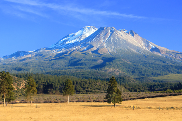
Mount Shasta ( Shasta: ''Waka-nunee-Tuki-wuki''; Karuk: ''Úytaahkoo'') is a potentially active volcano at the southern end of the Cascade Range in Siskiyou County, California. At an elevation of , it is the second-highest peak in the Cascades and the fifth-highest in the state. Mount Shasta has an estimated volume of , which makes it the most voluminous stratovolcano in the Cascade Volcanic Arc. The mountain and surrounding area are part of the Shasta–Trinity National Forest. Description Mount Shasta is connected to its satellite cone of Shastina, and together they dominate the landscape. Shasta rises abruptly to tower nearly above its surroundings. On a clear winter day, the mountain can be seen from the floor of the Central Valley to the south. The mountain has attracted the attention of poets, authors, and presidents. The mountain consists of four overlapping dormant volcanic cones that have built a complex shape, including the main summit and the prominent and visi ... [...More Info...] [...Related Items...] OR: [Wikipedia] [Google] [Baidu] |
Volcanoes
A volcano is a rupture in the crust of a planetary-mass object, such as Earth, that allows hot lava, volcanic ash, and gases to escape from a magma chamber below the surface. On Earth, volcanoes are most often found where tectonic plates are diverging or converging, and most are found underwater. For example, a mid-ocean ridge, such as the Mid-Atlantic Ridge, has volcanoes caused by divergent tectonic plates whereas the Pacific Ring of Fire has volcanoes caused by convergent tectonic plates. Volcanoes can also form where there is stretching and thinning of the crust's plates, such as in the East African Rift and the Wells Gray-Clearwater volcanic field and Rio Grande rift in North America. Volcanism away from plate boundaries has been postulated to arise from upwelling diapirs from the core–mantle boundary, deep in the Earth. This results in hotspot volcanism, of which the Hawaiian hotspot is an example. Volcanoes are usually not created where two tectonic plates slide pa ... [...More Info...] [...Related Items...] OR: [Wikipedia] [Google] [Baidu] |
Blanco Fracture Zone
The Blanco Fracture Zone or Blanco Transform Fault Zone (BTFZ) is a right lateral transform fault zone, which runs northwest off the coast of Oregon in the Pacific Northwest of the United States, extending from the Gorda Ridge in the south to the Juan de Fuca Ridge in the north. Morphology The Blanco Transform Fault Zone is an approximately 350 km long zone that varies in width between 20 and 75 km. The Blanco Fracture Zone starts about 150 km off Cape Blanco, and extends northwest to about 500 km off of Newport. It consists of a series of deep basins interrupted by transform faults. The western part of the fracture zone, from the Cascadia Depression to the Juan de Fuca Ridge, moves at 1.4 cm/a; the eastern segment, from the Cascadia Depression to the Gorda Ridge moves at 3.9 cm/a. The whole zone averages a slip rate of 2.0 cm/a. Through it, Cascadia Channel passes. Eastern segment The principal feature of the eastern portion of the zone ... [...More Info...] [...Related Items...] OR: [Wikipedia] [Google] [Baidu] |
Gorda Ridge
The Gorda Ridge (41°36'19.6"N 127°22'03.1"W), aka ''Gorda Ridges'' tectonic spreading center, is located roughly off the northern coast of California and southern Oregon. Running NE – SW it is roughly in length.Carey, Stein, & Rona. (1990). Benthos of the Gorda Ridge axial valley (NE Pacific Ocean): Taxonomic composition and trends in distribution. Progress in Oceanography, 24(1), 47–57. The ridge is broken into three segments;Sverdrup, K. (1986). Multiple-event relocation of earthquakes on and near the Gorda Ridge. Geophysical Research Letters., 13(7), 674–677. the northern ridge, central ridge, and the southern ridge, which contains the Escanaba Trough. Regional setting The Gorda Ridge runs in a north-easterly direction, bounded at both ends by transform faults. At the southern end, the ridge meets the Mendocino transform fault, while the northern end butts against the Blanco transform fault. To its east is the Gorda Plate, which together with the Juan de Fuca Plate ... [...More Info...] [...Related Items...] OR: [Wikipedia] [Google] [Baidu] |
Divergent Boundary
In plate tectonics, a divergent boundary or divergent plate boundary (also known as a constructive boundary or an extensional boundary) is a linear feature that exists between two tectonic plates that are moving away from each other. Divergent boundaries within continents initially produce rifts, which eventually become rift valleys. Most active divergent plate boundaries occur between oceanic plates and exist as mid-oceanic ridges. Current research indicates that complex convection within the Earth's mantle allows material to rise to the base of the lithosphere beneath each divergent plate boundary. This supplies the area with huge amounts of heat and a reduction in pressure that melts rock from the asthenosphere (or upper mantle) beneath the rift area, forming large flood basalt or lava flows. Each eruption occurs in only a part of the plate boundary at any one time, but when it does occur, it fills in the opening gap as the two opposing plates move away from each other. ... [...More Info...] [...Related Items...] OR: [Wikipedia] [Google] [Baidu] |


