|
Goodooga
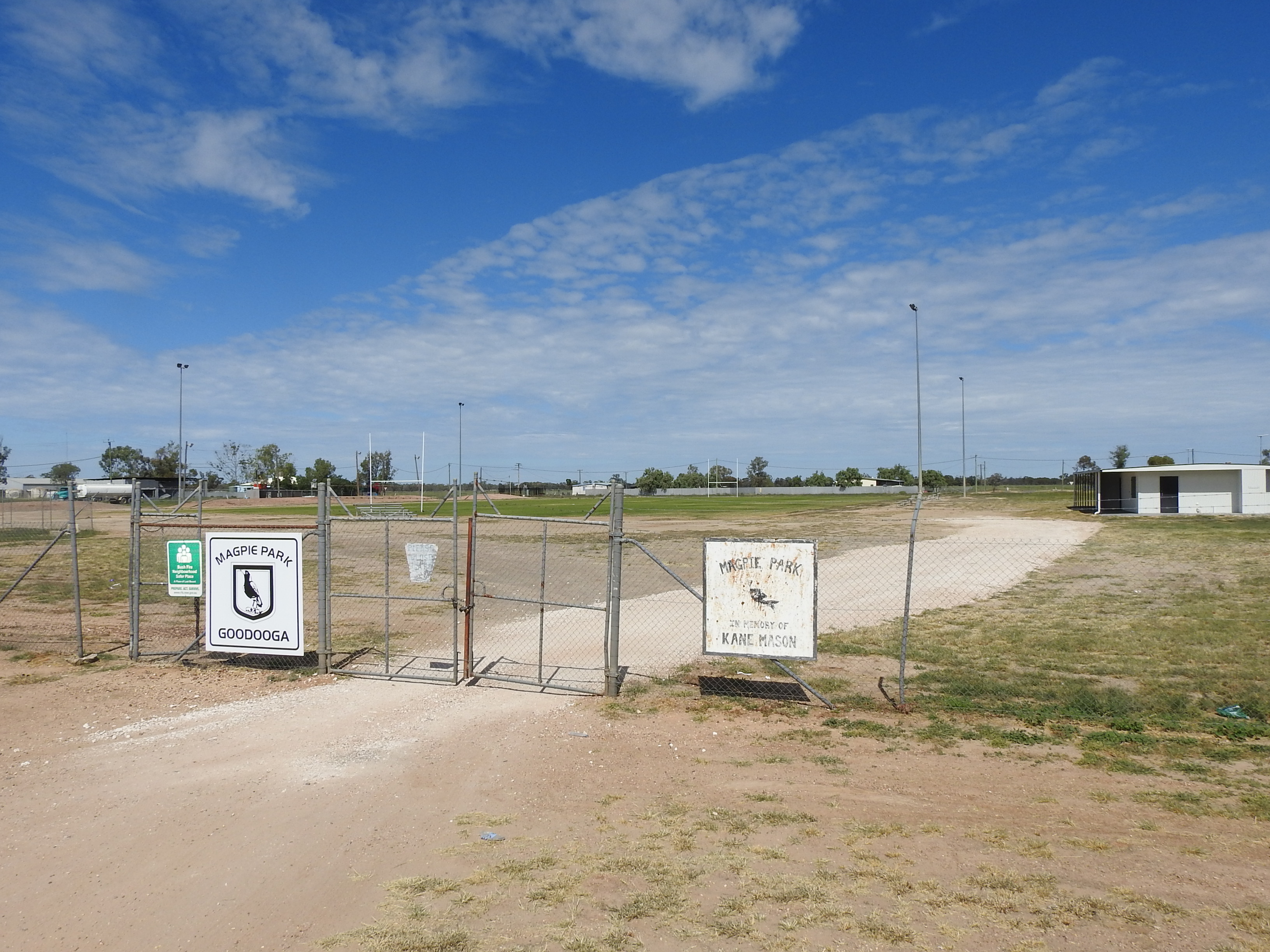
Goodooga is a town in the Australian state of New South Wales in Brewarrina Shire on the eastern bank of the Bokhara River. It is near Brewarrina and Lightning Ridge, its closest neighbour. The town lies south of the Queensland border, and the border town of Hebel. The shire council has also built the 'Great Artesian Baths' on the northside of town, heated water pool from the Great Artesian Basin. The Goodooga airstrip is west-north-west of the town (). History Yuwaalayaay (also known as ''Yuwalyai, Euahlayi, Yuwaaliyaay, Gamilaraay, Kamilaroi, Yuwaaliyaayi'') is an Australian Aboriginal language spoken on Yuwaalayaay country. It is closely related to the Gamilaraay and Yuwaalaraay languages. The Yuwaalayaay language region includes the landscape within the local government boundaries of the Shire of Balonne, including the town of Dirranbandi as well as the border town of Goodooga extending to Walgett and the Narran Lakes in New South Wales.' Goodooga is an Aborigi ... [...More Info...] [...Related Items...] OR: [Wikipedia] [Google] [Baidu] |
Hebel, Queensland
Hebel (pronounced ''he-bell'') is a rural town and locality in the Shire of Balonne, Queensland, Australia. It is on the border of Queensland and New South Wales. In the , Hebel had a population of 67 people. Geography Hebel is in south-west Queensland situated north of the border with New South Wales on the Castlereagh Highway. It is the eastern corner of the locality. The Bokhara River (a non-perennial river) enters the locality from the east (Dirranbandi) and flows past the immediate north of the town and exits the locality to the south (Goodooga in New South Wales). It is part of the Murray-Darling River system. In the west of the locality is the Culgoa River and the Culgoa Floodplain National Park (), which extends into neighbouring Jobs Gate. There are a number of homesteads in the locality: * Balgi () * Ballandool () * Byra () * Currawillinghi () * Davirton () * Goonaroo () * Kinglebilla () * Koala () * Morley () * Tara () * Yattenbury () History Yuwaalaraay ( ... [...More Info...] [...Related Items...] OR: [Wikipedia] [Google] [Baidu] |
Walgett, New South Wales
Walgett is a town in northern New South Wales, Australia, and the seat of Walgett Shire. It is near the junctions of the Barwon and Namoi Rivers and the Kamilaroi and Castlereagh Highways. In 2016, Walgett had a population of 2,145. In the 2016 Census, there were 6,107 people in the Walgett Local Government Area. Of these 52.9% were male and 47.1% were female. Aboriginal and/or Torres Strait Islander people made up 29.4% of the population. Walgett takes its name from an Aboriginal word meaning 'the meeting place of two rivers'. The town was listed as one of the most socially disadvantaged areas in the State according to the 2015 Dropping Off The Edge report. History The area was inhabited by the Gamilaroi (also spelt Kamilaroi) Nation of Indigenous peoples before European settlement. Yuwaalayaay (also known as ''Yuwalyai, Euahlayi, Yuwaaliyaay, Gamilaraay, Kamilaroi, Yuwaaliyaayi'') is an Australian Aboriginal language spoken on Yuwaalayaay country. It is closely related ... [...More Info...] [...Related Items...] OR: [Wikipedia] [Google] [Baidu] |
Bokhara River
The Bokhara River, a watercourse that is part of the Barwon catchment within the Murray–Darling basin, is located in the South Downs region of Queensland, flowing downstream into the north–western slopes of New South Wales, Australia. It flows through the lower Balonne floodplain. Course and features The river rises at the Balonne River south of Dirranbandi, within the state of Queensland, and is one of several branches of the Balonne that flows generally south–west, joined by five minor tributaries, before reaching its confluence with the Barwon River, downstream from Brewarrina. The river descends over its course. The Bokhara River, from its source towards its mouth, flows past the towns of Hebel and Goodooga. Water from the river is used by farmers to irrigate a variety of crops, including barley, wheat and cotton. [...More Info...] [...Related Items...] OR: [Wikipedia] [Google] [Baidu] |
Narran County
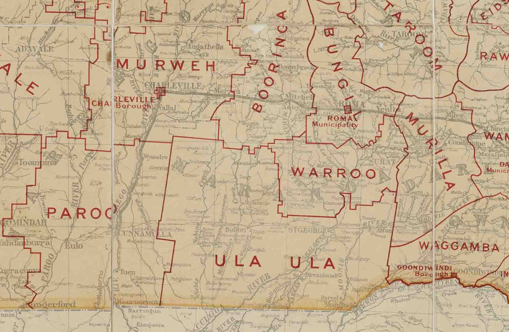
Narran County is one of the 141 Cadastral divisions of New South Wales. It is bounded by the Culgoa River on the west, the Narran River in the east, the Queensland border in the north, and the Barwon River in the south. It includes Goodooga and the area to the north of Brewarrina. A third river runs thought Narran County - the Bokhara River with Goodooga being on its eastern bank. The three rivers - the Narran, the Bokhara, and the Culgoa - are branches of the Balonne River and all three enter the Barwon River separately. The confluence of the Culgoa and the Barwon rivers is the start of the Darling River. Narran is believed to be derived from a local Aboriginal word. Parishes within this county A full list of parishes found within this county; their current LGA LaGuardia Airport is a civil airport in East Elmhurst, Queens, New York City. Covering , the facility was established in 1929 and began operating as a public airport in 1939. It is named after former New Y ... [...More Info...] [...Related Items...] OR: [Wikipedia] [Google] [Baidu] |
Shire Of Balonne
The Shire of Balonne is a local government area in South West Queensland, Australia, over from the state capital, Brisbane. It covers an area of , and has existed as a local government entity since 1879. It is headquartered in its main town, St George. History Kamilaroi (also known as Gamilaroi, Gamilaraay, Comilroy) is an Australian Aboriginal language of South-West Queensland. It is closely related to Yuwaalaraay and Yuwaalayaay. The Kamilaroi language region includes the local government area of the Shire of Balonne, including the towns of Dirranbandi, Thallon, Talwood and Bungunya as well as the border towns of Mungindi and Boomi extending to Moree, Tamworth and Coonabarabran in New South Wales. Yuwaalaraay (also known as ''Yuwalyai, Euahlayi, Yuwaaliyaay, Gamilaraay, Kamilaroi, Yuwaaliyaayi'') is an Australian Aboriginal language spoken on Yuwaalaraay country. The Yuwaalaraay language region includes the landscape within the local government boundaries of the Shire ... [...More Info...] [...Related Items...] OR: [Wikipedia] [Google] [Baidu] |
Narran Lakes
The Narran Wetlands, also known as the Narran Lakes, contained within the Narran Lake Nature Reserve, comprise a series of protected ephemeral lakes and swamps fed by the Narran River in the north-west of New South Wales, Australia. The reserve is located approximately east of . An area contained within the reserve is protected under the Ramsar Convention as a wetland of international importance. It is internationally important because of its rarity and naturalness; its significance for waterbirds, supporting large colonial waterbird breeding events of ibis, spoonbills and cormorants; and its importance as a drought refuge for waterbirds. The vegetation and the waterbird colonies are at risk from reduced flooding caused by upstream water abstraction for agriculture in Queensland. Description The wetland complex formed by the Narran floodplain is the terminal system of the Narran River, the easternmost distributary of the Balonne River, and lies between the towns of Brewa ... [...More Info...] [...Related Items...] OR: [Wikipedia] [Google] [Baidu] |
Dirranbandi, Queensland
Dirranbandi is a rural town and locality in the Shire of Balonne, Queensland, Australia. The locality is on the border of Queensland with New South Wales. In the , Dirranbandi had a population of 640 people. Geography Dirranbandi is on the Castlereagh Highway and the Balonne River. It is notable for the population variations each year as seasonal workers come to work on the extensive cotton fields. Due to the low annual rainfall, irrigation is used extensively. Cubbie Station, the largest cotton producing property in the southern hemisphere, is close to Dirranbandi. History Gamilaraay (also known as Gamilaroi, Kamilaroi, Comilroy) is a language from South-West Queensland and North-West New South Wales. The Gamilaraay language region includes the landscape within the local government boundaries of the Balonne Shire Council, including the towns of Dirranbandi, Thallon, Talwood and Bungunya as well as the border towns of Mungindi and Boomi extending to Moree, Tamworth and ... [...More Info...] [...Related Items...] OR: [Wikipedia] [Google] [Baidu] |
Brewarrina Shire
Brewarrina Shire is a local government area in the Orana region of New South Wales, Australia. The Shire is located adjacent to the Darling River, which is known as the Barwon River upstream from Bourke; and located adjacent to the Kamilaroi Highway. The northern boundary of the Shire is located adjacent to the border between New South Wales and Queensland. The Shire is a wool and cotton growing area. Towns and villages Brewarrina Shire includes Brewarrina and the villages of Gongolgon, Angledool and Goodooga and the ghost town of Tarcoon. Demographics According to the Australian Bureau of Statistics during 2003–04, there were 500 wage and salary earners (ranked 163rd in New South Wales and 528th in Australia, less than 0.1% of both New South Wales's 2,558,415 and Australia's 7,831,856) with a total income of $17 million (ranked 162nd in New South Wales and 527nd in Australia, less than 0.1% of both New South Wales's $107 billion and Australia's $304 billion). It was a ... [...More Info...] [...Related Items...] OR: [Wikipedia] [Google] [Baidu] |
Brewarrina, New South Wales
Brewarrina (pronounced 'bree-warren-ah'; locally known as "Bre") is a town in north-west New South Wales, Australia on the banks of the Barwon River (New South Wales), Barwon River in Brewarrina Shire. The name Brewarrina is derived from 'burru waranha', a Weilwan name for a species of Acacia, Cassia tree, "Acacia clumps", "a native standing" or "place where wild gooseberry grows". It is east of Bourke, New South Wales, Bourke and west of Walgett, New South Wales, Walgett on the Kamilaroi Highway, and 787km from Sydney. The population of Brewarrina in 2016 was 1,143. Other towns and villages in the Brewarrina district include: Goodooga, New South Wales, Goodooga, Gongolgon, Weilmoringle and Angledool, New South Wales, Angledool. History The town is located amid the traditional lands of the Muruwari, Ngemba, Weilwan and Yualwarri peoples. The area has a long Indigenous Australian history and was once the meeting ground for over 5,000 people. The first settlers arrived in the d ... [...More Info...] [...Related Items...] OR: [Wikipedia] [Google] [Baidu] |
Narran Wetlands
The Narran Wetlands, also known as the Narran Lakes, contained within the Narran Lake Nature Reserve, comprise a series of protected ephemeral lakes and swamps fed by the Narran River in the north-west of New South Wales, Australia. The reserve is located approximately east of . An area contained within the reserve is protected under the Ramsar Convention as a wetland of international importance. It is internationally important because of its rarity and naturalness; its significance for waterbirds, supporting large colonial waterbird breeding events of ibis, spoonbills and cormorants; and its importance as a drought refuge for waterbirds. The vegetation and the waterbird colonies are at risk from reduced flooding caused by upstream water abstraction for agriculture in Queensland. Description The wetland complex formed by the Narran floodplain is the terminal system of the Narran River, the easternmost distributary of the Balonne River, and lies between the towns of Brewarrina ... [...More Info...] [...Related Items...] OR: [Wikipedia] [Google] [Baidu] |
Lightning Ridge, New South Wales
Lightning Ridge is a small outback town in north-western New South Wales, Australia. Part of Walgett Shire, Lightning Ridge is situated near the southern border of Queensland, about east of the Castlereagh Highway. The Lightning Ridge area is a centre of the mining of black opal and other opal gemstones. Indigenous inhabitants The traditional owners of the land around Lightning Ridge are the Yuwaalaraay people. Yuwaalayaay (also known as ''Yuwalyai, Euahlayi, Yuwaaliyaay, Gamilaraay, Kamilaroi, Yuwaaliyaayi'') is an Australian Aboriginal language spoken on Yuwaalayaay country. It is closely related to the Gamilaraay and Yuwaalaraay languages. The Yuwaalayaay language region includes the landscape within the local government boundaries of the Shire of Balonne, including the town of Dirranbandi as well as the border town of Goodooga extending to Walgett and the Narran Lakes in New South Wales.' After they were displaced by the establishment of colonial pastoral stations, ma ... [...More Info...] [...Related Items...] OR: [Wikipedia] [Google] [Baidu] |
Yuwaalaraay-Gamilaraay
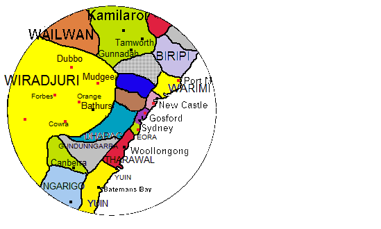
The Gamilaraay or Kamilaroi language is a Pama–Nyungan language of the Wiradhuric subgroup found mostly in south-eastern Australia. It is the traditional language of the Gamilaraay (Kamilaroi), an Aboriginal Australian people. It has been noted as endangered, but the number of speakers grew from 87 in the 2011 Australian Census to 105 in the 2016 Australian Census. Thousands of Australians identify as Gamilaraay, and the language is taught in some schools. Wirray Wirray, Guyinbaraay, Yuwaalayaay, Waalaraay and Gawambaraay are dialects; Yuwaalaraay/Euahlayi is a closely related language. Name The name Gamilaraay means '-having', with being the word for 'no'. Other dialects and languages are similarly named after their respective words for 'no'. (Compare the division between ''langues d'oïl'' and ''langues d'oc'' in France, distinguished by their respective words for 'yes'.) Spellings of the name, pronounced in the language itself, include Goomeroi; Kamilaroi; Gamilaraa ... [...More Info...] [...Related Items...] OR: [Wikipedia] [Google] [Baidu] |


.jpg)
