|
Gold Belt Tour Scenic And Historic Byway
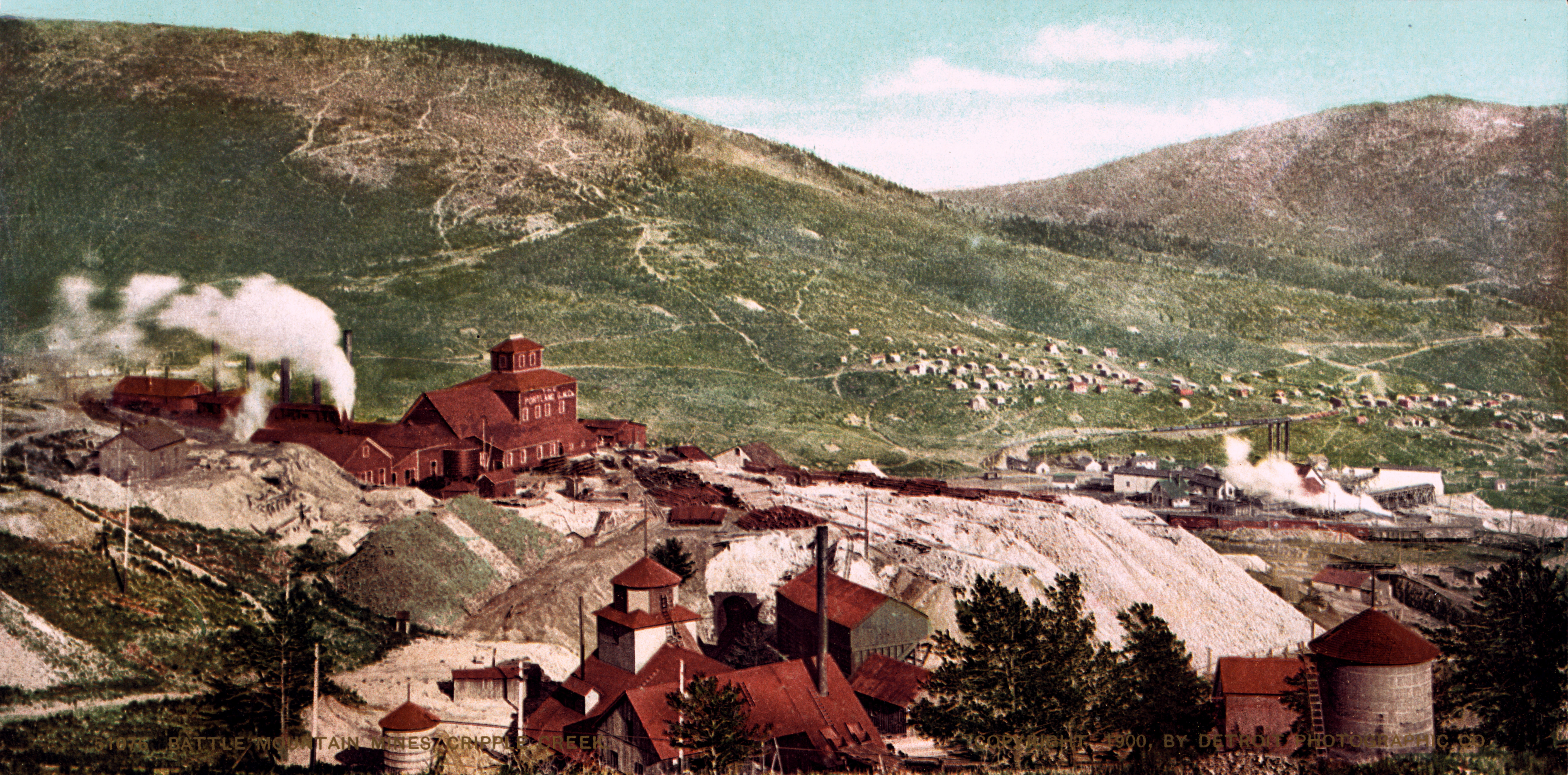
The Gold Belt Tour Scenic and Historic Byway is a National Scenic Byway, a Back Country Byway, and a Colorado Scenic and Historic Byway located in Fremont and Teller counties, Colorado, USA. The byway is named for the Gold Belt mining region. The Cripple Creek Historic District is a National Historic Landmark. The byway forms a three-legged loop with the Phantom Canyon Road (narrow gravel), the Shelf Road (narrow unimproved), and the High Park Road (paved). Route The Gold Belt Byway contains many roads. Most of them are dirt roads that are narrow and run through canyons and other geological features. Phantom Canyon Road Phantom Canyon Road is a scenic road that connects Cañon City and Victor. The road goes through Phantom Canyon. The road has two tunnels and three elevated bridges. It has many camp locations. It was originally the route of a railroad that connected Florence and Cripple Creek. The route contains many narrow roads and high wooden bridges. The road is unpaved. ... [...More Info...] [...Related Items...] OR: [Wikipedia] [Google] [Baidu] |
Colorado Department Of Transportation
The Colorado Department of Transportation (CDOT, pronounced See Dot) is the principal department of the Colorado state government that administers state government transportation responsibilities in the state of Colorado. CDOT is responsible for maintaining 9,144 mile highway system, including 3,429 bridges with over 28 billion vehicle miles of travel per year. CDOT's Mission is "To provide the best multi-modal transportation system for Colorado that most effectively moves people, goods, and information." It is governed by the Transportation Commission of Colorado. Motor Carriers over 10,000 lbs are regulated by the state and are required to obtain a federal United States Department of Transportation (USDOT) safety tracking number used to monitor carriers' safety management practices and controls. History :''Source: CDOT'' The Colorado Department of Transportation has its roots in 1909, when the first highway bill was passed by forming a three-member Highway Commission to appr ... [...More Info...] [...Related Items...] OR: [Wikipedia] [Google] [Baidu] |
Tunnel
A tunnel is an underground passageway, dug through surrounding soil, earth or rock, and enclosed except for the entrance and exit, commonly at each end. A pipeline is not a tunnel, though some recent tunnels have used immersed tube construction techniques rather than traditional tunnel boring methods. A tunnel may be for foot or vehicular road traffic, for rail traffic, or for a canal. The central portions of a rapid transit network are usually in the tunnel. Some tunnels are used as sewers or aqueducts to supply water for consumption or for hydroelectric stations. Utility tunnels are used for routing steam, chilled water, electrical power or telecommunication cables, as well as connecting buildings for convenient passage of people and equipment. Secret tunnels are built for military purposes, or by civilians for smuggling of weapons, contraband, or people. Special tunnels, such as wildlife crossings, are built to allow wildlife to cross human-made barriers safely. ... [...More Info...] [...Related Items...] OR: [Wikipedia] [Google] [Baidu] |
Cripple Creek, Colorado
Cripple Creek is a statutory city that is the county seat of Teller County, Colorado, United States. The city population was 1,155 at the 2020 United States Census. Cripple Creek is a former gold mining camp located southwest of Colorado Springs near the base of Pikes Peak. The Cripple Creek Historic District, which received National Historic Landmark status in 1961, includes part or all of the city and the surrounding area. The city is now a part of the Colorado Springs, CO Metropolitan Statistical Area and the Front Range Urban Corridor. History For many years, Cripple Creek's high valley, at an elevation of , was considered no more important than a cattle pasture. Many prospectors avoided the area after the ''Mount Pisgah hoax'', a mini gold rush caused by salting (adding gold to worthless rock). On 20 October, 1890, Robert Miller "Bob" Womack discovered a rich ore and the last great Colorado gold rush began. By July 1891, a post office was established. By November, h ... [...More Info...] [...Related Items...] OR: [Wikipedia] [Google] [Baidu] |
Brookside, Colorado
The Town of Brookside is a Statutory Town located in Fremont County, Colorado, United States. The town population was 236 at the 2020 United States Census. Brookside is a part of the Cañon City, CO Micropolitan Statistical Area. Geography Brookside is located at (38.413513, -105.190734). At the 2020 United States Census, the town had a total area of , all of it land. Demographics As of the census of 2000, there were 219 people, 85 households, and 62 families residing in the town. The population density was . There were 88 housing units at an average density of . The racial makeup of the town was 96.35% White, 0.46% Native American, 0.46% from other races, and 2.74% from two or more races. Hispanic or Latino of any race were 10.96% of the population. There were 85 households, out of which 28.2% had children under the age of 18 living with them, 63.5% were married couples living together, 5.9% had a female householder with no husband present, and 25.9% were non-families ... [...More Info...] [...Related Items...] OR: [Wikipedia] [Google] [Baidu] |

