|
Gogrial Airport
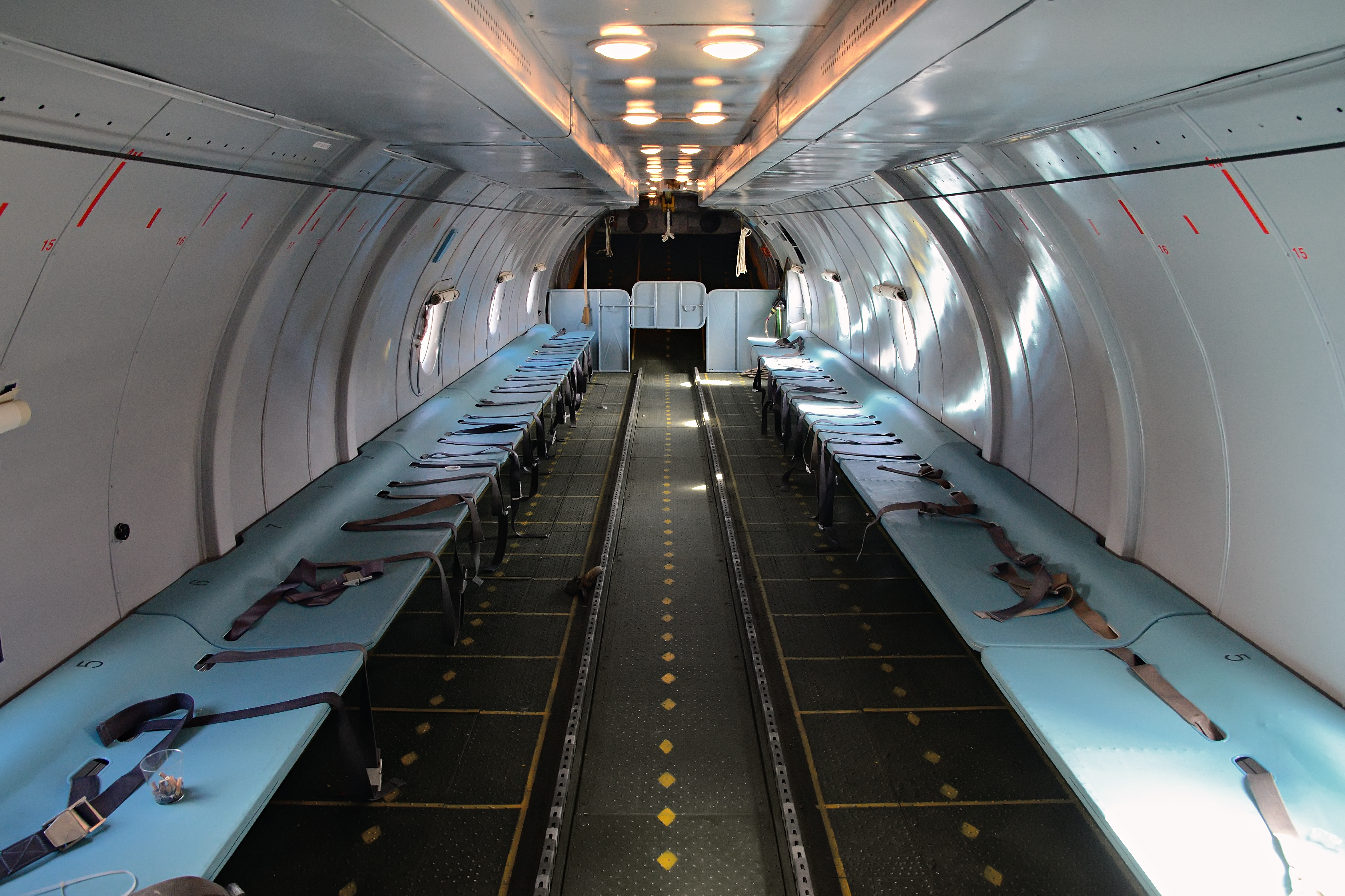
Gogrial Airport is an airport in South Sudan. Location Gogrial Airport is located in ''Gogrial West County'', Gogrial State, in the town of Gogrial, near the borders with the Republic of Sudan and the Abyei Region. The airport is located within the central business district of the town. This location lies approximately , by air, northwest of Juba International Airport, the largest airport in South Sudan. The geographic coordinates of this airport are: 8° 32' 24.00"N, 28° 06' 0.00"E (Latitude: 8.8670; Longitude: 28.1170). Gogrial Airport is situated above sea level. The airport has a single unpaved runway, the dimensions of which are not publicly known at this time. Overview Gogrial Airport is a small civilian airport that serves the town of Gogrial and surrounding communities. There are no scheduled airline flights to Gogrial Airport at this time. Sudan Air Force Antonov An-26-100 MTI-1.jpg, Sudan Air Force Antonov An-26-100 crash-landed in 1997 at the airstrip of Gogrial. ... [...More Info...] [...Related Items...] OR: [Wikipedia] [Google] [Baidu] |
Public Airport
An airport is an aerodrome with extended facilities, mostly for commercial air transport. Airports usually consists of a landing area, which comprises an aerially accessible open space including at least one operationally active surface such as a runway for a plane to take off and to land or a helipad, and often includes adjacent utility buildings such as control towers, hangars and terminals, to maintain and monitor aircraft. Larger airports may have airport aprons, taxiway bridges, air traffic control centres, passenger facilities such as restaurants and lounges, and emergency services. In some countries, the US in particular, airports also typically have one or more fixed-base operators, serving general aviation. Operating airports is extremely complicated, with a complex system of aircraft support services, passenger services, and aircraft control services contained within the operation. Thus airports can be major employers, as well as important hubs for tourism ... [...More Info...] [...Related Items...] OR: [Wikipedia] [Google] [Baidu] |
Central Business District
A central business district (CBD) is the commercial and business centre of a city. It contains commercial space and offices, and in larger cities will often be described as a financial district. Geographically, it often coincides with the "city centre" or "downtown". However, these concepts are not necessarily synonymous: many cities have a central ''business'' district located away from its commercial and or cultural centre and or downtown/city centre, and there may be multiple CBDs within a single urban area. The CBD will often be characterised by a high degree of accessibility as well as a large variety and concentration of specialised goods and services compared to other parts of the city. For instance, Midtown Manhattan, New York City, is the largest central business district in the city and in the United States. London's city centre is usually regarded as encompassing the historic City of London and the medieval City of Westminster, while the City of London and the transform ... [...More Info...] [...Related Items...] OR: [Wikipedia] [Google] [Baidu] |
Warrap (state)
Warrap (also spelled Warab), is a state in South Sudan located in the Bahr el Ghazal region. It has an area of 31,027 km². Overview Warrap State comprises an area of 31,027 km². Kuajok is the capital of Warrap state. All states in South Sudan are divided into counties, each headed by a County Commissioner appointed by the President of the Republic of South Sudan The state became part of South Sudan after a successful secession from Sudan on 9 July 2011. Location Warrap State is located in the Bahr el Ghazal region. To its north lies the disputed region of Abyei, to its east lies Unity State. To the west is Western Bahr el Ghazal and Northern Bahr el Ghazal, and to its south lies the Lakes State. People The state is home to the Luanyjang, Twic, Jur-Man Anger, Bongo and Rek subtribes of Nilotic ethnicity. The Twic, Luanyjang, and Rek are of Dinka tribes. Warrap State is also home to the late Manute Bol who hailed from Twic county. Upon his death in 2010, NBA basketball ... [...More Info...] [...Related Items...] OR: [Wikipedia] [Google] [Baidu] |
List Of Airports In South Sudan
This is a list of airports in South Sudan, sorted by location. South Sudan, officially the Republic of South Sudan, is a landlocked country in east-central Africa bordered by Ethiopia to the east, Kenya to the southeast, Uganda to the south, the Democratic Republic of the Congo to the southwest, the Central African Republic to the west, and Sudan to the north. South Sudan's capital and largest city is Juba. The country is divided into 10 states. __TOC__ Airports Airport names shown in bold indicate the airport has scheduled service on commercial airlines. * - International airports See also * Transport in South Sudan * List of airports by ICAO code: H#HS - Sudan and South Sudan * List of airports in Sudan * Wikipedia:WikiProject Aviation/Airline destination lists: Africa#Sudan References * - includes IATA codes * Great Circle Mapper: Airports in South Sudan- IATA and ICAO codes World Aero Data: Airports in Sudan- ICAO codes List of Sudan Airports with Google ... [...More Info...] [...Related Items...] OR: [Wikipedia] [Google] [Baidu] |
Antonov An-26
The Antonov An-26 ( NATO reporting name: Curl) is a twin-engined turboprop civilian and military transport aircraft, designed and produced in the Soviet Union from 1969 to 1986.Gordon, Yefim. Komissarov, Dmitry & Sergey. "Antonov's Turboprop Twins". Hinkley. Midland. 2003. Development While the An-24T tactical transport had proved successful in supporting Soviet troops in austere locations, its ventral loading hatch restricted the handling of cargo, and in particular vehicles, and made it less effective than hoped in parachuting men and supplies. As a result, interest in a version with a retractable cargo ramp increased, and the Antonov design bureau decided in 1966 to begin development on the new An-26 derivative, in advance of an official order. The cargo ramp was based on that design and allowed the cargo deck to be sealed and pressurised in flight. When loading cargo, it could either be lowered to allow vehicles to be driven in, or slid beneath the aircraft's fuselage, so th ... [...More Info...] [...Related Items...] OR: [Wikipedia] [Google] [Baidu] |
Sudan Air Force
The Sudanese Air Force ( ar, القوّات الجوّيّة السودانيّة, Al-Quwwat al-Jawwiya As-Sudaniya) is the air force operated by the Republic of the Sudan. As such it is part of the Sudanese Armed Forces. History The Sudanese Air Force was founded immediately after Sudan gained independence from the United Kingdom in 1956. The British assisted in the Air Force's establishment, providing equipment and training. Four new Hunting Provost T Mk 51s were delivered for jet training in 1961. In 1958, the Sudanese Air Force's transport wing acquired its first aircraft, a single Hunting President. In 1960 the Sudanese Air Force received an additional four re-furbished RAF Provosts and two more Hunting Presidents. Also in 1960, the transport wing's capability was increased by the addition of two Pembroke C Mk 54s. The Air Force gained its first combat aircraft when 12 Jet Provosts with a close air support capability were delivered in 1962. In the 1960s, the Soviet Unio ... [...More Info...] [...Related Items...] OR: [Wikipedia] [Google] [Baidu] |
Runway
According to the International Civil Aviation Organization (ICAO), a runway is a "defined rectangular area on a land aerodrome prepared for the landing and takeoff of aircraft". Runways may be a man-made surface (often asphalt concrete, asphalt, concrete, or a mixture of both) or a natural surface (sod, grass, soil, dirt, gravel, ice, sand or road salt, salt). Runways, as well as taxiways and Airport apron, ramps, are sometimes referred to as "tarmac", though very few runways are built using Tarmacadam, tarmac. Takeoff and landing areas defined on the surface of water for seaplanes are generally referred to as waterways. Runway lengths are now International Civil Aviation Organization#Use of the International System of Units, commonly given in meters worldwide, except in North America where feet are commonly used. History In 1916, in a World War I war effort context, the first concrete-paved runway was built in Clermont-Ferrand in France, allowing local company Michelin to ... [...More Info...] [...Related Items...] OR: [Wikipedia] [Google] [Baidu] |
Juba Airport
Juba () is the Capital city, capital and largest city of South Sudan. The city is situated on the White Nile and also serves as the capital of the Central Equatoria, Central Equatoria State. It is the world's newest capital city to be elevated as such, and had a population of 525,953 in 2017. It has an area of , with the metropolitan area covering . Juba was established in 1920–21 by the Church Missionary Society (CMS) in a small Bari people, Bari village, also called Juba. The city was made as the capital of Mongalla Province in the late 1920s. The growth of the town accelerated following the signing of the Comprehensive Peace Agreement in 2005, which made Juba the capital of the Autonomous Government of Southern Sudan. Juba became the capital of South Sudan in 2011 after its independence, but influential parties wanted Ramciel to be the capital. The government announced the move of the capital to Ramciel, but it is yet to occur. History Under the Khedivate of Egypt, Juba ... [...More Info...] [...Related Items...] OR: [Wikipedia] [Google] [Baidu] |
Abyei
The Abyei Area ( ar, منطقة أبيي) is an area of on the border between South Sudan and the Sudan that has been accorded "special administrative status" by the 2004 Protocol on the Resolution of the Abyei Conflict (Abyei Protocol) in the Comprehensive Peace Agreement (CPA) that ended the Second Sudanese Civil War.“Protocol on the resolution of Abyei conflict” Government of the Republic of Sudan and the Sudan People’s Liberation Movement/Army, 26 May 2004 (hosted by reliefweb.int) The capital of the Abyei Area is Abyei Town. Under the terms of the Abyei Protocol, the Abyei Area was considered, on an interim basis, to be simultaneously part of both the |
Civilian
Civilians under international humanitarian law are "persons who are not members of the armed forces" and they are not "combatants if they carry arms openly and respect the laws and customs of war". It is slightly different from a non-combatant, because some non-combatants are not civilians (for example, military chaplains who are attached to the belligerent party or military personnel who are serving with a neutral country). Civilians in the territories of a party to an armed conflict are entitled to certain privileges under the customary laws of war and international treaties such as the Fourth Geneva Convention. The privileges that they enjoy under international law depends on whether the conflict is an internal one (a civil war) or an international one. In some nations, uniformed members of civilian police or fire departments colloquially refer to members of the public as civilians. Etymology The word "civilian" goes back to the late 14th century and is from Old French '' ... [...More Info...] [...Related Items...] OR: [Wikipedia] [Google] [Baidu] |
Republic Of Sudan
Sudan ( or ; ar, السودان, as-Sūdān, officially the Republic of the Sudan ( ar, جمهورية السودان, link=no, Jumhūriyyat as-Sūdān), is a country in Northeast Africa. It shares borders with the Central African Republic to the southwest, Chad to the west, Egypt to the north, Eritrea to the northeast, Ethiopia to the southeast, Libya to the northwest, South Sudan to the south and the Red Sea. It has a population of 45.70 million people as of 2022 and occupies 1,886,068 square kilometres (728,215 square miles), making it Africa's List of African countries by area, third-largest country by area, and the third-largest by area in the Arab League. It was the largest country by area in Africa and the Arab League until the 2011 South Sudanese independence referendum, secession of South Sudan in 2011, since which both titles have been held by Algeria. Its Capital city, capital is Khartoum and its most populated city is Omdurman (part of the metropolitan area of Khar ... [...More Info...] [...Related Items...] OR: [Wikipedia] [Google] [Baidu] |
Gogrial State
Gogrial, or Qaqriyal, is a town in South Sudan. Location Gogrial is located in ''center of the state'', Warrap (state), Warrap State, close to the borders with the Republic of Sudan and the Abyei region. This location lies approximately , by road, northwest of Juba, South Sudan, Juba, the capital and largest city in that country. The coordinates of Gogrial are: 8° 31' 48.00"N, 28° 6' 0.00"E (Latitude: 8.5300; Longitude: 28.1000). Overview Gogrial, like most South Sudanese towns, sits on a riverbank. The Jur River flows north, then turns east, about to the east of the central business district of the town. This town is one of two places where former NBA player Manute Bol was reported to have been born, with some reports saying he was actually born in Turalei, where his remains were buried. Population , the exact population of Gogrial is not known. However, it is estimated that the human population within a radius of , from the center of town, is approximately 44,600. Points of ... [...More Info...] [...Related Items...] OR: [Wikipedia] [Google] [Baidu] |

.jpg)


