|
Goat Canyon (Carrizo Gorge)
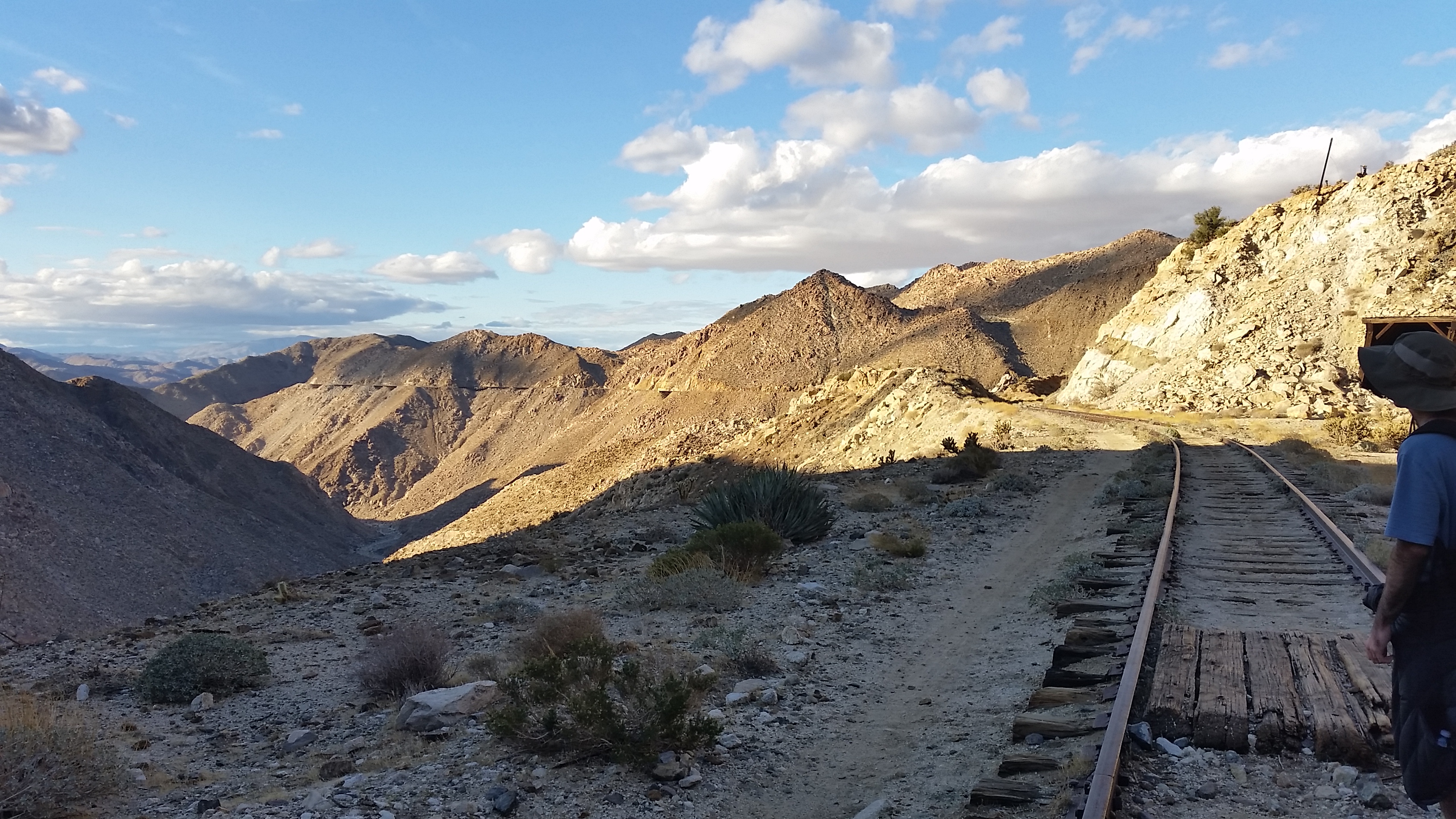
Goat Canyon is a valley in San Diego County, California, United States, located within the Carrizo Gorge in the Jacumba Mountains. The rock forming the canyon is crystalline basement. One feature of the canyon is a dry waterfall. The canyon is bridged by a wooden railroad trestle, the Goat Canyon Trestle, which is the world's largest curved all-wood trestle. The canyon is accessible by trail by traveling west from Mortero Palms. Flora and fauna Goat Canyon is named after desert bighorn sheep that live within and around the canyon. During a desert bloom, which occurred in 2017, monkey flowers were observed flowering in the canyon. The endangered species least Bell's vireo migrates through the area around the canyon. Human history Prior to Spanish governance, there was Native American activity in the area around Goat Canyon; the impact of this activity includes petroglyphs and pictograms in Carrizo Gorge. The last Native Americans to live in the area were the Kumeyaay. Later c ... [...More Info...] [...Related Items...] OR: [Wikipedia] [Google] [Baidu] |
Carrizo Gorge
Carrizo Gorge is a valley A valley is an elongated low area often running between hills or mountains, which will typically contain a river or stream running from one end to the other. Most valleys are formed by erosion of the land surface by rivers or streams ove ... in the Jacumba Mountains, in San Diego County, California. Its mouth is at an elevation of , where it widens out to become Carrizo Canyon, northeast of Palm Grove. Its head is located in the Jacumba Mountains, north of Round Mountain, at an elevation of at . References External linksCarrizo Gorge Wilderness- BLM Valleys of San Diego County, California {{SanDiegoCountyCA-geo-stub ... [...More Info...] [...Related Items...] OR: [Wikipedia] [Google] [Baidu] |
Petroglyphs
A petroglyph is an image created by removing part of a rock surface by incising, picking, carving, or abrading, as a form of rock art. Outside North America, scholars often use terms such as "carving", "engraving", or other descriptions of the technique to refer to such images. Petroglyphs are found worldwide, and are often associated with prehistoric peoples. The word comes from the Greek prefix , from meaning "stone", and meaning "carve", and was originally coined in French as . Another form of petroglyph, normally found in literate cultures, a rock relief or rock-cut relief is a relief sculpture carved on "living rock" such as a cliff, rather than a detached piece of stone. While these relief carvings are a category of rock art, sometimes found in conjunction with rock-cut architecture, they tend to be omitted in most works on rock art, which concentrate on engravings and paintings by prehistoric or nonliterate cultures. Some of these reliefs exploit the rock's na ... [...More Info...] [...Related Items...] OR: [Wikipedia] [Google] [Baidu] |
Anza-Borrego Desert State Park
Anza-Borrego Desert State Park (, '' AN-zə bə-RAY-goh'') is a California State Park located within the Colorado Desert of southern California, United States. The park takes its name from 18th century Spanish explorer Juan Bautista de Anza and ''borrego'', a Spanish word for sheep. With that includes one-fifth of San Diego County, it is the largest state park in California. The park occupies eastern San Diego County and reaches into Imperial and Riverside counties, enveloping two communities: Borrego Springs, which is home to the park's headquarters, and Shelter Valley. Geography The park is an anchor in the Mojave and Colorado Deserts Biosphere Reserve, and adjacent to the Santa Rosa and San Jacinto Mountains National Monument. The great bowl of the surrounding desert is surrounded by mountains, with the Vallecito Mountains to the south and the highest Santa Rosa Mountains to the north which are in the wilderness area, without paved roads and with the only year-round c ... [...More Info...] [...Related Items...] OR: [Wikipedia] [Google] [Baidu] |
Tijuana River
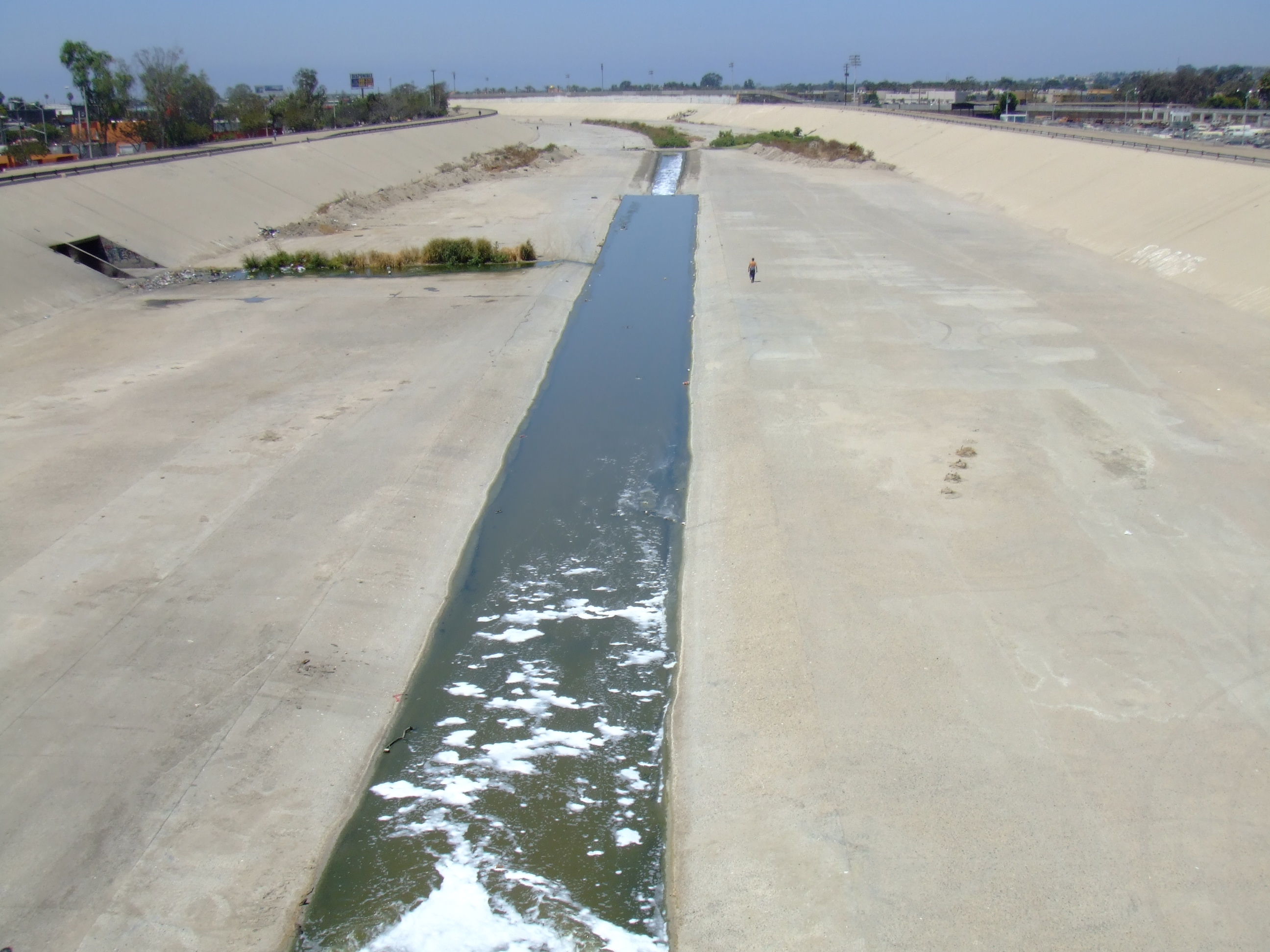
, name_etymology = , image = Presa Tij 1.jpg , image_size = , image_caption = Dam on the Tijuana River in Mexico. , map = Tijuana River Basin.svg , map_size = 250 , map_caption = Map of the Tijuana River basin , pushpin_map = , pushpin_map_size = , pushpin_map_caption= , subdivision_type1 = Country , subdivision_name1 = Mexico, United States , subdivision_type2 = State , subdivision_name2 = Baja California, California , subdivision_type3 = , subdivision_name3 = , subdivision_type4 = District , subdivision_name4 = San Diego County (California) , subdivision_type5 = Municipalities , subdivision_name5 = Ensenada, Tijuana, Tecate, San Ysidro (Baja California) , length = , width_min = , width_avg = , width_max = , depth_min = , depth_avg = , depth_max = , discharge1_location= Tijuana Slough Natio ... [...More Info...] [...Related Items...] OR: [Wikipedia] [Google] [Baidu] |
Mexico–United States Barrier
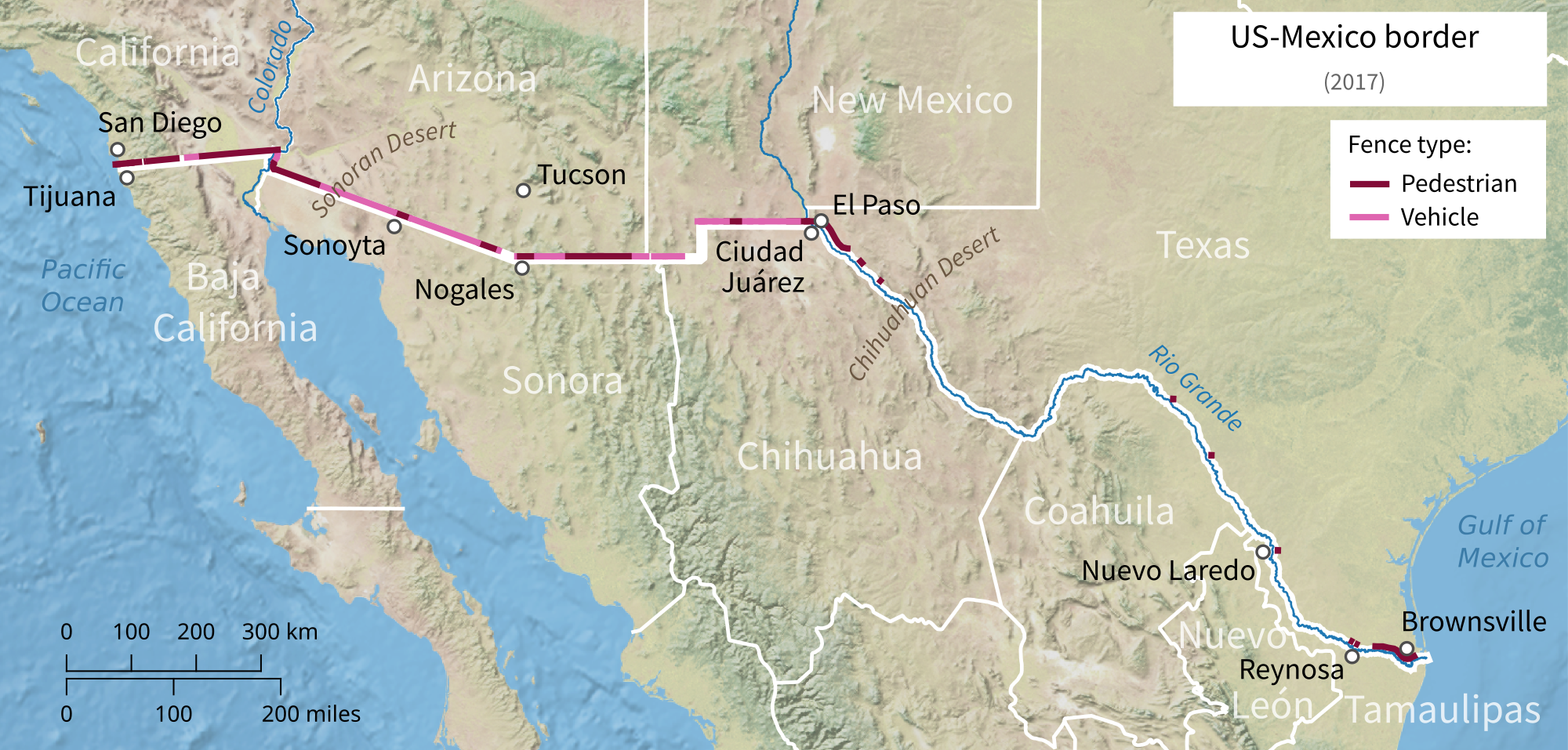
The Mexico–United States barrier ( es, barrera Estados Unidos–México), also known as the border wall, is a series of vertical barriers along the Mexico–United States border intended to reduce illegal immigration to the United States from Mexico. The barrier is not a continuous structure but a series of obstructions variously classified as "fences" or "walls". Between the physical barriers, security is provided by a "virtual fence" of sensors, cameras, and other surveillance equipment used to dispatch United States Border Patrol agents to suspected migrant crossings. In May 2011, the Department of Homeland Security (DHS) stated that it had of barriers in place. An additional 52 miles of primary barriers were built during Donald Trump's presidency. The total length of the national border is . On July 28th 2022, the Biden administration announced it would fill four wide gaps in Arizona near Yuma, an area with some of the busiest corridors for illegal crossings. Des ... [...More Info...] [...Related Items...] OR: [Wikipedia] [Google] [Baidu] |
Goat Canyon (Tijuana River Valley)
Goat Canyon ( es, Cañón de los Laureles) also known as Cañón de los Laureles, begins in Tijuana, Mexico, and ends in the United States just north of the Mexico–United States border, Mexico–U.S. border. The canyon is formed by Goat Canyon Creek, which receives water and other runoff from areas south of the border. Most of the canyon and its watershed lies within Baja California. The canyon originated during the Quaternary period; it is bordered by Bunker Hill to its west and Spooner's Mesa to its east. Part of the canyon contains California coastal salt marsh, coastal salt marshland and supports numerous sensitive and endangered species. Human activity in and around the canyon pre-dates Pre-Columbian era, European colonization; it was part of a route used by the Portolá expedition to San Diego Bay and later formed part of the El Camino Real (California)#Spanish and Mexican era, Missionary Road, which was abandoned in the late 19th century. Farms existed in and around G ... [...More Info...] [...Related Items...] OR: [Wikipedia] [Google] [Baidu] |
Science (TV Network)
Science Channel (often simply branded as Science; abbreviated to SCI) is an American pay television channel owned by Warner Bros. Discovery. The channel features programming focusing on science related to wilderness survival, engineering, manufacturing, technology, space, space exploration, ufology and prehistory. As of February 2015, Science is available to approximately 75.5 million pay television households (64.8% of households with at least one television set) in the United States. History In November 1994, Discovery Networks announced plans for four digital channels set to launch in 1996. Discovery originally named the network under the working title Quark!; this was changed before its launch to the Discovery Science Network. Discovery Science launched in October 1996 as part of the simultaneous rollout of the new channel suite (alongside Discovery Home & Leisure, Discovery Kids and Discovery Civilization). In 2007, adult shows began airing around the clock weekdays, whi ... [...More Info...] [...Related Items...] OR: [Wikipedia] [Google] [Baidu] |
Chapman University
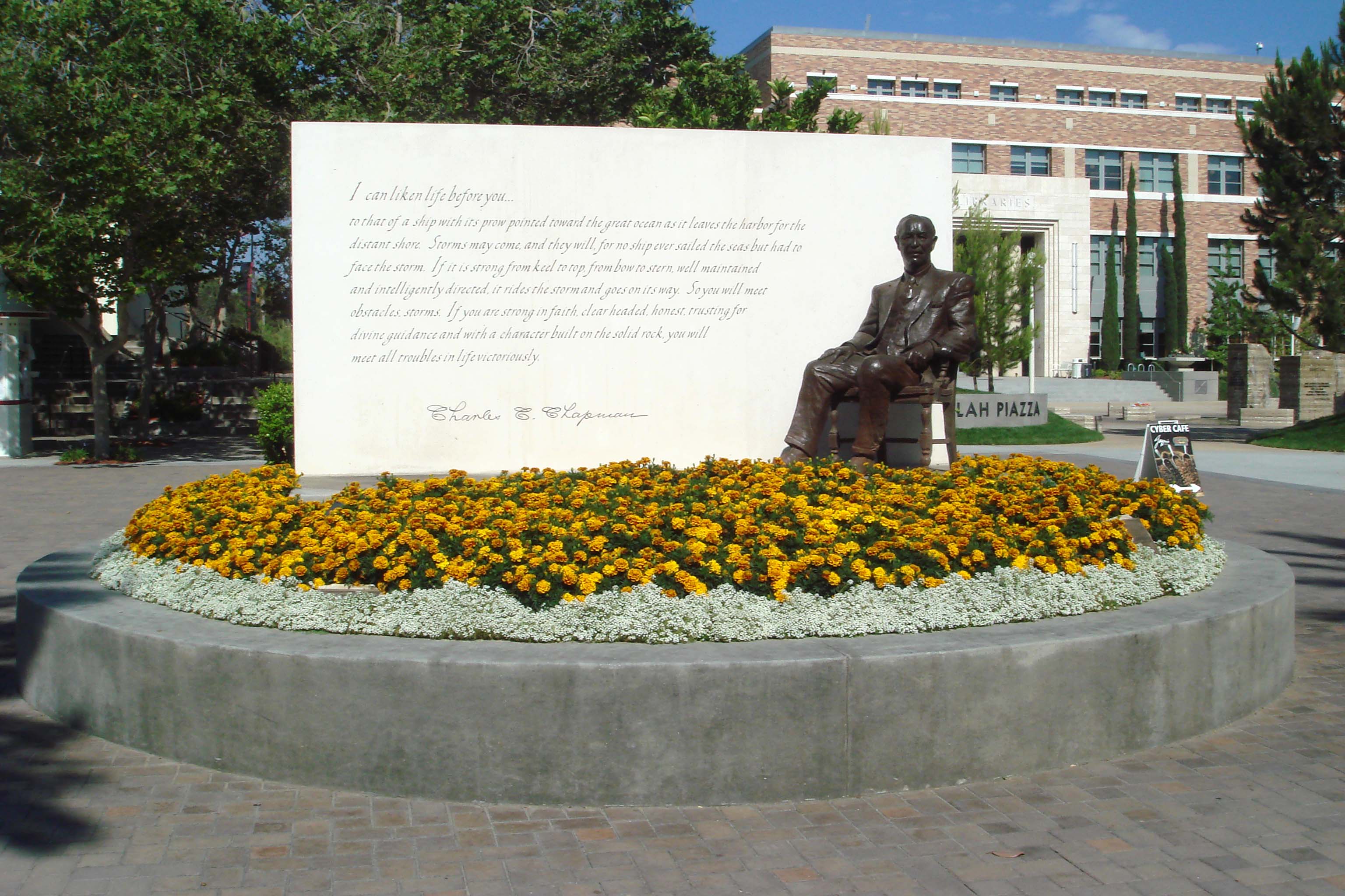
Chapman University is a private research university in Orange, California. It encompasses ten schools and colleges, including Fowler School of Engineering, Dodge College of Film and Media Arts, Fowler School of Law, and Schmid College of Science and Technology, and is classified among "R2: Doctoral Universities – High research activity". Although it does not claim to be a Christian college, it has had a relationship with the Disciples of Christ since the university's founding and with the United Church of Christ since 2011. History Founded in Woodland, California, as Hesperian College, the school began classes on March 4, 1861. Its opening was timed to coincide with the hour of Abraham Lincoln's first inauguration. Hesperian admitted students regardless of sex or race. In 1920, the assets of Hesperian College were absorbed by California Christian College, which held classes in downtown Los Angeles. In 1934, the school was renamed Chapman College, after the chairman ... [...More Info...] [...Related Items...] OR: [Wikipedia] [Google] [Baidu] |
Huell Howser
Huell Burnley Howser (October 18, 1945 – January 7, 2013) was an American television personality, actor, producer, writer, singer, and voice artist, best known for hosting, producing, and writing ''California's Gold'' and his human interest show ''Visiting... with Huell Howser'', produced by KCET in Los Angeles for California PBS stations. The archive of his video chronicles offers an enhanced understanding of the history, culture, and people of California. He also voiced the Backson in ''Winnie the Pooh'' (2011). Early life Howser was born in Gallatin, Tennessee, on October 18, 1945, to Harold Chamberlain and Jewell Havens (Burnley) Howser. Howser's first name is a portmanteau of his parents' given names, Harold and Jewell, as Howser explained in the ''California's Gold'' episode "Smartsville." Howser graduated from the University School of Nashville in 1963, then studied history and political science at the University of Tennessee, where he served as student body president. ... [...More Info...] [...Related Items...] OR: [Wikipedia] [Google] [Baidu] |
Hurricane Kathleen
Hurricane Kathleen was a tropical cyclone that had a destructive impact in California. On September 7, 1976, a tropical depression formed; two days later it accelerated north towards the Baja California Peninsula. Kathleen brushed the Pacific coast of the peninsula as a hurricane on September 9 and made landfall as a fast-moving tropical storm the next day. With its circulation intact and still a tropical storm, Kathleen headed north into the United States and affected California and Arizona. Kathleen finally dissipated late on September 11. Damage in the United States was considerable. California received record rainfall, with over a foot of rain falling in some areas. Flooding caused catastrophic destruction to Ocotillo, and six people drowned. Flooding extended west; railway tracks were destroyed in Palm Desert and high winds and severe flooding were recorded in Arizona. Overall, the damage total was $160 million (1976 USD) and 12 deaths were attributed to the storm. Backgro ... [...More Info...] [...Related Items...] OR: [Wikipedia] [Google] [Baidu] |
San Diego And Arizona Eastern Railway
The San Diego and Arizona Eastern Railway Company is a short-line American railroad founded in 1906 as the San Diego and Arizona Railway (SD&A) by sugar magnate, developer, and entrepreneur John D. Spreckels. Dubbed "The Impossible Railroad" by many engineers of its day due to the immense logistical challenges involved, the line was established in part to provide San Diego with a direct rail link to the east by connecting with the Southern Pacific Railroad lines in El Centro, California. The SD&A's route originates in San Diego, California, and terminates in El Centro, California. The SD&AE uses about of the original SD&A system, broken into four segments: * Main Line: Runs from Downtown San Diego south to San Ysidro. Also used by the San Diego Trolley's Blue Line. * La Mesa Branch: Runs east to the city of El Cajon. Also used by the San Diego Trolley's Orange Line. * Coronado Branch (currently unused): Splits from the Main Line in National City and runs south to ... [...More Info...] [...Related Items...] OR: [Wikipedia] [Google] [Baidu] |
Kumeyaay
The Kumeyaay, also known as Tipai-Ipai or by their historical Spanish name Diegueño, is a tribe of Indigenous peoples of the Americas who live at the northern border of Baja California in Mexico and the southern border of California in the United States. Their Kumeyaay language belongs to the Yuman–Cochimí language family. The Kumeyaay consist of three related groups, the Ipai, Tipai and Kamia. The San Diego River loosely divided the Ipai and the Tipai historical homelands, while the Kamia lived in the eastern desert areas. The Ipai lived to the north, from Escondido to Lake Henshaw, while the Tipai lived to the south, in lands including the Laguna Mountains, Ensenada, and Tecate. The Kamia lived to the east in an area that included Mexicali and bordered the Salton Sea. Name The Kumeyaay or Tipai-Ipai were formerly known as the Kamia or Diegueños, the former Spanish name applied to the Mission Indians living along the San Diego River. They are referred to as the Kumiai ... [...More Info...] [...Related Items...] OR: [Wikipedia] [Google] [Baidu] |


.jpg)


