|
Glenner
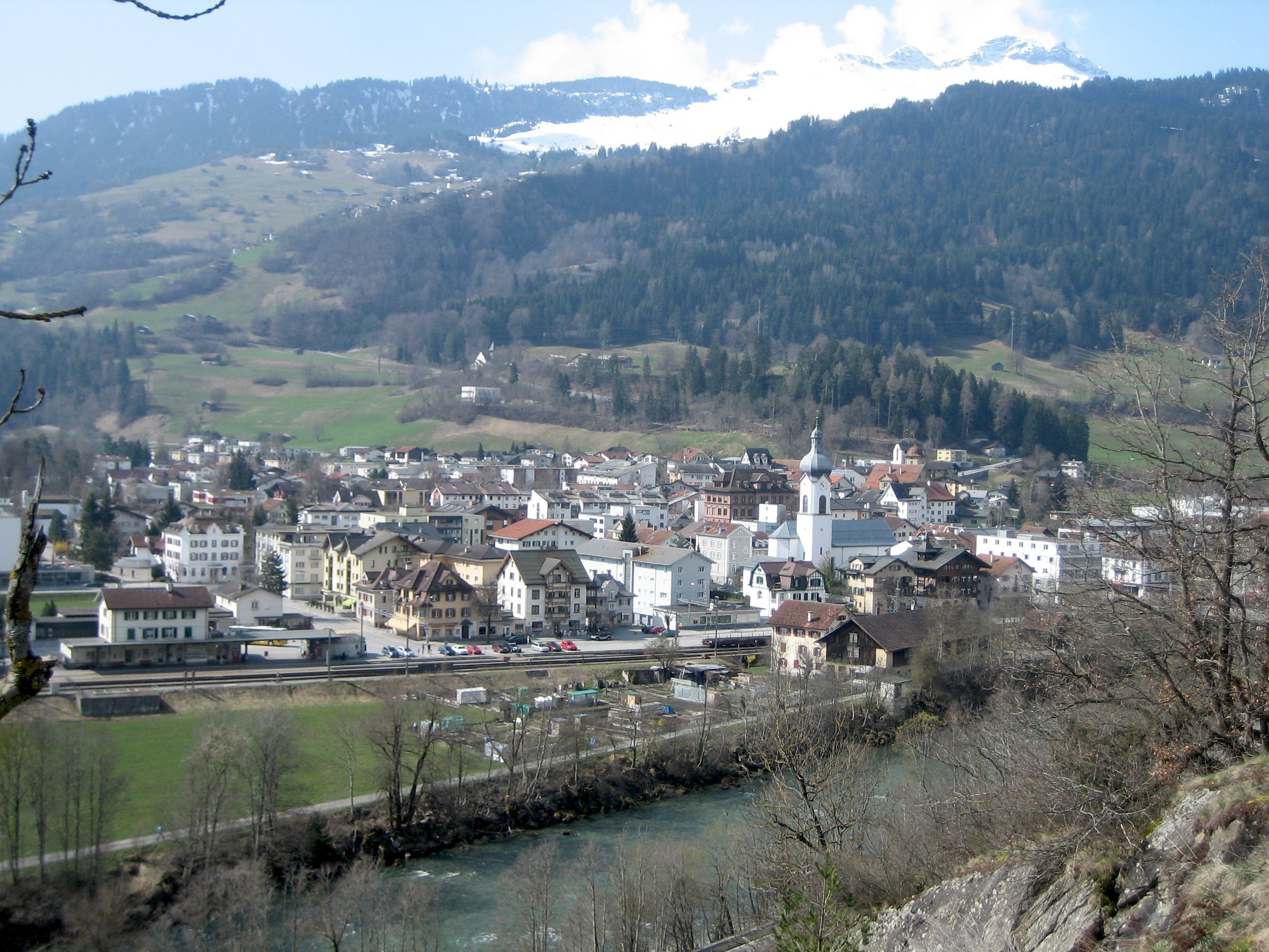
, image = Glenner Mai09.jpg , image_caption = Glogn/Glenner above Ilanz , progression = , length = , source1_location = Alp Scharboda, Piz Terri , source1_coordinates= , source1_elevation = , mouth_location = Confluence with Vorderrhein at Ilanz , mouth_coordinates = , mouth_elevation = , tributaries_right = Valser Rhine , subdivision_type1 = Country , subdivision_name1 = Switzerland , subdivision_type2 = Canton , subdivision_name2 = The Grisons , subdivision_type3 = Cities , subdivision_name3 = Ilanz The Glogn ( Romansh, german: Glenner) is a whitewater river in Graubünden. ''Glenner'' was also the name of a district in this area, which was annexed by Surselva District in 2001. The river rises near the border with Ticino and is surrounded by up to 3100m high mountains. The river flows through the Lumnezia. In Suraua, the Vals Rhine flows into the Glogn. After a few more kilometer ... [...More Info...] [...Related Items...] OR: [Wikipedia] [Google] [Baidu] |
Glenner01
, image = Glenner Mai09.jpg , image_caption = Glogn/Glenner above Ilanz , progression = , length = , source1_location = Alp Scharboda, Piz Terri , source1_coordinates= , source1_elevation = , mouth_location = Confluence with Vorderrhein at Ilanz , mouth_coordinates = , mouth_elevation = , tributaries_right = Valser Rhine , subdivision_type1 = Country , subdivision_name1 = Switzerland , subdivision_type2 = Canton , subdivision_name2 = The Grisons , subdivision_type3 = Cities , subdivision_name3 = Ilanz The Glogn ( Romansh, german: Glenner) is a whitewater river in Graubünden. ''Glenner'' was also the name of a district in this area, which was annexed by Surselva District in 2001. The river rises near the border with Ticino and is surrounded by up to 3100m high mountains. The river flows through the Lumnezia. In Suraua, the Vals Rhine flows into the Glogn. After a few more kilome ... [...More Info...] [...Related Items...] OR: [Wikipedia] [Google] [Baidu] |
Surselva (district)
Surselva Region is one of the eleven administrative districts in the canton of Graubünden in Switzerland. It was created on 1 January 2017 as part of a reorganization of the canton.Swiss Federal Statistical Office – Amtliches Gemeindeverzeichnis der Schweiz – Mutationsmeldungen 2016 accessed 16 February 2017 Surselva Region has an area of , with a population of as of .. It corresponds exactly to its predecessor, Surselva District, but the former subdistricts (''Kreise'') of Disentis, Ilanz, Lumnezia/Lugnez, Ruis and Safien have been abandoned. ''Surselva'' ("above the forest") is the name of the valley of ... [...More Info...] [...Related Items...] OR: [Wikipedia] [Google] [Baidu] |
Vorderrhein
The Vorderrhein (German; English: ''Anterior Rhine''; Sursilvan: ; Sutsilvan: ''Ragn Anteriur''; Rumantsch Grischun, Vallader, and Puter: ''Rain Anteriur''; Surmiran: ''Ragn anteriour'') is one of the two sources of the Rhine. Its catchment area of is located predominantly in the canton of Graubünden (Switzerland). The Vorderrhein is about long, thus more than 5% longer than the Hinterrhein/Rein Posteriur (each measured to the farthest source). The Vorderrhein, however, has an average water flow of , which is less than the flow of the Hinterrhein. According to the Atlas of Switzerland of the Swiss Federal Office of Topography, the source of the Vorderrhein—and thus of the Rhine—is located north of the Rein da Tuma and Lake Toma. ''Vorderrhein'' was also the name of a judicial district that was created in 1851 with the reorganization of the judiciary of Graubünden. In 2001, it was annexed by the District Surselva. The largest communities along the Vorderrhein are ... [...More Info...] [...Related Items...] OR: [Wikipedia] [Google] [Baidu] |
Valser Rhine
The Valser Rhine (german: Valser Rhein) is a source of the river Rhine in the Swiss canton of Graubünden. The river originates from the Länta Glacier and the Grauhorn Glacier at the northern foot of the Rheinwaldhorn and initially flows through the valley Länta before it flows into the Zervreilasee reservoir. Before the construction of the reservoir, the brooks Hornbach and Canalbach would flow into Valser Rhine from the right at the village of Zervreila. Today, the brooks flow into the reservoir, as does the Finsterbach, also from the right. Below the Zervreila dam, the Valser Rhine flows through the Vals Valley and the municipality of Vals. Before the village of Vals, the Peilerbach joins the Valser Rhine, below the village, the Tomuelbach from Tomül Pass joins from the right. The Valser Rhine then flows past St. Martin and joins the Glogn at Suraua. Several kilometers downstream, the Glogn flows into the Anterior Rhine The Vorderrhein (German; English: ''Anterior ... [...More Info...] [...Related Items...] OR: [Wikipedia] [Google] [Baidu] |
Vals Rhine
The Valser Rhine (german: Valser Rhein) is a source of the river Rhine in the Swiss canton of Graubünden. The river originates from the Länta Glacier and the Grauhorn Glacier at the northern foot of the Rheinwaldhorn and initially flows through the valley Länta before it flows into the Zervreilasee reservoir. Before the construction of the reservoir, the brooks Hornbach and Canalbach would flow into Valser Rhine from the right at the village of Zervreila. Today, the brooks flow into the reservoir, as does the Finsterbach, also from the right. Below the Zervreila dam, the Valser Rhine flows through the Vals Valley and the municipality of Vals. Before the village of Vals, the Peilerbach joins the Valser Rhine, below the village, the Tomuelbach from Tomül Pass joins from the right. The Valser Rhine then flows past St. Martin and joins the Glogn at Suraua. Several kilometers downstream, the Glogn flows into the Anterior Rhine The Vorderrhein (German; English: ''Anterior ... [...More Info...] [...Related Items...] OR: [Wikipedia] [Google] [Baidu] |
Lumnezia
Lumnezia is a valley region and a municipality in the Surselva Region in the Swiss of canton of Graubünden. The former municipalities of Cumbel, Degen, Lumbrein, Morissen, Suraua, Vignogn, Vella, and Vrin merged on 1 January 2013 into the new municipality of Lumnezia.Amtliches Gemeindeverzeichnis der Schweiz published by the Swiss Federal Statistical Office accessed 2 January 2013 It covers the Val Lumnezia (german: Lugnez), a high valley. Its upper regions are among the most remote areas in the |
Ilanz
Ilanz ( rm, Glion) is a former municipality in the district of Surselva in the Swiss canton of Graubünden. The former municipality of Ilanz was congruent with the town of Ilanz. On 1 January 1978, the former municipality of Strada merged into the new municipality of Ilanz. On 1 January 2014, the municipality of Ilanz and the surrounding municipalities Castrisch, Ladir, Luven, Pitasch, Riein, Ruschein, Schnaus, Sevgein, Duvin, Pigniu, Rueun and Siat merged into the new municipality of Ilanz/Glion. History Ilanz is first mentioned in 765 as "''Iliande''." Ilanz became the capital of the newly formed Grey League in 1395. The Grey League was the second of the Three Leagues which eventually formed canton Graubünden. Johannes von Ilanz, the Abbot of Disentis, was among the three nobles instrumental in creating this "eternal alliance." Ilanz has a special place in the history of the Protestant Reformation. In the 1520s, the Diet of Ilanz declared that citizens of the Three ... [...More Info...] [...Related Items...] OR: [Wikipedia] [Google] [Baidu] |
Rivers Of Switzerland
The following is a list of rivers in Switzerland: Rivers by length (> 100 km, only the length in Switzerland) #Rhine - 375 km - 36,494 km2 #Aare (or Aar) - 295 km - 17,779 km2 #Rhône - 264 km - 10,403 km2 #Reuss - 158 km - 3,425 km2 #Linth and Limmat together - 140 km - 2,416 km2 # Saane/La Sarine - 128 km - 1,892 km2 # Thur - 125 km Rivers by drainage area (> 1000 km2, only the area in Switzerland) #Rhine - 375 km - 36,494 km2 #Aare - 295 km - 17,779 km2 #Rhône - 264 km - 10,403 km2 #Reuss - 158 km - 3,425 km2 #Linth / Limmat - 140 km - 2,416 km2 # Inn - 104 km - 2,150 km2 # Saane/La Sarine - 128 km - 1,892 km2 # Thur - 125 km - 1,724 km2 #Ticino - 91 km - 1,616 km2 # Hinterrhein - 57.3 km - 1,693 km2 #Vorderrhein - 67.5 km - 1,514 km2 #Doubs - 74 km - 1,310 km2 # Kander - 44 km ... [...More Info...] [...Related Items...] OR: [Wikipedia] [Google] [Baidu] |
Suraua
Suraua is a former municipality in the district of Surselva in the canton of Graubünden in Switzerland. The former municipality was formed on January 1, 2002, through the union of Camuns, Surcasti, Tersnaus, and Uors-Peiden. The municipalities of Cumbel, Degen, Lumbrein, Morissen, Suraua, Vignogn, Vella, and Vrin merged on 1 January 2013 into the new municipality of Lumnezia. History The municipality was formed on 1 January 2002 through the merger of Camuns, Surcasti, Tersnaus, and Uors-Peiden. * Camuns is first mentioned in 1543 as ''Gamundtz''. * Surcasti is first mentioned in 1515 as ''Oberkastels'' and until 1943 it was known by its German name of ''Obercastels''. * Tersnaus is first mentioned in 1362 as ''Terzenaus''. * Uors was first mentioned in 831 as ''villa Vorce'', and in 1290 as ''Furze''. Peiden was first mentioned in 1345 as ''Pedens''. Coat of arms The municipal coat of arms is ''Vert a Bend wavy Azure fimbriated Argent and overall an Annulet of the las ... [...More Info...] [...Related Items...] OR: [Wikipedia] [Google] [Baidu] |
Ticino
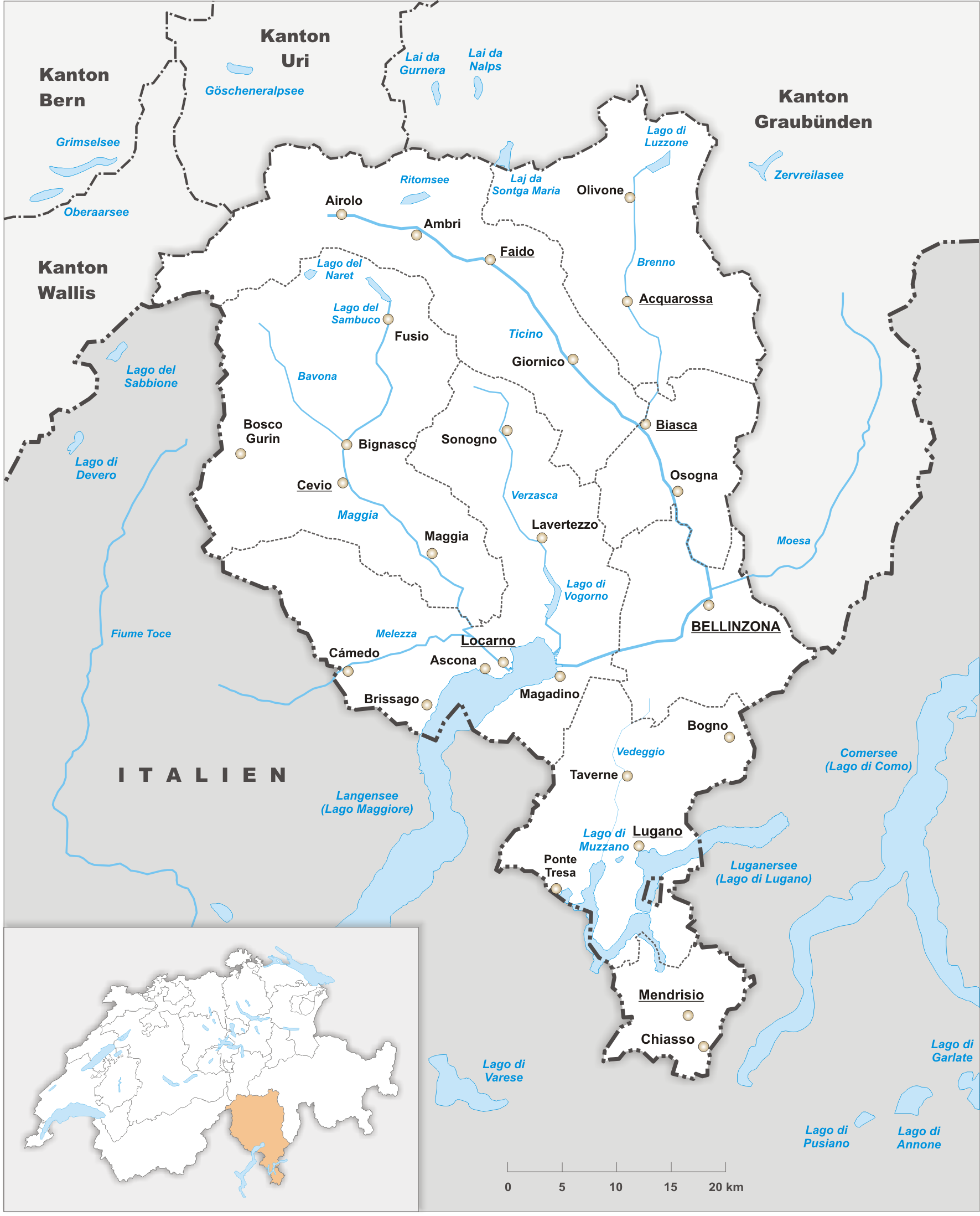
Ticino (), sometimes Tessin (), officially the Republic and Canton of Ticino or less formally the Canton of Ticino,, informally ''Canton Ticino'' ; lmo, Canton Tesin ; german: Kanton Tessin ; french: Canton du Tessin ; rm, Chantun dal Tessin . is one of the 26 cantons forming the Swiss Confederation. It is composed of eight districts and its capital city is Bellinzona. It is also traditionally divided into the Sopraceneri and the Sottoceneri, respectively north and south of Monte Ceneri. Red and blue are the colours of its flag. Ticino is the southernmost canton of Switzerland. It is one of the three large southern Alpine cantons, along with Valais and the Grisons. However, unlike all other cantons, it lies almost entirely south of the Alps, and has no natural access to the Swiss Plateau. Through the main crest of the Gotthard and adjacent mountain ranges, it borders the canton of Valais to the northwest, the canton of Uri to the north and the canton of Grisons to the n ... [...More Info...] [...Related Items...] OR: [Wikipedia] [Google] [Baidu] |
Alp Scharboda
{{Disambiguation, geo ...
Alp may refer to: * Alp, any mountain in the Alps * Alp (name) * Alp (folklore), a supernatural being in German folklore * Alp, Spain, a town and municipality in Catalonia, Spain * Alp (river), a river in Schwyz, Switzerland * Alpine pasture or alp * Alpine meadow or alp * Alıp or Alp, an Ottoman title See also * ALP (other) * Alp 2500, a ski resort in Catalonia, Spain * Alps (other) * ALPS (other) The Alps are a major European mountain range. Alps may also refer to: Places Europe Subdivisions of the Alps proper * Bavarian Alps, in Germany *Eastern Alps, in Austria, Switzerland, Germany, Italy, Slovenia and Liechtenstein *Julian Alps ... [...More Info...] [...Related Items...] OR: [Wikipedia] [Google] [Baidu] |


