|
Glenelly River
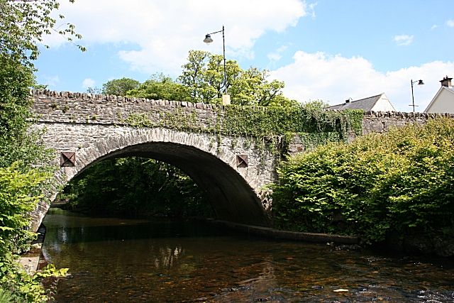
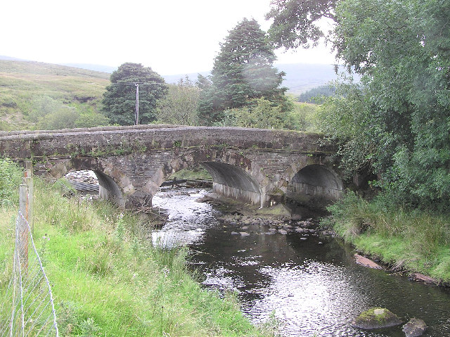
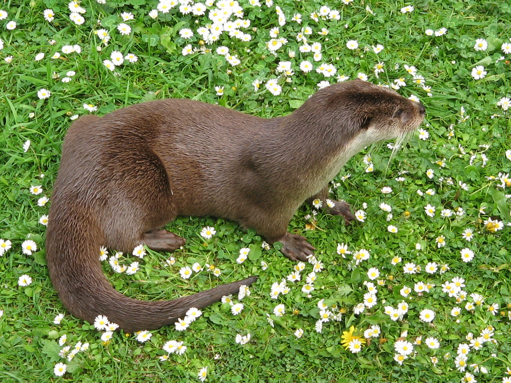
Glenelly River is a river in County Tyrone, Northern Ireland. It flows westwards along the long linear Glenelly Valley to the south of Sawel Mountain, following one of the principal fault-lines in the Sperrin Mountains. The river meanders across a complex, undulating floodplain of alluvium and glacial moraine. The channel has often carved deep ridges within these soft deposits, creating steep, irregular mounds and pockets of peaty marsh on the valley floor. The otter has been recorded in the Glenelly River, which is important also for salmon and trout. The village of Plumbridge stands on the banks of the Glenelly River which flows on to join the Owenkillew River near Newtownstewart Newtownstewart is a village and townland of in County Tyrone, Northern Ireland. It is overlooked by hills called Bessy Bell and Mary Gray and lies on the River Strule below the confluence with its tributary the Owenkillew. It is situated in th .... References Rivers of County Tyrone ... [...More Info...] [...Related Items...] OR: [Wikipedia] [Google] [Baidu] |
Plumbridge - Geograph
Plumbridge is a small village in County Tyrone, Northern Ireland. It is a crossroads village, standing on the banks of the Glenelly River. In the 2001 Census it had a population of 267 people. It lies within Derry City and Strabane District area. Most of the village is on the northern bank of the Glenelly River, within the townland of Glencoppagh. However, some of it lies on the southern bank, within the townland of Lisnacreaght. Religion The Roman Catholic church is Sacred Heart Church, a Grade B2 listed building, and the Presbyterian church isGlenelly PresbyterianChurch, Plumbridge. The village's nearest Church of Ireland church iUpper Badoney Parish Church a few miles up the Glenelly valley. Sport The local Gaelic Athletic Association club, Glenelly St. Joseph's, was established in 1891. There are ladies teams and men's teams. It is commonly referred to as Glenelly. In 2015 Glenelly Ladies senior football team won the Tyrone and Ulster Intermediate Championships. The vill ... [...More Info...] [...Related Items...] OR: [Wikipedia] [Google] [Baidu] |
County Tyrone
County Tyrone (; ) is one of the six Counties of Northern Ireland, counties of Northern Ireland, one of the nine counties of Ulster and one of the thirty-two traditional Counties of Ireland, counties of Ireland. It is no longer used as an administrative division for local government but retains a strong identity in popular culture. Adjoined to the south-west shore of Lough Neagh, the county covers an area of and has a population of about 177,986; its county town is Omagh. The county derives its name and general geographic location from Tír Eoghain, a Gaelic kingdom under the O'Neill dynasty which existed until the 17th century. Name The name ''Tyrone'' is derived , the name given to the conquests made by the Cenél nEógain from the provinces of Airgíalla and Ulaid.Art Cosgrove (2008); "A New History of Ireland, Volume II: Medieval Ireland 1169-1534". Oxford University Press. Historically, it was anglicised as ''Tirowen'' or ''Tyrowen'', which are closer to the Irish pronunci ... [...More Info...] [...Related Items...] OR: [Wikipedia] [Google] [Baidu] |
Northern Ireland
Northern Ireland ( ga, Tuaisceart Éireann ; sco, label= Ulster-Scots, Norlin Airlann) is a part of the United Kingdom, situated in the north-east of the island of Ireland, that is variously described as a country, province or region. Northern Ireland shares an open border to the south and west with the Republic of Ireland. In 2021, its population was 1,903,100, making up about 27% of Ireland's population and about 3% of the UK's population. The Northern Ireland Assembly (colloquially referred to as Stormont after its location), established by the Northern Ireland Act 1998, holds responsibility for a range of devolved policy matters, while other areas are reserved for the UK Government. Northern Ireland cooperates with the Republic of Ireland in several areas. Northern Ireland was created in May 1921, when Ireland was partitioned by the Government of Ireland Act 1920, creating a devolved government for the six northeastern counties. As was intended, Northern Ireland ... [...More Info...] [...Related Items...] OR: [Wikipedia] [Google] [Baidu] |
Glenelly Valley
Glenelly Valley or simply Glenelly (from the ga, Gleann Eallaigh meaning the valley of the cattle, (a sheltered place where cattle were grazed)) is the longest valley in the Sperrin Mountains in County Tyrone, Northern Ireland. It lies within the Sperrin Area of Outstanding Natural Beauty (AONB) and is also in an Environmentally Sensitive Area (ESA). In the year 858AD, Aed Finnliath mac Néill, king of Ailech, heavily defeated a large Viking army inland at Glenn Foichle (Glenelly, in the barony of Upper Strabane). They may have come from Lough Neagh and the Bann. Irish Language Glenelly was home to some of the last native Irish speakers in County Tyrone. The dialect was studied by Gearóid Stockman and Heinrich Wagner Heinrich Wagner (9 August 1888, Hamburg – 24 June 1959, Hamburg) was a German chess master. In 1920/21, he won in Kiel. In 1921, he took 8th in Hamburg (the 21st DSB Congress, Erhardt Post won), and won in Hamburg (''Quadrangular''). ... who note ... [...More Info...] [...Related Items...] OR: [Wikipedia] [Google] [Baidu] |
Sawel Mountain
Sawel Mountain () is the highest peak in the Sperrin Mountains, and the 8th highest in Northern Ireland. It is also the highest mountain in Northern Ireland outside of the Mourne Mountain range located in County Down. Geography To the north of Sawel is County Londonderry, and to the south, County Tyrone. The summit is high and is composed of crystalline limestone. Around the peak, there is "montane heathland", with plant life including heather, bilberries and cowberries, although this is being damaged by hillwalking and grazing. Sawel is the source of the River Faughan, a long tributary of the River Foyle. Naming The Irish name of the mountain is a reference to a glen or hollow on the side of Sawel. It was also historically called Slieve Sawel, from the Irish word ''sliabh'' ("mountain"). Plane crash On 5 January 1944 a Royal Navy Stinson Reliant (FK914) of 878 Naval Air Squadron was on a flight from RNAS Eglinton (HMS Gannet) to RNAS Machrihanish (HMS Landrail) when it cr ... [...More Info...] [...Related Items...] OR: [Wikipedia] [Google] [Baidu] |
Sperrins
The Sperrins or Sperrin Mountains () are a range of mountains in Northern Ireland and one of the largest upland areas in Northern Ireland. The range stretches from Strabane eastwards to Slieve Gallion in Desertmartin and north towards Limavady, in the counties of Tyrone and Londonderry. The region has a population of some 150,000 and is a designated Area of Outstanding Natural Beauty. Features It has a distinctive glaciated landscape. The Glenshane Pass, part of the A6 Belfast to Derry road, is in the mountains and has notoriously bad weather in winter. Sawel Mountain is the highest peak in the Sperrins, and the seventh highest in Northern Ireland. Its summit rises to . Another of the Sperrins, Carntogher (464 m), towers over the Glenshane Pass. Geologically, the Sperrins are formed mostly from Precambrian metamorphic rocks, with some younger Ordovician igneous rocks in the southern flank of the range. The Mountains are very sparsely populated and provide habitat for ... [...More Info...] [...Related Items...] OR: [Wikipedia] [Google] [Baidu] |
Floodplain
A floodplain or flood plain or bottomlands is an area of land adjacent to a river which stretches from the banks of its channel to the base of the enclosing valley walls, and which experiences flooding during periods of high discharge.Goudie, A. S., 2004, ''Encyclopedia of Geomorphology'', vol. 1. Routledge, New York. The soils usually consist of clays, silts, sands, and gravels deposited during floods. Because the regular flooding of floodplains can deposit nutrients and water, floodplains frequently have high soil fertility; some important agricultural regions, such as the Mississippi river basin and the Nile, rely heavily on the flood plains. Agricultural regions as well as urban areas have developed near or on floodplains to take advantage of the rich soil and fresh water. However, the risk of flooding has led to increasing efforts to control flooding. Formation Most floodplains are formed by deposition on the inside of river meanders and by overbank flow. Whereve ... [...More Info...] [...Related Items...] OR: [Wikipedia] [Google] [Baidu] |
Alluvium
Alluvium (from Latin ''alluvius'', from ''alluere'' 'to wash against') is loose clay, silt, sand, or gravel that has been deposited by running water in a stream bed, on a floodplain, in an alluvial fan or beach, or in similar settings. Alluvium is also sometimes called alluvial deposit. Alluvium is typically geologically young and is not consolidated into solid rock. Sediments deposited underwater, in seas, estuaries, lakes, or ponds, are not described as alluvium. Floodplain alluvium can be highly fertile, and supported some of the earliest human civilizations. Definitions The present consensus is that "alluvium" refers to loose sediments of all types deposited by running water in floodplains or in alluvial fans or related landforms. However, the meaning of the term has varied considerably since it was first defined in the French dictionary of Antoine Furetière, posthumously published in 1690. Drawing upon concepts from Roman law, Furetière defined ''alluvion'' (the F ... [...More Info...] [...Related Items...] OR: [Wikipedia] [Google] [Baidu] |
Moraine
A moraine is any accumulation of unconsolidated debris (regolith and rock), sometimes referred to as glacial till, that occurs in both currently and formerly glaciated regions, and that has been previously carried along by a glacier or ice sheet. It may consist of partly rounded particles ranging in size from boulders (in which case it is often referred to as boulder clay) down to gravel and sand, in a groundmass of finely-divided clayey material sometimes called glacial flour. Lateral moraines are those formed at the side of the ice flow, and terminal moraines were formed at the foot, marking the maximum advance of the glacier. Other types of moraine include ground moraines (till-covered areas forming sheets on flat or irregular topography) and medial moraines (moraines formed where two glaciers meet). Etymology The word ''moraine'' is borrowed from French , which in turn is derived from the Savoyard Italian ("mound of earth"). ''Morena'' in this case was derived from Proven� ... [...More Info...] [...Related Items...] OR: [Wikipedia] [Google] [Baidu] |
Peat
Peat (), also known as turf (), is an accumulation of partially decayed vegetation or organic matter. It is unique to natural areas called peatlands, bogs, mires, moors, or muskegs. The peatland ecosystem covers and is the most efficient carbon sink on the planet, because peatland plants capture carbon dioxide (CO2) naturally released from the peat, maintaining an equilibrium. In natural peatlands, the "annual rate of biomass production is greater than the rate of decomposition", but it takes "thousands of years for peatlands to develop the deposits of , which is the average depth of the boreal orthernpeatlands", which store around 415 gigatonnes (Gt) of carbon (about 46 times 2019 global CO2 emissions). Globally, peat stores up to 550 Gt of carbon, 42% of all soil carbon, which exceeds the carbon stored in all other vegetation types, including the world's forests, although it covers just 3% of the land's surface. ''Sphagnum'' moss, also called peat moss, is one of th ... [...More Info...] [...Related Items...] OR: [Wikipedia] [Google] [Baidu] |
Otter
Otters are carnivorous mammals in the subfamily Lutrinae. The 13 extant otter species are all semiaquatic, aquatic, or marine, with diets based on fish and invertebrates. Lutrinae is a branch of the Mustelidae family, which also includes weasels, badgers, mink, and wolverines, among other animals. Etymology The word ''otter'' derives from the Old English word or . This, and cognate words in other Indo-European languages, ultimately stem from the Proto-Indo-European language root , which also gave rise to the English word "water". Terminology An otter's den is called a holt or couch. Male otters are called dogs or boars, females are called bitches or sows, and their offspring are called pups or cubs. The collective nouns for otters are bevy, family, lodge, romp (being descriptive of their often playful nature) or, when in water, raft. The feces of otters are typically identified by their distinctive aroma, the smell of which has been described as ranging from freshly ... [...More Info...] [...Related Items...] OR: [Wikipedia] [Google] [Baidu] |
Salmon
Salmon () is the common name for several list of commercially important fish species, commercially important species of euryhaline ray-finned fish from the family (biology), family Salmonidae, which are native to tributary, tributaries of the North Atlantic (genus ''Salmo'') and North Pacific (genus ''Oncorhynchus'') basin. Other closely related fish in the same family include trout, Salvelinus, char, Thymallus, grayling, Freshwater whitefish, whitefish, lenok and Hucho, taimen. Salmon are typically fish migration, anadromous: they hatch in the gravel stream bed, beds of shallow fresh water streams, migrate to the ocean as adults and live like sea fish, then return to fresh water to reproduce. However, populations of several species are restricted to fresh water throughout their lives. Folklore has it that the fish return to the exact spot where they hatched to spawn (biology), spawn, and tracking studies have shown this to be mostly true. A portion of a returning salmon run ma ... [...More Info...] [...Related Items...] OR: [Wikipedia] [Google] [Baidu] |


.jpg)
