|
Gleneagle (other)
__NOTOC__ Gleneagle can mean: Australia *Gleneagle, Queensland, a rural locality in the Scenic Rim Region *Gleneagle, Western Australia Canada * Gleneagle Secondary School, a public high school in Coquitlam, British Columbia, Canada United States * Gleneagle, Colorado Gleneagle is an unincorporated community and a census-designated place (CDP) located in and governed by El Paso County, Colorado, United States. The CDP is a part of the Colorado Springs, CO Metropolitan Statistical Area. The population of the ... * A neighborhood in Arlington, Washington See also * Gleneagles (other) {{disambiguation, geo ... [...More Info...] [...Related Items...] OR: [Wikipedia] [Google] [Baidu] |
Gleneagle, Queensland
Gleneagle is a rural locality in the Scenic Rim Region, Queensland, Australia. In the , Gleneagle had a population of 1,877 people. Geography The Logan River and the Mount Lindesay Highway pass through eastern parts of locality. Large sections of land are rural with some parts used for irrigated agriculture. A housing estate was established to the east of the highway. In the centre of Gleneagle is a large man-made dam called Lake Brabazon. The western boundary follows the Sydney–Brisbane railway line.Gin Gin, Queensland. History The locality takes its name from a cotton farm called ''Glen Eagles'' established in the 1860s by William Tutin Walker (1833-1920). Walker began as a manager on ''Townsvale'' established by Robert Towns who pioneered cotton growing in the Logan River valley. Townsvale was in the area of the present-day localities of Gleneagle and Veresdale. After Towns' death, Walker took over ''Townsvale''. St Joseph's Catholic Church was the first Catholic churc ... [...More Info...] [...Related Items...] OR: [Wikipedia] [Google] [Baidu] |
Gleneagle, Western Australia
Gleneagle or Glen Eagle is a locality in Western Australia. The locality is south east of the state capital, Perth, close to Jarrahdale on the Albany Highway. It now remains as a rest stop for drivers. The townsite functioned as a settlement for forest workers and their families. The locality was seriously affected by the bushfires in summer of 1960/61, the Jarrahdale fires. Fire burned the town of Dwellingup and the smaller settlements of Holyoak, Nanga Brook and Karridale. There were many injuries but no deaths and serious losses of pasture, stock and fencing. A Royal Commission was held in the wake of these fires.Rodger, G.J. (1961). Report of the Royal Commission into Bushfires of December 1960 and January, February and March 1961 in Western Australia. The settlement operated its own school between 1939 and 1967. The school closed due to declining enrolments as the district of Wandering became the larger service centre. Located on the Albany Highway a plaque commemora ... [...More Info...] [...Related Items...] OR: [Wikipedia] [Google] [Baidu] |
Gleneagle Secondary School
Gleneagle Secondary School, or simply Gleneagle, is a public coeducational high school located in Coquitlam, British Columbia, established in 1997. It is run by School District 43 Coquitlam. Gleneagle serves grades 9-12 and has an enrolment of about 1500 students. In addition to academic programs, Gleneagle offers specialty programs such as ACE-IT Culinary Arts and Hairdressing, the COAST outdoor education program, the grade 9 JumpstART art program, and the school district's TALONS gifted program. As of the 2013-14 school year Gleneagle ranked 80 out of 293 by the Fraser Institute with a rating of 7.1, down from previous years. Gleneagle has one of the highest rates of student acceptance to post secondary education among BC's high schools, with more than 50% of graduates entering a Public Post-Secondary Institution in British Columbia. Gleneagle's Model United Nations team is particularly successful, with 75% of its participants winning awards at the Canadian International Model U ... [...More Info...] [...Related Items...] OR: [Wikipedia] [Google] [Baidu] |
Gleneagle, Colorado
Gleneagle is an unincorporated community and a census-designated place (CDP) located in and governed by El Paso County, Colorado, United States. The CDP is a part of the Colorado Springs, CO Metropolitan Statistical Area. The population of the Gleneagle CDP was 6,649 at the United States Census 2020. The Colorado Springs post office ( Zip Code 80921) serves the area. Geography The Gleneagle CDP has an area of , including of water. Demographics The United States Census Bureau initially defined the for the Politics In the Colorado General Assembly Gleneagle is located in the 4th Senate District, represented by Republican Jim Smallwood, and in the 20th House District, represented by Republican Terri Carver. Federally, Gleneagle is located in Colorado's 5th congressional district, which has a Cook PVI of R +14 and is represented by Republican Doug Lamborn. Media Gleneagle is served by Colorado Springs radio and television stations. Newspapers *''The Gazette (Colorado Spri ... [...More Info...] [...Related Items...] OR: [Wikipedia] [Google] [Baidu] |
Arlington, Washington
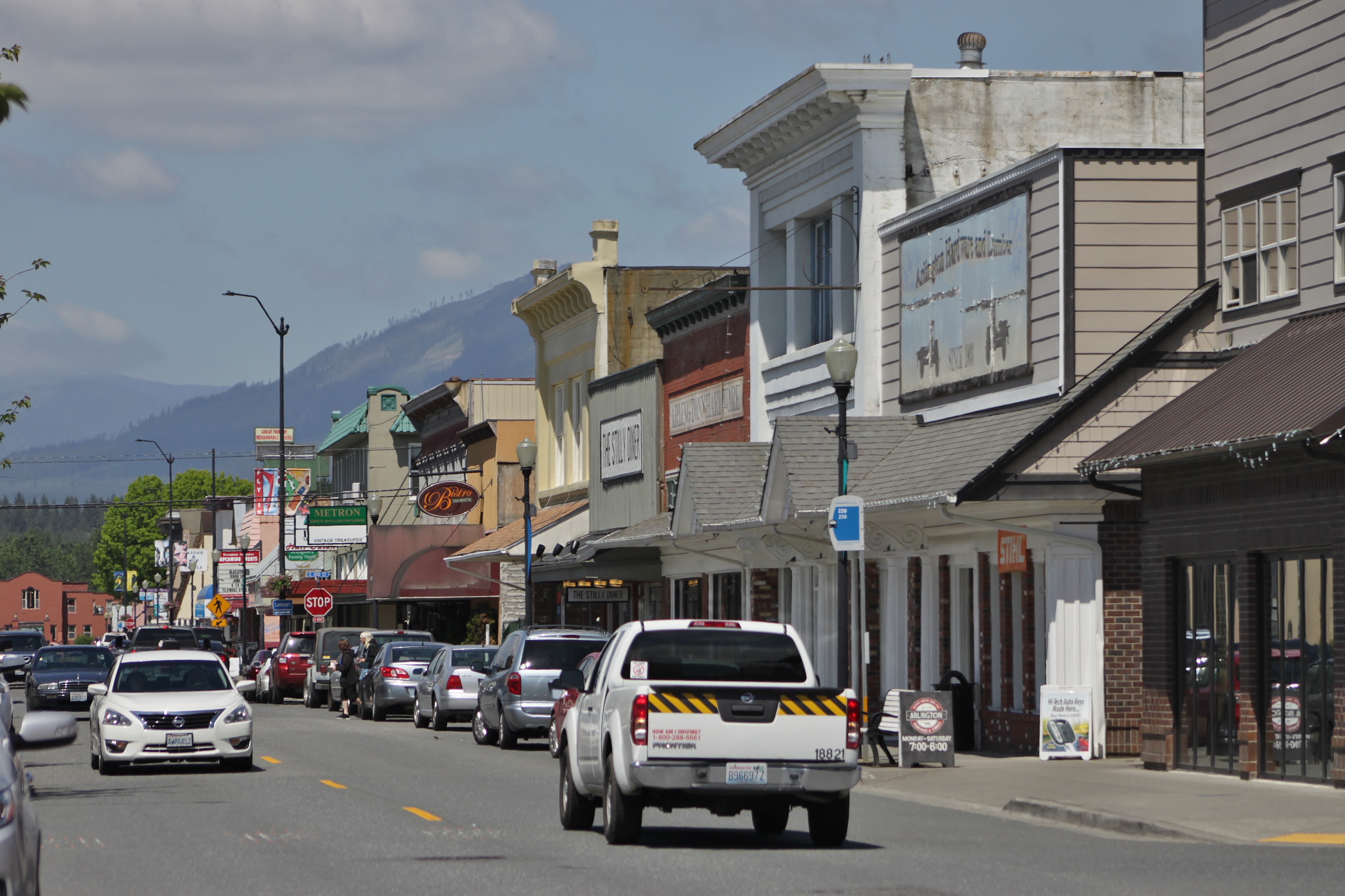
Arlington is a city in northern Snohomish County, Washington, United States, part of the Seattle metropolitan area. The city lies on the Stillaguamish River in the western foothills of the Cascade Range, adjacent to the city of Marysville. It is approximately north of Everett, the county seat, and north of Seattle, the state's largest city. As of the 2020 U.S. census, Arlington had a population of 19,868; its estimated population is 20,075 as of 2021. Arlington was established in the 1880s by settlers and the area was platted as two towns, Arlington and Haller City. Haller City was absorbed by the larger Arlington, which was incorporated as a city in 1903. During the Great Depression of the 1930s, the Arlington area was the site of major projects undertaken for employment under the direction of federal relief agencies, including construction of a municipal airport that would serve as a naval air station during World War II. Arlington began suburbanizing in the 1980s, grow ... [...More Info...] [...Related Items...] OR: [Wikipedia] [Google] [Baidu] |

