|
Glastonbury Canal (medieval)
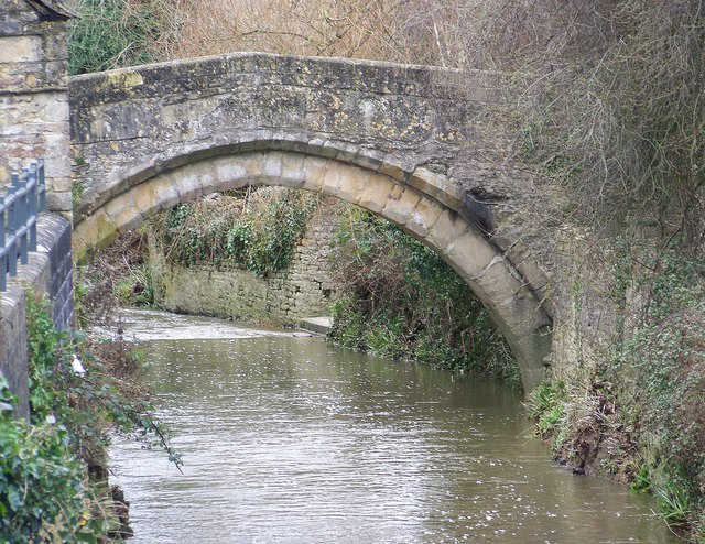
The medieval Glastonbury canal was built in about the middle of the 10th century to link the River Brue at Northover () with Glastonbury Abbey, a distance of about . Its initial purpose is believed to be the transport of building stone for the abbey, but later it was used for delivering produce, including grain, wine and fish, from the abbey's outlying properties. It remained in use until at least the 14th century, but possibly as late as the mid-16th century. English Heritage assess the canal remains, based on a "provisional" interpretation, as a site of "national importance". Construction Modern archaeological excavations have shown that this was a "true canal" wide and deep, with a flat bottom and sloping sides. The place where it met the River Brue, then flowing about north of its present course, was already significant: it had been an important crossing point, with a timber causeway over the river and the associated marshy floodplain, since at least the 8th century. For mo ... [...More Info...] [...Related Items...] OR: [Wikipedia] [Google] [Baidu] |
River Brue
The River Brue originates in the parish of Brewham in Somerset, England, and reaches the sea some west at Burnham-on-Sea. It originally took a different route from Glastonbury to the sea, but this was changed by Glastonbury Abbey in the twelfth century. The river provides an important drainage route for water from a low-lying area which is prone to flooding which man has tried to manage through rhynes, canals, artificial rivers and sluices for centuries. The Brue Valley Living Landscape is an ecological conservation project based on the Somerset Levels and Moors and managed by the Somerset Wildlife Trust. The valley includes several Sites of Special Scientific Interest including Westhay Moor, Shapwick Heath and Shapwick Moor. Much of the area has been at the centre of peat extraction on the Somerset Levels. The Brue Valley Living Landscape project commenced in January 2009 to restore and reconnect habitat that will support wildlife. The aim is to be able to sustain itself in ... [...More Info...] [...Related Items...] OR: [Wikipedia] [Google] [Baidu] |
Bristol Channel
The Bristol Channel ( cy, Môr Hafren, literal translation: "Severn Sea") is a major inlet in the island of Great Britain, separating South Wales from Devon and Somerset in South West England. It extends from the lower estuary of the River Severn ( cy, Afon Hafren) to the North Atlantic Ocean. It takes its name from the English city of Bristol, and is over 30 miles (50 km) wide at its western limit. Long stretches of both sides of the coastline are designated as Heritage Coast. These include Exmoor, Bideford Bay, the Hartland Point peninsula, Lundy Island, Glamorgan, Gower Peninsula, Carmarthenshire, South Pembrokeshire and Caldey Island. Until Tudor times the Bristol Channel was known as the Severn Sea, and it is still known as this in both cy, Môr Hafren and kw, Mor Havren. Geography The International Hydrographic Organization now defines the western limit of the Bristol Channel as "a line joining Hartland Point in Devon () to St. Govan's Head in Pembrokeshire ... [...More Info...] [...Related Items...] OR: [Wikipedia] [Google] [Baidu] |
Glastonbury
Glastonbury (, ) is a town and civil parish in Somerset, England, situated at a dry point on the low-lying Somerset Levels, south of Bristol. The town, which is in the Mendip district, had a population of 8,932 in the 2011 census. Glastonbury is less than across the River Brue from Street, which is now larger than Glastonbury. Evidence from timber trackways such as the Sweet Track show that the town has been inhabited since Neolithic times. Glastonbury Lake Village was an Iron Age village, close to the old course of the River Brue and Sharpham Park approximately west of Glastonbury, that dates back to the Bronze Age. Centwine was the first Saxon patron of Glastonbury Abbey, which dominated the town for the next 700 years. One of the most important abbeys in England, it was the site of Edmund Ironside's coronation as King of England in 1016. Many of the oldest surviving buildings in the town, including the Tribunal, George Hotel and Pilgrims' Inn and the Somerset Rural Lif ... [...More Info...] [...Related Items...] OR: [Wikipedia] [Google] [Baidu] |
History Of Somerset
Somerset is a historic county in the south west of England. There is evidence of human occupation since prehistoric times with hand axes and flint points from the Palaeolithic and Mesolithic eras, and a range of burial mounds, hill forts and other artefacts dating from the Neolithic, Bronze and Iron Ages. The oldest dated human road work in Great Britain is the Sweet Track, constructed across the Somerset Levels with wooden planks in the 39th century BCE. Following the Roman Empire's invasion of southern Britain, the mining of lead and silver in the Mendip Hills provided a basis for local industry and commerce. Bath became the site of a major Roman fort and city, the remains of which can still be seen. During the Early Medieval period Somerset was the scene of battles between the Anglo-Saxons and first the Britons and later the Danes. In this period it was ruled first by various kings of Wessex, and later by kings of England. Following the defeat of the Anglo-Saxon monarchy b ... [...More Info...] [...Related Items...] OR: [Wikipedia] [Google] [Baidu] |
Canals In Somerset
Canals or artificial waterways are waterways or engineered channels built for drainage management (e.g. flood control and irrigation) or for conveyancing water transport vehicles (e.g. water taxi). They carry free, calm surface flow under atmospheric pressure, and can be thought of as artificial rivers. In most cases, a canal has a series of dams and locks that create reservoirs of low speed current flow. These reservoirs are referred to as ''slack water levels'', often just called ''levels''. A canal can be called a ''navigation canal'' when it parallels a natural river and shares part of the latter's discharges and drainage basin, and leverages its resources by building dams and locks to increase and lengthen its stretches of slack water levels while staying in its valley. A canal can cut across a drainage divide atop a ridge, generally requiring an external water source above the highest elevation. The best-known example of such a canal is the Panama Canal. Many ca ... [...More Info...] [...Related Items...] OR: [Wikipedia] [Google] [Baidu] |
A39 Road
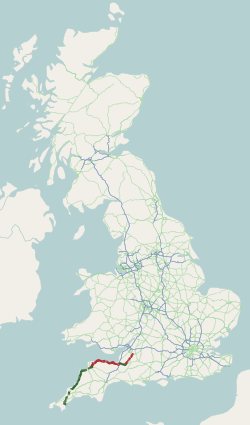
The A39 is an A road in south west England. It runs south-west from Bath in Somerset through Wells, Glastonbury, Street and Bridgwater. It then follows the north coast of Somerset, Devon and Cornwall through Williton, Minehead, Porlock, Lynmouth, Barnstaple, Bideford, Stratton, Camelford, Wadebridge and St Columb Major. It then joins the route of the A30 road for around , re-emerging near Zelah to head for the south Cornish coast via Truro and Falmouth. In Cornwall and North Devon (until the junction with the A361 "North Devon Link Road"), the road is known as the Atlantic Highway, and was classified as a trunk road until 2002. Porlock Hill Porlock Hill is a section of the A39 west of the village of Porlock. The road climbs approximately in less than up onto Exmoor: a very steep hill with gradients of up to 1 in 4 and hairpin bends. In Porlock itself you will often smell burning brakes from vehicles who have just descended the hill. On 12 January 1899, the ten- ... [...More Info...] [...Related Items...] OR: [Wikipedia] [Google] [Baidu] |
Turnpike Trust
Turnpike trusts were bodies set up by individual Acts of Parliament in the United Kingdom, acts of Parliament, with powers to collect road toll road, tolls for maintaining the principal roads in Kingdom of Great Britain, Britain from the 17th but especially during the 18th and 19th centuries. At the peak, in the 1830s, over 1,000 trusts administered around of turnpike road in England and Wales, taking tolls at almost 8,000 toll-gates and side-bars. During the early 19th century the concept of the turnpike trust was adopted and adapted to manage roads within the British Empire (Ireland, Canada, Australia, New Zealand, India, and South Africa) and in the United States. Turnpikes declined with the Railway mania, coming of the railways and then the Local Government Act 1888 gave responsibility for maintaining main roads to county councils and county borough councils. Etymology The term "turnpike" originates from the similarity of the gate used to control access to the road, to ... [...More Info...] [...Related Items...] OR: [Wikipedia] [Google] [Baidu] |
Rescue Archaeology
Rescue archaeology, sometimes called commercial archaeology, preventive archaeology, salvage archaeology, contract archaeology, developer-funded archaeology or compliance archaeology, is state-sanctioned, archaeological survey and excavation carried out in advance of construction or other land development. Other causes for salvage digs can be looting and illegal construction. One effect of rescue archaeology is that it diverts resources and impacts pre-planned archaeological work. Conditions leading to rescue archaeology could include, but are not limited to, highway projects, major construction, the flood plain of a proposed dam, or even before the onset of war. Unlike traditional survey and excavation, rescue archaeology must be undertaken at speed. Rescue archaeology is included in the broader categories that are cultural resource management (CRM) and cultural heritage management (CHM). Background Rescue archaeology occurs on sites about to be destroyed but, on occasion, ... [...More Info...] [...Related Items...] OR: [Wikipedia] [Google] [Baidu] |
Sherd
In archaeology, a sherd, or more precisely, potsherd, is commonly a historic or prehistoric fragment of pottery, although the term is occasionally used to refer to fragments of stone and glass vessels, as well. Occasionally, a piece of broken pottery may be referred to as a shard. While the spelling shard is generally reserved for referring to fragments of glass vessels, the term does not exclude pottery fragments. The etymology is connected with the idea of breakage, from Old English ''sceard'', related to Old Norse ''skarð'', "notch", and Middle High German ''schart'', "notch". A sherd or potsherd that has been used by having writing painted or inscribed on it can be more precisely referred to as an ostracon An ostracon (Greek: ''ostrakon'', plural ''ostraka'') is a piece of pottery, usually broken off from a vase or other earthenware vessel. In an archaeological or epigraphical context, ''ostraca'' refer to sherds or even small pieces of ston .... The analysis of ... [...More Info...] [...Related Items...] OR: [Wikipedia] [Google] [Baidu] |
Meare
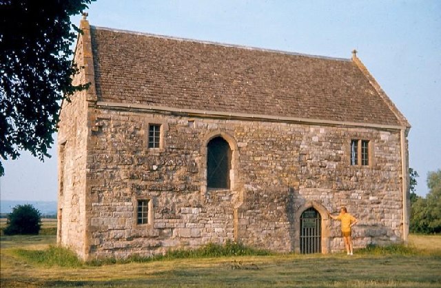
Meare is a village and civil parish north west of Glastonbury on the Somerset Levels, in the Mendip district of Somerset, England. The parish includes the village of Westhay. History Meare is a marshland village in typical Somerset "rhyne" country, standing on the site of pre-historic lake dwellings. The site of the Meare Lake Village is marked by groups of mounds. It has been occupied for thousands of years and some of the archaeological finds are now being reported. A 14th-century fish house at Meare was once the abode of Glastonbury Abbey fishermen, who fished the, now drained, Meare Pool. The Manor Farmhouse was built at the same time as the summer residence of the Abbots from Glastonbury Abbey and is now a farmhouse. Along with its outbuildings the farmhouse has been designated as a Grade I listed building. The parish was part of the hundred of Glaston Twelve Hides. Governance The parish council has responsibility for local issues, including setting an annual precept ... [...More Info...] [...Related Items...] OR: [Wikipedia] [Google] [Baidu] |
Glastonbury Abbey
Glastonbury Abbey was a monastery in Glastonbury, Somerset, England. Its ruins, a grade I listed building and scheduled ancient monument, are open as a visitor attraction. The abbey was founded in the 8th century and enlarged in the 10th. It was destroyed by a major fire in 1184, but subsequently rebuilt and by the 14th century was one of the richest and most powerful monasteries in England. The abbey controlled large tracts of the surrounding land and was instrumental in major drainage projects on the Somerset Levels. The abbey was suppressed during the Dissolution of the Monasteries under King Henry VIII of England. The last abbot, Richard Whiting (Whyting), was hanged, drawn and quartered as a traitor on Glastonbury Tor in 1539. From at least the 12th century the Glastonbury area has been associated with the legend of King Arthur, a connection promoted by medieval monks who asserted that Glastonbury was Avalon. Christian legends have claimed that the abbey was founded by J ... [...More Info...] [...Related Items...] OR: [Wikipedia] [Google] [Baidu] |


