|
Gisborough Moor
Gisborough Moor is a moor in England's North York Moors, lying to the south of the town of Guisborough. The summit is a broad flat ridge, with the highest point at the southern end, some south of a trig point. It is crossed by a number of footpaths leading between the Cleveland Way and Commondale and other settlements to the south. Highcliff Nab, near the moor's north-western corner, overlooks Guisborough from the edge of the scarp. 1.4 km from the highest point of the moor, on nearby Commondale Moor, (Grid reference NZ6469 1175) is a First World War memorial to two friends who worked on the Gisborough Estate and who left for London in 1914 to join the Grenadier Guards. One died on the Somme in 1916 (his body was never found) and the other died of his wounds in 1920. The memorial is now grade II listed. 3.2 km away, on nearby Great Ayton Moor (Grid reference NZ6020 1241), was the location of a ''Starfish'' site during the Second World War World War II or the ... [...More Info...] [...Related Items...] OR: [Wikipedia] [Google] [Baidu] |
Marilyn (hill)
This is a list of Marilyn hills and mountains in the United Kingdom, Isle of Man and Republic of Ireland, Ireland by height. Lists of mountains and hills in the British Isles#Marilyns, Marilyns are defined as peaks with a topographic prominence, prominence of or more, regardless of height or any other merit (e.g. topographic isolation, as used in Lists of mountains and hills in the British Isles#Munros, Munros). Thus, Marilyns can be mountains, with a height above , or relatively small hills. there were 2,011 recorded Marilyns. Definition The Marilyn classification was created by Alan Dawson in his 1992 book ''The Relative Hills of Britain''. The name Marilyn was coined by Dawson as a punning contrast to the ''Munro'' classification of Scottish mountains above , but which has no explicit prominence threshold, being homophonous with (Marilyn) ''Marilyn Monroe, Monroe''. The list of Marilyns was extended to Ireland by Clem Clements. Marilyn was the first of several subsequen ... [...More Info...] [...Related Items...] OR: [Wikipedia] [Google] [Baidu] |
First World War
World War I (28 July 1914 11 November 1918), often abbreviated as WWI, was one of the deadliest global conflicts in history. Belligerents included much of Europe, the Russian Empire, the United States, and the Ottoman Empire, with fighting occurring throughout Europe, the Middle East, Africa, the Pacific, and parts of Asia. An estimated 9 million soldiers were killed in combat, plus another 23 million wounded, while 5 million civilians died as a result of military action, hunger, and disease. Millions more died in genocides within the Ottoman Empire and in the 1918 influenza pandemic, which was exacerbated by the movement of combatants during the war. Prior to 1914, the European great powers were divided between the Triple Entente (comprising France, Russia, and Britain) and the Triple Alliance (containing Germany, Austria-Hungary, and Italy). Tensions in the Balkans came to a head on 28 June 1914, following the assassination of Archduke Franz Ferdina ... [...More Info...] [...Related Items...] OR: [Wikipedia] [Google] [Baidu] |
Mountains And Hills Of North Yorkshire
A mountain is an elevated portion of the Earth's crust, generally with steep sides that show significant exposed bedrock. Although definitions vary, a mountain may differ from a plateau in having a limited summit area, and is usually higher than a hill, typically rising at least 300 metres (1,000 feet) above the surrounding land. A few mountains are isolated summits, but most occur in mountain ranges. Mountains are formed through tectonic forces, erosion, or volcanism, which act on time scales of up to tens of millions of years. Once mountain building ceases, mountains are slowly leveled through the action of weathering, through slumping and other forms of mass wasting, as well as through erosion by rivers and glaciers. High elevations on mountains produce colder climates than at sea level at similar latitude. These colder climates strongly affect the ecosystems of mountains: different elevations have different plants and animals. Because of the less hospitable terrain ... [...More Info...] [...Related Items...] OR: [Wikipedia] [Google] [Baidu] |
Marilyns Of England
This is a list of Marilyn hills and mountains in the United Kingdom, Isle of Man and Ireland by height. Marilyns are defined as peaks with a prominence of or more, regardless of height or any other merit (e.g. topographic isolation, as used in Munros). Thus, Marilyns can be mountains, with a height above , or relatively small hills. there were 2,011 recorded Marilyns. Definition The Marilyn classification was created by Alan Dawson in his 1992 book ''The Relative Hills of Britain''. The name Marilyn was coined by Dawson as a punning contrast to the ''Munro'' classification of Scottish mountains above , but which has no explicit prominence threshold, being homophonous with (Marilyn) '' Monroe''. The list of Marilyns was extended to Ireland by Clem Clements. Marilyn was the first of several subsequent British Isles classifications that rely solely on prominence, including the P600s, the HuMPs, and the TuMPs. Topographic prominence is a more difficult to estimate than to ... [...More Info...] [...Related Items...] OR: [Wikipedia] [Google] [Baidu] |
Second World War
World War II or the Second World War, often abbreviated as WWII or WW2, was a world war that lasted from 1939 to 1945. It involved the vast majority of the world's countries—including all of the great powers—forming two opposing military alliances: the Allies and the Axis powers. World War II was a total war that directly involved more than 100 million personnel from more than 30 countries. The major participants in the war threw their entire economic, industrial, and scientific capabilities behind the war effort, blurring the distinction between civilian and military resources. Aircraft played a major role in the conflict, enabling the strategic bombing of population centres and deploying the only two nuclear weapons ever used in war. World War II was by far the deadliest conflict in human history; it resulted in 70 to 85 million fatalities, mostly among civilians. Tens of millions died due to genocides (including the Holocaust), starvation, ma ... [...More Info...] [...Related Items...] OR: [Wikipedia] [Google] [Baidu] |
Grade II Listed
In the United Kingdom, a listed building or listed structure is one that has been placed on one of the four statutory lists maintained by Historic England in England, Historic Environment Scotland in Scotland, in Wales, and the Northern Ireland Environment Agency in Northern Ireland. The term has also been used in the Republic of Ireland, where buildings are protected under the Planning and Development Act 2000. The statutory term in Ireland is " protected structure". A listed building may not be demolished, extended, or altered without special permission from the local planning authority, which typically consults the relevant central government agency, particularly for significant alterations to the more notable listed buildings. In England and Wales, a national amenity society must be notified of any work to a listed building which involves any element of demolition. Exemption from secular listed building control is provided for some buildings in current use for worship, ... [...More Info...] [...Related Items...] OR: [Wikipedia] [Google] [Baidu] |
Battle Of The Somme
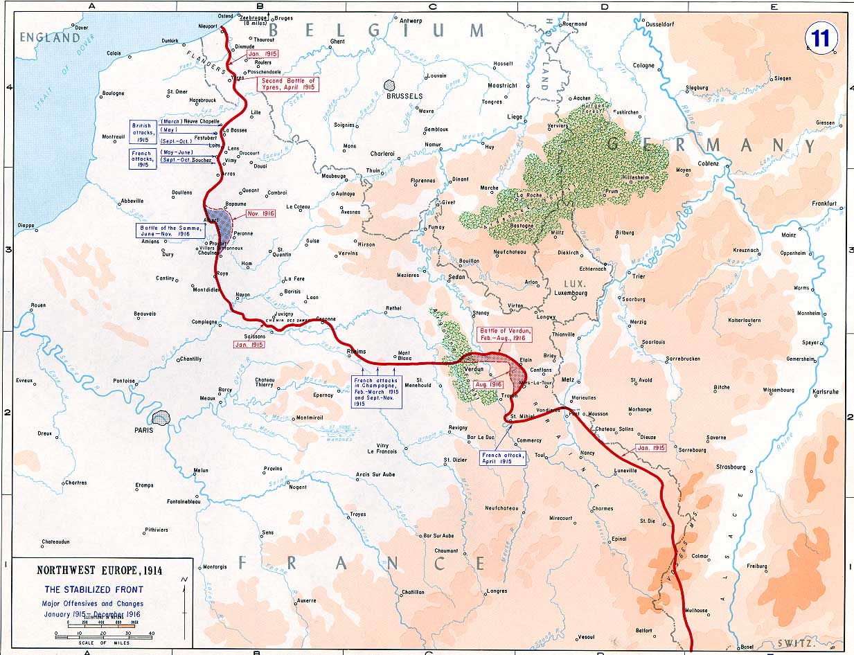
The Battle of the Somme ( French: Bataille de la Somme), also known as the Somme offensive, was a battle of the First World War fought by the armies of the British Empire and French Third Republic against the German Empire. It took place between 1 July and 18 November 1916 on both sides of the upper reaches of the Somme, a river in France. The battle was intended to hasten a victory for the Allies. More than three million men fought in the battle of whom one million were wounded or killed, making it one of the deadliest battles in human history. The French and British had committed themselves to an offensive on the Somme during the Chantilly Conference in December 1915. The Allies agreed upon a strategy of combined offensives against the Central Powers in 1916 by the French, Russian, British and Italian armies, with the Somme offensive as the Franco-British contribution. Initial plans called for the French army to undertake the main part of the Somme offensive, supported on ... [...More Info...] [...Related Items...] OR: [Wikipedia] [Google] [Baidu] |
Grenadier Guards
"Shamed be whoever thinks ill of it." , colors = , colors_label = , march = Slow: " Scipio" , mascot = , equipment = , equipment_label = , battles = Oudenarde WaterlooAlmaInkermanSevastopol OmdurmanYpresBattle of the BulgeCyprus Emergency , anniversaries = , decorations = , battle_honours = , battle_honours_label = , disbanded = , flying_hours = , website = , commander1 = The King , commander1_label = Colonel-in-Chief , commander2 = The Queen Consort , commander2_label = Colonel of the Regiment , commander3 = , commander3_label = , commander4 = , commander4_label ... [...More Info...] [...Related Items...] OR: [Wikipedia] [Google] [Baidu] |
London
London is the capital and largest city of England and the United Kingdom, with a population of just under 9 million. It stands on the River Thames in south-east England at the head of a estuary down to the North Sea, and has been a major settlement for two millennia. The City of London, its ancient core and financial centre, was founded by the Romans as '' Londinium'' and retains its medieval boundaries.See also: Independent city § National capitals The City of Westminster, to the west of the City of London, has for centuries hosted the national government and parliament. Since the 19th century, the name "London" has also referred to the metropolis around this core, historically split between the counties of Middlesex, Essex, Surrey, Kent, and Hertfordshire, which largely comprises Greater London, governed by the Greater London Authority.The Greater London Authority consists of the Mayor of London and the London Assembly. The London Mayor is distinguished fr ... [...More Info...] [...Related Items...] OR: [Wikipedia] [Google] [Baidu] |
Commondale
Commondale is a village and civil parish in the Scarborough district of North Yorkshire, England that lies within the North York Moors National Park. The village is served by Commondale railway station. It has a small pub called The Cleveland Inn. According to the 2011 UK census, Commondale parish had a population of 129, the same as in the 2001 UK census A nationwide census, known as Census 2001, was conducted in the United Kingdom on Sunday, 29 April 2001. This was the 20th UK census and recorded a resident population of 58,789,194. The 2001 UK census was organised by the Office for National .... The village's name was also historically recorded as ''Colmandale'' or ''Colemandale''. Commondale is also the home of the Cleveland County Scouts campsite known as Raven Gill Campsite. This is used by Scouts and other youth groups from all around the world. This provides a good trade for the village pub and also promotes good farming practice in the area. References ... [...More Info...] [...Related Items...] OR: [Wikipedia] [Google] [Baidu] |
List Of English Counties By Highest Point
This is a list of the ceremonial counties of England by their highest point. See also *List of counties of England and Wales in 1964 by highest point *List of mountains and hills of the United Kingdom *List of Scottish council areas by highest point * List of Scottish counties by highest point *List of Welsh principal areas by highest point * List of Northern Ireland districts by highest point *List of Northern Ireland counties by highest point References SourcesCounty and Unitary Authority Topsfrom the ''Database of British and Irish Hills'', which holds information on all English county and unitary authority tops. {{Mountains of Great Britain and Ireland Counties Highest point English counties The counties of England are areas used for different purposes, which include administrative, geographical, cultural and political demarcation. The term "county" is defined in several ways and can apply to similar or the same areas used by each ... ... [...More Info...] [...Related Items...] OR: [Wikipedia] [Google] [Baidu] |
Cleveland Way
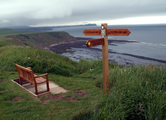
The Cleveland Way is a National Trail in the historic area of Cleveland in North Yorkshire, northern England. It runs between Helmsley and the Brigg at Filey, skirting the North York Moors National Park. History Development of the Cleveland Way began in the 1930s when the Teesside Ramblers' Association pressed for the creation of a long-distance path in the north-east of Yorkshire linking the Hambleton Drove Road, the Cleveland escarpment and footpaths on the Yorkshire coast. Subsequently, in 1953, a formal proposal to create the route was submitted to the North Riding of Yorkshire Council by the National Parks Commission. The trail was officially opened in 1969. It was the second official National Trail to be opened. Route The trail can be walked in either direction linking the trailheads of Helmsley () and Filey () in a horseshoe configuration. The trail is waymarked along its length using the standard National Trail acorn symbol. The trail falls into two roughly equa ... [...More Info...] [...Related Items...] OR: [Wikipedia] [Google] [Baidu] |


