|
Germanic Trias
The Germanic Trias Supergroup (german: Germanische Trias-Supergruppe) is a lithostratigraphy, lithostratigraphic unit (a sequence of rock strata) in the subsurface of large parts of western and central Europe (north of the Alps) and the North Sea. Almost all of the Germanic Trias was deposited during the Triassic period (geology), period and consists of three clearly different units: Buntsandstein, Muschelkalk and Keuper, that gave the period its name (''Triassic'' means "threefold"). In the past the names of these three units were also used as units in the geologic timescale, but in modern literature they only have a lithostratigraphic meaning. Origin The Germanic Trias formed in the large Germanic Basin, a basin (geology), basin that covered much of midwestern Europe (including the south of the North Sea and Baltic Sea) during the Triassic. The Muschelkalk has a predominantly marine (ocean), marine sedimentary facies, facies whereas the Buntsandstein and Keuper are mostly continen ... [...More Info...] [...Related Items...] OR: [Wikipedia] [Google] [Baidu] |
Lithostratigraphy
Lithostratigraphy is a sub-discipline of stratigraphy, the geological science associated with the study of strata or rock layers. Major focuses include geochronology, comparative geology, and petrology. In general, strata are primarily igneous or sedimentary relating to how the rock was formed. Sedimentary layers are laid down by deposition of sediment associated with weathering processes, decaying organic matter (biogenic) or through chemical precipitation. These layers are often distinguishable as having many fossils and are important for the study of biostratigraphy. Igneous layers occur as stacks of lava flows, layers of lava fragments (called tephra) both erupted onto the Earth's surface by volcanoes, and in layered intrusions formed deep underground. Igneous layers are generally devoid of fossils and represent magmatic or volcanic activity that occurred during the geologic history of an area. There are a number of principles that are used to explain the appearance of ... [...More Info...] [...Related Items...] OR: [Wikipedia] [Google] [Baidu] |
Permian
The Permian ( ) is a geologic period and stratigraphic system which spans 47 million years from the end of the Carboniferous Period million years ago (Mya), to the beginning of the Triassic Period 251.9 Mya. It is the last period of the Paleozoic Era; the following Triassic Period belongs to the Mesozoic Era. The concept of the Permian was introduced in 1841 by geologist Sir Roderick Murchison, who named it after the region of Perm in Russia. The Permian witnessed the diversification of the two groups of amniotes, the synapsids and the sauropsids ( reptiles). The world at the time was dominated by the supercontinent Pangaea, which had formed due to the collision of Euramerica and Gondwana during the Carboniferous. Pangaea was surrounded by the superocean Panthalassa. The Carboniferous rainforest collapse left behind vast regions of desert within the continental interior. Amniotes, which could better cope with these drier conditions, rose to dominance in place of their am ... [...More Info...] [...Related Items...] OR: [Wikipedia] [Google] [Baidu] |
Hiatus (stratigraphy)
An unconformity is a buried erosional or non-depositional surface separating two rock masses or strata of different ages, indicating that sediment deposition was not continuous. In general, the older layer was exposed to erosion for an interval of time before deposition of the younger layer, but the term is used to describe any break in the sedimentary geologic record. The significance of angular unconformity (see below) was shown by James Hutton, who found examples of Hutton's Unconformity at Jedburgh in 1787 and at Siccar Point in 1788. The rocks above an unconformity are younger than the rocks beneath (unless the sequence has been overturned). An unconformity represents time during which no sediments were preserved in a region or were subsequently eroded before the next deposition. The local record for that time interval is missing and geologists must use other clues to discover that part of the geologic history of that area. The interval of geologic time not represented ... [...More Info...] [...Related Items...] OR: [Wikipedia] [Google] [Baidu] |
Rhaetian
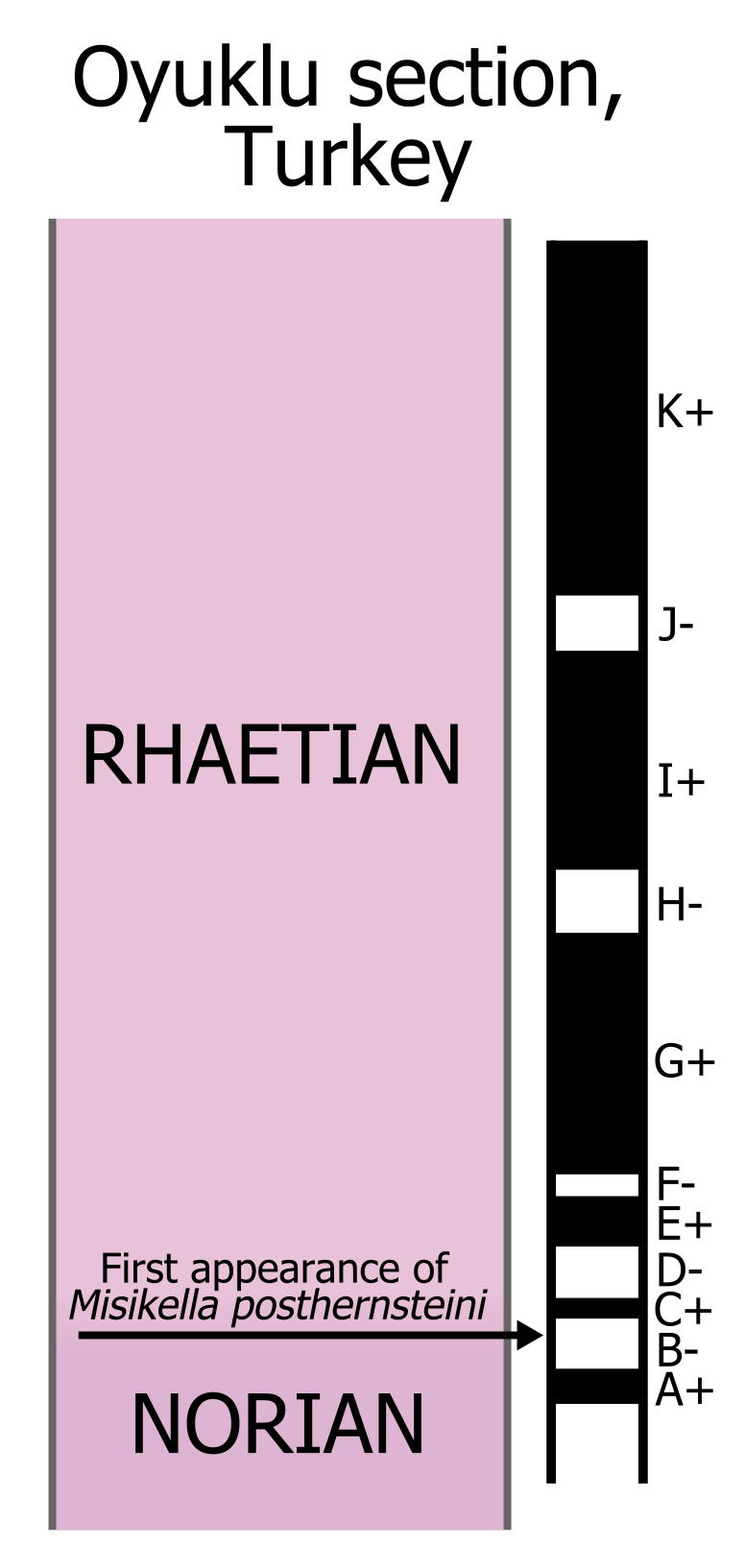
The Rhaetian is the latest age of the Triassic Period (in geochronology) or the uppermost stage of the Triassic System (in chronostratigraphy). It was preceded by the Norian and succeeded by the Hettangian (the lowermost stage or earliest age of the Jurassic). The base of the Rhaetian lacks a formal GSSP, though candidate sections include Steinbergkogel in Austria (since 2007) and Pignola-Abriola in Italy (since 2016). The end of the Rhaetian (and the base of the overlying Hettangian Stage) is more well-defined. According to the current ICS (International Commission on Stratigraphy) system, the Rhaetian ended ± 0.2 Ma (million years ago). In 2010, the base of the Rhaetian (i.e. the Norian-Rhaetian boundary) was voted to be defined based on the first appearance of '' Misikella posthernsteini'', a marine conodont. However, there is still much debate over the age of this boundary, as well as the evolution of ''M. posthernsteini''. The most comprehensive source of precise age ... [...More Info...] [...Related Items...] OR: [Wikipedia] [Google] [Baidu] |
Stage (stratigraphy)
In chronostratigraphy, a stage is a succession of rock strata laid down in a single age on the geologic timescale, which usually represents millions of years of deposition. A given stage of rock and the corresponding age of time will by convention have the same name, and the same boundaries. Rock series are divided into stages, just as geological epochs are divided into ages. Stages can be divided into smaller stratigraphic units called chronozones. (See chart at right for full terminology hierarchy.) Stages may also be divided into substages or indeed grouped as superstages. The term faunal stage is sometimes used, referring to the fact that the same fauna (animals) are found throughout the layer (by definition). Definition Stages are primarily defined by a consistent set of fossils (biostratigraphy) or a consistent magnetic polarity (see paleomagnetism) in the rock. Usually one or more index fossils that are common, found worldwide, easily recognized, and limited to a sing ... [...More Info...] [...Related Items...] OR: [Wikipedia] [Google] [Baidu] |
Changhsingian
In the geologic time scale, the Changhsingian or Changxingian is the latest age or uppermost stage of the Permian. It is also the upper or latest of two subdivisions of the Lopingian Epoch or Series. The Changhsingian lasted from to 251.902 million years ago (Ma). It was preceded by the Wuchiapingian and followed by the Induan. The greatest mass extinction in the Phanerozoic eon, the Permian–Triassic extinction event, occurred during this age. The extinction rate peaked about a million years before the end of this stage. Stratigraphic definitions The Changhsingian is named after Changxing () in northern Zhejiang, China. The stage was named for the Changhsing Limestone. The name was first used for a stage in 1970; 1973: ''Permian stages names'', in: : ''The Permian and Triassic systems and their mutual boundary'', Canadian Society of Petroleum Geologists Memoir 2, pp 522–548. and was anchored in the international timescale in 1981.; 2006: ''The Global Boundary Stratotype Sect ... [...More Info...] [...Related Items...] OR: [Wikipedia] [Google] [Baidu] |
Radiometric Dating
Radiometric dating, radioactive dating or radioisotope dating is a technique which is used to date materials such as rocks or carbon, in which trace radioactive impurities were selectively incorporated when they were formed. The method compares the abundance of a naturally occurring radioactive isotope within the material to the abundance of its decay products, which form at a known constant rate of decay. The use of radiometric dating was first published in 1907 by Bertram Boltwood and is now the principal source of information about the absolute age of rocks and other geological features, including the age of fossilized life forms or the age of Earth itself, and can also be used to date a wide range of natural and man-made materials. Together with stratigraphic principles, radiometric dating methods are used in geochronology to establish the geologic time scale. Among the best-known techniques are radiocarbon dating, potassium–argon dating and uranium–lead dating. By al ... [...More Info...] [...Related Items...] OR: [Wikipedia] [Google] [Baidu] |
Odenwald
The Odenwald () is a low mountain range in the German states of Hesse, Bavaria and Baden-Württemberg. Location The Odenwald is located between the Upper Rhine Plain with the Bergstraße and the ''Hessisches Ried'' (the northeastern section of the Rhine rift) to the west, the Main and the Bauland (a mostly unwooded area with good soils) to the east, the Hanau-Seligenstadt Basin – a subbasin of the Upper Rhine Rift Valley in the Rhine-Main Lowlands – to the north and the Kraichgau to the south. The part south of the Neckar valley is sometimes called the ''Kleiner Odenwald'' ("Little Odenwald"). The northern and western Odenwald belong to southern Hesse, with the south stretching into Baden. In the northeast, a small part lies in Lower Franconia in Bavaria. Geology The Odenwald, along with other parts of the Central German Uplands, belongs to the Variscan, which more than 300 million years ago in the Carboniferous period ran through great parts of Europe. The cause ... [...More Info...] [...Related Items...] OR: [Wikipedia] [Google] [Baidu] |
Spessart
Spessart is a ''Mittelgebirge'', a range of low wooded mountains, in the States of Bavaria and Hesse in Germany. It is bordered by the Vogelsberg, Rhön and Odenwald. The highest elevation is the Geiersberg at 586 metres above sea level. Etymology The name is derived from "Spechtshardt". ''Specht'' is the German word for woodpecker and ''Hardt'' is an outdated word meaning "hilly forest". Geography Location The Spessart is a ''Mittelgebirge'', part of the German Central Uplands, located in the Lower Franconia region of Bavaria and in Hesse, Germany. It is bordered by other ranges of hills: the Vogelsberg in the north, Rhön in the northeast and Odenwald in the southwest. Another way of describing the extent of the range is by naming the rivers that border it: the Main in the south and west, the Kinzig in the north and the Sinn in the northeast. The area of the Spessart totals around 2,440 square kilometres, of which 1,710 square kilometres are part of Bavaria. The high ... [...More Info...] [...Related Items...] OR: [Wikipedia] [Google] [Baidu] |
Calvörde Beds
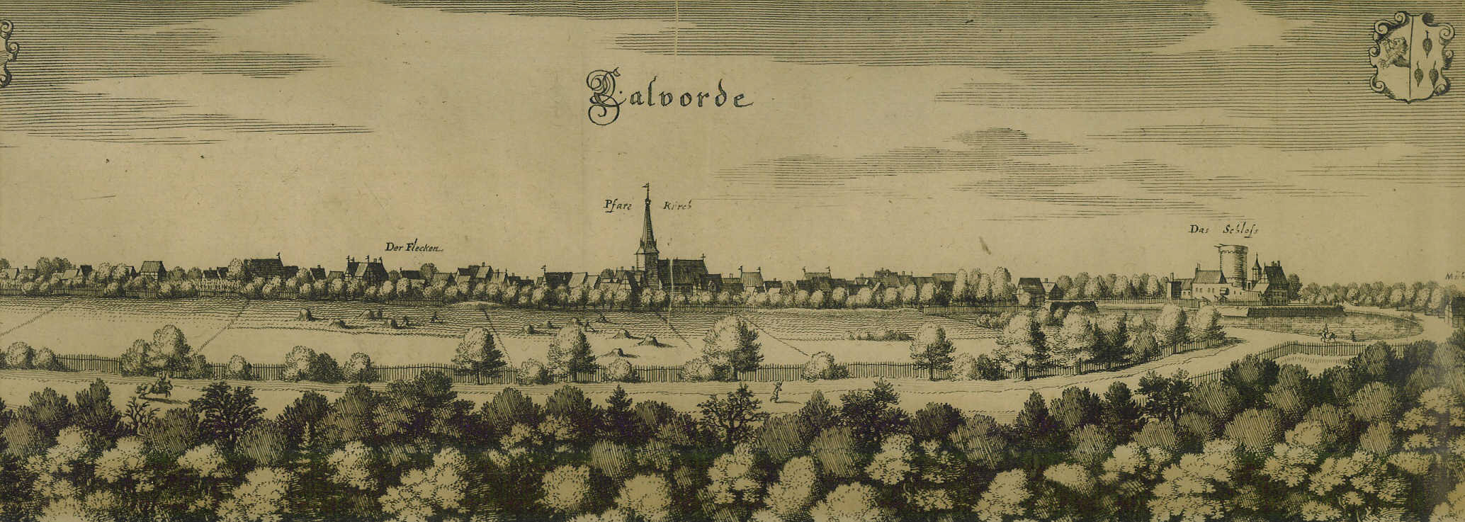
Calvörde () is a municipality in the Börde district of Saxony-Anhalt, Germany. It is part of the Verbandsgemeinde ("collective municipality") Flechtingen. Geography Calvörde is situated approximately northwest of Haldensleben and northwest of the state capital Magdeburg. It is located between the Drömling range in the west and the Flechtingen Hills in the south. In the north, it borders on Gardelegen in the Altmarkkreis Salzwedel district. The main settlement Calvörde proper lies between the Ohre River and the parallel Midland Canal. The municipal area comprises 11 localities (''Ortsteile''):Hauptsatzung der Gemeinde Calvörde July 2014. * |
Altena Group
Altena (; Westphalian: ''Altenoa'') is a town in the district of Märkischer Kreis, North Rhine-Westphalia, Germany. The town's castle is the origin for the later Dukes of Berg. Altena is situated on the Lenne river valley, in the northern stretches of the Sauerland. History Altena Castle was built in the early 12th century, as a stronghold of the older Counts of Berg. A short time later a village was founded beneath the hill, with the castle alongside the river Lenne, which feeds into the river Ruhr. After the distribution of the Berg family estates in 1161, Altena became the centre of the County of Altena. The first Count of Altena became Eberhard I, Count of Berg-Altena. In 1180, after the death of the first count, the county was divided between the two oldest sons: Arnold of Altena and Friedrich of Altena. The third son, Adolf of Altena, became Archbishop of Cologne. Arnold was provided with on half of the Castle and County of Altena, the Castle Hövel and some estates as ... [...More Info...] [...Related Items...] OR: [Wikipedia] [Google] [Baidu] |


