|
Georgia State Route 371
State Route 371 (SR 371) was a two-lane south-to-north State highway (US), state highway in unincorporated area, unincorporated Forsyth County, Georgia, Forsyth County in the North Georgia, north-central part of the U.S. state of Georgia (U.S. state), Georgia. The highway connected Georgia State Route 9, SR 9 in the south to Georgia State Route 20, SR 20 in the north. SR 371 served as a Connector (road), connecting route for the residential area, residential neighborhoods between SR 9 and SR 20 to Georgia State Route 400, SR 400, the major north–south commuter route into and out of Atlanta. SR 371's path is known locally as Post Road. Route description SR 371 began at an intersection (road), intersection with Georgia State Route 9, SR 9 (Atlanta Highway) northeast of Milton, Georgia, Milton and first traveled slightly to the northeast, then bended mostly north through the residential southwestern portion of Forsyth County, ... [...More Info...] [...Related Items...] OR: [Wikipedia] [Google] [Baidu] |
Milton, Georgia
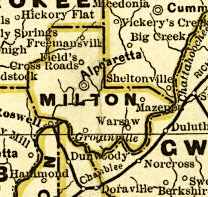
Milton is a city in Fulton County, Georgia, United States. Located about 30 miles due north of Atlanta, Milton is known for its rural and equestrian heritage. The City was incorporated on December 1, 2006, out of the unincorporated northernmost part of northern Fulton County. As of the 2010 census, Milton's population was 32,661, with an estimated population of 39,587 in 2019. Milton is named in honor of the former Milton County, which was named after Revolutionary War hero John Milton. The portion of north Fulton County generally north of the Chattahoochee River comprises most of the territory of the former Milton County. History Incorporation A citizens' committee was formed in 2005 to help determine the viability of incorporating unincorporated northern Fulton County. After debate, the Georgia State House and Senate approved a bill creating the city of Milton on March 9, 2006. On March 28, Governor Sonny Perdue signed the bill into law. In July 2006, voters approved a ballot ref ... [...More Info...] [...Related Items...] OR: [Wikipedia] [Google] [Baidu] |
Atlanta
Atlanta ( ) is the capital and most populous city of the U.S. state of Georgia. It is the seat of Fulton County, the most populous county in Georgia, but its territory falls in both Fulton and DeKalb counties. With a population of 498,715 living within the city limits, it is the eighth most populous city in the Southeast and 38th most populous city in the United States according to the 2020 U.S. census. It is the core of the much larger Atlanta metropolitan area, which is home to more than 6.1 million people, making it the eighth-largest metropolitan area in the United States. Situated among the foothills of the Appalachian Mountains at an elevation of just over above sea level, it features unique topography that includes rolling hills, lush greenery, and the most dense urban tree coverage of any major city in the United States. Atlanta was originally founded as the terminus of a major state-sponsored railroad, but it soon became the convergence point among several rai ... [...More Info...] [...Related Items...] OR: [Wikipedia] [Google] [Baidu] |
Georgia State Route 369
State Route 369 (SR 369) is a west-to-east state highway in the northern part of the U.S. state of Georgia. It travels from its intersection with SR 20 near the community of Macedonia in eastern Cherokee County, through northern Forsyth County, bisecting the county, to its eastern terminus in the northeastern part of Gainesville in Hall County. Route description SR 369 begins at an intersection with SR 20 (Canton Highway) near the community of Macedonia in eastern Cherokee County, and travels in a loop to the east, through unincorporated and generally rural (though becoming somewhat exurban) areas of Cherokee and Forsyth counties. This includes Matt, for which the road is named Matt Highway west of SR 9 (Dahlonega Highway), while running southeast from Matt to Coal Mountain. The intersection of SR 369 and US 19/ SR 400 is just north of the end of the limited-access portion of US 19/SR 400 at exit 17. East ... [...More Info...] [...Related Items...] OR: [Wikipedia] [Google] [Baidu] |
Georgia State Route 141
State Route 141 (SR 141) is a state highway that runs southwest-to-northeast in the northwest part of the U.S. state of Georgia. It connects the Buckhead area of Atlanta with Cumming. Its routing exists within portions of Fulton, DeKalb, Gwinnett, Forsyth counties. Route description SR 141 begins at an intersection with US 19/ SR 9 (Roswell Road NE) in the Buckhead neighborhood of Atlanta, in Fulton County. It travels to the northeast to an intersection with SR 237 (Piedmont Road NE). Just after that intersection, it goes over, but does not have an interchange with SR 400 (T. Harvey Mathis Parkway). Immediately after is the southern terminus of SR 141 Connector (Lenox Road NE). The highway passes just northwest of the Buckhead Heights neighborhood, crosses into DeKalb County, and passes through Brookhaven. SR 141 passes Oglethorpe University and the Peachtree Golf Club, just before passing through Chamblee. In Doraville, it ... [...More Info...] [...Related Items...] OR: [Wikipedia] [Google] [Baidu] |
Annual Average Daily Traffic
Annual average daily traffic, abbreviated AADT, is a measure used primarily in transportation planning, transportation engineering and retail location selection. Traditionally, it is the total volume of vehicle traffic of a highway or road for a year divided by 365 days. AADT is a simple, but useful, measurement of how busy the road is. AADT is the standard measurement for vehicle traffic load on a section of road, and the basis for most decisions regarding transport planning, or to the environmental hazards of pollution related to road transport. Uses One of the most important uses of AADT is for determining funding for the maintenance and improvement of highways. In the United States the amount of federal funding a state will receive is related to the total traffic measured across its highway network. Each year on June 15, every state in the United States submits Highway Performance Monitoring System HPMS">Highway Performance Monitoring System">Highway Performance Monitoring Sy ... [...More Info...] [...Related Items...] OR: [Wikipedia] [Google] [Baidu] |
West Forsyth High School (Georgia)
West Forsyth High School is a public high school, located in Cumming, Georgia, United States, a suburb northeast of Atlanta Atlanta ( ) is the capital and most populous city of the U.S. state of Georgia. It is the seat of Fulton County, the most populous county in Georgia, but its territory falls in both Fulton and DeKalb counties. With a population of 498,715 .... The school is located at 4155 Drew Road. West Forsyth High School opened in 2007 with 1,200 students in grades 9 through 11, with a senior class added the following year. West Forsyth High School was the first true high school since Forsyth Central (formally Forsyth County High) was built in 1955. North and South Forsyth High are converted junior high schools. West Forsyth High was built to alleviate overcrowding at South Forsyth and Forsyth Central high schools. West Forsyth High is the first construction of the district's two-story high school prototype. The school motto, "I am West Forsyth, and we are famil ... [...More Info...] [...Related Items...] OR: [Wikipedia] [Google] [Baidu] |
Alpharetta, Georgia
Alpharetta is a city in northern Fulton County, Georgia, United States, and is a part of the Atlanta metropolitan area. As of the 2020 US Census, Alpharetta's population was 65,818 The population in 2010 was 57,551. History In the 1830s, the Cherokee people in Georgia and elsewhere in the South were forcibly relocated to the Indian Territory (present-day Oklahoma) under the Indian Removal Act. Pioneers and farmers later settled on the newly vacated land, situated along a former Cherokee trail stretching from the North Georgia mountains to the Chattahoochee River. One of the area's first permanent landmarks was the New Prospect Camp Ground (also known as the Methodist Camp Ground), beside a natural spring near what is now downtown Alpharetta. It later served as a trading post for the exchanging of goods among settlers. Known as the town of Milton through July 1858, the city of Alpharetta was chartered on December 11, 1858, with boundaries extending in a radius from the city ... [...More Info...] [...Related Items...] OR: [Wikipedia] [Google] [Baidu] |
Intersection (road)
An intersection or an at-grade junction is a junction where two or more roads converge, diverge, meet or cross at the same height, as opposed to an interchange, which uses bridges or tunnels to separate different roads. Major intersections are often delineated by gores and may be classified by road segments, traffic controls and lane design. Types Road segments One way to classify intersections is by the number of road segments (arms) that are involved. * A three-way intersection is a junction between three road segments (arms): a T junction when two arms form one road, or a Y junction, the latter also known as a fork if approached from the stem of the Y. * A four-way intersection, or crossroads, usually involves a crossing over of two streets or roads. In areas where there are blocks and in some other cases, the crossing streets or roads are perpendicular to each other. However, two roads may cross at a different angle. In a few cases, the junction of two road segments ... [...More Info...] [...Related Items...] OR: [Wikipedia] [Google] [Baidu] |
Georgia State Route 400
Georgia State Route 400 (SR 400; commonly known as Georgia 400) is a freeway and state highway in the U.S. state of Georgia serving parts of Metro Atlanta. It is concurrent with U.S. Route 19 (US 19) from exit 4 ( Interstate 285) until its northern terminus south-southeast of Dahlonega, linking the city of Atlanta to its north-central suburbs and exurbs. SR 400 travels from the Lindbergh neighborhood in the Buckhead district of Atlanta, at Interstate 85 (I-85), to just south-southeast of Dahlonega. Like the Interstate highways, it is a limited-access road (with interchanges instead of intersections), but unlike the interstates (which were renumbered by GDOT in 2000), the exit numbers are not mileage-based, they are sequential. Once SR 400 passes exit 17 ( SR 306), it changes from a limited-access freeway into an at-grade divided highway with traffic lights, but still with a high speed limit of , and ends at the J.B. Jones Inter ... [...More Info...] [...Related Items...] OR: [Wikipedia] [Google] [Baidu] |
Free Home, Georgia
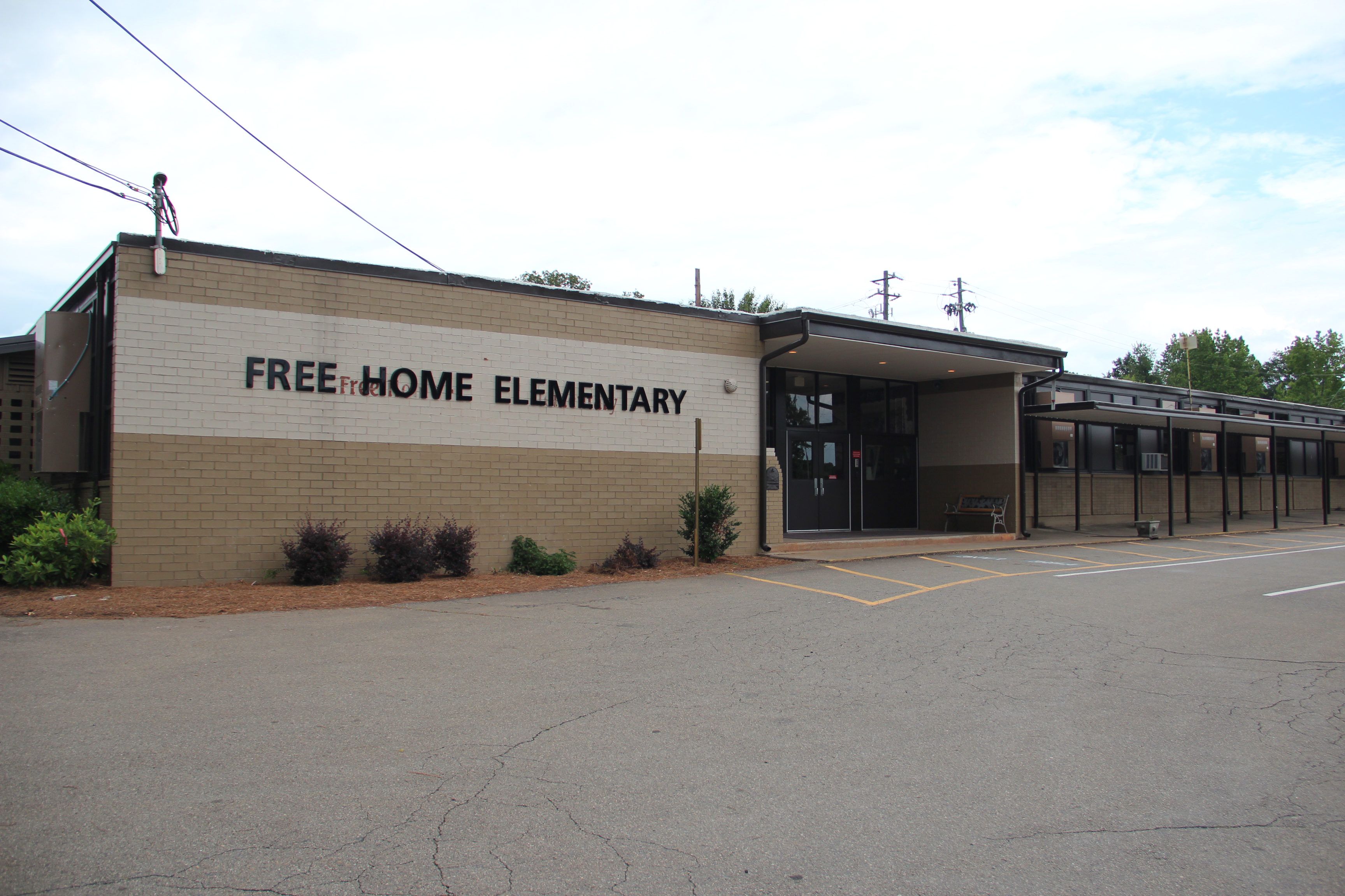
Free Home is an unincorporated community in the eastern part of Cherokee County, Georgia, United States. Centered at the intersection of state highways 20 and 372, the rural community has seen moderate suburbanization of the area since the late 1990s. It is home to Free Home Elementary School. The community is home to a Publix Supermarket center, which has a few stores/restaurants. There is also a Tractor Supply Company that was completed in September 2011. Free Home is about halfway between Ball Ground to the north and Milton to the south-southeast on Georgia 372 (also called Free Home Highway and Birmingham Highway, for the community now within Milton). On Cumming Highway (Georgia 20), it is also about halfway between Canton (west) and Cumming (east), the Cherokee and Forsyth county seat A county seat is an administrative center, seat of government, or capital city of a county or civil parish. The term is in use in Canada, China, Hungary, Romania, Taiwan, and the Unite ... [...More Info...] [...Related Items...] OR: [Wikipedia] [Google] [Baidu] |


