|
George Tyler Wood
George Tyler Wood (March 12, 1795 – September 3, 1858) was an American military officer and politician who served as the second Governor of Texas. Background Most records dealing with Wood's personal life have been lost due to fire or other causes. As a result many details about his life are unknown. Wood was born near Cuthbert, Georgia on March 12, 1795. His mother was Elizabeth Burris Wood. His father, name unknown, died when he was five. When he was nineteen, Wood raised a company of volunteers for the Creek War and fought in the Battle of Horseshoe Bend. According to tradition, Wood met Sam Houston and Edward Burleson during the campaign. Wood operated a successful dry goods business based in Cuthbert. During a buying trip in 1837 he met a young widow named Martha Evans Gindrat, daughter of Jesse and Elizabeth (Fitzpatrick) Evans, during a stop in Milledgeville, Georgia. The two married on September 18, 1837. The marriage produced two children in addition to the three Mart ... [...More Info...] [...Related Items...] OR: [Wikipedia] [Google] [Baidu] |
John Alexander Greer
John Alexander Greer (July 18, 1802 – July 4, 1855) was a Texan politician, and the second Lieutenant Governor of Texas serving under Governors George T. Wood and Peter H. Bell. Greer was born at Shelbyville, Tennessee on July 18, 1802. He was in Kentucky before moving to Texas in 1830. He represented San Augustine as a senator in the Congress of the Republic of Texas from 1837–1845. Anson Jones, the last president of the Republic of Texas, appointed him as secretary of the treasury in July 1845. He was the Lieutenant Governor of Texas from 1847–1851. He died on July 4, 1855.. Retrieved on July 31, 2009. John A. Greer is the namesake of Greer County, Oklahoma Greer County is a county located along the southwest border of the U.S. state of Oklahoma. As of the 2010 census, the population was 6,239. Its county seat is Mangum. From 1860 to 1896, the state of Texas claimed an area known as Greer County .... References {{DEFAULTSORT:Greer, John Alexand ... [...More Info...] [...Related Items...] OR: [Wikipedia] [Google] [Baidu] |
Battle Of Horseshoe Bend (1814)
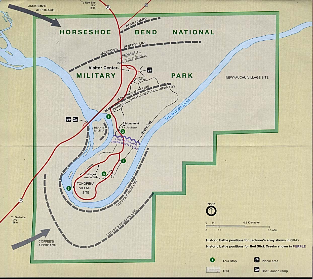
The Battle of Horseshoe Bend (also known as ''Tohopeka'', ''Cholocco Litabixbee'', or ''The Horseshoe''), was fought during the War of 1812 in the Mississippi Territory, now central Alabama. On March 27, 1814, United States forces and Indian allies under Major General Andrew Jackson defeated the Red Sticks, a part of the Creek Indian tribe who opposed American expansion, effectively ending the Creek War. Background The Creek Indians of Georgia and the eastern part of the Mississippi Territory had become divided into two factions: the Upper Creek (or Red Sticks), a majority who opposed American expansion and sided with the British and the colonial authorities of Spanish Florida during the War of 1812; and the Lower Creek, who were more assimilated into the Anglo culture, had a stronger relationship with the U.S. Indian Agent Benjamin Hawkins, and sought to remain on good terms with the Americans. The Shawnee war leader Tecumseh visited Creek and other Southeast Indian towns i ... [...More Info...] [...Related Items...] OR: [Wikipedia] [Google] [Baidu] |
Congress Of The Republic Of Texas
: ''For the current Texas legislative body, see Texas Legislature.'' The Congress of the Republic of Texas was the national legislature of the Republic of Texas established by the Constitution of the Republic of Texas in 1836. It was a bicameral legislature based on the model of the United States Congress. It was transformed into the Texas Legislature upon annexation of Texas by the United States in 1846. A vestige of it remains in the name of Austin's main north–south street leading from the State Capitol, Congress Avenue, when it was founded as the intended national capital. Membership and organization House of Representatives The House of Representatives was to be made up of 24-40 members. until such time as the population of the republic should exceed 100,000. When the population exceeded this number the house was to be made up of "not less than forty nor more than one hundred pieces provided that each county was entitled to at least one representative." Members of the Hous ... [...More Info...] [...Related Items...] OR: [Wikipedia] [Google] [Baidu] |
Plantations In The American South
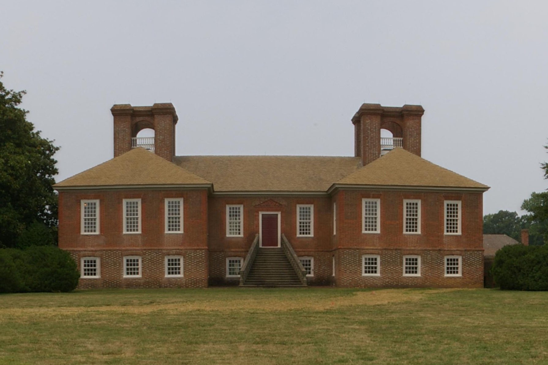
A plantation complex in the Southern United States is the built environment (or complex) that was common on agricultural plantations in the American South from the 17th into the 20th century. The complex included everything from the main residence down to the pens for livestock. Until the abolition of slavery, such plantations were generally self-sufficient settlements that relied on the forced labor of enslaved people. Plantations are an important aspect of the history of the Southern United States, particularly the antebellum era (pre-American Civil War). The mild temperate climate, plentiful rainfall, and fertile soils of the southeastern United States allowed the flourishing of large plantations, where large numbers of enslaved Africans or African Americans were held captive and forced to produce crops to create wealth for a white elite. Today, as was also true in the past, there is a wide range of opinion as to what differentiated a plantation from a farm. Typically, th ... [...More Info...] [...Related Items...] OR: [Wikipedia] [Google] [Baidu] |
San Jacinto County, Texas
San Jacinto County ( ) is a county in the U.S. state of Texas. As of the 2020 census, its population was 27,402. Its county seat is Coldspring. The county's name comes from the Battle of San Jacinto which secured Texas' independence from Mexico and established a republic in 1836. Geography According to the U.S. Census Bureau, the county has a total area of , of which are land and (9.3%) are covered by water. Major highways * U.S. Highway 59 ** Interstate 69 is currently under construction and will follow the current route of U.S. 59 in most places. * U.S. Highway 190 * State Highway 150 * State Highway 156 The TTC-69 component (recommended preferred) of the once-planned Trans-Texas Corridor went through San Jacinto County. Adjacent counties * Trinity County (north) * Polk County (east) * Liberty County (southeast) * Montgomery County (southwest) * Walker County (west) National protected area * Sam Houston National Forest (part) Demographics ''Note: the US ... [...More Info...] [...Related Items...] OR: [Wikipedia] [Google] [Baidu] |
Liberty County, Texas
Liberty County is a county in the U.S. state of Texas. As of the 2020 census, its population was 91,628. The county seat is Liberty. The county was created in 1831 as a municipality in Mexico and organized as a county in 1837. It is named for the popular American ideal of liberty. Liberty County is included in the Houston- The Woodlands-Sugar Land, TX metropolitan statistical area. Geography According to the U.S. Census Bureau, the county has a total area of , of which (1.5%) are covered by water. The Trinity River flows through this county, dividing the county roughly in half. The river begins on the northern border of Liberty County, forming the San Jacinto - Polk County line through the Liberty County line. The east fork of the San Jacinto River flows through far northeast parts of the county, flowing through Cleveland. Tarkington Bayou begins in the Sam Houston National Forest in San Jacinto County, working its way south through northeast and east Liberty County and j ... [...More Info...] [...Related Items...] OR: [Wikipedia] [Google] [Baidu] |
Trinity River (Texas)
The Trinity River is a river, the longest with a watershed entirely within the U.S. state of Texas. It rises in extreme northern Texas, a few miles south of the Red River. The headwaters are separated by the high bluffs on the southern side of the Red River. Indigenous peoples call the northern sections ''Arkikosa'' and the parts closer to the coast ''Daycoa''. French explorer Robert Cavelier de La Salle, in 1687, named it ''Riviere des canoës'' ("River of Canoes"). In 1690 Spanish explorer Alonso de León named the river ''"La Santísima Trinidad"'' ("the Most Holy Trinity"), in the Spanish Catholic practice of memorializing places by religious references. Course The Trinity River has four branches: the West Fork, the Clear Fork, the Elm Fork, and the East Fork. The West Fork Trinity River has its headwaters in Archer County. From there it flows southeast, through the man-made reservoirs Lake Bridgeport and Eagle Mountain Lake, and eastward through Lake Worth and the ... [...More Info...] [...Related Items...] OR: [Wikipedia] [Google] [Baidu] |
Colorado River (Texas)
The Colorado River is an approximately long river in the U.S. state of Texas. It is the 18th longest river in the United States and the longest river with both its source and its mouth within Texas. Its drainage basin and some of its usually dry tributaries extend into New Mexico. It flows generally southeast from Dawson County through Ballinger, Marble Falls, Lago Vista, Austin, Bastrop, Smithville, La Grange, Columbus, Wharton, and Bay City, before emptying into the Gulf of Mexico at Matagorda Bay. Course The Colorado River originates south of Lubbock, on the Llano Estacado near Lamesa. It flows generally southeast out of the Llano Estacado and through the Texas Hill Country, then through several reservoirs including Lake J.B. Thomas, E.V. Spence Reservoir, and O.H. Ivie Lake. The river flows through several more reservoirs before reaching Austin, including Lake Buchanan, Inks Lake, Lake Lyndon B. Johnson (commonly referred to as Lake LBJ), and Lake Travis. ... [...More Info...] [...Related Items...] OR: [Wikipedia] [Google] [Baidu] |
Brazos River
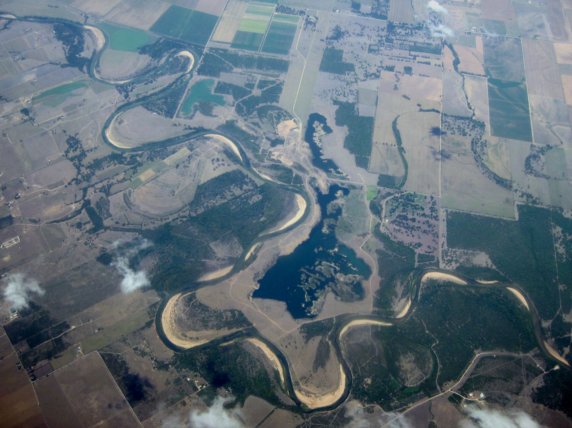
The Brazos River ( , ), called the ''Río de los Brazos de Dios'' (translated as "The River of the Arms of God") by early Spanish explorers, is the 11th-longest river in the United States at from its headwater source at the head of Blackwater Draw, Roosevelt County, New Mexico to its mouth at the Gulf of Mexico with a drainage basin. Being one of Texas' largest rivers,"Brazos River." Britannica Academic, Encyclopædia Britannica, 11 Aug. 2018. academic.eb.com/levels/collegiate/article/Brazos-River/16291. Accessed 27 Nov. 2018. it is sometimes used to mark the boundary between East Texas and West Texas. The river is closely associated with Texas history, particularly the Austin settlement and Texas Revolution eras. Today major Texas institutions such as Texas Tech University, Baylor University, and Texas A&M University are located close to the river's basin, as are parts of metropolitan Houston. Geography The Brazos proper begins at the confluence of the Salt Fork and Double ... [...More Info...] [...Related Items...] OR: [Wikipedia] [Google] [Baidu] |
Republic Of Texas
The Republic of Texas ( es, República de Tejas) was a sovereign state in North America that existed from March 2, 1836, to February 19, 1846, that bordered Mexico, the Republic of the Rio Grande in 1840 (another breakaway republic from Mexico), and the United States of America, although Mexico considered it a rebellious province during its entire existence despite the Treaties of Velasco of May 1836. It was bordered by Mexico to the west and southwest, the Gulf of Mexico to the southeast, the two U.S. states of Louisiana and Arkansas to the east and northeast, and Territories of the United States, United States territories encompassing parts of the current U.S. states of Oklahoma, Kansas, Colorado, Wyoming, and New Mexico to the north and west. The Anglo residents of the area and of the republic became known as Texians. The region of the Mexican state of Coahuila y Tejas, now commonly referred to as Mexican Texas, declared its independence from Mexico during the Texas Revo ... [...More Info...] [...Related Items...] OR: [Wikipedia] [Google] [Baidu] |
Georgia General Assembly
The Georgia General Assembly is the state legislature of the U.S. state of Georgia. It is bicameral, consisting of the Senate and the House of Representatives. Each of the General Assembly's 236 members serve two-year terms and are directly elected by constituents of their district.. georgia.gov. Retrieved June 26, 2008. The Constitution of Georgia vests all legislative power with the General Assembly. Both houses have similar powers, though each has unique duties as well. For example, the origination of appropriations bills only occurs in the House, while the Senate is tasked with confirmation of the Governor's appointments. The General Assembly meets in the Georgia State Capitol in Atlanta. History The General Assembly, which is the legislative branch of the state's government, was created in 1777 during the American Revolution—it is older than the United States Congress. During its existence the Assembly has moved four different times when the state capital changed i ... [...More Info...] [...Related Items...] OR: [Wikipedia] [Google] [Baidu] |
Milledgeville, Georgia
Milledgeville is a city in and the county seat of Baldwin County in the U.S. state of Georgia. It is northeast of Macon and bordered on the east by the Oconee River. The rapid current of the river here made this an attractive location to build a city. It was the capital of Georgia from 1804 to 1868, including during the American Civil War. Milledgeville was preceded as the capital city by Louisville and was succeeded by Atlanta, the current capital. Today U.S. Highway 441 connects Milledgeville to Madison, Athens, and Dublin. As of April 1, 2020, the population of Milledgeville was 17,070 down from 17,715 at the 2010 US Census. Milledgeville is along the route of the Fall Line Freeway, which is under construction to link Milledgeville with Augusta, Macon, Columbus, and other Fall Line cities. They have long histories from the colonial era of Georgia. Milledgeville is the principal city of the Milledgeville Micropolitan Statistical Area, a micropolitan area that include ... [...More Info...] [...Related Items...] OR: [Wikipedia] [Google] [Baidu] |


