|
George H. Guernsey
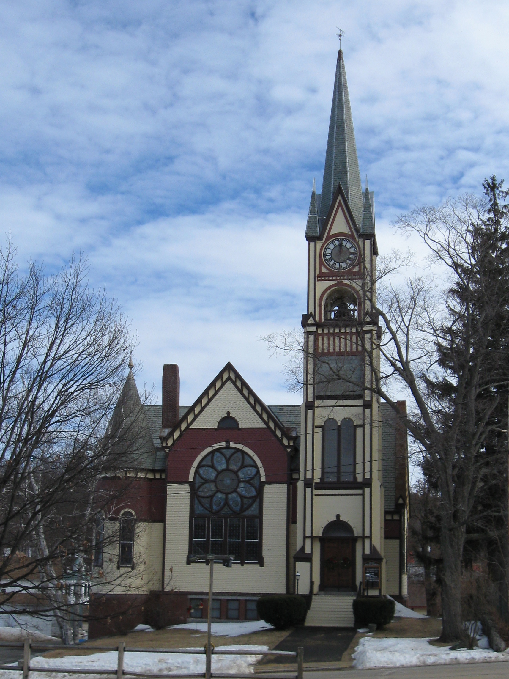
George H. Guernsey (December 10, 1839 – November 28, 1900) was an American architect from Montpelier, Vermont. Life Guernsey was born on December 10, 1839, in Calais, Vermont, to Gilman and Clotina (Southwick) Guernsey. He served in the Civil War, after which he relocated to Montpelier. After working as a builder, he established himself as an architect. He would go on to become the leading architect in Vermont.Papazian, Lyssa. "Guernsey, George H". ''The Vermont Encyclopedia''. Ed. John J. Duffy, Samuel B. Hand, and Ralph H. Orth. Burlington, VT: University of Vermont Press, 2003. In 1897, he was elected as Montpelier's third mayor. He died of tuberculosis at home in 1900. Guernsey was buried at Green Mount Cemetery in Montpelier. Legacy Many of Guernsey's buildings contribute to historic districts on the National Register of Historic Places, in addition to one individual structure. In 2013, a book called ''Vermont's Elusive Architect: George H. Guernsey'' was published ... [...More Info...] [...Related Items...] OR: [Wikipedia] [Google] [Baidu] |
Calais, Vermont
Calais is a town in Washington County, Vermont, United States. The population was 1,661 at the 2020 census. Calais is homophonous with ''callous''. Calais contains the unincorporated communities of Adamant, East Calais, North Calais, Kent's Corner, Maple Corner and Pekin. History Colonel Jacob Davis named Calais after the French port city of the same name, during a time of general enthusiasm for things French as a result of France's aid during the American Revolution. The Wheelocks and Parkers were the first families to settle the town, in the latter part of the 18th century. In the early and mid 19th century, the Vermont wool industry spawned sheep pastures in the town. Photographs of the time show a heavily de-forested Calais. Like many small Vermont towns, Calais was devastated by the Civil War. Volunteers from Calais flocked to the Union cause, most serving in the Army's volunteer regiments. In the post-Civil War era, agriculture turned from sheep to dairy, and new fam ... [...More Info...] [...Related Items...] OR: [Wikipedia] [Google] [Baidu] |
Bennington, Vermont
Bennington is a New England town, town in Bennington County, Vermont, Bennington County, Vermont, United States. It is one of two shire towns (county seats) of the county, the other being Manchester (town), Vermont, Manchester. As of the 2020 United States Census, US Census, the population was 15,333. Bennington is the most populous town in southern Vermont, the List of towns in Vermont, second-largest town in Vermont (after Colchester, Vermont, Colchester) and the sixth-largest municipality in the state, including the cities of Burlington, Vermont, Burlington, Rutland (city), Vermont, Rutland, and South Burlington, Vermont, South Burlington. The town is home to the Bennington Battle Monument, which is the tallest human-made structure in the Vermont, state of Vermont. The town has a long history of manufacturing, primarily within wood processing. The town is also recognized nationally for its pottery, iron, and textiles. History First of the New Hampshire Grants, Bennington ... [...More Info...] [...Related Items...] OR: [Wikipedia] [Google] [Baidu] |
Vermont Law School
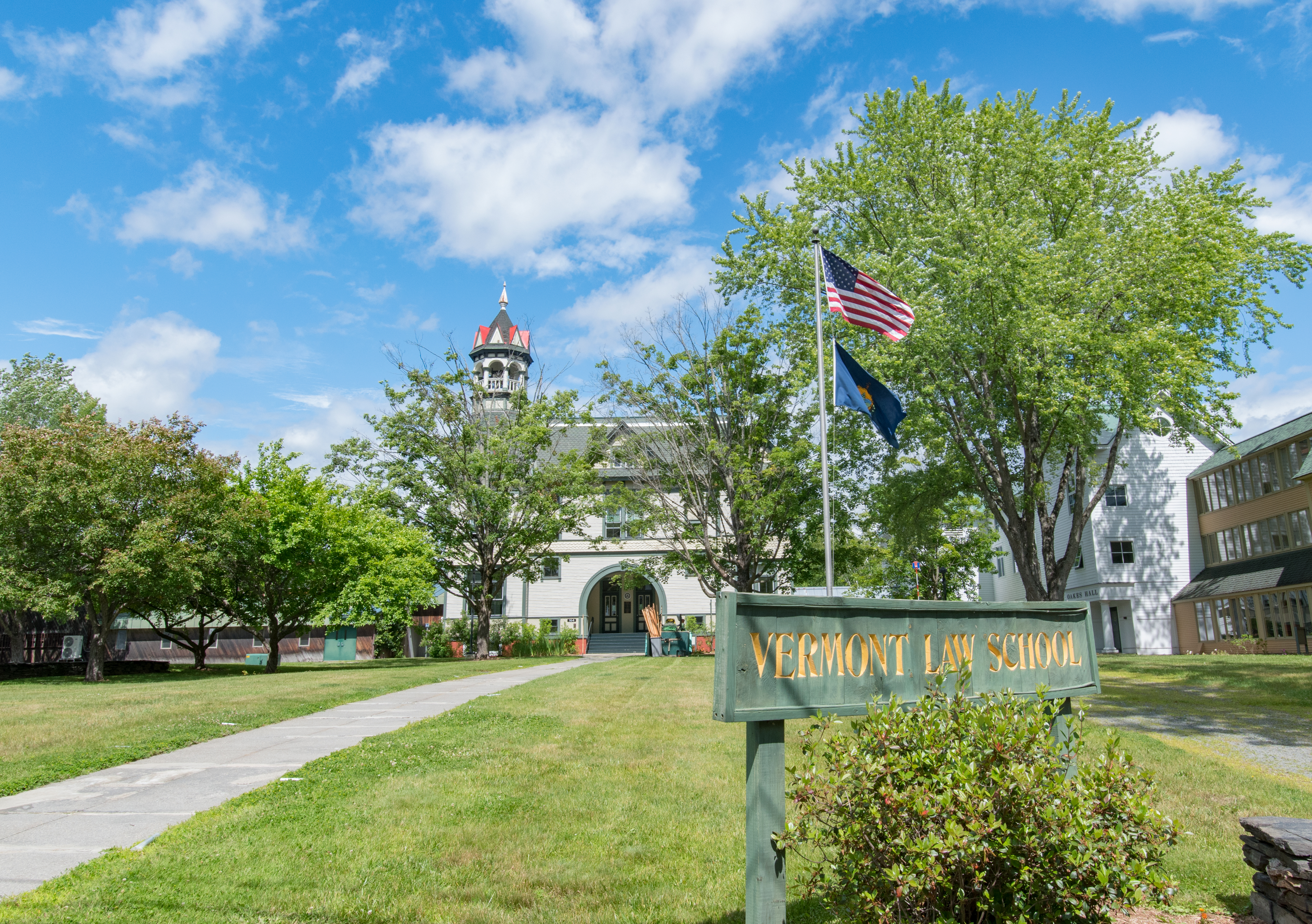
Vermont Law and Graduate School (VLGS) is a private law and public policy graduate school in South Royalton, Vermont. It offers several degrees, including Juris Doctor (JD), Master of Laws (LLM) in Environmental Law, Master of Environmental Law and Policy (MELP), Master of Food and Agriculture Law and Policy (MFALP), Master of Energy Regulation and Law (MERL), and dual degrees with a diverse range of institutions. According to the school's 2018 ABA-required disclosures, 61.5% of the Class of 2018 obtained full-time, long-term, JD-required employment nine months after graduation. History Vermont Law School was founded in 1972 by Anthony Doria and held its first classes in the summer of 1973 with 113 students in what was then known as the old South Royalton schoolhouse. In December 1973, VLS was certified by the Vermont State Board of Education as an institution of higher learning. Doria resigned as dean of the school in 1974, after it emerged that he had been convicted of embezzle ... [...More Info...] [...Related Items...] OR: [Wikipedia] [Google] [Baidu] |
Debevoise Hall
Debevoise Hall is the main academic building of the Vermont Law School, in South Royalton, Vermont. The Queen Anne-style structure was built in 1892 as Royalton's schoolhouse, and became the law school's first building in 1973. The building contributes to the South Royalton Historic District, on the National Register of Historic Places.. Attributes The original building is designed in the Queen Anne style. It has a wood frame, 2.5 stories, clapboard siding, and a brick foundation. The southeast corner of the building is topped with an ornate eight-sided belfry. The building was likely designed by George H. Guernsey, who designed the South Royalton business block. The school building is a contributing part of the South Royalton Historic District, on the National Register of Historic Places The National Register of Historic Places (NRHP) is the United States federal government's official list of districts, sites, buildings, structures and objects deemed worthy of preserv ... [...More Info...] [...Related Items...] OR: [Wikipedia] [Google] [Baidu] |
Bradford, Vermont
Bradford is a town in Orange County, Vermont, United States. The population was 2,790 at the 2020 census. Bradford is located on the county's eastern border, bordering both the Connecticut River and New Hampshire, and is a commercial center for some of its surrounding towns. History The earliest name of the settlement was Wait's River Town or Waitstown,Silas McKeen, ''A History of Bradford, Vermont'' (J.D. Clark & Son: Montpelier, Vermont: 1875), pp. 29-30. in honor of Joseph Wait, a member of Rogers' Rangers."Bradford" in ''The Vermont Encyclopedia'' (eds. John J. Duffy, Samuel B. Hand & Ralph H. Orth: University of Vermont Press, 2003), p. 61. The town was originally part of Gloucester County in the Province of New York before becoming part of Vermont. In 1770, the town was established by New York patent: 3,000 acres (1200 hectares) were granted on May 3, 1770, and the town was named Mooretown after Sir Henry Moore, 1st Baronet, then the royal governor of New York. On Oc ... [...More Info...] [...Related Items...] OR: [Wikipedia] [Google] [Baidu] |
Chester, Vermont
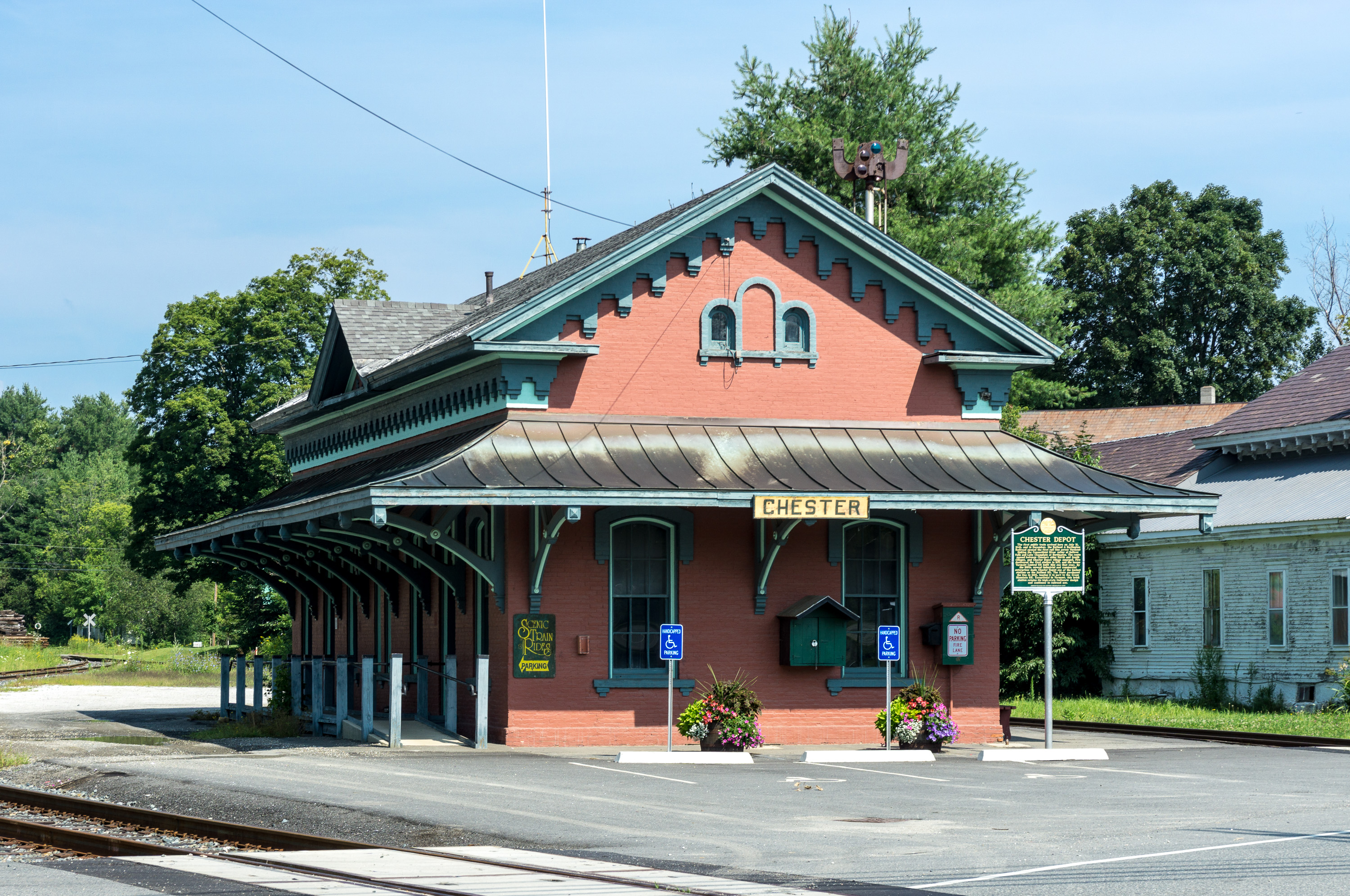
Chester is a town in Windsor County, Vermont, United States. The population was 3,005 at the 2020 census. History The town was originally chartered by New Hampshire Governor Benning Wentworth as Flamstead in 1754. The terms of the charter were not met and the town was re-chartered as New Flamstead in 1761. In 1766, a patent was issued by New York that changed the name of the town to Chester, after George Augustus Frederick, the Earl of Chester and the eldest son of King George III. Later, the governing authority of Chester reverted to the 1761 charter by an act of the Vermont legislature, although it left the name "Chester" in place. 2011 was thus the 250th anniversary of the town. Geography According to the United States Census Bureau, the town has a total area of , of which is land and , or 0.46%, is water. A prominent geological feature of the town is the Williams River, a tributary of the Connecticut River, whose three branches come together as a central river and run thr ... [...More Info...] [...Related Items...] OR: [Wikipedia] [Google] [Baidu] |
Saint Augustine Church, Montpelier
Saint Augustine Church is a Roman Catholic church dedicated to Saint Augustine and located on Barre Street in Montpelier, Vermont. History Beginning The first Catholic mass in Montpelier was celebrated by the "Apostle of Vermont", Father Jeremiah O'Callaghan in the autumn of 1830. The first members of the parish were French Canadians. Mass was celebrated at parishioners houses' for the first two decades. In 1850, the old courthouse was purchased, and mass was celebrated there for nine years. Court Street Church In 1850, a Québecois priest, the Reverend Hector Drolet, moved to Montpelier to become the first resident Catholic priest in the city. He also needed to find a site for a permanent Roman Catholic church in the city. Drolet purchased a small former brick courthouse on Court Street, located about 300 yards east of the Vermont State House. The old courthouse had been replaced by the new Washington County Court House on State Street. The Vermont General Assembly ... [...More Info...] [...Related Items...] OR: [Wikipedia] [Google] [Baidu] |
Ludlow (town), Vermont
Ludlow is a town in Windsor County, Vermont, Windsor County, Vermont, United States. The population was 2,172 at the 2020 United States Census, 2020 census. Ludlow is the home of Okemo Mountain, a popular ski resort. Before becoming a ski destination, Ludlow was originally a mill town, and was the home of a General Electric plant until 1977. It was named after Ludlow, Massachusetts which is less than 100 miles away. There is also a Ludlow (village), Vermont, village of Ludlow in the town. Geography According to the United States Census Bureau, the town has a total area of , of which is land and , or 1.46%, is water. Within the town are located the village (Vermont), incorporated village of Ludlow (village), Vermont, Ludlow and the small hamlets of Grahamville and Smithville. Lake Rescue (Vermont), Lake Rescue, a popular lake for recreational activities, is located about three miles north of the town center along Vermont Route 100. Vermont Route 103 passes east–west through the c ... [...More Info...] [...Related Items...] OR: [Wikipedia] [Google] [Baidu] |
Underhill, Vermont
Underhill is a town in Chittenden County, Vermont, United States. The population was 3,129 at the 2020 census. The town of Underhill shares a fire department with Jericho, the Underhill-Jericho Fire Department. Geography According to the United States Census Bureau, the town has a total area of 51.4 mi2 (133.1 km2), of which 51.3 mi2 (133.0 km2) is land and 0.1 mi2 (0.1 km2) (0.10%) is water. Underhill is home to the highest summit within the state, Mount Mansfield, which has a peak elevation of above sea level. The Browns River is the primary waterway within the town and originates as a stream from Mount Mansfield. It runs southwest and converges in the valley, just east of the village of Underhill Center with two other streams that also originate from Mount Mansfield; first with Stevensville Brook, and then with Clay Brook about further. Harvey Brook, Cranes Brook, and Mill Brook draining from other hillsides within the town also converge wi ... [...More Info...] [...Related Items...] OR: [Wikipedia] [Google] [Baidu] |
Lakeport, New Hampshire
Lakeport is a neighborhood in the city of Laconia in Belknap County, New Hampshire, in the United States. It was once known as "Lake Village" and is centered on a power dam on the short river channel between Paugus Bay (an arm of Lake Winnipesaukee) to the north, and Opechee Bay to the south. Lakeport lies approximately north of downtown Laconia. During the summer months the Lakeport train station is the southern destination of the Winnipesaukee Scenic Railroad. Trains are boarded at Weirs Beach or Meredith to the north. Once a busy center for entertainment, the business area of Lakeport now consists of a couple of convenience stores, several restaurants, a large hotel on Opechee Bay, a small post office, and other small businesses. Over the past few years projects to revitalize the area have included redesign of the main intersection, replacement of the Lakeport Bridge, new plantings and foot bridges for pedestrians. Such projects have encouraged new business growth and inve ... [...More Info...] [...Related Items...] OR: [Wikipedia] [Google] [Baidu] |
United Baptist Church Of Lakeport
United Baptist Church of Lakeport (also known as Lake Village Free Baptist Church or Park Street Baptist Church) is a historic church at 35 Park Street in the village of Lakeport in Laconia, New Hampshire, United States. Built in 1891 after a fire destroyed an older church, it is an eclectic local example of Late Victorian architecture. It was listed on the National Register of Historic Places in 1985. Architecture and history The United Baptist Church of Lakeport is located in the village of Lakeport, on a lot extending to both Park Street and Railroad Avenue. It is a -story wood-frame structure, with a steeply pitched gable roof. It is basically cruciform in plan, with wide gabled transepts projecting from the sides. On the facade facing Park Street, the transept is flanked on one side by a two-stage tower capped by a conical turret, and the other by a five-stage square tower. The lower level of the building is faced in brick, while the upper levels are finished in a var ... [...More Info...] [...Related Items...] OR: [Wikipedia] [Google] [Baidu] |
Rutland (city), Vermont
The city of Rutland is the seat of Rutland County, Vermont, United States. As of the 2020 census, the city had a total population of 15,807. It is located approximately north of the Massachusetts state line, west of New Hampshire state line, and east of the New York state line. Rutland is the third largest city in the state of Vermont after Burlington and South Burlington. It is surrounded by the town of Rutland, which is a separate municipality. The downtown area of the city is listed as a historic district on the National Register of Historic Places. History The town of Rutland was chartered in 1761 and named after John Manners, 3rd Duke of Rutland. It was settled in 1770 and served as one of the capitals of the Republic of Vermont. In the early 19th century, small high-quality marble deposits were discovered in Rutland, and in the 1830s a large deposit of nearly solid marble was found in what is now West Rutland. By the 1840s, small firms had begun excavations, but ... [...More Info...] [...Related Items...] OR: [Wikipedia] [Google] [Baidu] |

.jpg)


