|
Geology Of Nauru
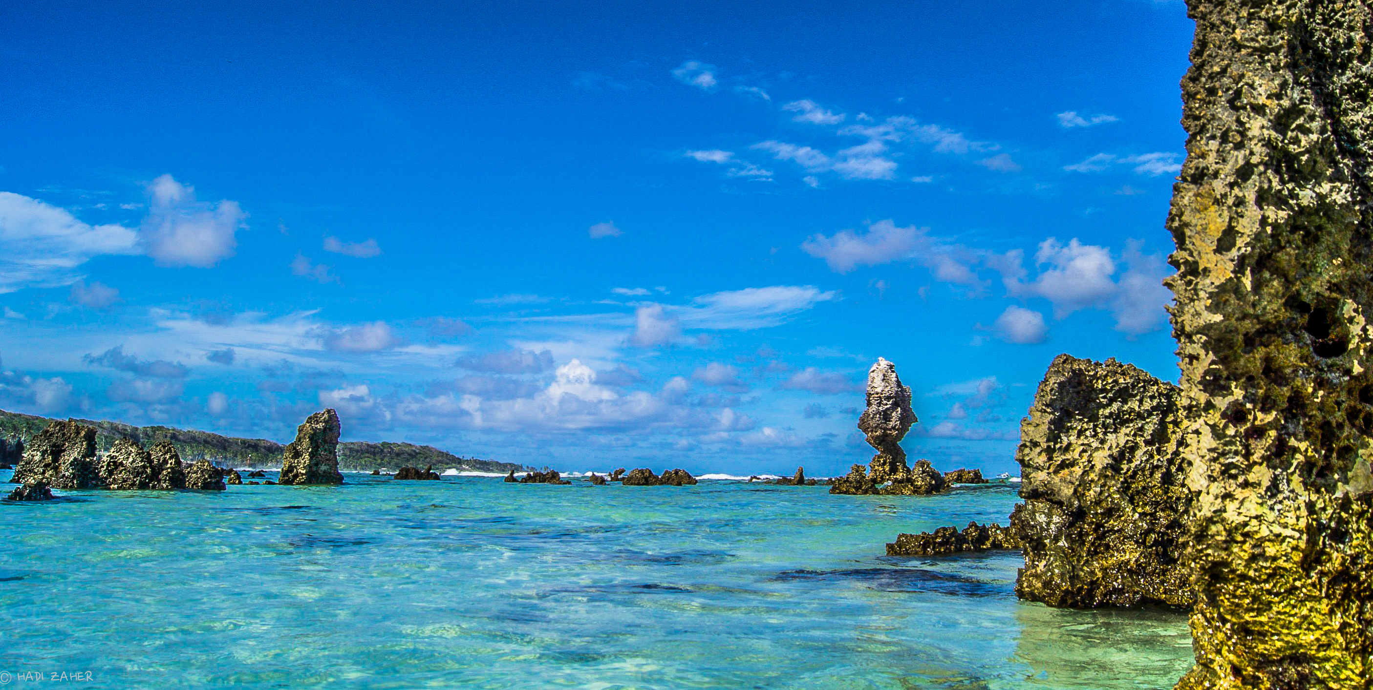
Nauru is positioned in the Nauru Basin of the Pacific Ocean, on a part of the Pacific Plate that formed at a mid oceanic ridge at 132 Ma. From mid Eocene (35 Ma) to Oligocene times a submarine volcano built up over a hotspot, and formed a seamount composed of basalt. The seamount rises over 4300 m above the ocean floor. This hotspot developed simultaneously with a major Pacific Plate reorganisation. The volcano was eroded to sealevel and a coral atoll grew on top to a thickness of about 500 m. Coral near the surface has been dated from 5 to 0.3 Ma. The original limestone has been dolomitised by magnesium from sea water. The coral was raised above sea level about 30 m, and is now a dolomite limestone outcrop which was eroded in classic karst style into pinnacles up to 20 m high. To at least a depth of 55 m below sea level, the limestone has been dissolved forming cavities, sinkholes and caves. The island was a seabird rookery and depressi ... [...More Info...] [...Related Items...] OR: [Wikipedia] [Google] [Baidu] |
Magnesium
Magnesium is a chemical element with the symbol Mg and atomic number 12. It is a shiny gray metal having a low density, low melting point and high chemical reactivity. Like the other alkaline earth metals (group 2 of the periodic table) it occurs naturally only in combination with other elements and it almost always has an oxidation state of +2. It reacts readily with air to form a thin passivation coating of magnesium oxide that inhibits further corrosion of the metal. The free metal burns with a brilliant-white light. The metal is obtained mainly by electrolysis of magnesium salts obtained from brine. It is less dense than aluminium and is used primarily as a component in strong and lightweight alloys that contain aluminium. In the cosmos, magnesium is produced in large, aging stars by the sequential addition of three helium nuclei to a carbon nucleus. When such stars explode as supernovas, much of the magnesium is expelled into the interstellar medium where it ma ... [...More Info...] [...Related Items...] OR: [Wikipedia] [Google] [Baidu] |
Moqua Well
The Moqua Well is a small underground lake, in Nauru. History During World War II, Moqua Well was the primary source of drinking water for inhabitants of Nauru."Moqua Caves and Moqua Well" Gatis Pāvils, 30 October 2011. It is for this reason that the body of water is referred to as a instead of a lake."Nauru – Attractions" iExplore. In 2001, Nauruan authorities decided to put up a fence to prevent accidents, after an alcohol-related drowning in the same year. [...More Info...] [...Related Items...] OR: [Wikipedia] [Google] [Baidu] |
Anabar District
Anabar is a district in the Pacific country of Nauru. Geography It is part of the Anabar Constituency. It is located in the northeast of the island, covers an area of 1.5 km² and has a population of 452 (2011). History Anabar, along with neighbouring district of Ijuw, is believed to be the 3rd areas to submerged after Buada first and Anibare second about 3000+ years ago. Its first inhabitants are Deiboe clans people, led by Deianoang, who fled to save his family of three daughters, from the raging war of Atemor's open field between Eamwit clansmen off Anuquoge village and his clan, the Deiboe people from Ganokoro. Irutsi clan was born amongst the rocky regions of Abodeatsi where three men slaves and two slave women met during a month-long hide amidst the rocky region, who five slave people later intermarried each other to expand the population along the rocky regions of Anabar. Anabar's pond 'Tibinor' was the deepest pond on the island. Such legends like the ones of ... [...More Info...] [...Related Items...] OR: [Wikipedia] [Google] [Baidu] |
Buada Lagoon
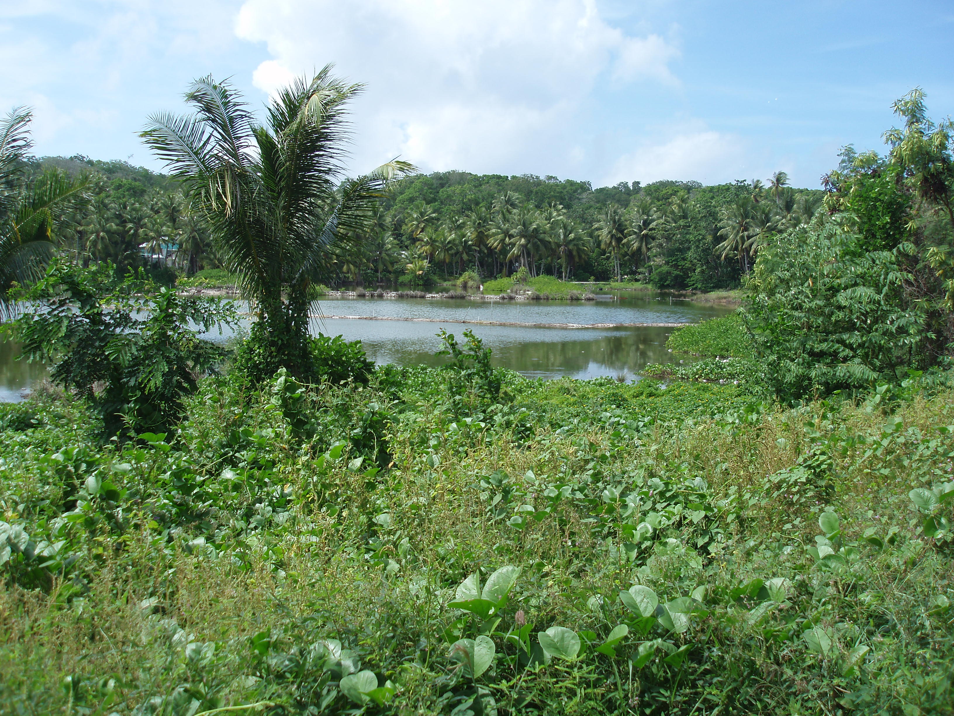
Buada Lagoon is a landlocked, slightly brackish, freshwater lake of Buada District in the island nation of Nauru. It occupies about . The lagoon is classified as an endorheic lake, meaning there is no outflow to other bodies of water such as oceans or rivers. The Buada Lagoon is the biggest and only true lake in Nauru, a small independent republic in Oceania consisting of a flat island of 21.3 km² in area. The lake lies in Nauru's Buada district, from which it gets its name. It is not a lagoon as such, in that the lake is not joined to the sea, but its water is slightly brackish. Freshwater is rare in Nauru, being present only in the form of a small phreatic zone, the Moqua Well (a small underground lake) and the Buada Lagoon, which is the most visible, rivers and streams being utterly absent from the country. The lake has traditionally been used for pisciculture, which saw the raising of milkfish for human consumption through the centuries, and even though this pra ... [...More Info...] [...Related Items...] OR: [Wikipedia] [Google] [Baidu] |
Lineament
''See also Line (geometry)'' A lineament is a linear feature in a landscape which is an expression of an underlying geological structure such as a fault. Typically a lineament will appear as a fault-aligned valley, a series of fault or fold-aligned hills, a straight coastline or indeed a combination of these features. Fracture zones, shear zones and igneous intrusions such as dykes can also be expressed as geomorphic lineaments. Lineaments are often apparent in geological or topographic maps and can appear obvious on aerial or satellite photographs. There are for example, several instances within Great Britain. In Scotland the Great Glen Fault and Highland Boundary Fault give rise to lineaments as does the Malvern Line in western England and the Neath Disturbance in South Wales. The term 'megalineament' has been used to describe such features on a continental scale. The trace of the San Andreas Fault might be considered an example.Whitten & Brooks, The Penguin Dictionary of Ge ... [...More Info...] [...Related Items...] OR: [Wikipedia] [Google] [Baidu] |
Ijuw District
Ijuw is a district in the country of Nauru, located in the northeast of the island. The area covers 1.1 km2 and has a population of 180, making Ijuw the least populated district in the country. Geography Ijuw borders Anabar District to the north and Anibare District to the south. It is a part of the Anabar Constituency. Cape Ijuw is the northernmost point of Anibare Bay, and the easternmost point of Nauru. Two former village A village is a clustered human settlement or community, larger than a hamlet but smaller than a town (although the word is often used to describe both hamlets and smaller towns), with a population typically ranging from a few hundred ...s, Ijuw and Ganokoro, are located within the district. See also * Ijuh * Anibare Bay#Physical features * List of settlements in Nauru References External links Districts of Nauru Populated places in Nauru {{Nauru-geo-stub ... [...More Info...] [...Related Items...] OR: [Wikipedia] [Google] [Baidu] |
Anibare Bay
Anibare Bay is a large bay located in the Anibare District of eastern Nauru island. Physical features It is bordered by capes to the north and south, in Ijuw and Meneng districts respectively. Its Anibare Beach is in excess of two kilometers long. Anibare Bay was formed by the underwater collapse of the east side of the volcano that underlies Nauru. A large arc shaped block slid away from the side of Nauru and rotated out. This block extends to about 1100 m below sea level, with rough bulging landslide deposits down to 2000 m below sea level. Natural ripcurrent hazards While Anibare Bay is popular with tourists and naturalists, it can be at times dangerous owing to frequent heavy surf and the presence of rip currents. Anibare Bay Escarpment Important Bird Area The Anibare Bay escarpment is a line of wooded cliffs overlooking the bay. It ranges in gradient from vertical cliffs to gradually sloping areas, and contains the richest remaining native vegetation on the island. ... [...More Info...] [...Related Items...] OR: [Wikipedia] [Google] [Baidu] |
Guano
Guano (Spanish from qu, wanu) is the accumulated excrement of seabirds or bats. As a manure, guano is a highly effective fertilizer due to the high content of nitrogen, phosphate, and potassium, all key nutrients essential for plant growth. Guano was also, to a lesser extent, sought for the production of gunpowder and other explosive materials. The 19th-century seabird guano trade played a pivotal role in the development of modern input-intensive farming. The demand for guano spurred the human colonization of remote bird islands in many parts of the world. Unsustainable seabird guano mining processes can result in permanent habitat destruction and the loss of millions of seabirds. Bat guano is found in caves throughout the world. Many cave ecosystems are wholly dependent on bats to provide nutrients via their guano which supports bacteria, fungi, invertebrates, and vertebrates. The loss of bats from a cave can result in the extinction of species that rely on their guano. U ... [...More Info...] [...Related Items...] OR: [Wikipedia] [Google] [Baidu] |
Phosphate
In chemistry, a phosphate is an anion, salt, functional group or ester derived from a phosphoric acid. It most commonly means orthophosphate, a derivative of orthophosphoric acid . The phosphate or orthophosphate ion is derived from phosphoric acid by the removal of three protons . Removal of one or two protons gives the dihydrogen phosphate ion and the hydrogen phosphate ion ion, respectively. These names are also used for salts of those anions, such as ammonium dihydrogen phosphate and trisodium phosphate. File:3-phosphoric-acid-3D-balls.png, Phosphoricacid File:2-dihydrogenphosphate-3D-balls.png, Dihydrogenphosphate File:1-hydrogenphosphate-3D-balls.png, Hydrogenphosphate File:0-phosphate-3D-balls.png, Phosphate In organic chemistry, phosphate or orthophosphate is an organophosphate, an ester of orthophosphoric acid of the form where one or more hydrogen atoms are replaced by organic groups. An example is trimethyl phosphate, . The term also refers to the triv ... [...More Info...] [...Related Items...] OR: [Wikipedia] [Google] [Baidu] |
Rookery
A rookery is a colony of breeding animals, generally gregarious birds. Coming from the nesting habits of rooks, the term is used for corvids and the breeding grounds of colony-forming seabirds, marine mammals (true seals and sea lions), and even some turtles. Rooks (northern-European and central-Asian members of the crow family) have multiple nests in prominent colonies at the tops of trees. Paleontological evidence points to the existence of rookery-like colonies in the pterosaur ''Pterodaustro''. The term ''rookery'' was also borrowed as a name for dense slum housing in nineteenth-century cities, especially in London. See also *Auca Mahuevo, for a titanosaurid sauropod dinosaur rookery *Bird colony *Heronry *Rook shooting Rook shooting was a previously popular sport in the United Kingdom, in which young rooks were shot from tree branches, often using purpose-built rifles known as rook rifles. Rook shooting could serve as a form of pest control, a blood sport ... R ... [...More Info...] [...Related Items...] OR: [Wikipedia] [Google] [Baidu] |
Seabird
Seabirds (also known as marine birds) are birds that are adapted to life within the marine environment. While seabirds vary greatly in lifestyle, behaviour and physiology, they often exhibit striking convergent evolution, as the same environmental problems and feeding niches have resulted in similar adaptations. The first seabirds evolved in the Cretaceous period, and modern seabird families emerged in the Paleogene. In general, seabirds live longer, breed later and have fewer young than other birds do, but they invest a great deal of time in their young. Most species nest in colonies, which can vary in size from a few dozen birds to millions. Many species are famous for undertaking long annual migrations, crossing the equator or circumnavigating the Earth in some cases. They feed both at the ocean's surface and below it, and even feed on each other. Seabirds can be highly pelagic, coastal, or in some cases spend a part of the year away from the sea entirely. Seabirds and ... [...More Info...] [...Related Items...] OR: [Wikipedia] [Google] [Baidu] |


