|
General Coote (1781 EIC Ship)
''General Coote'' was built by John Barnard probably at Barnard's Wharf in Rotherhithe and launched in 1781 or 1782 as an East Indiaman. Between 1782 and 1797 she made six voyages to India or China for the British East India Company (EIC). On the last voyage she participated as a transport in a campaign. She was sold in 1797. Career 1st EIC voyage (1782–1784): Captain Daniel Griffith Hoare sailed from Gravesend on 7 May 1782 and arrived at Portsmouth on 23 May, from Sunderland. She sailed from Portsmouth on 11 September 1782, bound for Madras and China, and in company with , , and several other East Indiamen. ''General Coote'' reached Madras on 9 April 1783 Madras and Malacca on 6 September; she arrived at Whampoa Anchorage on 7 October. At Madras there had been cargo destined for China that had belonged to , , and . (''Earl of Hertford'' had foundered at Madras on 15 October 1782.) ''General Coote'', , and ''Montague'' carried the cargo to Canton. Homeward bound, ''General ... [...More Info...] [...Related Items...] OR: [Wikipedia] [Google] [Baidu] |
Flag Of The British East India Company (1707)
The flag of the East India Company was used to represent the East India Company, which was chartered in England in 1600. The flag was altered as the nation changed from England to Great Britain to the United Kingdom. It was initially a red and white striped ensign with the flag of England in the canton. The flag displayed in the canton was later replaced by the flag of Great Britain and then the flag of the United Kingdom, as the nation developed. Early years Upon receiving a Royal Charter to trade in the Indian Ocean from Queen Elizabeth I in 1600, the English East India Company adopted a flag of red and white stripes (varying from nine to thirteen stripes in total), with the flag of England in the canton. It was reported that the number of stripes was chosen because many of the East India Company's shareholders were Freemasons, and the number thirteen is considered powerful in Freemasonry. However, different reports gave varying initial numbers of stripes. The flag cause ... [...More Info...] [...Related Items...] OR: [Wikipedia] [Google] [Baidu] |
Cape Of Good Hope
The Cape of Good Hope ( af, Kaap die Goeie Hoop ) ;''Kaap'' in isolation: pt, Cabo da Boa Esperança is a rocky headland on the Atlantic coast of the Cape Peninsula in South Africa. A common misconception is that the Cape of Good Hope is the southern tip of Africa, based on the misbelief that the Cape was the dividing point between the Atlantic and Indian oceans, and have nothing to do with north or south. In fact, by looking at a map, the southernmost point of Africa is Cape Agulhas about to the east-southeast. The currents of the two oceans meet at the point where the warm-water Agulhas current meets the cold-water Benguela current and turns back on itself. That oceanic meeting point fluctuates between Cape Agulhas and Cape Point (about east of the Cape of Good Hope). When following the western side of the African coastline from the equator, however, the Cape of Good Hope marks the point where a ship begins to travel more eastward than southward. Thus, the first mode ... [...More Info...] [...Related Items...] OR: [Wikipedia] [Google] [Baidu] |
1781 Ships
Events January–March * January – William Pitt the Younger, later Prime Minister of Great Britain, enters Parliament, aged 21. * January 1 – Industrial Revolution: The Iron Bridge opens across the River Severn in England. * January 2 – Virginia passes a law ceding its western land claims, paving the way for Maryland to ratify the Articles of Confederation. * January 5 – American Revolutionary War: Richmond, Virginia is burned by British naval forces, led by Benedict Arnold. * January 6 – Battle of Jersey: British troops prevent the French from occupying Jersey in the Channel Islands. * January 17 – American Revolutionary War – Battle of Cowpens: The American Continental Army, under Daniel Morgan, decisively defeats British forces in South Carolina. * February 2 – The Articles of Confederation are ratified by Maryland, the 13th and final state to do so. * February 3 – Fourth Anglo-Dutch War – Captu ... [...More Info...] [...Related Items...] OR: [Wikipedia] [Google] [Baidu] |
Balambangan Island
Balambangan Island ( ms, Pulau Balambangan) is an island in Kudat Division, Sabah, Malaysia. It is located off the northern tip of Borneo and is situated just about 3 kilometres west of Banggi Island. It is now part of the Tun Mustapha Marine Park. History Alexander Dalrymple, an officer of the East India Company (EIC), concluded an agreement with Sultan Bantilan Muizzud-Din on 12 September 1762 whereby the Sultanate of Sulu ceded the island of Balambangan to the company, and Dalrymple took possession of the island on 22 January 1763. The establishment of a factory on Balambangan was officially approved by a committee of the board of directors in 1768 and Dalrymple was offered the role of management of the new settlement. However, Dalrymple quarrelled with the directors, and his insistence on absolute management of Balambangan led to his dismissal in March 1771. Dalrymple was replaced by John Herbert who commanded the ''Britannia'' as it transported soldiers, goods, and suppl ... [...More Info...] [...Related Items...] OR: [Wikipedia] [Google] [Baidu] |
Simon's Bay
Simon's Town ( af, Simonstad), sometimes spelled Simonstown, is a town in the Western Cape, South Africa and is home to Naval Base Simon's Town, the South African Navy's largest base. It is located on the shores of False Bay, on the eastern side of the Cape Peninsula. For more than two centuries it has been a naval base and harbour (first for the British Royal Navy and now the South African Navy). The town is named after Simon van der Stel, an early governor of the Cape Colony. Topography The land rises steeply from near the water's edge and the town is boxed in along the shoreline by the heights above. The small harbour itself is protected from swells by a breakwater that was built with thousands of huge blocks of sandstone quarried out of the face of the mountain above. Simon's Town is now in effect a suburb of the City of Cape Town Metropolitan Municipality. The Simon's Town railway station is the terminus of the Southern Line, a railway line that runs south of the central ... [...More Info...] [...Related Items...] OR: [Wikipedia] [Google] [Baidu] |
Salvador, Bahia
Salvador (English: ''Savior'') is a Brazilian municipality and capital city of the state of Bahia. Situated in the Zona da Mata in the Northeast Region of Brazil, Salvador is recognized throughout the country and internationally for its cuisine, music and architecture. The African influence in many cultural aspects of the city makes it a center of Afro-Brazilian culture. As the first capital of Colonial Brazil, the city is one of the oldest in the Americas and one of the first planned cities in the world, having been established during the Renaissance period. Its foundation in 1549 by Tomé de Sousa took place on account of the implementation of the General Government of Brazil by the Portuguese Empire. Centralization as a capital, along with Portuguese colonization, were important factors in shaping the profile of the municipality, as were certain geographic characteristics. The construction of the city followed the uneven topography, initially with the formation of two leve ... [...More Info...] [...Related Items...] OR: [Wikipedia] [Google] [Baidu] |
Invasion Of The Cape Colony
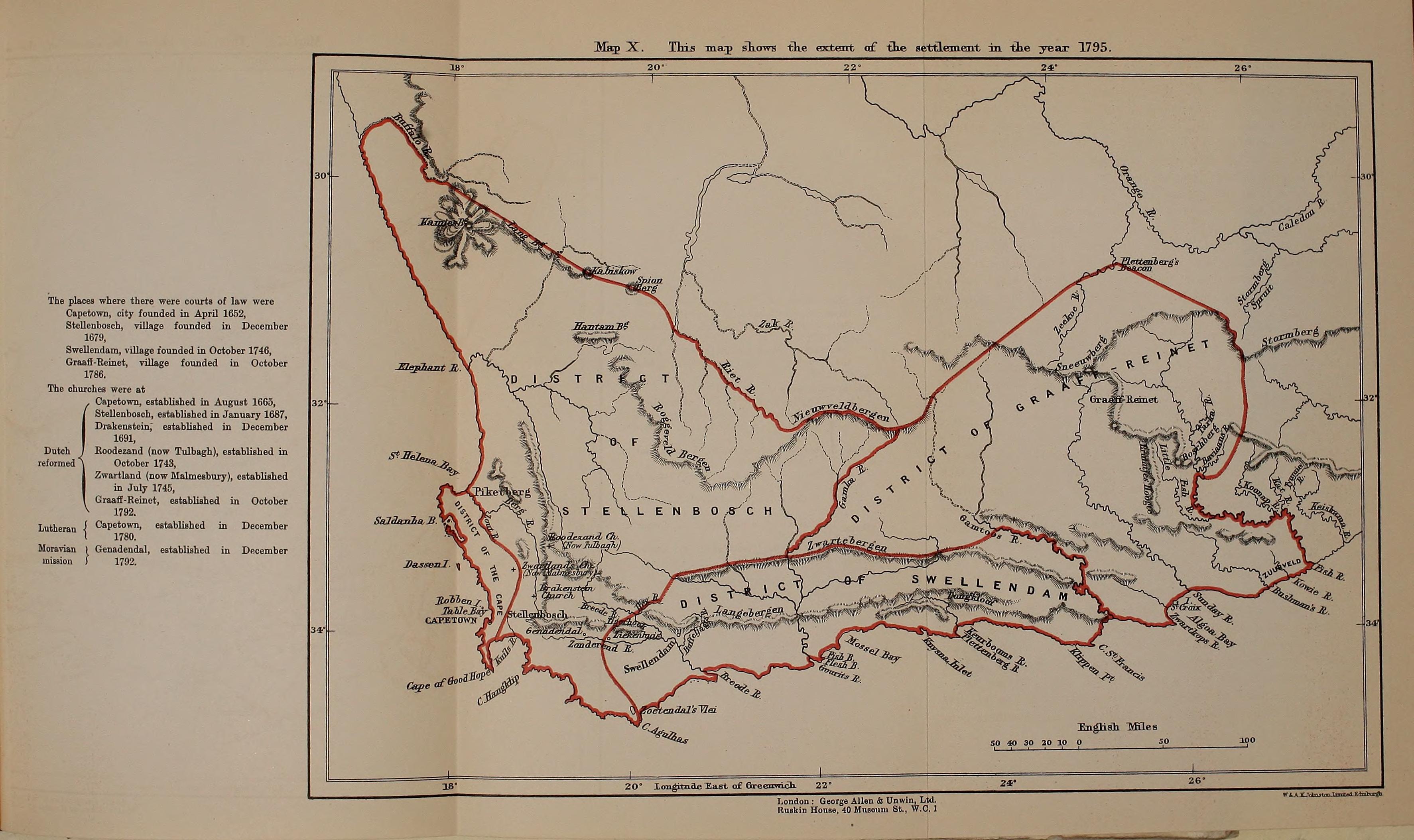
The Invasion of the Cape Colony, also known as the Battle of Muizenberg, was a British military expedition launched in 1795 against the Dutch Cape Colony at the Cape of Good Hope. The Dutch colony at the Cape, established and controlled by the United East India Company in the seventeenth century, was at the time the only viable South African port for ships making the journey from Europe to the European colonies in the East Indies. It therefore held vital strategic importance, although it was otherwise economically insignificant. In the winter of 1794, during the French Revolutionary Wars, French troops entered the Dutch Republic, which was reformed into the Batavian Republic. In response, Great Britain launched operations against the Dutch Empire to use its facilities against the French Navy. The British expedition was led by Vice-Admiral Sir George Keith Elphinstone and sailed in April 1795, arriving off Simon's Town at the Cape in June. Attempts were made to negotiate a ... [...More Info...] [...Related Items...] OR: [Wikipedia] [Google] [Baidu] |
Alured Clarke
Sir Alured Clarke (24 November 1744 – 16 September 1832) was a British Army officer. He took charge of all British troops in Georgia in May 1780 and was then deployed to Philadelphia to supervise the evacuation of British prisoners of war at the closing stages of the American Revolutionary War. He went on to be Governor of Jamaica and then lieutenant-governor of Lower Canada in which role he had responsibility for implementing the Constitutional Act 1791. He was then sent to India where he became Commander-in-Chief of the Madras Army, then briefly Governor-General of India and finally Commander-in-Chief of India during the Fourth Anglo-Mysore War. Military career Born the son of Charles Clarke (c.1702–1750) and Jane Clarke (née Mullins), Alured Clarke was educated at Eton College and was commissioned as an ensign in the 50th Regiment of Foot on 20 March 1759.Heathcote, p. 89 Later that year he served in Germany under the Marquess of Granby. Promoted to lieutenant in ... [...More Info...] [...Related Items...] OR: [Wikipedia] [Google] [Baidu] |
Diamond Harbour
Diamond Harbour () is a town and a municipality of the South 24 Parganas district in the Indian state of West Bengal. It is situated on the eastern banks of the Hooghly River. It is the headquarters of the Diamond Harbour subdivision. History Diamond Harbour was originally known as ''Hajipur'', as it was situated on the banks of the Hajipur creek. The name Diamond Harbour was applied by the British, who used it for both river and sea shipping. Geography Area overview Diamond Harbour subdivision is a rural subdivision with patches of urbanisation. Only 14.61% of the population lives in the urban areas and an overwhelming 85.39% lives in the rural areas. In the western portion of the subdivision (shown in the map alongside) there are 11 census towns. The entire district is situated in the Ganges Delta and the western part, located on the east bank of the Hooghly River, is covered by the Kulpi Diamond Harbour Plain, which is 5–6 metres above sea level. Archaeological excava ... [...More Info...] [...Related Items...] OR: [Wikipedia] [Google] [Baidu] |
The Downs (ship Anchorage)
The Downs is a roadstead (area of sheltered, favourable sea) in the southern North Sea near the English Channel off the east Kent coast, between the North and the South Foreland in southern England. In 1639 the Battle of the Downs took place here, when the Dutch navy destroyed a Spanish fleet which had sought refuge in neutral English waters. From the Elizabethan era onwards, the presence of the Downs helped to make Deal one of the premier ports in England, and in the 19th century, it was equipped with its own telegraph and timeball tower to enable ships to set their marine chronometers. The anchorage has depths down to 12 fathoms (22 m). Even during southerly gales some shelter was afforded, though under this condition wrecks were not infrequent. Storms from any direction could also drive ships onto the shore or onto the sands, which—in spite of providing the sheltered water—were constantly shifting, and not always adequately marked. The Downs served in the age of sail as a ... [...More Info...] [...Related Items...] OR: [Wikipedia] [Google] [Baidu] |
Eyre Coote (East India Company Officer)
Lieutenant-General Sir Eyre Coote, KB (1726 – 28 April 1783) was a British soldier and politician who sat in the House of Commons from 1768 to 1780. He is best known for his many years of service with the British Army in India. His victory at the Battle of Wandiwash is considered a decisive turning point in the struggle for control in India between Britain and France. He was known by his sepoy troops as Coote Bahadur (Coote the Brave). Early life A member of the Coote family headed by the Earl of Mountrath, he was born in Kilmallock, near Limerick, Ireland, the son of the Reverend Chidley Coote and Jane Evans, daughter of George Evans, and sister of George Evans, 1st Baron Carbery. He entered the 27th Regiment of Foot. He first saw active service in the Jacobite rising of 1745, and later obtained a captaincy in the 39th Regiment, the first regular British regiment to serve in India. Career in India Recapture of Calcutta In 1756 a part of the regiment, then quartered ... [...More Info...] [...Related Items...] OR: [Wikipedia] [Google] [Baidu] |


