|
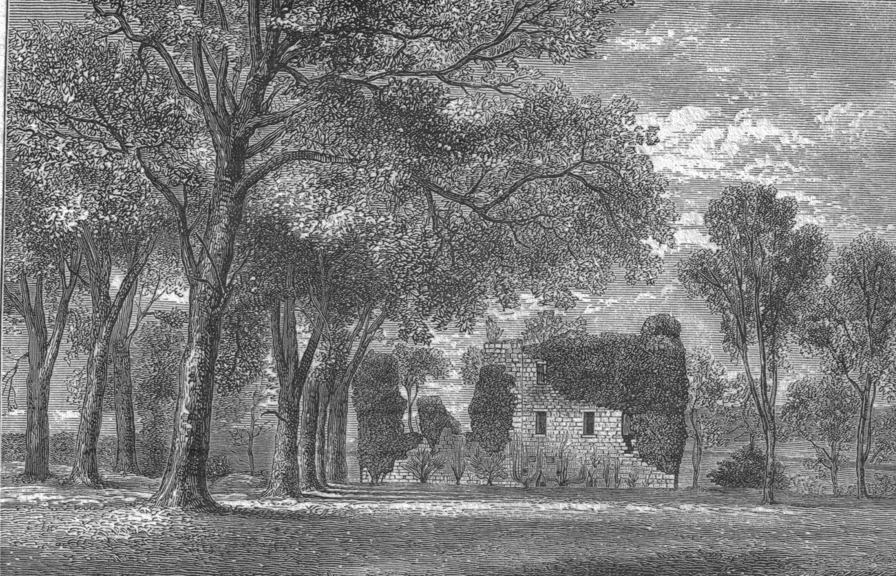
Geilsland House
Geilsland House lies in between the village of Gateside and the town of Beith in North Ayrshire, Scotland. After serving as a private house it became a school and most recently (2015) has passed into the ownership of the Beith Development Community Trust. History Geilsland was a half merk land, part of the 4 merk land of Marshalland of old extent, in the Barony of Braidstone. An earlier name is said to have been 'Neilsland'. The name is pronounced 'Jillsland' locally. The origin of the name may refer to a gil or gyll, referring to a cleft or ravine as found at the 'Fairy Glen' where the Powgree Burn cuts through the fields. The lands of Geilsland were bounded to the south and west by the lands held by James Kerr; by the Lands of Crummock held by Fanny Brown; by the lands of Little Hill of Beith once held by John Shedden and then by Alexander Aitkenhead and finally by the road from Beith to Broadstone. Owners In 1672 the lands were held by John Anderson of Cruckhills whose wif ... [...More Info...] [...Related Items...] OR: [Wikipedia] [Google] [Baidu] |
Gateside (Garnock)
Gateside is a small village in North Ayrshire, Scotland about east of Beith on the B777. The village Gateside Primary School was opened in 1903, and nowadays it has 74 pupils (2009). The school has an extension built in 1998 which provided indoor toilets and a school hall, which is used by the nursery, PE classes, and for school dinners and assemblies. Another extension is to be built soon. The school is very environmentally aware and has achieved its Green Flag Award (2009). Spier's school stood nearby and the grounds are now a public park used by the Gateside and Beith communities. The Isabel Patrick Memorial Hall is a building in the Gothic style. Trearne House stood near Gateside, but it was demolished and the site is now a large worked out limestone quarry. A field behind the primary school was given to the community by the Marshall family who were the village blacksmiths for many years. The meaning of Powgree, Gateside's burn, is suggested as being 'Stream of the herd ... [...More Info...] [...Related Items...] OR: [Wikipedia] [Google] [Baidu] |
Beith
Beith is a small town in the Garnock Valley, North Ayrshire, Scotland approximately south-west of Glasgow. The town is situated on the crest of a hill and was known originally as the "''Hill o' Beith''" (hill of the birches) after its ''Court Hill''. History Name Beith's name is thought to emanate from Ogham, which is sometimes referred to as the "''Celtic Tree Alphabet''", ascribing names of trees to individual letters. ''Beithe'' in Old Irish means ''Birch-tree'' (cognate to Latin ''betula''). There is reason to believe that the whole of the district was covered with woods. The town of Beith itself was once known as 'Hill of Beith' as this was the name of the feudal barony and was itself derived from the Court Hill near Hill of Beith Castle. Alternatively, Beith may be derived from Cumbric ''*baɣeδ'', 'boar' (Welsh ''baedd''). The local pronunciation of the name would favour this theory. The Wood of Beit, now the 'Moor of Beith', has been identified as an Arthurian sit ... [...More Info...] [...Related Items...] OR: [Wikipedia] [Google] [Baidu] |
North Ayrshire
North Ayrshire ( gd, Siorrachd Àir a Tuath, ) is one of 32 council areas in Scotland. The council area borders Inverclyde to the north, Renfrewshire and East Renfrewshire to the northeast, and East Ayrshire and South Ayrshire to the east and south respectively. The local authority is North Ayrshire Council, formed in 1997 and following similar boundaries to the district of Cunninghame. Located in the west central Lowlands with the Firth of Clyde to its west, the council area covers the northern portion of the historic county of Ayrshire, in addition to the islands forming Buteshire. It has a population of roughly people. with its largest settlements at Irvine and Kilwinning. History and formation The area was created in 1996 as a successor to the district of Cunninghame. The council headquarters are located in Irvine, which is the largest town. The area also contains the towns of Ardrossan, Beith, Dalry, Kilbirnie, Kilwinning, Largs, Saltcoats, Skelmorlie, Stevenston, W ... [...More Info...] [...Related Items...] OR: [Wikipedia] [Google] [Baidu] |
Merk (coin)
The merk is a long-obsolete Scottish silver coin. Originally the same word as a money mark of silver, the merk was in circulation at the end of the 16th century and in the 17th century. It was originally valued at 13 shillings 4 pence (exactly of a pound Scots, or about one shilling sterling), later raised to 14''s.'' Scots. In addition to the merks, coins issued include the four merk worth 56s or £2/16/- (£2.8); the half merk (or noble), 6 shillings and 8 pence or 80d; the quarter merk, 3s and 4d or 40d; the eighth-thistle merk, worth 20d. The first issue weighed and was 50% silver and 50% base metals,. thus it contained of pure silver. "Markland", or "Merkland", was used to describe an amount of land in Scottish deeds and legal papers. It was based upon a common valuation of the land. During the "Lang Siege" of Edinburgh Castle in 1572, the last phase of the Marian civil war, the goldsmith James Cockie minted half merks in the castle, while the supporters of James VI ... [...More Info...] [...Related Items...] OR: [Wikipedia] [Google] [Baidu] |
Lands Of Marshalland
The lands of Marshalland, Marsheland,Dobie (1896), Page 191 MarsheylandThomson's Map Retrieved : 2013--06-25 or Marshyland were part of the holdings of the Barony of Beith, Regality of and Bailiary of Cuninghame. They became the property of the Lyle family, then the Shedden family, passing next to the Spier's family before finally becoming part of the Spier's Trust lands. The laird's house and farm were demolished in the 1960s. The History of the Lands of Marshalland ...[...More Info...] [...Related Items...] OR: [Wikipedia] [Google] [Baidu] |
Broadstone Castle And Barony, Ayrshire
Broadstone lies close to the small village of Gateside in North Ayrshire, Scotland about half a mile east of Beith in the old Barony of Giffen. The history of Broadstone The castle The ruins of Braidstone or Broadstone Castle (NS 362 531) remained until about 1850. but when Broadstonehall Farm buildings were being rebuilt, the castle was pulled down and its stones used in the building works; the Broadstone Crags, the site of the castle, remain however despite local quarrying. An avenue of trees and the vestiges of a garden had survived until the time of the building of the farm. Its site was pointed out by Mr W Kerr of Broadstonehall in 1855. The Barony mill Most baronies had a water mill which was under the control of the laird or lord and to which the tenants were thirled or obliged to go to have their grain ground into flour. A proportion of the grain was taken as payment. Thirlage ended in the late 18th century and resulted in a number of mills being abandoned once market ... [...More Info...] [...Related Items...] OR: [Wikipedia] [Google] [Baidu] |
Hessilhead
Hessilhead is in Beith, North Ayrshire, Scotland. Hessilhead used to be called Hazlehead or Hasslehead. The lands were part of the Lordship of Giffen, and the Barony of Hessilhead, within the Baillerie of Cunninghame and the Parish of Beith. The castle was situated at . Hessilhead Castle In the late 19th century, the castle was described as "now roofless and ruinous, is an oblong structure, built at two periods, measuring some by 38½ feet. The old west part was apparently a 15th-17th century keep; the east addition was built by Francis Montgomerie, who bought the estate in 1680. Both old and new parts are vaulted on the ground floor; the upper parts are too ruinous to describe. The mansion was allowed to become ruinous about 1776."MacGibbon and Ross, D and T (1887 - 92), ''The Castellated and Domestic Architecture of Scotland from the Twelfth to the Eighteenth Centuries'', 5 V, Edinburgh, Vol. 3, pp. 375–7. It was noted by Pont as a strong old building, surrounded with lar ... [...More Info...] [...Related Items...] OR: [Wikipedia] [Google] [Baidu] |
Millport Chapel Interior, Geilsland
Millport may refer to: *Millport, Cumbrae, a town on the island of Cumbrae in North Ayrshire, Scotland *Millport, Alabama, a small town in Alabama, United States * Millport, New York, a village in New York, United States *Millport, Indiana, an unincorporated community in Washington County *Millport, Missouri, an unincorporated community *Millport, Columbiana County, Ohio, an unincorporated community *Millport, Pickaway County, Ohio Millport is an unincorporated community in Pickaway County, in the U.S. state of Ohio. The community is located between Ashville, Ohio and South Bloomfield, Ohio on Ohio State Route 316. As of 2019, the Millport has approximately 50 homes and has b ..., an unincorporated community * ''Millport'' (radio show), a BBC radio show about the Scottish town * ''Millport'' (album), a 2017 album by Greg Graffin {{disambiguation, geo ... [...More Info...] [...Related Items...] OR: [Wikipedia] [Google] [Baidu] |
Church Of Scotland
The Church of Scotland ( sco, The Kirk o Scotland; gd, Eaglais na h-Alba) is the national church in Scotland. The Church of Scotland was principally shaped by John Knox, in the Scottish Reformation, Reformation of 1560, when it split from the Catholic Church and established itself as a church in the reformed tradition. The church is Calvinist Presbyterian, having no head of faith or leadership group and believing that God invited the church's adherents to worship Jesus. The annual meeting of its general assembly is chaired by the Moderator of the General Assembly of the Church of Scotland. The Church of Scotland celebrates two sacraments, Baptism and the Lord's Supper in Reformed theology, Lord's Supper, as well as five other Rite (Christianity), rites, such as Confirmation and Christian views on marriage, Matrimony. The church adheres to the Bible and the Westminster Confession of Faith, and is a member of the World Communion of Reformed Churches. History Presbyterian tra ... [...More Info...] [...Related Items...] OR: [Wikipedia] [Google] [Baidu] |
Parquetry
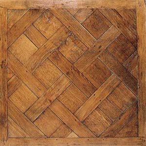
Parquet (; French for "a small compartment") is a geometric mosaic of wood pieces used for decorative effect in flooring. Parquet patterns are often entirely geometrical and angular—squares, triangles, lozenges—but may contain curves. The most popular parquet flooring pattern is herringbone. Etymology The word derives from the Old French ''parchet'' (the diminutive of ''parc''), literally meaning "''a small enclosed space''". History Large diagonal squares known as ''parquet de Versailles'' were introduced in 1684 as ''parquet de menuiserie'' ("woodwork parquet") to replace the marble flooring that required constant washing, which tended to rot the joists beneath the floors. Such ''parquets en losange'' were noted by the Swedish architect Daniel Cronström at Versailles and at the Grand Trianon in 1693. Materials Timber contrasting in color and grain, such as oak, walnut, cherry, lime, pine, maple etc. are sometimes employed, and in the more expensive kinds the ric ... [...More Info...] [...Related Items...] OR: [Wikipedia] [Google] [Baidu] |


