|
Garnet Range
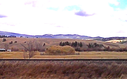
The Garnet Range, highest point Old Baldy Mountain, elevation , is a mountain range northeast of Drummond, Montana in Powell County, Montana. A popular historic site, Garnet Ghost Town, is in the Garnet Range. Situated on Bureau of Land Management (BLM) land, the ghost town is the remnant of a mining settlement that was inhabited from the late 1800s to the 1930s. The town's population reached several thousand during its peak. A visitor center and self-guided tours are available. Although heavily forested, no portion of the Garnet Range is part of the National Forest system. The BLM owns much of the range, including the 11,580-acre Wales Creek Wilderness Study Area. The Wales Creek WSA is the last major drainage area without a road in the western Garnets, and features dense forests of lodgepole pine, spruce, Douglas fir, larch, aspen, and subalpine fir. Wales Creek WSA also hosts a thriving moose herd, goshawk nesting sites, a native cutthroat trout fishery, and four hot spring ... [...More Info...] [...Related Items...] OR: [Wikipedia] [Google] [Baidu] |
Mountain Range
A mountain range or hill range is a series of mountains or hills arranged in a line and connected by high ground. A mountain system or mountain belt is a group of mountain ranges with similarity in form, structure, and alignment that have arisen from the same cause, usually an orogeny. Mountain ranges are formed by a variety of geological processes, but most of the significant ones on Earth are the result of plate tectonics. Mountain ranges are also found on many planetary mass objects in the Solar System and are likely a feature of most terrestrial planets. Mountain ranges are usually segmented by highlands or mountain passes and valleys. Individual mountains within the same mountain range do not necessarily have the same geologic structure or petrology. They may be a mix of different orogenic expressions and terranes, for example thrust sheets, uplifted blocks, fold mountains, and volcanic landforms resulting in a variety of rock types. Major ranges Most geolo ... [...More Info...] [...Related Items...] OR: [Wikipedia] [Google] [Baidu] |
Drummond, Montana
Drummond is a town in Granite County, Montana, United States. The population was 272 at the 2020 census. Geography Drummond is located at (46.667983, -113.146355). The town can be accessed via exits 153 and 154 on Interstate 90. It is just north of the Clark Fork River. According to the United States Census Bureau, the town has a total area of , all land. History The Northern Pacific Railroad arrived in 1883. They changed the town name from Edwardsville to Drummond, after either a Northern Pacific engineer or Hugh Drummond, a local trapper. Mayor Gail Leeper is known for her long tenure. Elected to the office in 1993, Leeper is seeking her 7th term as Mayor in 2017. Demographics 2010 census As of the census of 2010, there were 309 people, 143 households, and 84 families residing in the town. The population density was . There were 179 housing units at an average density of . The racial makeup of the town was 97.7% White (U.S. Census)], 0.3% African American, 0.3% Native ... [...More Info...] [...Related Items...] OR: [Wikipedia] [Google] [Baidu] |
Powell County, Montana
Powell County is a county in the U.S. state of Montana. As of the 2020 census, the population was 6,946. Its county seat is Deer Lodge. Geography According to the United States Census Bureau, the county has a total area of , of which is land and (0.3%) is water. Major highways * Interstate 90 * U.S. Route 10 (Former) * U.S. Route 12 * Montana Highway 141 * Montana Highway 200 Adjacent counties * Flathead County - north * Lewis and Clark County - east * Jefferson County - southeast * Deer Lodge County - south * Granite County - southwest * Missoula County - west National protected areas * Beaverhead-Deerlodge National Forest (part) * Flathead National Forest (part) * Grant-Kohrs Ranch National Historic Site * Helena National Forest (part) * Lolo National Forest (part) * Bob Marshall Wilderness Area (part) * Scapegoat Wilderness Area (part) Demographics 2000 census As of the 2000 United States census, there were 7,180 people, 2,422 households, and 1, ... [...More Info...] [...Related Items...] OR: [Wikipedia] [Google] [Baidu] |
Bureau Of Land Management
The Bureau of Land Management (BLM) is an agency within the United States Department of the Interior responsible for administering federal lands. Headquartered in Washington DC, and with oversight over , it governs one eighth of the country's landmass. President Harry S. Truman created the BLM in 1946 by combining two existing agencies: the General Land Office and the Grazing Service. The agency manages the federal government's nearly of subsurface mineral estate located beneath federal, state and private lands severed from their surface rights by the Homestead Act of 1862. Most BLM public lands are located in these 12 western states: Alaska, Arizona, California, Colorado, Idaho, Montana, Nevada, New Mexico, Oregon, Utah, Washington and Wyoming. The mission of the BLM is "to sustain the health, diversity, and productivity of the public lands for the use and enjoyment of present and future generations." Originally BLM holdings were described as "land nobody wanted" because home ... [...More Info...] [...Related Items...] OR: [Wikipedia] [Google] [Baidu] |
Lodgepole Pine
''Pinus contorta'', with the common names lodgepole pine and shore pine, and also known as twisted pine, and contorta pine, is a common tree in western North America. It is common near the ocean shore and in dry montane forests to the subalpine, but is rare in lowland rain forests. Like all pines (member species of the genus ''Pinus''), it is an evergreen conifer. Description Depending on subspecies, ''Pinus contorta'' grows as an evergreen shrub or tree. The shrub form is krummholz and is approximately high. The thin and narrow-crowned tree can grow high and achieve up to in diameter at chest height. The ''murrayana'' subspecies is the tallest. The crown is rounded and the top of the tree is flattened. In dense forests, the tree has a slim, conical crown. The formation of twin trees is common in some populations in British Columbia. The elastic branches stand upright or overhang and are difficult to break. The branches are covered with short shoots that are easy to remove. ... [...More Info...] [...Related Items...] OR: [Wikipedia] [Google] [Baidu] |
Douglas Fir
The Douglas fir (''Pseudotsuga menziesii'') is an evergreen conifer species in the pine family, Pinaceae. It is native to western North America and is also known as Douglas-fir, Douglas spruce, Oregon pine, and Columbian pine. There are three varieties: coast Douglas-fir (''P. menziesii'' var. ''menziesii''), Rocky Mountain Douglas-fir (''P. menziesii'' var. ''glauca'') and Mexican Douglas-fir (''P. menziesii'' var. ''lindleyana''). Despite its common names, it is not a true fir (genus ''Abies''), spruce (genus '' Picea''), or pine (genus ''Pinus''). It is also not a hemlock; the genus name ''Pseudotsuga'' means "false hemlock". Description Douglas-firs are medium-size to extremely large evergreen trees, tall (although only ''Pseudotsuga menziesii var. menziesii'', common name coast Douglas-firs, reach heights near 100 m) and commonly reach in diameter, although trees with diameters of almost exist. The largest coast Douglas-firs regularly live over 500 years, with the old ... [...More Info...] [...Related Items...] OR: [Wikipedia] [Google] [Baidu] |
Subalpine Fir
''Abies lasiocarpa'', the subalpine fir or Rocky Mountain fir, is a western North American fir tree. Description ''Abies lasiocarpa'' is a medium-sized evergreen conifer with a very narrow conic crown, growing to tall, exceptionally , with a trunk up to thick, exceptionally . The bark on young trees is smooth, gray, and with resin blisters, becoming rough and fissured or scaly on old trees. The lowest branches can be observed growing above ground level. The leaves are flat and needle-like, long, glaucous green above with a broad stripe of stomata, and two blue-white stomatal bands below; the fresh leaf scars are reddish (tan on the inland variety). They are arranged spirally on the shoot, but with the leaf bases twisted to be arranged to the sides of and above the shoot, with few or none below the shoot. The cones are erect, long, dark purple with fine yellow-brown pubescence, ripening brown and disintegrating to release the winged seeds in early fall. Taxonomy There are ... [...More Info...] [...Related Items...] OR: [Wikipedia] [Google] [Baidu] |
Moose
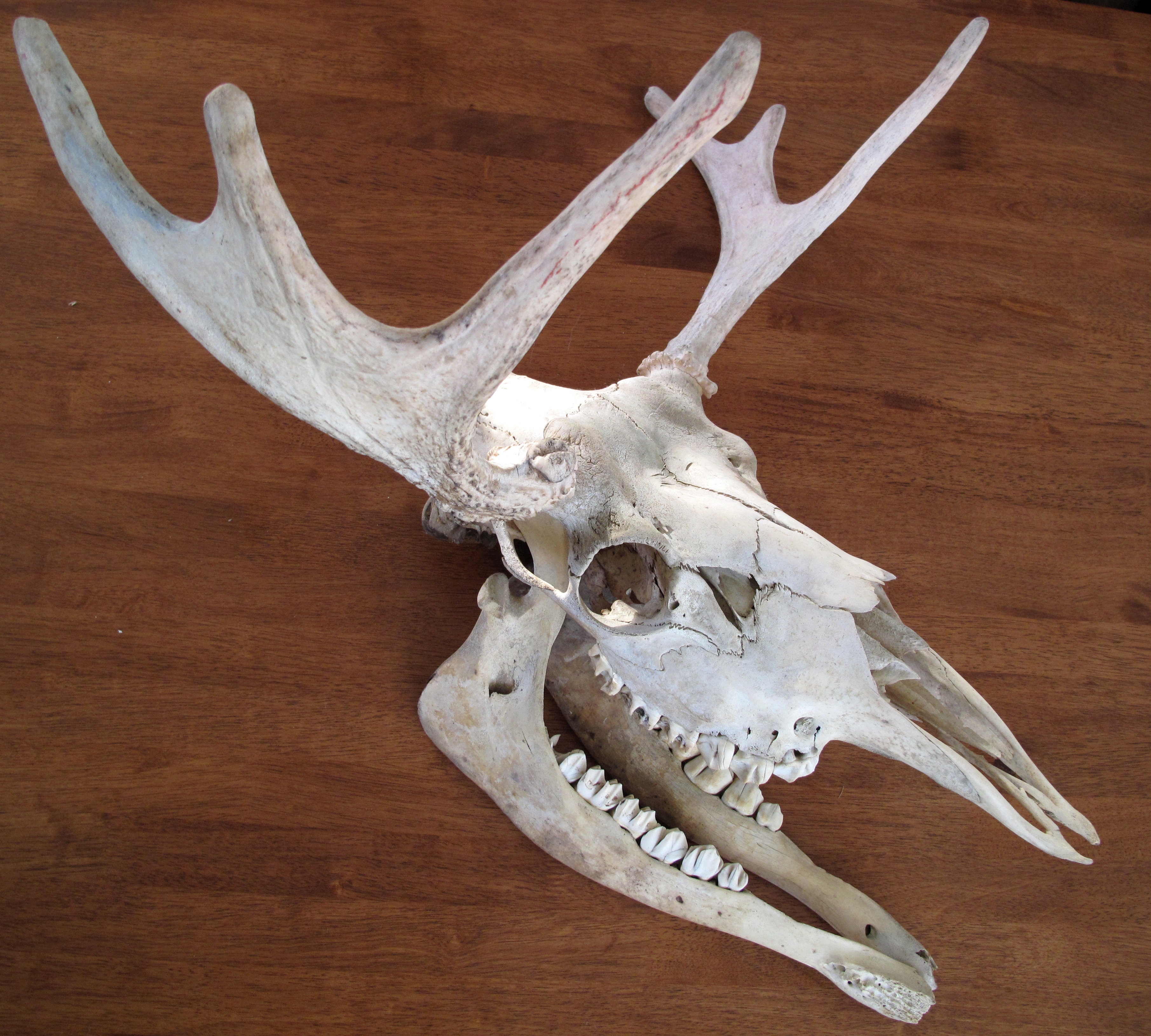
The moose (in North America) or elk (in Eurasia) (''Alces alces'') is a member of the New World deer subfamily and is the only species in the genus ''Alces''. It is the largest and heaviest extant species in the deer family. Most adult male moose have distinctive broad, palmate ("open-hand shaped") antlers; most other members of the deer family have antlers with a dendritic ("twig-like") configuration. Moose typically inhabit boreal forests and temperate broadleaf and mixed forests of the Northern Hemisphere The Northern Hemisphere is the half of Earth that is north of the Equator. For other planets in the Solar System, north is defined as being in the same celestial hemisphere relative to the invariable plane of the solar system as Earth's Nort ... in temperate to subarctic climates. Hunting and other human activities have caused a reduction in the size of the moose's range over time. It has been reintroduced to some of its former habitats. Currently, most moose occ ... [...More Info...] [...Related Items...] OR: [Wikipedia] [Google] [Baidu] |
Cutthroat Trout
The cutthroat trout is a fish species of the family Salmonidae native to cold-water tributaries of the Pacific Ocean, Rocky Mountains, and Great Basin in North America. As a member of the genus '' Oncorhynchus'', it is one of the Pacific trout, a group that includes the widely distributed rainbow trout. Cutthroat trout are popular gamefish, especially among anglers who enjoy fly fishing. The common name "cutthroat" refers to the distinctive red coloration on the underside of the lower jaw. The specific name ''clarkii'' was given to honor explorer William Clark, coleader of the Lewis and Clark Expedition. Cutthroat trout usually inhabit and spawn in small to moderately large, clear, well- oxygenated, shallow rivers with gravel bottoms. They reproduce in clear, cold, moderately deep lakes. They are native to the alluvial or freestone streams that are typical tributaries of the rivers of the Pacific Basin, Great Basin and Rocky Mountains. Cutthroat trout spawn in the spring ... [...More Info...] [...Related Items...] OR: [Wikipedia] [Google] [Baidu] |
Petrified Wood
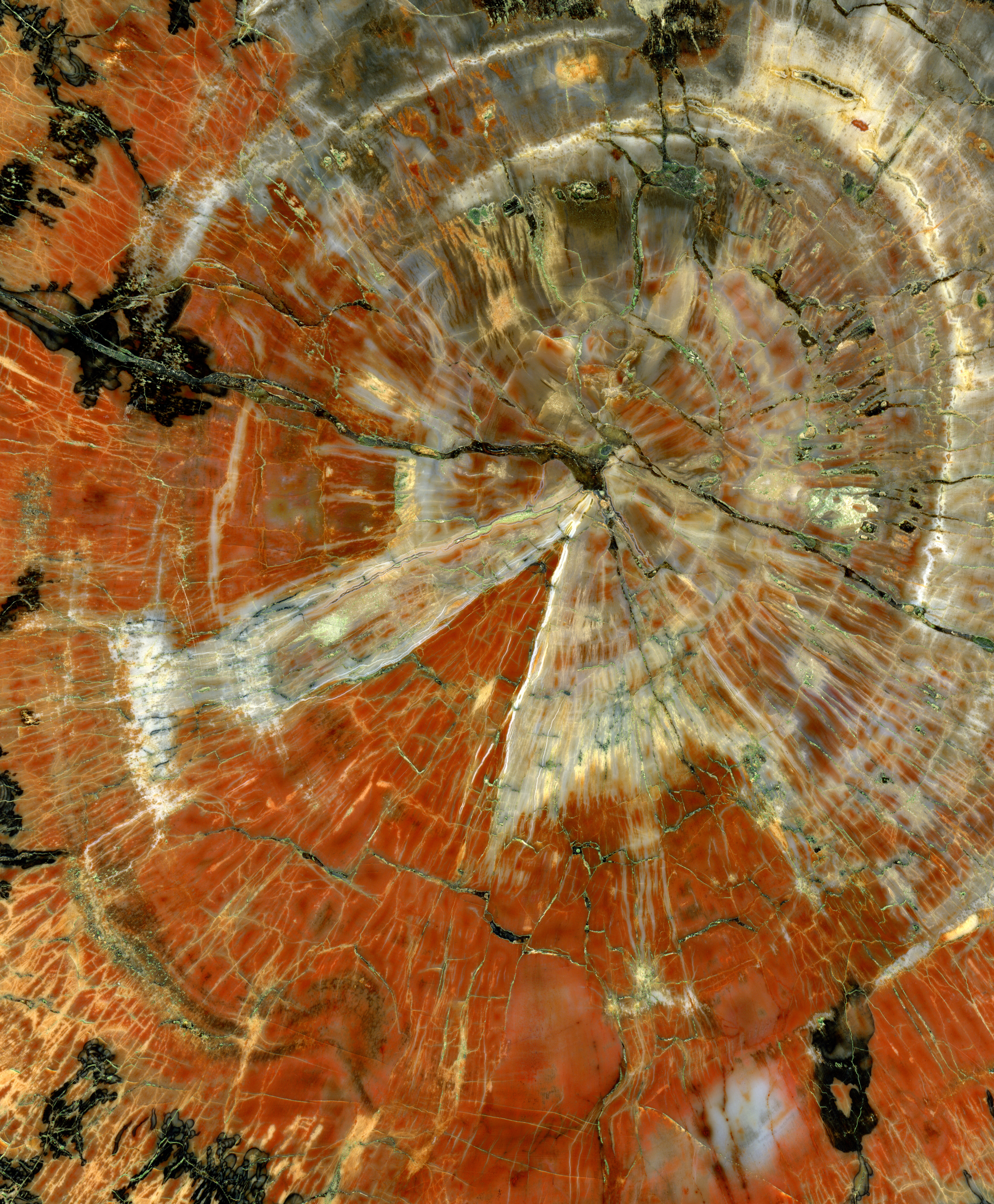
Petrified wood, also known as petrified tree (from Ancient Greek meaning 'rock' or 'stone'; literally 'wood turned into stone'), is the name given to a special type of ''fossilized wood'', the fossilized remains of terrestrial vegetation. ''Petrifaction'' is the result of a tree or tree-like plants having been replaced by stone via a mineralization process that often includes permineralization and replacement. The organic materials making up cell walls have been replicated with minerals (mostly silica in the form of opal, chalcedony, or quartz). In some instances, the original structure of the stem tissue may be partially retained. Unlike other plant fossils, which are typically impressions or compressions, petrified wood is a three-dimensional representation of the original organic material. The petrifaction process occurs underground, when wood becomes buried in water-saturated sediment or volcanic ash. The presence of water reduces the availability of oxygen which inhibits ... [...More Info...] [...Related Items...] OR: [Wikipedia] [Google] [Baidu] |
Area Of Critical Environmental Concern
Areas of Critical Environmental Concern (ACEC) is a conservation ecology program in the Western United States, managed by the Bureau of Land Management (BLM). The ACEC program was conceived in the 1976 Federal Lands Policy and Management Act (FLPMA), which established the first conservation ecology mandate for the BLM. The FLPMA mandate directs the BLM to protect important riparian corridors, threatened and endangered species habitats, cultural and archeological resources, as well as unique scenic landscapes that the agency assesses as in need of special management attention. Criteria To be considered a potential ACEC an area must meet criteria of both relevance and importance. Relevance An area meets the relevance criteria of an ACEC if it contains one or more of the following: *A significant historic, cultural, or scenic value; *A fish or wildlife resource; *A natural process or system (including but not limited to areas supporting rare, endemic, relict, or endangered plant s ... [...More Info...] [...Related Items...] OR: [Wikipedia] [Google] [Baidu] |


