|
Garden Of Forgiveness
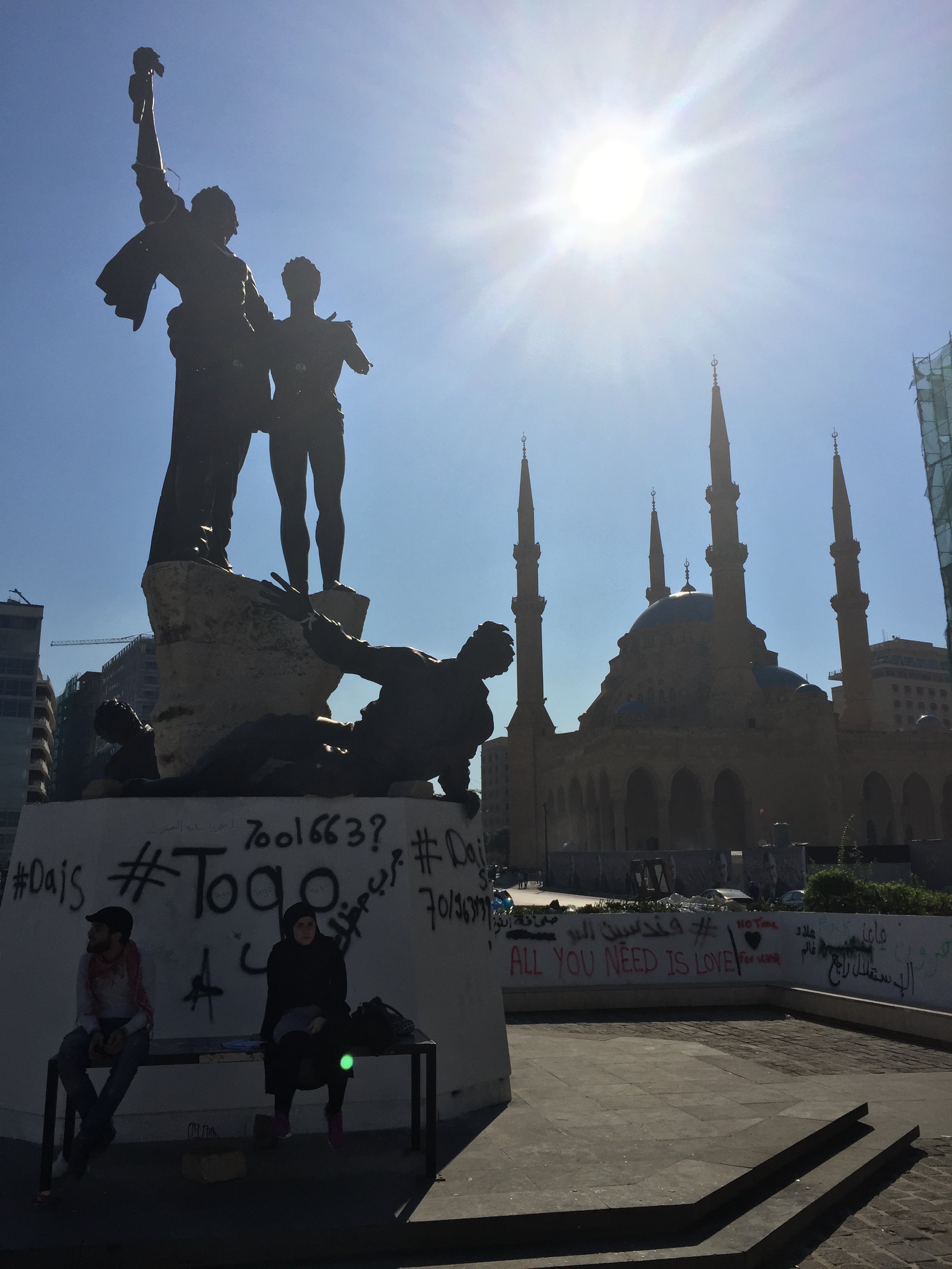
The Garden of Forgiveness (also known as ''Hadiqat As-Samah'' in Arabic) is a garden in Beirut, close to Martyrs’ Square and the wartime Green Line (1975-1990). History The area was classified as non aedificandi (Latin for "not to be built"), in the Master Plan of the Beirut City Center. British-Lebanese citizen Alexandra Asseily first came up with the idea for the garden in 1998 as a response to the Lebanese Civil War. In 1998, the winning design of Gustafson Porter was chosen for its construction. The design brought together different aspects of Lebanon’s ancient heritage and rich landscapes, emphasizing national unity. Excavations on the site revealed the two main streets of the Roman city of Berytus, the Cardo and Decumanus Maximus, and, underneath them, a sacred platform dating from Phoenico-Persian times. Construction on the site by Beirut redevelopment company Solidere began in 2003. In 2006, the construction of the garden was placed on hold due to the 2006 Leba ... [...More Info...] [...Related Items...] OR: [Wikipedia] [Google] [Baidu] |
Beirut
Beirut, french: Beyrouth is the capital and largest city of Lebanon. , Greater Beirut has a population of 2.5 million, which makes it the third-largest city in the Levant region. The city is situated on a peninsula at the midpoint of Lebanon's Mediterranean coast. Beirut has been inhabited for more than 5,000 years, and was one of Phoenicia's most prominent city states, making it one of the oldest cities in the world (see Berytus). The first historical mention of Beirut is found in the Amarna letters from the New Kingdom of Egypt, which date to the 14th century BC. Beirut is Lebanon's seat of government and plays a central role in the Lebanese economy, with many banks and corporations based in the city. Beirut is an important seaport for the country and region, and rated a Beta + World City by the Globalization and World Cities Research Network. Beirut was severely damaged by the Lebanese Civil War, the 2006 Lebanon War, and the 2020 massive explosion in the ... [...More Info...] [...Related Items...] OR: [Wikipedia] [Google] [Baidu] |
Martyrs’ Square
Martyrs' Square ( ; french: Place des Martyrs), historically known as "Al Burj" or "Place des Cannons", is the historical central public square of Beirut, Lebanon. Like the Martyr's Square in Damascus, it is named after the 6 May 1916 executions ordered by Djemal Pasha during World War I. Overview In 1931, the historic square took its name to commemorate the martyrs executed there under Ottoman rule. In the 1950s, the square became a popular venue for cinemas and coffee-houses. During the Lebanese Civil War, it was part of the demarcation line that divided the city in half. Construction Initially named ''Sahat al-Burj'', the Municipality of Beirut modernized the square in 1878 as the main meeting place of the city. Beshara Effendi designed a garden with fountain and kiosks, overlooked by the Petit Serail - the seat of Beirut’s governor general – as well as public buildings and souks. After that, the square underwent a lot of transformations until 1931, where it took the ... [...More Info...] [...Related Items...] OR: [Wikipedia] [Google] [Baidu] |
Green Line (Lebanon)
The Green Line (Arabic: الخط الأخضر) was a line of demarcation in Beirut, Lebanon, during the Lebanese Civil War from 1975 to 1990. It separated the mainly Muslim factions in predominantly Muslim West Beirut from the predominantly Christian East Beirut controlled by the Lebanese Front. However, as the Civil War continued, it also came to separate Sunni from Shia. At the beginning of the Civil War, the division was not absolute as some Muslims lived East of the Green Line and some Christians lived in West Beirut; but, as the Civil War continued, each sector became more homogeneous as minorities left the sector they were in. The appellation refers to the coloration of the foliage that grew because the space was uninhabited. While most commonly referred to as the "Green Line", it was also sometimes called the "Demarcation Line". It generally stretched from the North of Beirut to the South, and the primary street that followed the Green Line was Damascus Street. There wa ... [...More Info...] [...Related Items...] OR: [Wikipedia] [Google] [Baidu] |
Latin
Latin (, or , ) is a classical language belonging to the Italic branch of the Indo-European languages. Latin was originally a dialect spoken in the lower Tiber area (then known as Latium) around present-day Rome, but through the power of the Roman Republic it became the dominant language in the Italian region and subsequently throughout the Roman Empire. Even after the fall of Western Rome, Latin remained the common language of international communication, science, scholarship and academia in Europe until well into the 18th century, when other regional vernaculars (including its own descendants, the Romance languages) supplanted it in common academic and political usage, and it eventually became a dead language in the modern linguistic definition. Latin is a highly inflected language, with three distinct genders (masculine, feminine, and neuter), six or seven noun cases (nominative, accusative, genitive, dative, ablative, and vocative), five declensions, four verb conjuga ... [...More Info...] [...Related Items...] OR: [Wikipedia] [Google] [Baidu] |
Lebanese Civil War
The Lebanese Civil War ( ar, الحرب الأهلية اللبنانية, translit=Al-Ḥarb al-Ahliyyah al-Libnāniyyah) was a multifaceted armed conflict that took place from 1975 to 1990. It resulted in an estimated 120,000 fatalities and an exodus of almost one million people from Lebanon. The diversity of the Lebanese population played a notable role in the lead-up to and during the conflict: Sunni Muslims and Christians comprised the majority in the coastal cities; Shia Muslims were primarily based in the south and the Beqaa Valley in the east; and Druze and Christians populated the country's mountainous areas. The Lebanese government had been run under the significant influence of elites within the Maronite Christian community. The link between politics and religion had been reinforced under the French Mandate from 1920 to 1943, and the country's parliamentary structure favoured a leading position for its Christian-majority population. However, the country had a ... [...More Info...] [...Related Items...] OR: [Wikipedia] [Google] [Baidu] |
Gustafson Porter
Kathryn Gustafson (born 1951) is an American landscape architect. Her work includes the Gardens of the Imagination in Terrasson, France; a city square in Évry, France; and the Diana, Princess of Wales Memorial Fountain in Hyde Park, London. She has won awards and prizes including the Millennium Garden Design Competition. She is known for her ability to create sculptural forms, using earth, grass, stone and water. Early life Gustafson was born and grew up in Yakima, Washington in 1951, her father was a heart surgeon. The basis of her designs comes from her memories of past settings. The region around Yakima is a desert-like plateau surrounded by mountains. At the age of 18, Gustafson attended the University of Washington in Seattle, where she studied applied arts for about a year. She then moved to New York City to attend the Fashion Institute of Technology. After graduating from the Fashion Institute, Gustafson moved to Paris to be a fashion designer. Gustafson turned to landsc ... [...More Info...] [...Related Items...] OR: [Wikipedia] [Google] [Baidu] |
Ancient Rome
In modern historiography, ancient Rome refers to Roman civilisation from the founding of the city of Rome in the 8th century BC to the collapse of the Western Roman Empire in the 5th century AD. It encompasses the Roman Kingdom (753–509 BC), Roman Republic (509–27 BC) and Roman Empire (27 BC–476 AD) until the fall of the western empire. Ancient Rome began as an Italic settlement, traditionally dated to 753 BC, beside the River Tiber in the Italian Peninsula. The settlement grew into the city and polity of Rome, and came to control its neighbours through a combination of treaties and military strength. It eventually dominated the Italian Peninsula, assimilated the Greek culture of southern Italy ( Magna Grecia) and the Etruscan culture and acquired an Empire that took in much of Europe and the lands and peoples surrounding the Mediterranean Sea. It was among the largest empires in the ancient world, with an estimated 50 to 90 million inhabitants, roughly 20% of t ... [...More Info...] [...Related Items...] OR: [Wikipedia] [Google] [Baidu] |
Berytus
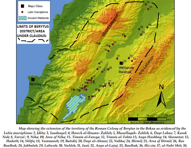
) or Laodicea in Canaan (2nd century to 64 BCE) , image = St. George's Cathedral, Beirut.jpg , image_size = , alt = , caption = Roman ruins of Berytus, in front of Saint George Greek Orthodox Cathedral in modern-day Beirut , map = , map_type = Lebanon , map_alt = , map_size = 270 , coordinates = , altitude_m = , altitude_ref = , relief = , gbgridref = , map_dot_label = , location = Beirut, Lebanon , region = , type = Settlement , part_of = , length = , width = , area = , volume = , diameter = , circumference = , height = , builder = , material = , built = Roman republic (merchants from early Laodicea/Berytus recorded by 110–109 BCE) , abandoned = , epochs = Roman and Early Byzantine/late antiquity; previous port dating back to Iron ... [...More Info...] [...Related Items...] OR: [Wikipedia] [Google] [Baidu] |
Cardo Decumanus Crossing
Cardo Decumanus Crossing was in the heart of Roman Berytus (actual Beirut, Lebanon). Overview The Cardo and Decumanus Maximus were the main colonnaded streets of Roman Berytus. Today, five erected columns mark the crossing of the Cardo and the Decumanus Maximus, the two main colonnaded streets of Roman Berytus. The Cardo Maximus connected the Roman Forum to a large complex, extending from the al-Azariyeh building to Riad Al Solh Square. The Decumanus Maximus ran parallel to Emir Bashir Street. Salvaged material from these colonnaded streets was used since the Umayyad period to build a new city wall and a water reservoir near the Roman crossing. The construction of the ring road in 1860 and building projects of the 20th century eliminated most of the ancient features. The new entrance to the Garden of Forgiveness gives access to the original Roman street. History The Cardo Maximus connected the Roman Forum to a large complex, that was the center of the old Roman city. The D ... [...More Info...] [...Related Items...] OR: [Wikipedia] [Google] [Baidu] |
2006 Lebanon War
The 2006 Lebanon War, also called the 2006 Israel–Hezbollah War and known in Lebanon as the July War ( ar, حرب تموز, ''Ḥarb Tammūz'') and in Israel as the Second Lebanon War ( he, מלחמת לבנון השנייה, ''Milhemet Levanon HaShniya''), was a 34-day war, military conflict in Lebanon, Northern Israel and the Golan Heights. The principal parties were Hezbollah paramilitary forces and the Israel Defense Forces (IDF). The conflict started on 12 July 2006, and continued until a United Nations-brokered ceasefire went into effect in the morning on 14 August 2006, though it formally ended on 8 September 2006 when Israel lifted its naval blockade of Lebanon. Due to unprecedented Iranian military support to Hezbollah before and during the war, some consider it the first round of the Iran–Israel proxy conflict, rather than a continuation of the Arab–Israeli conflict. The conflict was precipitated by the 2006 Hezbollah cross-border raid. On 12 July 2006, Hezbolla ... [...More Info...] [...Related Items...] OR: [Wikipedia] [Google] [Baidu] |
East Bay Times
The ''East Bay Times'' is a daily broadsheet newspaper based in Walnut Creek, California, United States, owned by the Bay Area News Group (BANG), a subsidiary of Media News Group, that serves Contra Costa and Alameda counties, in the East Bay region of the San Francisco Bay Area. It was founded as the ''Contra Costa Times'', and took its current name in 2016 when it was merged with other sister papers in the East Bay. Its oldest merged title is the ''Oakland Tribune'' founded in 1874. History The original ''Contra Costa Times'' was founded by Dean Lesher in 1947, and served central Contra Costa County, especially Walnut Creek. However, Lesher began expanding by purchasing weekly newspapers in neighboring communities, as well as two eastern Contra Costa daily papers, the '' Antioch Ledger'' and the ''Pittsburg Post-Dispatch''. Originally the weekly newspapers were free for shoppers, but Lesher gradually converted the papers to "controlled circulation" in 1962, an aggressive ... [...More Info...] [...Related Items...] OR: [Wikipedia] [Google] [Baidu] |
Place Charles De Gaulle
Place Charles de Gaulle (), historically known as the Place de l'Étoile (), is a large road junction in Paris, France, the meeting point of twelve straight avenues (hence its historic name, which translates as "Square of the Star") including the Champs-Élysées. It was renamed in 1970 following the death of President Charles de Gaulle. It is still often referred to by its original name; the nearby Métro and RER station retains the designation Charles de Gaulle–Étoile. Paris's ''Axe historique'' ("historical axis") cuts through the Arc de Triomphe, which stands at the centre of Place Charles de Gaulle. History The original name of the area was the ''Butte Chaillot'' ("Chaillot mound", named after the locality). At the time it was the point of convergence of several hunting trails. The Marquis de Marigny constructed monumental roadworks, completed in 1777, on the mound when he was establishing the plantations along the Champs-Élysées. This work included paving of the r ... [...More Info...] [...Related Items...] OR: [Wikipedia] [Google] [Baidu] |


.png)


