|
Galilee Basin
The Galilee Basin is a large inland geological basin in the western Queensland region of Australia. The Galilee Basin is part of a larger Carboniferous to Mid-Triassic basin system that contains the Cooper Basin, situated towards the south-west of the Galilee Basin, and the Bowen Basin to the east.Phillips, L., Esterle, J. & Sliwa, R., 2015, Rationalising the Late Permian coal seam stratigraphy of the Koburra Trough, Galilee Basin. Bowen Basin Symposium 2015, p219 – 226. The Galilee Basin covers a total area of approximately .Scott, S.G., Beeston, J,W., Carr, A.F., 1995, Galilee Basin. In: Ward CR, Harrington HJ, Mallett CW and Beeston JW (eds) Geology of Australian Coal Basins. Geological Society of Australia – Coal Geology Group. 1, 341–353. The basin is underlain by the Carboniferous Drummond Basin and overlain by the Cretaceous – Jurassic Eromanga Basin. The Triassic and younger sediments of the Galilee Basin form the basal sequence of the Great Artesian Basin drainage ... [...More Info...] [...Related Items...] OR: [Wikipedia] [Google] [Baidu] |
Geological Basin
A structural basin is a large-scale structural formation of rock strata formed by tectonic warping of previously flat-lying strata. They are geological depressions, the inverse of domes. Elongated structural basins are also known as synclines. Some are sedimentary basins, aggregations of sediment that filled up a depression or accumulated in an area. Others were formed by tectonic events long after the sedimentary layers were deposited. Basins may appear on a geologic map as roughly circular or elliptical, with concentric layers. Because the strata dip toward the center, the exposed strata in a basin are progressively younger from the outside in, with the youngest rocks in the center. Basins are often large in areal extent, often hundreds of kilometers across. Structural basins are often important sources of coal, petroleum, and groundwater. Examples Europe * Hampshire Basin, United Kingdom * London Basin, United Kingdom * Paris Basin, France * Permian Basin, Poland, northern ... [...More Info...] [...Related Items...] OR: [Wikipedia] [Google] [Baidu] |
Wetland
A wetland is a distinct ecosystem that is flooded or saturated by water, either permanently (for years or decades) or seasonally (for weeks or months). Flooding results in oxygen-free (anoxic) processes prevailing, especially in the soils. The primary factor that distinguishes wetlands from terrestrial land forms or Body of water, water bodies is the characteristic vegetation of aquatic plants, adapted to the unique anoxic hydric soils. Wetlands are considered among the most biologically diverse of all ecosystems, serving as home to a wide range of plant and animal species. Methods for assessing wetland functions, wetland ecological health, and general wetland condition have been developed for many regions of the world. These methods have contributed to wetland conservation partly by raising public awareness of the functions some wetlands provide. Wetlands occur naturally on every continent. The water in wetlands is either freshwater, brackish or seawater, saltwater. The main w ... [...More Info...] [...Related Items...] OR: [Wikipedia] [Google] [Baidu] |
Maranoa Region
Maranoa Region is a local government area in South West Queensland, Australia. The town of Roma is the administrative headquarters of the region. History The Gunggari language region of South West Queensland includes the landscape within the local government boundaries of the Maranoa Region particularly the towns of Mitchell, Amby, Dunkeld and Mungallala and the properties of Forest Vale and North Yanco. '' Gungabula'' (also known as ''Kongabula'' and ''Khungabula'') is an Australian Aboriginal language of the headwaters of the Dawson River in Central Queensland. The language region includes areas within the local government area of Maranoa Region, particularly the towns of Charleville, Augathella and Blackall and as well as the Carnarvon Range. On 17 May 1927, 57 allotments of Mount Abundance land, south-west of Roma, were advertised for lease by the Lands Department. Each lease carried a condition that a certain area had to be cultivated with wheat within a specified peri ... [...More Info...] [...Related Items...] OR: [Wikipedia] [Google] [Baidu] |
Longreach Region
The Longreach Region is a local government area in Central West Queensland, Australia. Established in 2008, it superseded three previous local government areas that had existed for more than a century. It has an estimated operating budget of A$22.3m. Traditionally, pastoral activities, tourism, and rural education have been the areas of focus within the region, with a major agricultural college and attractions such as the Australian Stockman's Hall of Fame and the Qantas Founders Outback Museum. History Longreach Region lay on the traditional tribal lands of the Iningai. Iningai (also known as Yiningay, Muttaburra, Tateburra, Yinangay, Yinangi) is an Australian Aboriginal language spoken by the Iningai people. The Iningai language region includes the landscape within the local government boundaries of the Longreach Region, particularly the towns of Longreach, Barcaldine, Muttaburra and Aramac as well as the properties of Bowen Downs and catchments of Cornish Creek and A ... [...More Info...] [...Related Items...] OR: [Wikipedia] [Google] [Baidu] |
Shire Of Flinders (Queensland)
The Shire of Flinders is a local government area in north-western Queensland, Australia. It covers an area of , and has existed as a local government entity since 1882. The Shire, named for the Flinders River, is predominantly a grazing area with cattle in the north of the shire and mixed grazing to the south in the black soil area. History Jirandali (also known as Yirandali, Warungu, Yirandhali) is an Australian Aboriginal language of North-West Queensland, particularly the Hughenden area. The language region includes the local government area of the Shire of Flinders, including Dutton River, Flinders River, Mount Sturgeon, Caledonia, Richmond, Corfield, Winton, Torrens, Tower Hill, Landsborough Creek, Lammermoor Station, Hughenden, and Tangorin. The Hughenden Division was established on 20 July 1882 under the ''Divisional Boards Act 1879''. On 20 April 1887, the Borough of Hughenden was constituted separately as a municipality for the emerging town of Hughenden. On ... [...More Info...] [...Related Items...] OR: [Wikipedia] [Google] [Baidu] |
Diamantina Shire
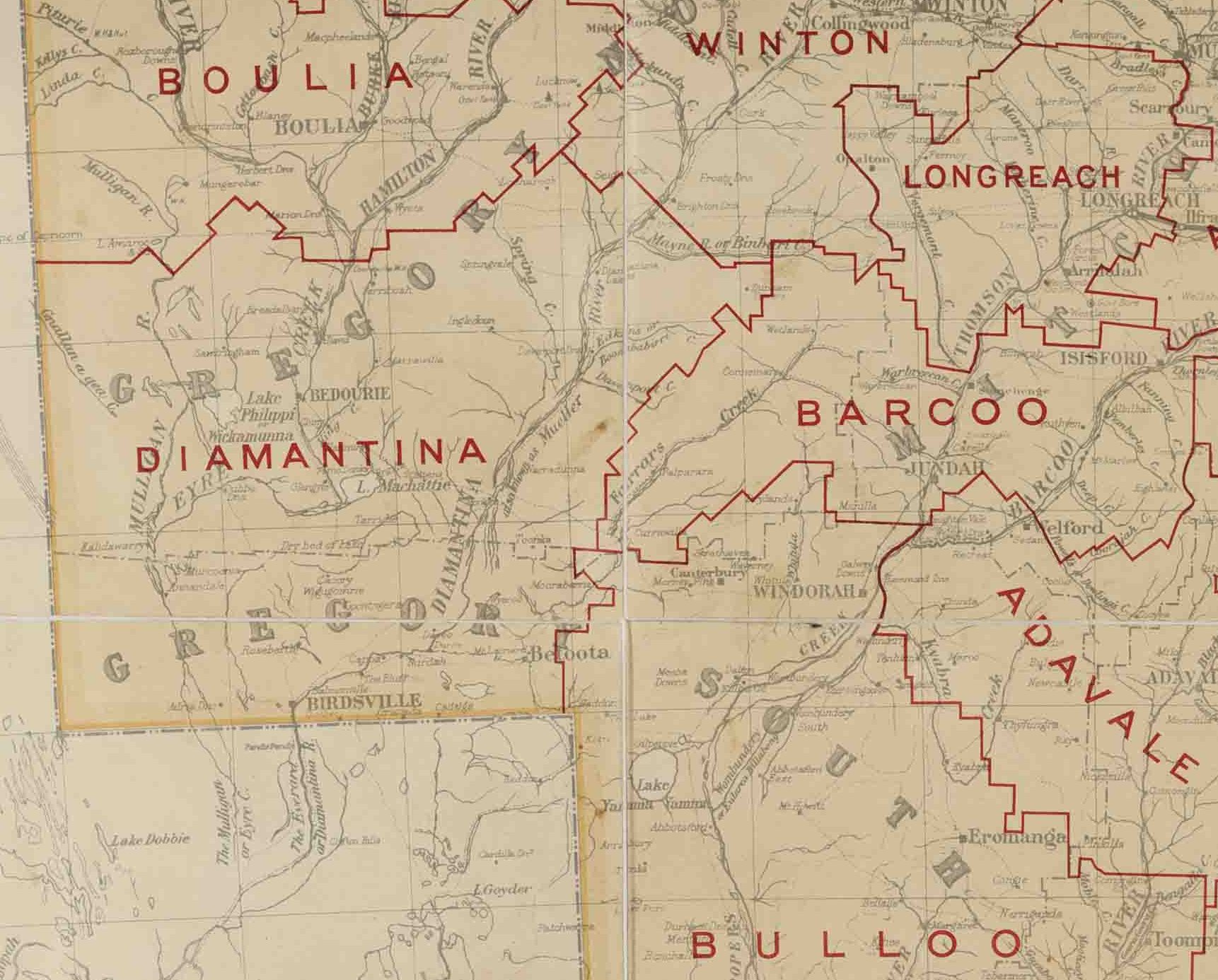
The Shire of Diamantina is a local government area in Central West Queensland, bordering South Australia and the Northern Territory. Its administrative centre is in the town of Bedourie. Like most places in Queensland with the "Diamantina" name, it was named after Lady Diamantina Bowen (née Roma), the wife of the first governor of Queensland, Sir George Bowen. It covers an area of , and is the second largest LGA in the state. The shire was established in 1879. The town of Birdsville is home to the Birdsville Races, a horse race meeting to raise money for the Royal Flying Doctor Service. History ''Wangkangurru (''also known as ''Arabana/Wangkangurru, Wangganguru, Wanggangurru, Wongkangurru)'' is an Australian Aboriginal language spoken on Wangkangurru country. It is closely related to Arabana language of South Australia. The Wangkangurru language region was traditionally in the South Australian-Queensland border region taking in Birdsville and extending south towards Innam ... [...More Info...] [...Related Items...] OR: [Wikipedia] [Google] [Baidu] |
Charters Towers Region
The Charters Towers Region is a local government area in North Queensland, Australia southwest of, and inland from the city of Townsville, based in Charters Towers. Established in 2008, it was preceded by two previous local government areas which dated back to the 1870s. It has an estimated operating budget of A$27.5 m. History ''Gugu Badhun'' (also known as ''Koko-Badun'' and ''Kokopatun'') is an Australian Aboriginal language of North Queensland. The language region includes areas within the local government area of Charters Towers Region, particularly the localities of Greenvale and the Valley of Lagoons, and in the Upper Burdekin River area and in Abergowrie. Prior to 2008, the Charters Towers Region was an entire area of two previous and distinct local government areas: * the City of Charters Towers; * and the Shire of Dalrymple. The City of Charters Towers had its beginning in the Charters Towers Municipality which was proclaimed on 21 June 1877 under the ''Munici ... [...More Info...] [...Related Items...] OR: [Wikipedia] [Google] [Baidu] |
Central Highlands Region
Central Highlands Region is a local government area in Queensland, Australia. History '' Wadja'' (also known as ''Wadjigu'', ''Wadya'', ''Wadjainngo'', ''Mandalgu'', and ''Wadjigun)'' is an Australian Aboriginal language in Central Queensland. The language region includes the local government areas of the Aboriginal Shire of Woorabinda and Central Highlands Region, including the Blackdown Tableland, the Comet River, and the Expedition Range, and the towns of Woorabinda, Springsure and Rolleston. '' Yambina'' (also known as ''Jambina'' and ''Jambeena'') is an Australian Aboriginal language of Central Queensland. Its traditional language region is the local government area of Central Highlands Region, including Peak Downs, Logan Creek, south to Avon Downs, east to Denham Range and Logan Downs, west to Elgin Downs and at Solferino. '' Yetimarala'' (also known as ''Jetimarala'', ''Yetimaralla'', and ''Bayali'') is an Australian Aboriginal language of Central Queensland. Its tr ... [...More Info...] [...Related Items...] OR: [Wikipedia] [Google] [Baidu] |
Blackall-Tambo Region
The Blackall-Tambo Region is a local government area in Central West Queensland, Australia. Established in 2008, it was preceded by two previous local government areas dating from the 1870s. For the financial year 2010/11 it had an approximate operating budget of A$30m. In June 2018, the Blackall-Tambo Region had a population of . History Kuungkari (also known as Kungkari and Koonkerri) is a language of Western Queensland. The Kuungkari language region includes the landscape within the local government boundaries of Longreach Shire Council and Blackall-Tambo Shire Council. Prior to the 2008 amalgamation, the Blackall-Tambo Region existed as two distinct local government areas: * the Shire of Blackall; * and the Shire of Tambo. The entire Region was originally part of Kargoolnah Division, which was created on 11 November 1879 as one of 74 divisions around Queensland under the ''Divisional Boards Act 1879''. On 20 May 1880, a municipal Borough of Blackall was created to c ... [...More Info...] [...Related Items...] OR: [Wikipedia] [Google] [Baidu] |
Barcoo Shire
The Shire of Barcoo is a local government area in Central West Queensland, Australia. In June 2018, the shire had a population of 267 people. It covers an area of , and has existed as a local government entity since 1887. It is named for the Barcoo River which reaches a confluence with the Thomson River in the shire to form Cooper Creek. The major industry in the shire is beef production and some opal mining. There has been some development of the known oil and gas reserves in the region. History Kuungkari (also known as Kungkari and Koonkerri) is a language of Western Queensland. The Kuungkari language region includes the landscape within the local government boundaries of Longreach Shire Council and Blackall-Tambo Shire Council. The Barcoo Division was created on 24 December 1887 out of the eastern part of the Diamantina Division, and was subject to the ''Divisional Boards Act 1887''. In 1927, the council met at Stonehenge. With the passage of the ''Local Autho ... [...More Info...] [...Related Items...] OR: [Wikipedia] [Google] [Baidu] |
Barcaldine Region
The Barcaldine Region is a local government area in Central West Queensland, Australia. Established in 2008, it was preceded by three previous local government areas which had existed for over a century. It has an estimated operating budget of A$21.6 million. History Barcaldine Region includes the traditional tribal lands of the Iningai. Iningai (also known as Yiningay, Muttaburra, Tateburra, Yinangay, Yinangi) is an Australian Aboriginal language spoken by the Iningai people. The Iningai language region includes the landscape within the local government boundaries of the Longreach Region and Barcaldine Region, particularly the towns of Longreach, Barcaldine, Muttaburra and Aramac as well as the properties of Bowen Downs and catchments of Cornish Creek and Alice River. Kuungkari (also known as Kungkari and Koonkerri) is a language of Western Queensland. The Kuungkari language region includes the landscape within the local government boundaries of Longreach Shire Council ... [...More Info...] [...Related Items...] OR: [Wikipedia] [Google] [Baidu] |


