|
Gabriola Island
Gabriola Island is one of the Gulf Islands in the Strait of Georgia in British Columbia (BC), Canada. It is about east of Nanaimo on Vancouver Island, to which it is linked by a 20-minute ferry service. It has a land area of about and a resident population of 4,500. Gabriola has public beaches and forests, shopping centres, restaurants, a library, an elementary school and a museum. It is known as the Isle of the Arts due to its high percentage of working artists, and its many cultural events include annual festivals related to art, poetry, gardens, music, boating and fishing. The Gabriola Arts Council produces three large annual events: the Isle of the Arts Festival (April), Gabriola Theatre Festival (now defunct) and Thanksgiving Studio Tour (October). History Pre-contact Gabriola is part of the traditional territory of the Snunéymux (of whose name the nearby city of Nanaimo was given an anglicized form). The earliest archeological record on Gabriola is a cave burial date ... [...More Info...] [...Related Items...] OR: [Wikipedia] [Google] [Baidu] |
Gulf Islands
The Gulf Islands are a group of islands in the Salish Sea between Vancouver Island and the mainland coast of British Columbia. Etymology The name "Gulf Islands" comes from "Gulf of Georgia," the original term used by George Vancouver in his mapping of the southern part of the archipelago and which before the San Juan Island dispute also was taken to include what have since been called the San Juan Islands. Strictly speaking, the Strait of Georgia is only the wide, open waters of the main strait between the mainland and Vancouver Island, and does not officially refer to the adjoining waters between the islands and Vancouver Island but has become a common misnomer for the entire Gulf, which includes waters such as Active Pass (between Galiano Island and Mayne Island), Trincomali Channel (between Galiano Island and Saltspring Island), Sansum Narrows (between Saltspring Island and Vancouver Island), and Malaspina Strait (between Texada Island and the mainland around Powell Rive ... [...More Info...] [...Related Items...] OR: [Wikipedia] [Google] [Baidu] |
Juan Francisco De La Bodega Y Quadra
Juan Francisco de la Bodega y Quadra (22 May 1743 – 26 March 1794) was a Spanish Criollo naval officer operating in the Americas. Assigned to the Pacific coast Spanish Naval Department base at San Blas, in Viceroyalty of New Spain (present day Mexico), he explored the Northwest Coast of North America as far north as present day Alaska. Bodega Bay in California is named for him. Juan Francisco de la Bodega y Quadra joined the Spanish Naval Academy in Cádiz at 19, and four years later, in 1767 was commissioned as an officer of the rank Frigate Ensign (''alférez de fragata''). In 1773 he was promoted to Ship Ensign (''alférez de navío''), and in 1774 to Ship Lieutenant (''teniente de navío''). Parentage Bodega y Quadra was born in Lima, Peru, to Tomás de la Bodega y de las Llanas of Biscay, Spain and Francisca de Mollinedo y Losada of Lima, Peru (her parents were from Bilbao in Spain). His family was of Basque origin. He studied at the National University of San Marcos ... [...More Info...] [...Related Items...] OR: [Wikipedia] [Google] [Baidu] |
San Juan Islands
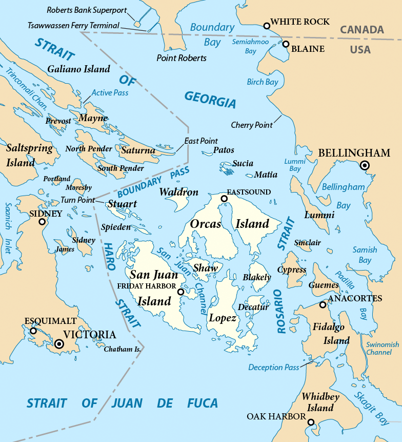
The San Juan Islands are an archipelago in the Pacific Northwest of the United States between the U.S. state of Washington and Vancouver Island, British Columbia, Canada. The San Juan Islands are part of Washington state, and form the core of San Juan County. In the archipelago, four islands are accessible to vehicular and foot traffic via the Washington State Ferries system.San Juan Islands Route Map , Washington State Ferries 
History [...More Info...] [...Related Items...] OR: [Wikipedia] [Google] [Baidu] |
Diatomaceous Earth
Diatomaceous earth (), diatomite (), or kieselgur/kieselguhr is a naturally occurring, soft, siliceous sedimentary rock that can be crumbled into a fine white to off-white powder. It has a particle size ranging from more than 3 μm to less than 1 mm, but typically 10 to 200 μm. Depending on the granularity, this powder can have an abrasive feel, similar to pumice powder, and has a low density as a result of its high porosity. The typical chemical composition of oven-dried diatomaceous earth is 80–90% silica, with 2–4% alumina (attributed mostly to clay minerals), and 0.5–2% iron oxide. Diatomaceous earth consists of the fossilized remains of diatoms, a type of hard-shelled microalgae. It is used as a filtration aid, mild abrasive in products including metal polishes and toothpaste, mechanical insecticide, absorbent for liquids, matting agent for coatings, reinforcing filler in plastics and rubber, anti-block in plastic films, porous support for c ... [...More Info...] [...Related Items...] OR: [Wikipedia] [Google] [Baidu] |
Millstone
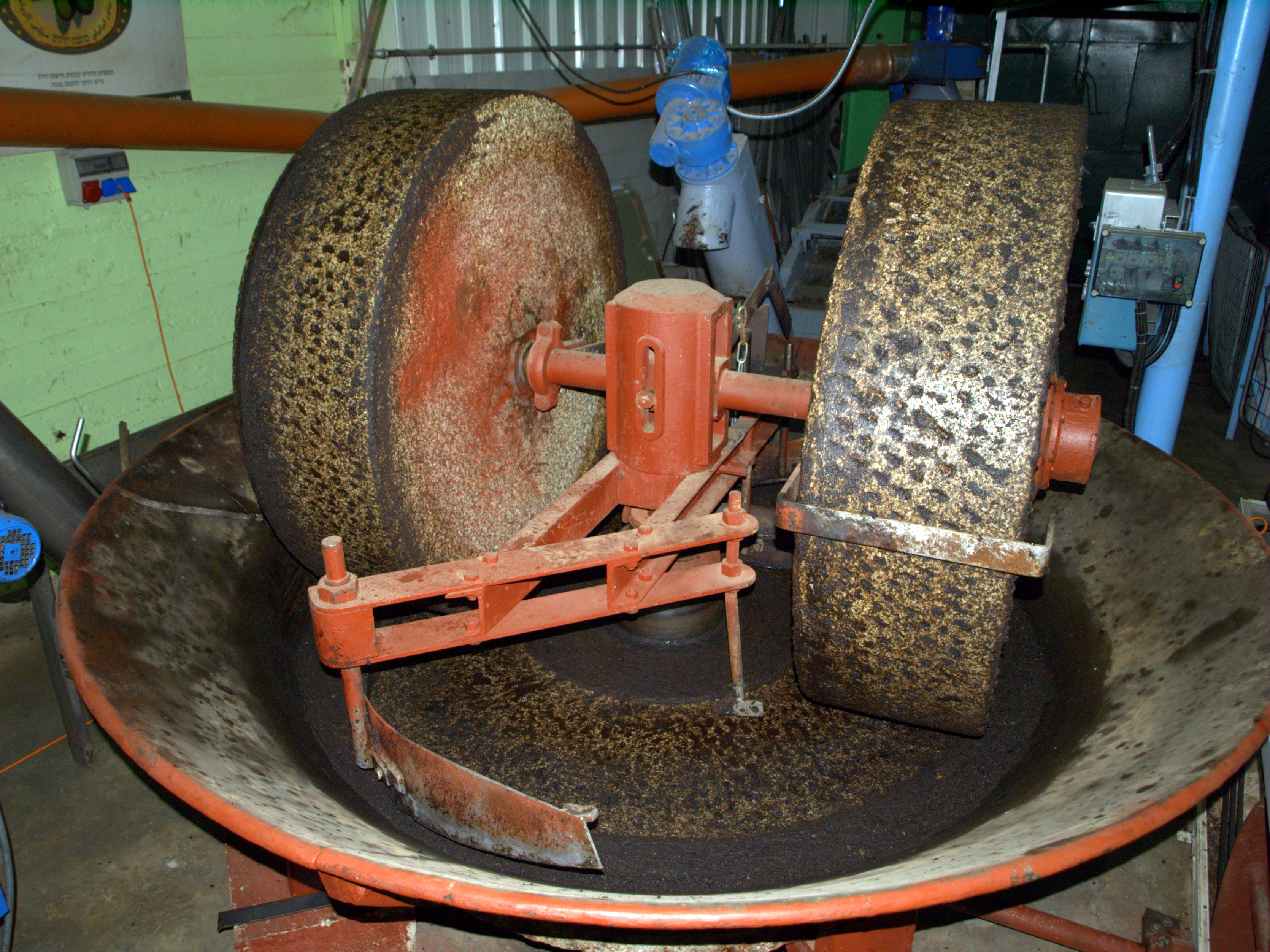
Millstones or mill stones are stones used in gristmills, for grinding wheat or other grains. They are sometimes referred to as grindstones or grinding stones. Millstones come in pairs: a convex stationary base known as the ''bedstone'' and a concave ''runner stone'' that rotates. The movement of the runner on top of the bedstone creates a "scissoring" action that grinds grain trapped between the stones. Millstones are constructed so that their shape and configuration help to channel ground flour to the outer edges of the mechanism for collection. The runner stone is supported by a cross-shaped metal piece (millrind or rynd) fixed to a "mace head" topping the main shaft or spindle leading to the driving mechanism of the mill (wind, water (including tide) or other means). History The earliest evidence for stones used to grind food is found in northern Australia, at the Madjedbebe rock shelter in Arnhem Land, dating back around 60,000 years. Grinding stones or grindston ... [...More Info...] [...Related Items...] OR: [Wikipedia] [Google] [Baidu] |
Victoria, British Columbia
Victoria is the capital city of the Canadian province of British Columbia, on the southern tip of Vancouver Island off Canada's Pacific coast. The city has a population of 91,867, and the Greater Victoria area has a population of 397,237. The city of Victoria is the 7th most densely populated city in Canada with . Victoria is the southernmost major city in Western Canada and is about southwest from British Columbia's largest city of Vancouver on the mainland. The city is about from Seattle by airplane, seaplane, ferry, or the Victoria Clipper passenger-only ferry, and from Port Angeles, Washington, by ferry across the Strait of Juan de Fuca. Named for Queen Victoria, the city is one of the oldest in the Pacific Northwest, with British settlement beginning in 1843. The city has retained a large number of its historic buildings, in particular its two most famous landmarks, the Parliament Buildings (finished in 1897 and home of the Legislative Assembly of British Columbia ... [...More Info...] [...Related Items...] OR: [Wikipedia] [Google] [Baidu] |
Vancouver
Vancouver ( ) is a major city in western Canada, located in the Lower Mainland region of British Columbia. As the List of cities in British Columbia, most populous city in the province, the 2021 Canadian census recorded 662,248 people in the city, up from 631,486 in 2016. The Greater Vancouver, Greater Vancouver area had a population of 2.6million in 2021, making it the List of census metropolitan areas and agglomerations in Canada#List, third-largest metropolitan area in Canada. Greater Vancouver, along with the Fraser Valley Regional District, Fraser Valley, comprises the Lower Mainland with a regional population of over 3 million. Vancouver has the highest population density in Canada, with over 5,700 people per square kilometre, and fourth highest in North America (after New York City, San Francisco, and Mexico City). Vancouver is one of the most Ethnic origins of people in Canada, ethnically and Languages of Canada, linguistically diverse cities in Canada: 49.3 percent of ... [...More Info...] [...Related Items...] OR: [Wikipedia] [Google] [Baidu] |
Hippie
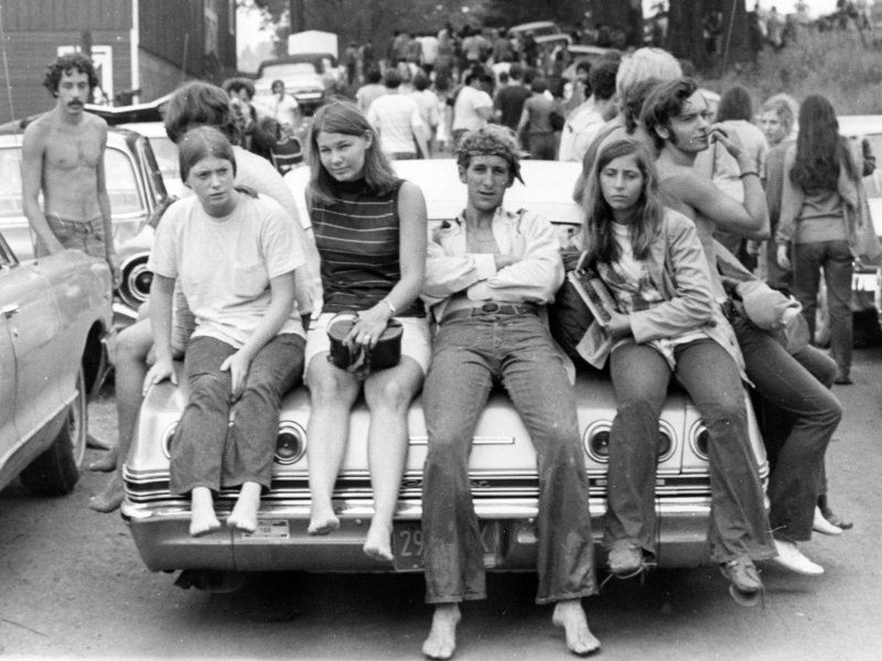
A hippie, also spelled hippy, especially in British English, is someone associated with the counterculture of the 1960s, originally a youth movement that began in the United States during the mid-1960s and spread to different countries around the world. The word '' hippie'' came from '' hipster'' and was used to describe beatniks who moved into New York City's Greenwich Village, in San Francisco's Haight-Ashbury district, and Chicago's Old Town community. The term ''hippie'' was used in print by San Francisco writer Michael Fallon, helping popularize use of the term in the media, although the tag was seen elsewhere earlier. The origins of the terms ''hip'' and ''hep'' are uncertain. By the 1940s, both had become part of African American jive slang and meant "sophisticated; currently fashionable; fully up-to-date". The Beats adopted the term ''hip'', and early hippies inherited the language and countercultural values of the Beat Generation. Hippies created their own communit ... [...More Info...] [...Related Items...] OR: [Wikipedia] [Google] [Baidu] |
First Nations In Canada
First Nations (french: Premières Nations) is a term used to identify those Indigenous Canadian peoples who are neither Inuit nor Métis. Traditionally, First Nations in Canada were peoples who lived south of the tree line, and mainly south of the Arctic Circle. There are 634 recognized First Nations governments or bands across Canada. Roughly half are located in the provinces of Ontario and British Columbia. Under Charter jurisprudence, First Nations are a "designated group," along with women, visible minorities, and people with physical or mental disabilities. First Nations are not defined as a visible minority by the criteria of Statistics Canada. North American indigenous peoples have cultures spanning thousands of years. Some of their oral traditions accurately describe historical events, such as the Cascadia earthquake of 1700 and the 18th-century Tseax Cone eruption. Written records began with the arrival of European explorers and colonists during the Age of Dis ... [...More Info...] [...Related Items...] OR: [Wikipedia] [Google] [Baidu] |
Fraser River
The Fraser River is the longest river within British Columbia, Canada, rising at Fraser Pass near Blackrock Mountain in the Rocky Mountains and flowing for , into the Strait of Georgia just south of the City of Vancouver. The river's annual discharge at its mouth is or , and it discharges 20 million tons of sediment into the ocean. Naming The river is named after Simon Fraser, who led an expedition in 1808 on behalf of the North West Company from the site of present-day Prince George almost to the mouth of the river. The river's name in the Halqemeylem (Upriver Halkomelem) language is , often seen archaically as Staulo, and has been adopted by the Halkomelem-speaking peoples of the Lower Mainland as their collective name, . The river's name in the Dakelh language is . The ''Tsilhqot'in'' name for the river, not dissimilar to the ''Dakelh'' name, is , meaning Sturgeon ''()'' River ''()''. Course The Fraser drains a area. Its source is a dripping spring at Fraser Pas ... [...More Info...] [...Related Items...] OR: [Wikipedia] [Google] [Baidu] |
Fort Langley, British Columbia
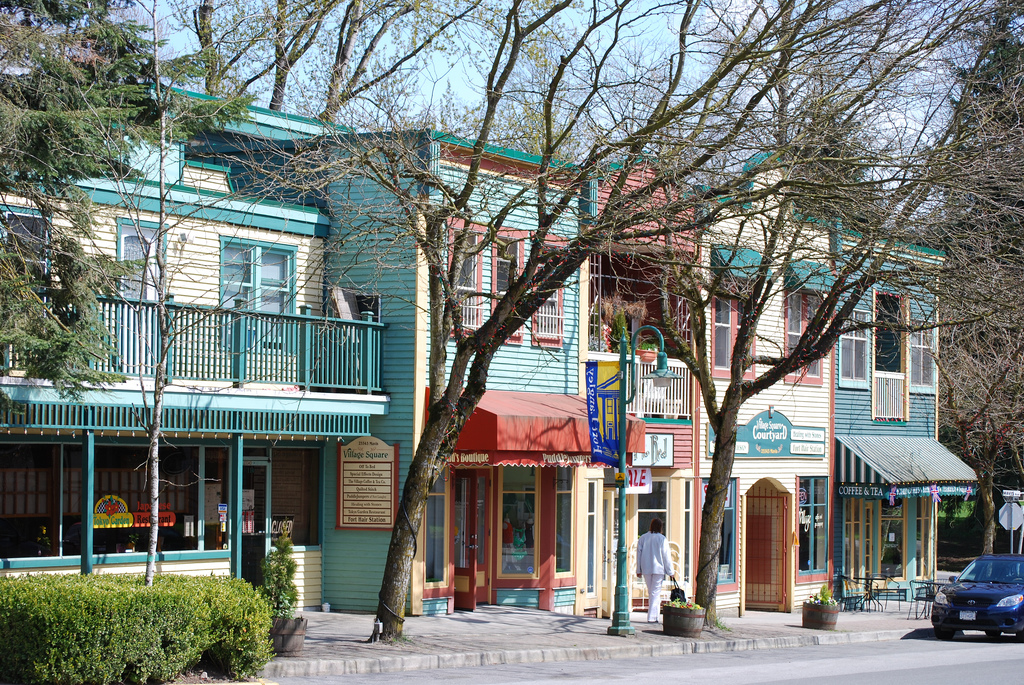
Fort Langley is a village community in Township of Langley, British Columbia, Canada. It has a population of approximately 3,400 people. It is the home of Fort Langley National Historic Site, a former fur trade post of the Hudson's Bay Company. Lying on the Fraser River, Fort Langley is at the northern edge of the Township of Langley. History Fort Langley was named after Thomas Langley, a director with HBC. and dates from a time when the boundary between British and American possession of the trans-mountain west, known as the Columbia District to the British and Oregon Country to Americans, had not yet been decided. Sir George Simpson, Governor of the Hudson's Bay Company, realized that Fort Vancouver opposite of present-day Portland, Oregon might be lost to the Americans if the border did not follow the Columbia River. Fearing the 49th parallel north could become the demarcation line, Simpson ordered the Hudson's Bay Company to construct the original Fort Langley in 1827 a ... [...More Info...] [...Related Items...] OR: [Wikipedia] [Google] [Baidu] |
Hudson's Bay Company
The Hudson's Bay Company (HBC; french: Compagnie de la Baie d'Hudson) is a Canadian retail business group. A fur trading business for much of its existence, HBC now owns and operates retail stores in Canada. The company's namesake business division is Hudson's Bay, commonly referred to as The Bay ( in French). After incorporation by English royal charter in 1670, the company functioned as the ''de facto'' government in parts of North America for nearly 200 years until the HBC sold the land it owned (the entire Hudson Bay drainage basin, known as Rupert's Land) to Canada in 1869 as part of the Deed of Surrender, authorized by the Rupert's Land Act 1868. At its peak, the company controlled the fur trade throughout much of the English- and later British-controlled North America. By the mid-19th century, the company evolved into a mercantile business selling a wide variety of products from furs to fine homeware in a small number of sales shops (as opposed to trading posts) acros ... [...More Info...] [...Related Items...] OR: [Wikipedia] [Google] [Baidu] |


_VICTORIA_FROM_JAMES'_BAY_LOOKING_UP_GOVERNMENT_STREET.jpg)


