|
Funafala
Funafala is an islet of Funafuti, Tuvalu that is inhabited by five families, with a church also located on the islet. Funafala means 'the pandanus of Funa', the name of a chief, after whom also the group has been named Funafuti. Cyclones of 1883 & 1972 George Westbrook, a trader on Funafuti, recorded a Cyclone that struck Funafuti in 1883. At the time the Cyclone struck he was the sole inhabitant of Fongafale as Tema, the Samoan missionary, had taken everyone else to Funafala to work on erecting a church. The buildings on Fongafale were destroyed, including the church and the trade stores of George Westbrook and Alfred Restieaux. Little damage had occurred at Funafala and the people returned to rebuild at Fongafale. In 1972 Funafuti was in the path of Cyclone Bebe. Tropical Cyclone Bebe was a pre-season tropical cyclone that impacted the Gilbert, Ellice Islands, and Fiji island groups.Bureau of Meteorology (1975) ''Tropical Cyclones in the Northern Australian Regions 1971-1972' ... [...More Info...] [...Related Items...] OR: [Wikipedia] [Google] [Baidu] |
Funafuti
Funafuti is the capital of the island nation of Tuvalu. It has a population of 6,320 people (2017 census), and so it has more people than the rest of Tuvalu combined, with approximately 60% of the population. It consists of a narrow sweep of land between wide, encircling a large lagoon (''Te Namo'') long and wide. The average depth of the Funafuti lagoon is about 20 fathoms (36.5 metres or 120 feet). With a surface area of , it is by far the largest lagoon in Tuvalu. The land area of the 33 islets around the atoll of Funafuti totals ; taken together, they constitute less than one percent of the total area of the atoll. Cargo ships can enter Funafuti's lagoon and dock at the port facilities on Fongafale. The capital of Tuvalu is sometimes said to be Fongafale or Vaiaku, but, officially, the entire atoll of Funafuti is its capital, since it has a single government that is responsible for the whole atoll. Fongafale The largest island is Fongafale. The island houses four villag ... [...More Info...] [...Related Items...] OR: [Wikipedia] [Google] [Baidu] |
Fongafale
Fongafale (also spelled Fogale or Fagafale) is the largest of Funafuti's islets in Tuvalu. It is a long narrow sliver of land, 12 kilometres long and between 10 and 400 metres wide, with the South Pacific Ocean and reef on the east and the protected lagoon on the west. The north part is the Tengako peninsula, and Funafuti International Airport runs from northeast to southwest on the widest part of the island, with the village and administrative centre of Vaiaku on the lagoon side. On Fongafale, the Funafuti Kaupule is responsible for approval of the construction of houses or extensions to existing buildings on private land, and the Lands Management Committee is the responsible authority in relation to lands leased by government. In 1972, Funafuti was in the path of Cyclone Bebe. Cyclone Bebe knocked down 90% of the houses and trees on Fongafale. The storm surge created a wall of coral rubble along the ocean side of Fongafale and Funafala that was about long, and about to thic ... [...More Info...] [...Related Items...] OR: [Wikipedia] [Google] [Baidu] |
Princess Margaret Hospital (Funafuti)
Princess Margaret Hospital (PMH) on Funafuti atoll in Tuvalu is the only hospital in the country, and the primary provider of medical services for all the islands of Tuvalu. The hospital is located about 1.3 kilometres north from the centre of Funafuti on Fongafale islet. For 2010, the total health budget was AUD $4,696,042. The hospital has 50 beds with separate wards for men, women and infants. It offers basic routine medical, surgical, obstetric and gynaecologic services. There is also an Intensive Care Unit (ICU), a surgery room and nurses' station. PMH also provides accident and emergency services. Services to the outer islands of the country is provided by satellite clinics, staffed generally with a nurse and a midwife. History of health services First hospital at Funafuti (1913) The first hospital was established at Funafuti in 1913 at the direction of G.B.W. Smith-Rewse, during his tenure as the District Officer at Funafuti from 1909 to 1915. At this time Tuvalu was kno ... [...More Info...] [...Related Items...] OR: [Wikipedia] [Google] [Baidu] |
Island
An island (or isle) is an isolated piece of habitat that is surrounded by a dramatically different habitat, such as water. Very small islands such as emergent land features on atolls can be called islets, skerries, cays or keys. An island in a river or a lake island may be called an eyot or ait, and a small island off the coast may be called a holm. Sedimentary islands in the Ganges delta are called chars. A grouping of geographically or geologically related islands, such as the Philippines, is referred to as an archipelago. There are two main types of islands in the sea: continental and oceanic. There are also artificial islands, which are man-made. Etymology The word ''island'' derives from Middle English ''iland'', from Old English ''igland'' (from ''ig'' or ''ieg'', similarly meaning 'island' when used independently, and -land carrying its contemporary meaning; cf. Dutch ''eiland'' ("island"), German ''Eiland'' ("small island")). However, the spelling of the word ... [...More Info...] [...Related Items...] OR: [Wikipedia] [Google] [Baidu] |
Tuvalu
Tuvalu ( or ; formerly known as the Ellice Islands) is an island country and microstate in the Polynesian subregion of Oceania in the Pacific Ocean. Its islands are situated about midway between Hawaii and Australia. They lie east-northeast of the Santa Cruz Islands (which belong to the Solomon Islands), northeast of Vanuatu, southeast of Nauru, south of Kiribati, west of Tokelau, northwest of Samoa and Wallis and Futuna, and north of Fiji. Tuvalu is composed of three reef islands and six atolls. They are spread out between the latitude of 5th parallel south, 5° and 10th parallel south, 10° south and between the longitude of 176th meridian east, 176° and 180th meridian, 180°. They lie west of the International Date Line. Tuvalu has a population of 10,507 (2017 census). The total land area of the islands of Tuvalu is . The first inhabitants of Tuvalu were Polynesians, according to well-established theories regarding a History of the Polynesian people, migration of Polynes ... [...More Info...] [...Related Items...] OR: [Wikipedia] [Google] [Baidu] |
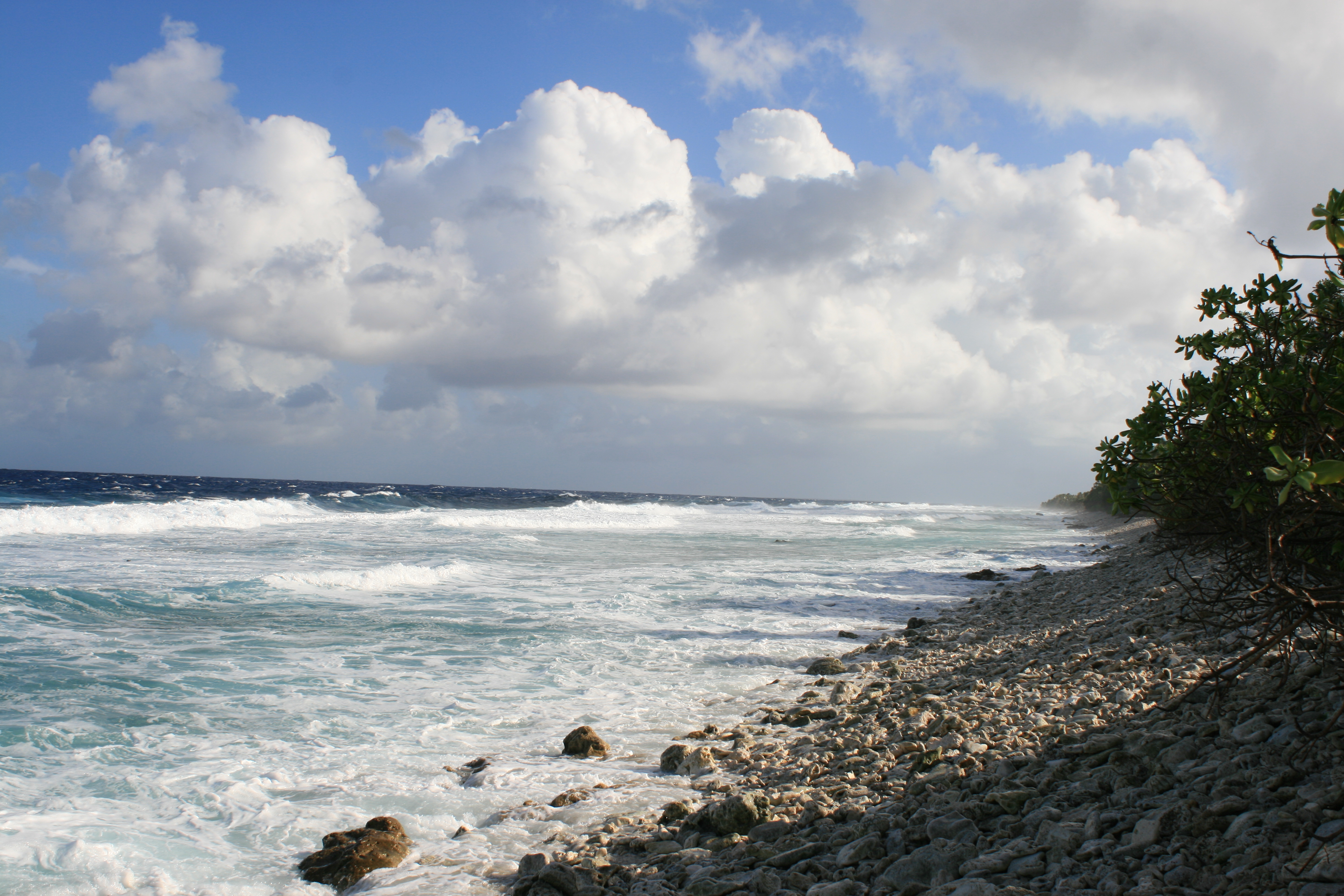
Ocean Side Funafuti
The ocean (also the sea or the world ocean) is the body of salt water that covers approximately 70.8% of the surface of Earth and contains 97% of Earth's water. An ocean can also refer to any of the large bodies of water into which the world ocean is conventionally divided."Ocean." ''Merriam-Webster.com Dictionary'', Merriam-Webster, |
Alfred Restieaux
Alfred Restieaux (1832–1911) was born in Somers Town, London, England and came from a family of French descent. His grandfather was a French nobleman who escaped the guillotine during the French Revolution. At the age of 16 he migrated to Australia and later he travelled to South America and North America. He later became an island trader in the central Pacific. From 1867 to 1872 he had dealings with Ben Pease and Bully Hayes, two of the more notorious captains of ships and blackbirders that operated in the Pacific at that time. Early history Restieaux left England in the Barque ''Cromwell'' soon after the Chartist Riots in London and arrived in South Australia in August 1848 or 1849. He worked on sheep stations and engaged in exploration for gold in South Australia and Victoria. At one time he spent two weeks in the company of 3 bushrangers, who were on the run from the police after a robbery of gold. It is possible that this was the party of bushrangers, led by John Fra ... [...More Info...] [...Related Items...] OR: [Wikipedia] [Google] [Baidu] |
Cyclone Bebe
Severe Tropical Cyclone Bebe, also known as Hurricane Bebe, was a pre-season storm during October 1972 in the South Pacific Ocean that severely affected Fiji, the Ellice Islands (now Tuvalu), and the Gilbert Islands (now Kiribati). Meteorological history The origins of Severe Tropical Cyclone Bebe can be traced to a pair of tropical disturbances, which were first noted on either side of the Equator near the 175th meridian west during October 16. The first system developed in the Northern Hemisphere and eventually developed into Typhoon Olga, before it impacted the Marshall Islands. The second disturbance developed within the South Pacific Ocean and started to move westwards, before it started to show signs of developing into a tropical cyclone during October 19. Over the next couple of days, the system started to move south-westwards and was named Bebe by the New Zealand Meteorological Service, after it had become a category 1 tropical cyclone on the modern-day Australian scal ... [...More Info...] [...Related Items...] OR: [Wikipedia] [Google] [Baidu] |
Tropical Cyclone
A tropical cyclone is a rapidly rotating storm system characterized by a low-pressure center, a closed low-level atmospheric circulation, strong winds, and a spiral arrangement of thunderstorms that produce heavy rain and squalls. Depending on its location and strength, a tropical cyclone is referred to by different names, including hurricane (), typhoon (), tropical storm, cyclonic storm, tropical depression, or simply cyclone. A hurricane is a strong tropical cyclone that occurs in the Atlantic Ocean or northeastern Pacific Ocean, and a typhoon occurs in the northwestern Pacific Ocean. In the Indian Ocean, South Pacific, or (rarely) South Atlantic, comparable storms are referred to simply as "tropical cyclones", and such storms in the Indian Ocean can also be called "severe cyclonic storms". "Tropical" refers to the geographical origin of these systems, which form almost exclusively over tropical seas. "Cyclone" refers to their winds moving in a circle, whirling round ... [...More Info...] [...Related Items...] OR: [Wikipedia] [Google] [Baidu] |
Gilbert Islands
The Gilbert Islands ( gil, Tungaru;Reilly Ridgell. ''Pacific Nations and Territories: The Islands of Micronesia, Melanesia, and Polynesia.'' 3rd. Ed. Honolulu: Bess Press, 1995. p. 95. formerly Kingsmill or King's-Mill IslandsVery often, this name applied only to the southern islands of the archipelago, the northern half being designated as the Scarborough Islands. ''Merriam-Webster's Geographical Dictionary''. Springfield, Massachusetts: Merriam Webster, 1997. p. 594) are a chain of sixteen atolls and coral islands in the Pacific Ocean, about halfway between Papua New Guinea and Hawaii. They constitute the main part of the nation of Kiribati (the name of which is a rendering of “Gilberts” in the phonology of the indigenous Gilbertese). Geography The atolls and islands of the Gilbert Islands are arranged in an approximate north-to-south line. The northernmost island in the group, Makin, it is approximately from southernmost, Arorae, as the crow flies. Geographically, the ... [...More Info...] [...Related Items...] OR: [Wikipedia] [Google] [Baidu] |
Fiji
Fiji ( , ,; fj, Viti, ; Fiji Hindi: फ़िजी, ''Fijī''), officially the Republic of Fiji, is an island country in Melanesia, part of Oceania in the South Pacific Ocean. It lies about north-northeast of New Zealand. Fiji consists of an archipelago of more than 330 islands—of which about 110 are permanently inhabited—and more than 500 islets, amounting to a total land area of about . The most outlying island group is Ono-i-Lau. About 87% of the total population of live on the two major islands, Viti Levu and Vanua Levu. About three-quarters of Fijians live on Viti Levu's coasts: either in the capital city of Suva; or in smaller urban centres such as Nadi—where tourism is the major local industry; or in Lautoka, where the Sugarcane, sugar-cane industry is dominant. The interior of Viti Levu is sparsely inhabited because of its terrain. The majority of Fiji's islands were formed by Volcano, volcanic activity starting around 150 million years ago. Some geo ... [...More Info...] [...Related Items...] OR: [Wikipedia] [Google] [Baidu] |
Pacific War
The Pacific War, sometimes called the Asia–Pacific War, was the theater of World War II that was fought in Asia, the Pacific Ocean, the Indian Ocean, and Oceania. It was geographically the largest theater of the war, including the vast Pacific Ocean theater, the South West Pacific theater, the Second Sino-Japanese War, and the Soviet–Japanese War. The Second Sino-Japanese War between the Empire of Japan and the Republic of China had been in progress since 7 July 1937, with hostilities dating back as far as 19 September 1931 with the Japanese invasion of Manchuria. However, it is more widely accepted that the Pacific War itself began on 7 December (8 December Japanese time) 1941, when the Japanese simultaneously invaded Thailand, attacked the British colonies of Malaya, Singapore, and Hong Kong as well as the United States military and naval bases in Hawaii, Wake Island, Guam, and the Philippines. The Pacific War saw the Allies pitted against Japan, the latter ai ... [...More Info...] [...Related Items...] OR: [Wikipedia] [Google] [Baidu] |


