|
François Xavier Aubry
François Xavier Aubry (December 3, 1824 – August 18, 1854) was a French Canadian merchant and explorer of the American Southwest. His achievements include speed records riding the Santa Fe Trail and early exploration of the 35th parallel north west of the North American continental divide. Biography Aubry was born to Joseph and Magdeleine (Lupien) Aubry in Saint-Justin, Quebec on December 3, 1824. There he grew up on a farm. When he was 18, he moved to St. Louis where he worked as a store clerk. After seeing the profits available for merchants transporting goods along the Santa Fe Trail, Aubry saved his money to purchase several wagons and draft animals. He then obtained a line of credit with which to purchase trade goods and left on his first trip down Santa Fe trail from Independence on May 9, 1846 as part of a trader's caravan. After selling his goods in Santa Fe, Aubry returned with enough profits to fully pay off his loans. In 1847 he moved to Independence, Missou ... [...More Info...] [...Related Items...] OR: [Wikipedia] [Google] [Baidu] |
Saint-Justin, Quebec
Saint-Justin is a municipality in the Mauricie region of the province of Quebec in Canada Canada is a country in North America. Its ten provinces and three territories extend from the Atlantic Ocean to the Pacific Ocean and northward into the Arctic Ocean, covering over , making it the world's second-largest country by tot .... On December 6, 2014, Saint-Justin changed from parish municipality to a (regular) municipality. References Municipalities in Quebec Incorporated places in Mauricie {{Quebec-geo-stub ... [...More Info...] [...Related Items...] OR: [Wikipedia] [Google] [Baidu] |
Tejon Pass
The Tejon Pass , previously known as ''Portezuelo de Cortes'', ''Portezuela de Castac'', and Fort Tejon Pass is a mountain pass between the southwest end of the Tehachapi Mountains and northeastern San Emigdio Mountains, linking Southern California north to the Central Valley. Both the pass and the grade north of it to the Central Valley is commonly referred to as " the Grapevine". It has been traversed by major roads such as the El Camino Viejo, the Stockton – Los Angeles Road, the Ridge Route, U.S. Route 99, and now Interstate 5. Geography Tejon Pass marks the intersection of the two largest seismic faults in California: the San Andreas and Garlock fault systems. The highest point of the pass is near the northwesternmost corner of Los Angeles County, north of Gorman. Its elevation is along Peace Valley Road and Gorman Post Road, northwest of downtown Los Angeles and south of Bakersfield. Interstate 5, which connects Southern California with the San Joaquin Valley a ... [...More Info...] [...Related Items...] OR: [Wikipedia] [Google] [Baidu] |
San Jose, California
San Jose, officially San José (; ; ), is a major city in the U.S. state of California that is the cultural, financial, and political center of Silicon Valley and largest city in Northern California by both population and area. With a 2020 population of 1,013,240, it is the most populous city in both the Bay Area and the San Jose–San Francisco–Oakland, CA Combined Statistical Area, San Jose-San Francisco-Oakland Combined Statistical Area, which contain 7.7 million and 9.7 million people respectively, the List of largest California cities by population, third-most populous city in California (after Los Angeles and San Diego and ahead of San Francisco), and the List of United States cities by population, tenth-most populous in the United States. Located in the center of the Santa Clara Valley on the southern shore of San Francisco Bay, San Jose covers an area of . San Jose is the county seat of Santa Clara County, California, Santa Clara County and the main component of the San ... [...More Info...] [...Related Items...] OR: [Wikipedia] [Google] [Baidu] |
Arizona
Arizona ( ; nv, Hoozdo Hahoodzo ; ood, Alĭ ṣonak ) is a state in the Southwestern United States. It is the 6th largest and the 14th most populous of the 50 states. Its capital and largest city is Phoenix. Arizona is part of the Four Corners region with Utah to the north, Colorado to the northeast, and New Mexico to the east; its other neighboring states are Nevada to the northwest, California to the west and the Mexican states of Sonora and Baja California to the south and southwest. Arizona is the 48th state and last of the contiguous states to be admitted to the Union, achieving statehood on February 14, 1912. Historically part of the territory of in New Spain, it became part of independent Mexico in 1821. After being defeated in the Mexican–American War, Mexico ceded much of this territory to the United States in 1848. The southernmost portion of the state was acquired in 1853 through the Gadsden Purchase. Southern Arizona is known for its desert cl ... [...More Info...] [...Related Items...] OR: [Wikipedia] [Google] [Baidu] |
Pacific Railroad Surveys
The Pacific Railroad Surveys (1853–1855) were of a series of explorations of the American West designed to find and document possible routes for a transcontinental railroad across North America. The expeditions included surveyors, scientists, and artists and resulted in an immense body of data covering at least on the American West. "These volumes... constitute probably the most important single contemporary source of knowledge on Western geography and history and their value is greatly enhanced by the inclusion of many beautiful plates in color of scenery, native inhabitants, fauna and flora of the Western country." Published by the United States War Department from 1855 to 1860, the surveys contained significant material on natural history, including many illustrations of reptiles, amphibians, birds, and mammals. In addition to describing the route, these surveys also reported on the geology, zoology, botany, paleontology of the land as well as provided ethnographic descriptions ... [...More Info...] [...Related Items...] OR: [Wikipedia] [Google] [Baidu] |
Amiel W (born 1979), American-Australian pop singer
{{given name, type=both ...
Amiel is both a surname and a given name. Notable people with the name include: Surname: * Barbara Amiel (born 1940), writer and wife of Conrad Black * Gausbert Amiel (fl. 13th century), troubadour * Henri-Frédéric Amiel (1821–1881), Swiss philosopher, poet and critic * Jack Amiel (fl. 20th–21st century), American screenwriter * Jon Amiel (born 1948), British director * Stephanie Amiel (born 1954), British physician and academic * Thierry Amiel (born 1982), French singer Given name: * Amiel Daemion Amiel Muki Daemion (born 13 August 1979), also known as just Amiel, is an American-Australian pop singer, songwriter and actress. She moved to Australia with her family at the age of two and starred in films in the 1990s, including '' The Silver ... [...More Info...] [...Related Items...] OR: [Wikipedia] [Google] [Baidu] |
David Meriwether (Kentucky Politician)
David Meriwether (October 30, 1800 – April 4, 1893) was a United States Senator from Kentucky and a Governor of the New Mexico Territory. Born in Louisa County, Virginia, Meriwether moved with his parents to Jefferson County, Kentucky, in 1803. He attended the common schools and engaged in fur trading in 1818 near what is now Council Bluffs, Iowa. He later engaged in agricultural pursuits in Jefferson County. Meriwether studied law, was admitted to the bar, and commenced practice. He was a member of the Kentucky House of Representatives from 1832 to 1845. He was an unsuccessful candidate for election in 1847 to the Thirtieth Congress. He was a delegate to the state constitutional convention in 1849, and was Secretary of State of Kentucky in 1851. Meriwether was appointed as a Democrat to the United States Senate to fill the vacancy caused by the death of Henry Clay, and served from July 6, 1852 to August 31, 1852, when Archibald Dixon was elected his successor. He was not ... [...More Info...] [...Related Items...] OR: [Wikipedia] [Google] [Baidu] |
Zuni Pueblo, New Mexico
Zuni Pueblo (also Zuñi Pueblo, Zuni: ''Halona Idiwan’a'' meaning ‘Middle Place’) is a census-designated place (CDP) in McKinley County, New Mexico, United States. The population was 6,302 as of the 2010 Census. It is inhabited largely by members of the Zuni people (''A:shiwi''). The first contact with Spaniards occurred in 1539 in the ancient village of Hawikku when Esteban, an Arab/Berber of Moroccan origin, entered Zuni territory seeking the fabled "Seven Cities of Cibola" and when Marco da Nizza, an Italian franciscan, reached Zuni Pueblo and called it ''Cibola''. It is on the Trails of the Ancients Byway, one of the designated New Mexico Scenic Byways.Trail of the Ancients. New Mexico Tourism Department. Retrieved August 14, 2014. Geography Zuni Pueblo is located at (35.069327, -108.846716) ...[...More Info...] [...Related Items...] OR: [Wikipedia] [Google] [Baidu] |
Colt Revolver
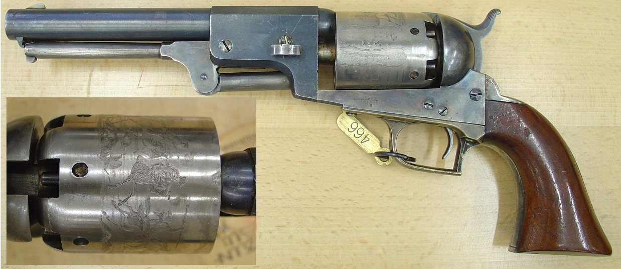
Colt's Manufacturing Company, LLC (CMC, formerly Colt's Patent Firearms Manufacturing Company) is an American firearms manufacturer, founded in 1855 by Samuel Colt and is now a subsidiary of Czech holding company Colt CZ Group. It is the successor corporation to Colt's earlier firearms-making efforts, which started in 1836. Colt is known for the engineering, production, and marketing of firearms, most especially between the 1850s and World War I, when it was a dominating force in its industry and a seminal influence on manufacturing technology. Colt's earliest designs played a major role in the popularization of the revolver and the shift away from earlier single-shot pistols. Although Samuel Colt did not invent the revolver concept, his designs resulted in the first very successful ones. The most famous Colt products include the Colt Walker, made in 1847 in the facilities of Eli Whitney Jr., the Colt Single Action Army or Peacemaker, the Colt Python, and the Colt M1911 pisto ... [...More Info...] [...Related Items...] OR: [Wikipedia] [Google] [Baidu] |
Mohave People
Mohave or Mojave ( Mojave: 'Aha Makhav) are a Native American people indigenous to the Colorado River in the Mojave Desert. The Fort Mojave Indian Reservation includes territory within the borders of California, Arizona, and Nevada. The Colorado River Indian Reservation includes parts of California and Arizona and is shared by members of the Chemehuevi, Hopi, and Navajo peoples. The original Colorado River and Fort Mojave reservations were established in 1865 and 1870, respectively. Both reservations include substantial senior water rights in the Colorado River; water is drawn for use in irrigated farming. The four combined tribes sharing the Colorado River Indian Reservation function today as one geo-political unit known as the federally recognized Colorado River Indian Tribes; each tribe also continues to maintain and observe its individual traditions, distinct religions, and culturally unique identities. Culture In the 1930s, George Devereux, a Hungarian-French anthropo ... [...More Info...] [...Related Items...] OR: [Wikipedia] [Google] [Baidu] |
Quechan People
The Quechan (or Yuma) (Quechan: ''Kwatsáan'' 'those who descended') are a Native American tribe who live on the Fort Yuma Indian Reservation on the lower Colorado River in Arizona and California just north of the Mexican border. Despite their name, they are not related to the Quechua people of the Andes. Members are enrolled into the Quechan Tribe of the Fort Yuma Indian Reservation. The federally recognized Quechan tribe's main office is located in Winterhaven, California. Its operations and the majority of its reservation land are located in California, United States. History The historic Yuman-speaking people in this region were skilled warriors and active traders, maintaining exchange networks with the Pima in southern Arizona, New Mexico, and with peoples of the Pacific coast. The first significant contact of the Quechan with Europeans was with the Spanish explorer Juan Bautista de Anza and his party in the winter of 1774. Relations were friendly. On Anza's return fr ... [...More Info...] [...Related Items...] OR: [Wikipedia] [Google] [Baidu] |


.jpg)


