|
Foymount, Ontario
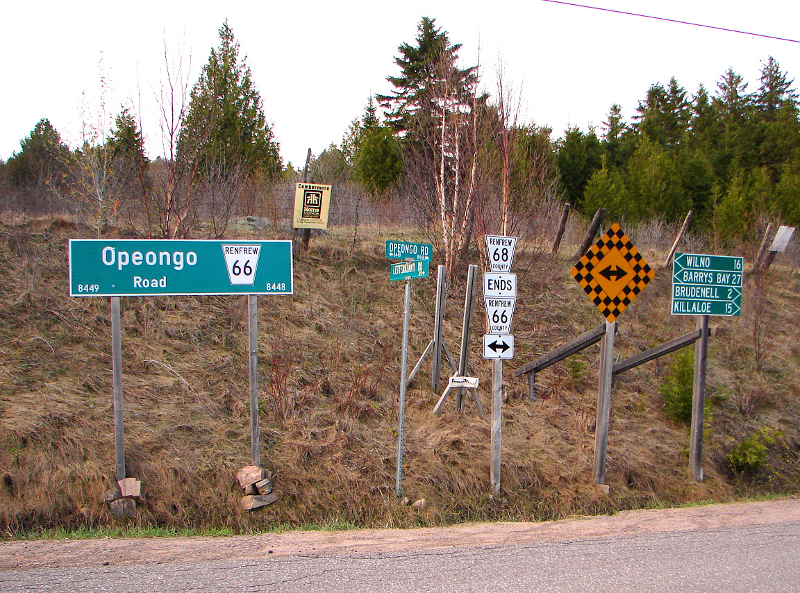
Foymount is a community situated in the township of Bonnechere Valley, Ontario, Canada, located on the 512 and Opeongo Road in Renfrew County, west of Eganville. Foymount is approximately 125 kilometres (80 mi) due west of Ottawa. Foymount falsely claims to be Ontario's highest populated point at above sea level, well below Dundalk's . The community was named for John Foy, postmaster. Foymount and the surrounding area is a popular destination for backpackers and hikers, and was the location of warranty and repair facilities for camping equipment manufacturer Sierra Designs. However, the outlet closed on August 26, 2010. The location is also popular for amateur astronomers given the high altitude and low levels of artificial light. Canadian military history Because of the high altitude, the Royal Canadian Air Force built a radar base on the site in the 1950s as part of the Pinetree Radar Line, established for the detection of nuclear bombers coming over the polar r ... [...More Info...] [...Related Items...] OR: [Wikipedia] [Google] [Baidu] |
Bonnechere Valley, Ontario
Bonnechere Valley is a township municipality in Renfrew County, Ontario, Canada. It had a population of 3,674 in the Canada 2016 Census. It was established in 2001 by amalgamation of the village of Eganville and the townships of Grattan, Sebastapol and South Algona. Communities The administrative and commercial centre of Bonnechere Valley is Eganville, a small community occupying a deep limestone valley carved at the Fifth Chute of the Bonnechere River The Bonnechere River is a river in the Saint Lawrence River drainage basin in Nipissing District and Renfrew County in eastern and northeastern Ontario, Canada. Shows the river course highlighted on a topographic map. The river flows from Algonq .... The township also comprises the smaller communities of Augsburg, Castile, Clontarf, Constant Creek, Cormac, Dacre, Donegal, Esmonde, Grattan, Lake Clear, McGrath, Perrault, Ruby, Silver Lake, Scotch Bush, Vanbrugh, Woermke and Zadow, as well as the ghost towns of Newfoundout, Balac ... [...More Info...] [...Related Items...] OR: [Wikipedia] [Google] [Baidu] |
Opeongo Line
The colonization roads were created during the 1840s and 1850s to open up or provide access to areas in Central and Eastern Ontario for settlement and agricultural development. The colonization roads were used by settlers to lead them toward areas for settlement, much like modern-day highways. History The colonization roads of the 1840s and 1850s were preceded by other government-sponsored road programmes going back to the period immediately after the American Revolutionary War. One early road was cut through the geographic Beverley Township from Ancaster westward toward the Grand River by two Englishmen named Ward and Smith in 1799–1800. This allowed European settlers to access the northern part of the Grand River Valley. During and after the War of 1812, government spending on roads in Upper Canada (present-day Ontario) increased significantly, leading to the improvement and extension of a number of roads. Roads into the interior were still not plentiful, however. By this ... [...More Info...] [...Related Items...] OR: [Wikipedia] [Google] [Baidu] |
Renfrew County, Ontario
Renfrew County is a county in the Canadian province of Ontario. It stands on the west bank of the Ottawa River. There are 17 municipalities in the county. History Bathurst District When Carleton County was withdrawn from Bathurst District in 1838, Renfrew County was severed from part of the remaining Lanark County, but the two remained united for electoral purposes. By 1845, all lands in the District had been surveyed into the following townships: United Counties of Lanark and Renfrew Effective January 1, 1850, Bathurst District was abolished, and the "United Counties of Lanark and Renfrew" replaced it for municipal and judicial purposes. The counties remained united for electoral purposes in the Parliament of the Province of Canada, referred to as the County of Lanark, until Renfrew gained its own seat in 1853. The separation of Renfrew from Lanark began in 1861, with the creation of a Provisional Municipal Council that held its first meeting in June 1861. The United Counties ... [...More Info...] [...Related Items...] OR: [Wikipedia] [Google] [Baidu] |
Ottawa
Ottawa (, ; Canadian French: ) is the capital city of Canada. It is located at the confluence of the Ottawa River and the Rideau River in the southern portion of the province of Ontario. Ottawa borders Gatineau, Quebec, and forms the core of the Ottawa–Gatineau census metropolitan area (CMA) and the National Capital Region (NCR). Ottawa had a city population of 1,017,449 and a metropolitan population of 1,488,307, making it the fourth-largest city and fourth-largest metropolitan area in Canada. Ottawa is the political centre of Canada and headquarters to the federal government. The city houses numerous foreign embassies, key buildings, organizations, and institutions of Canada's government, including the Parliament of Canada, the Supreme Court, the residence of Canada's viceroy, and Office of the Prime Minister. Founded in 1826 as Bytown, and incorporated as Ottawa in 1855, its original boundaries were expanded through numerous annexations and were ultimately ... [...More Info...] [...Related Items...] OR: [Wikipedia] [Google] [Baidu] |
Royal Canadian Air Force
The Royal Canadian Air Force (RCAF; french: Aviation royale canadienne, ARC) is the air and space force of Canada. Its role is to "provide the Canadian Forces with relevant, responsive and effective airpower". The RCAF is one of three environmental commands within the unified Canadian Armed Forces. As of 2020, the Royal Canadian Air Force consists of 12,074 Regular Force and 1,969 Primary Reserve personnel, supported by 1,518 civilians, and operates 258 manned aircraft and nine unmanned aerial vehicles. Lieutenant-General Eric Kenny is the current commander of the Royal Canadian Air Force and chief of the Air Force Staff. The Royal Canadian Air Force is responsible for all aircraft operations of the Canadian Forces, enforcing the security of Canada's airspace and providing aircraft to support the missions of the Royal Canadian Navy and the Canadian Army. The RCAF is a partner with the United States Air Force in protecting continental airspace under the North American Aerospac ... [...More Info...] [...Related Items...] OR: [Wikipedia] [Google] [Baidu] |
Pinetree Line
The Pinetree Line was a series of radar stations located across the northern United States and southern Canada at about the 50th parallel north, along with a number of other stations located on the Atlantic Ocean, Atlantic and Pacific coasts. Run by North American Aerospace Defense Command (NORAD) (after its creation), over half were staffed by United States Air Force personnel with the balance operated by the Royal Canadian Air Force. The line was the first coordinated system for early detection of a Soviet Union, Soviet bomber attack on North America, but before the early 1950s radar technology quickly became outdated and the line was in full operation only for a short time. History Plans for what would become the Pinetree Line were underway as early as 1946 within the Permanent Joint Board on Defense (PJBD), a Canadian-U.S. organization. However, the costs of running such a system in the post-war era was too high, and instead Canada concentrated on the areas around Ontari ... [...More Info...] [...Related Items...] OR: [Wikipedia] [Google] [Baidu] |
CFS Foymount
Canadian Forces Station Foymount (CFS Foymount) was a military radar station in Foymount, Ontario, Canada, (part of Bonnechere Valley). RCAF Station Foymount was opened in 1952 as part of the Pinetree Line of NORAD radar stations. The radar itself was situated at the top of a 523-metre hill, one of the highest points in Eastern Ontario. The main lodger unit was No. 32 Aircraft Control and Warning Squadron, later renamed No. 32 Radar Squadron when the Semi Automatic Ground Environment system was implemented in 1961. In 1967, RCAF Station Foymount was renamed CFS Foymount with the unification of the Canadian Forces. A few years later, the base was declared redundant; radars at CFS Falconbridge Canadian Forces Station Falconbridge (CFS Falconbridge) was a military radar station in the Canada, Canadian province of Ontario, active from 1952 to 1985. The station was geographically located in Valley East, Ontario, although the nearest settl ... and CFS Lac St. Denis were deemed ... [...More Info...] [...Related Items...] OR: [Wikipedia] [Google] [Baidu] |
CFS Falconbridge
Canadian Forces Station Falconbridge (CFS Falconbridge) was a military radar station in the Canada, Canadian province of Ontario, active from 1952 to 1985. The station was geographically located in Valley East, Ontario, although the nearest settlement — and the source of the station's name — was the community of Falconbridge, Greater Sudbury, Ontario, Falconbridge in Nickel Centre. The site is now within the municipal boundaries of Greater Sudbury. History CFS Falconbridge was opened as RCAF Station Falconbridge in 1952 as part of NORAD's Pinetree Line of radar stations. The original operating unit was No. 33 Aircraft Control and Warning Squadron, later renamed No. 33 Radar Squadron when aircraft monitoring functions were transferred to Regional Headquarters in Duluth, Minnesota. In 1967, the base was renamed Canadian Forces Station Falconbridge with the unification of Canada's military into the Canadian Forces.Ozorak, Paul. ''Abandoned Military Installations of Canada: Vo ... [...More Info...] [...Related Items...] OR: [Wikipedia] [Google] [Baidu] |
CFS Lac St
CFS is an acronym for: Organizations * Canadian Federation of Students * Canadian Forest Service * Center for Financial Studies, a research institute affiliated with Goethe University Frankfurt * Center for Subjectivity Research, a research institute affiliated with the University of Copenhagen * Child and family services * Christian Family Solutions, a Christian non-profit social service agency headquartered in Germantown, Wisconsin * Citizens for Sunshine, an Ohio nonprofit promoting access to public records * Committee on World Food Security * Commonwealth Fusion Systems, an American fusion energy company * Conservative Future Scotland, the youth branch of the Scottish Conservative Party * Co-operative Financial Services Ltd. * ''Corpo Forestale dello Stato'', the Italian state forestry department * South Australian Country Fire Service, a volunteer firefighting service * Craigmillar Festival Society, a disestablished community organisation from Edinburgh, Scotland * Craniofaci ... [...More Info...] [...Related Items...] OR: [Wikipedia] [Google] [Baidu] |
Canadian Broadcasting Corporation
The Canadian Broadcasting Corporation (french: Société Radio-Canada), branded as CBC/Radio-Canada, is a Canadian public broadcaster for both radio and television. It is a federal Crown corporation that receives funding from the government. The English- and French-language service units of the corporation are commonly known as CBC and Radio-Canada, respectively. Although some local stations in Canada predate the CBC's founding, CBC is the oldest existing broadcasting network in Canada. The CBC was established on November 2, 1936. The CBC operates four terrestrial radio networks: The English-language CBC Radio One and CBC Music, and the French-language Ici Radio-Canada Première and Ici Musique. (International radio service Radio Canada International historically transmitted via shortwave radio, but since 2012 its content is only available as podcasts on its website.) The CBC also operates two terrestrial television networks, the English-language CBC Television and the Frenc ... [...More Info...] [...Related Items...] OR: [Wikipedia] [Google] [Baidu] |


