|
Fort Loudoun Dam
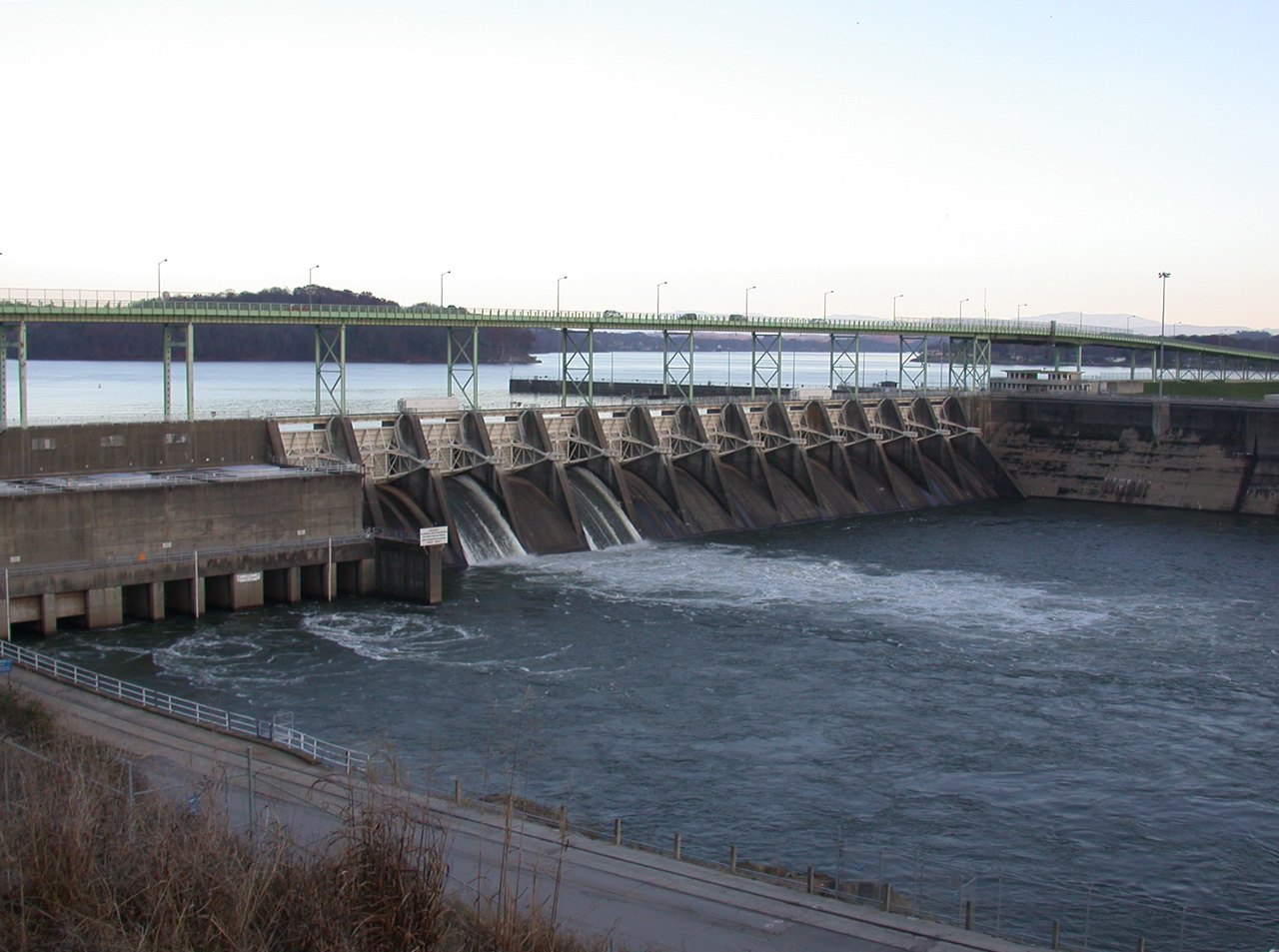
Fort Loudoun Dam is a hydroelectric dam on the Tennessee River in Loudon County, Tennessee, in the southeastern United States. The dam is operated by the Tennessee Valley Authority (TVA), which built the dam in the early 1940s as part of a unified plan to provide electricity and flood control in the Tennessee Valley and create a continuous navigable river channel from Knoxville, Tennessee to Paducah, Kentucky. It is the uppermost of nine TVA dams on the Tennessee River. The dam impounds the Fort Loudoun Lake and its tailwaters are part of Watts Bar Lake. The generating capacity of Fort Loudoun Dam is enhanced by the Tellico Reservoir, from which water is diverted via canal to Fort Loudoun Lake. It and associated infrastructure were listed on the National Register of Historic Places in 2017. Fort Loudoun Dam is named after Fort Loudoun, an 18th-century British colonial fort built during the French and Indian War. The fort— which was located about south of the dam site†... [...More Info...] [...Related Items...] OR: [Wikipedia] [Google] [Baidu] |
Tennessee River
The Tennessee River is the largest tributary of the Ohio River. It is approximately long and is located in the southeastern United States in the Tennessee Valley. The river was once popularly known as the Cherokee River, among other names, as the Cherokee people had their homelands along its banks, especially in what are now East Tennessee and northern Alabama. Additionally, its tributary, the Little Tennessee River, flows into it from Western North Carolina and northeastern Georgia, where the river also was bordered by numerous Cherokee towns. Its current name is derived from the Cherokee town, ''Tanasi'', which was located on the Tennessee side of the Appalachian Mountains. Course The Tennessee River is formed at the confluence of the Holston and French Broad rivers in present-day Knoxville, Tennessee. From Knoxville, it flows southwest through East Tennessee into Chattanooga before crossing into Alabama. It travels through the Huntsville and Decatur area before rea ... [...More Info...] [...Related Items...] OR: [Wikipedia] [Google] [Baidu] |
Holston River
The Holston River is a river that flows from Kingsport, Tennessee, to Knoxville, Tennessee. Along with its three major forks (North Fork, Middle Fork and South Fork), it comprises a major river system that drains much of northeastern Tennessee, southwestern Virginia, and northwestern North Carolina. The Holston's confluence with the French Broad River at Knoxville marks the beginning of the Tennessee River. The North Fork flows southwest from Sharon Springs in Bland County, Virginia. The Middle Fork flows from near the western border of Wythe County, Virginia, joining the South Fork in Washington County, Virginia, southeast of Abingdon. The South Fork rises near Sugar Grove in Smyth County and flows southwest to join the North Fork at Kingsport. The Watauga River, a tributary of the South Fork Holston, flows westward from Watauga County, North Carolina. The main stem of the Holston is impounded by the Tennessee Valley Authority's Cherokee Dam near Jefferson City, Ten ... [...More Info...] [...Related Items...] OR: [Wikipedia] [Google] [Baidu] |
USACE Fort Loudoun Lock And Dam
, colors = , anniversaries = 16 June (Organization Day) , battles = , battles_label = Wars , website = , commander1 = Lieutenant general (United States), LTG Scott A. Spellmon , commander1_label = List of United States Army Corps of Engineers Chiefs of Engineers, Chief of Engineers and Commanding General of the U.S. Army Corps of Engineers , commander2 = Major general (United States), MG]Richard J. Heitkamp, commander2_label = Deputy Chief of Engineers and Deputy Commanding General , commander3 = Major general (United States), MGKimberly M. Colloton, commander3_label = Deputy Commanding General for Military and International Operations , commander4 = Major general (United States), MG]William H. Graham, commander4_label = Deputy Command ... [...More Info...] [...Related Items...] OR: [Wikipedia] [Google] [Baidu] |
Interstate 140 (Tennessee)
Interstate 140 may refer to: *Interstate 140 (North Carolina), a partially built spur route near Wilmington, North Carolina ** Interstate 140 (North Carolina 1999), a cancelled proposed spur between Sanford and Raleigh, North Carolina *Interstate 140 (Tennessee) Interstate 140 may refer to: *Interstate 140 (North Carolina), a partially built spur route near Wilmington, North Carolina **Interstate 140 (North Carolina 1999), a cancelled proposed spur between Sanford and Raleigh, North Carolina *Interstate 140 ..., a spur route in Knoxville, Tennessee {{road disambiguation 40-1 1 ... [...More Info...] [...Related Items...] OR: [Wikipedia] [Google] [Baidu] |
Great Smoky Mountains National Park
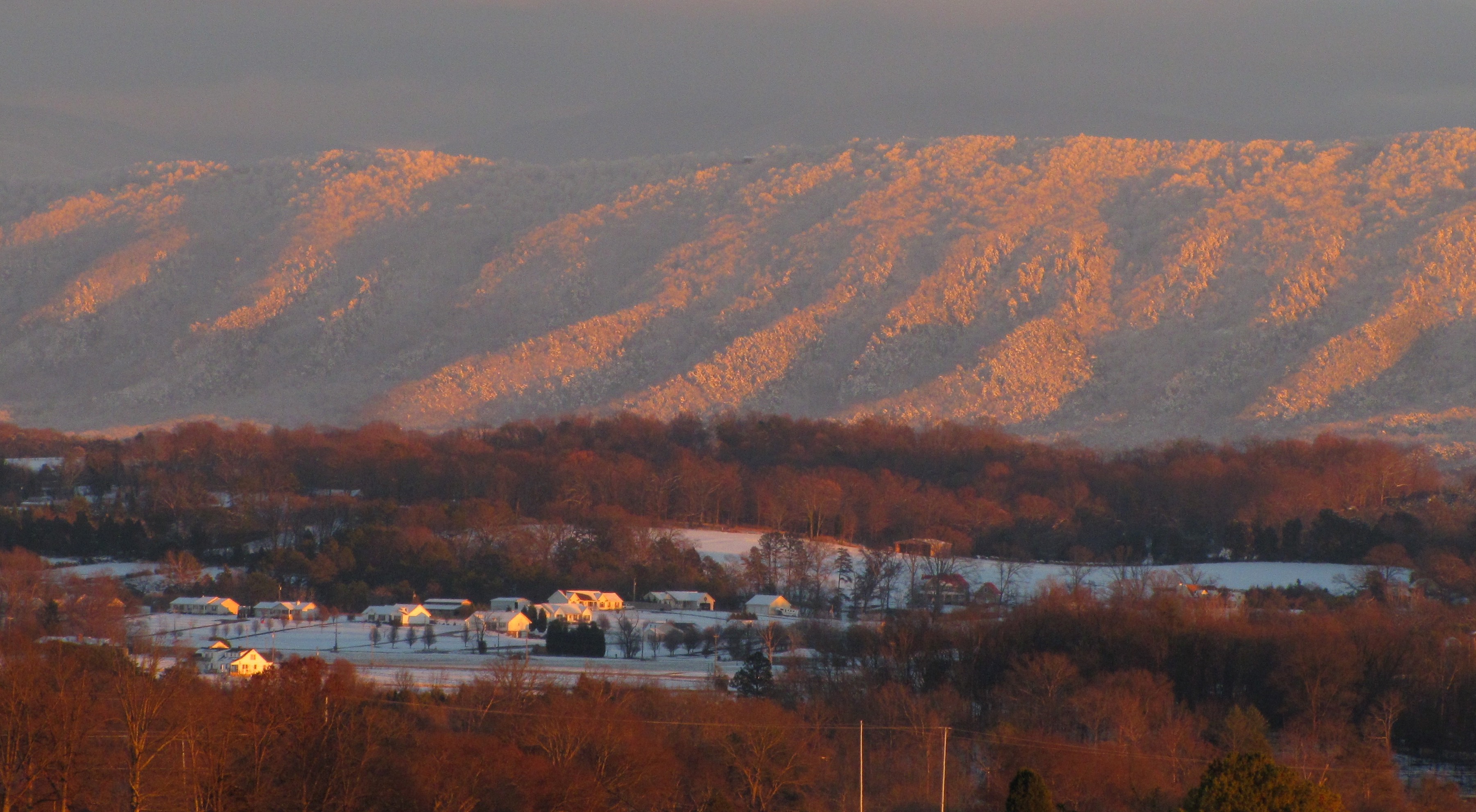
Great Smoky Mountains National Park is an American national park in the southeastern United States, with parts in North Carolina and Tennessee. The park straddles the ridgeline of the Great Smoky Mountains, part of the Blue Ridge Mountains, which are a division of the larger Appalachian Mountain chain. The park contains some of the highest mountains in eastern North America, including Clingmans Dome, Mount Guyot, and Mount Le Conte. The border between the two states runs northeast to southwest through the center of the park. The Appalachian Trail passes through the center of the park on its route from Georgia to Maine. With 14.1 million visitors in 2021, the Great Smoky Mountains National Park is the most visited national park in the United States. The park encompasses , making it one of the largest protected areas in the eastern United States. The main park entrances are located along U.S. Highway 441 (Newfound Gap Road) in the towns of Gatlinburg, Tennessee and Cherokee ... [...More Info...] [...Related Items...] OR: [Wikipedia] [Google] [Baidu] |
Maryville, Tennessee
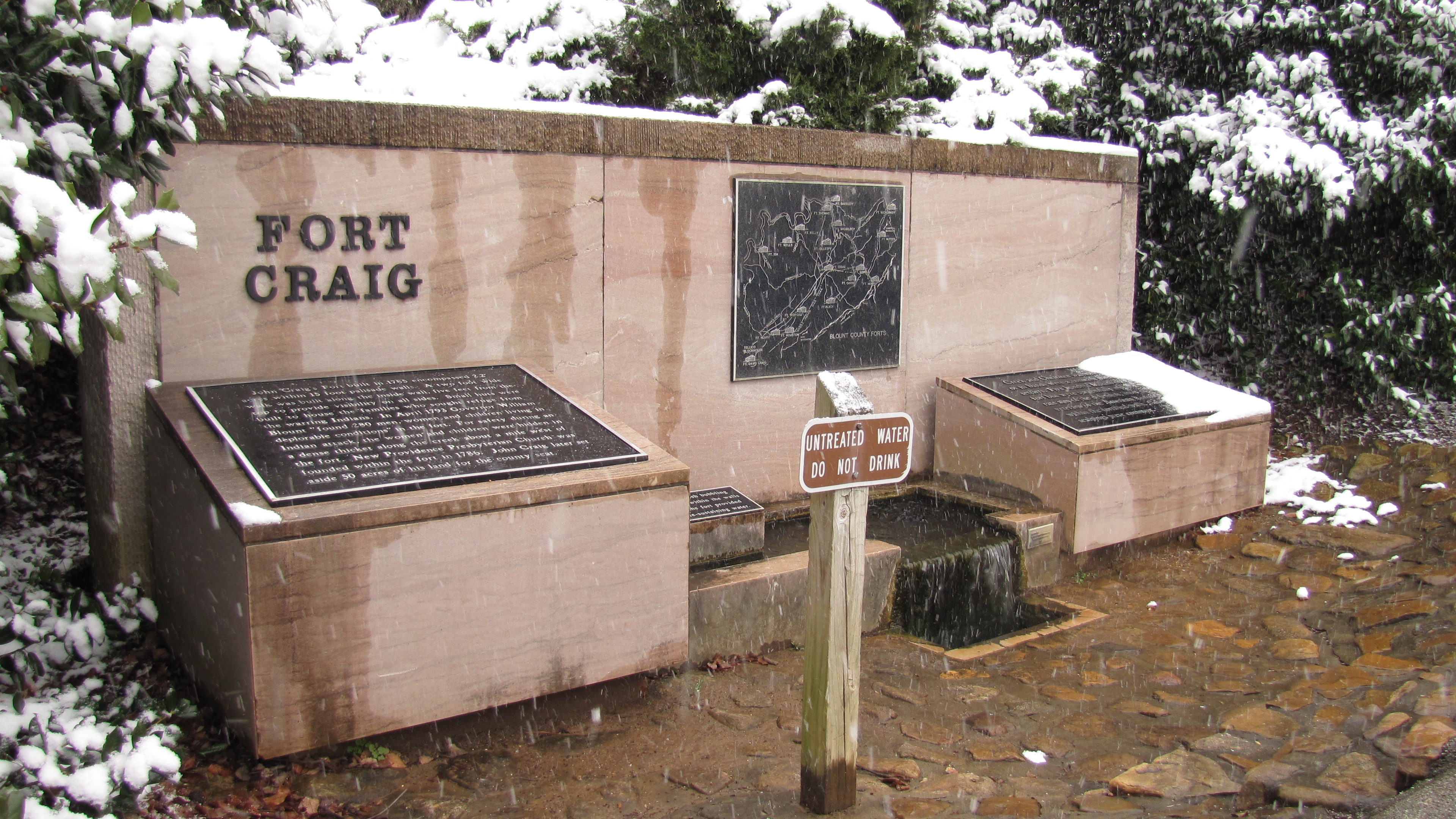
Maryville is a city in and the county seat of Blount County, Tennessee, and is a suburb of Knoxville. Its population was 31,907 at the 2020 census. It is included in the Knoxville Metropolitan Area and a short distance from popular tourist destinations such as the Great Smoky Mountains National Park, Dollywood, Gatlinburg, and Pigeon Forge. History When the first European explorers arrived in the area, they found the Great Indian Warpath, which ran along the route where the modern US-411 has been built. The trail was long used by the indigenous peoples of the area. A historic Cherokee village known as "Elajay" was situated at the confluence of Ellejoy Creek (named after the village) and the Little River. Its site was near the modern Heritage High School. Ensign Henry Timberlake passed through the village in 1762 while returning from his expedition to the Overhill villages to the west. He reported that it had been abandoned. In 1785, Revolutionary War veteran John Craig bu ... [...More Info...] [...Related Items...] OR: [Wikipedia] [Google] [Baidu] |
Interstate 40
Interstate 40 (I-40) is a major east–west Interstate Highway running through the south-central portion of the United States. At a length of , it is the third-longest Interstate Highway in the country, after I-90 and I-80. From west to east, it passes through California, Arizona, New Mexico, Texas, Oklahoma, Arkansas, Tennessee, and North Carolina. Its western end is at I-15 in Barstow, California, while its eastern end is at a concurrency of U.S. Route 117 (US 117) and North Carolina Highway 132 (NC 132) in Wilmington, North Carolina. Major cities served by the interstate include Flagstaff, Arizona; Albuquerque, New Mexico; Amarillo, Texas; Oklahoma City, Oklahoma; Little Rock, Arkansas; Memphis, Nashville, and Knoxville in Tennessee; and Asheville, Winston-Salem, Greensboro, Durham, Raleigh, and Wilmington in North Carolina. Much of the western part of I-40, from Barstow to Oklahoma City, parallels or overlays the historic U.S. Route 66. East of Oklaho ... [...More Info...] [...Related Items...] OR: [Wikipedia] [Google] [Baidu] |
Interstate 75
Interstate 75 (I-75) is a major north–south Interstate Highway in the Great Lakes and Southeastern regions of the United States. As with most Interstates that end in 5, it is a major cross-country, north–south route, traveling from State Road 826 (SR 826, Palmetto Expressway) and SR 924 (Gratigny Parkway) on the Hialeah–Miami Lakes border (northwest of Miami, Florida) to Sault Ste. Marie, Michigan, at the Canadian border. It is the second-longest north–south Interstate Highway (after I-95) and the seventh-longest Interstate Highway overall. I-75 passes through six different states. The highway runs the length of the Florida peninsula from the Miami area and up the Gulf Coast through Tampa. Farther north in Georgia, I-75 continues on through Macon and Atlanta before running through Chattanooga and Knoxville and the Cumberland Mountains in Tennessee. I-75 crosses Kentucky, passing through Lexington before crossing the Ohio River into Cincinnati, ... [...More Info...] [...Related Items...] OR: [Wikipedia] [Google] [Baidu] |
Bussell Island
Bussell Island, formerly Lenoir Island, is an island located at the mouth of the Little Tennessee River, at its confluence with the Tennessee River in Loudon County, near the U.S. city of Lenoir City, Tennessee. The island was inhabited by various Native American cultures for thousands of years before the arrival of early European explorers. The Tellico Dam and a recreational area occupy part of the island. Part of the island was added in 1978 to the National Register of Historic Places for its archaeological potential. Native American habitation of Bussell Island dates to the Late Archaic period (c. 3000–1000 BC).Bobby Braly and Shannon KoernerA History of Archaeology in Tennessee. ''Tennessee Archaeology: A Synthesis'' (Chapter 2). p. 12-14. The island is believed to have been the location of the capital of ''Coste''—a Mississippian-period chiefdom visited by Spanish explorer Hernando de Soto in 1540—and was later part of the domain of the Overhill Cherokee and the r ... [...More Info...] [...Related Items...] OR: [Wikipedia] [Google] [Baidu] |
Tellico Dam
Tellico Dam is a dam built by the Tennessee Valley Authority (TVA) in Loudon County, Tennessee, on the Little Tennessee River as part of the Tellico Project. Planning for a dam structure on the Little Tennessee was reported as early as 1936 but was dismissed until 1942 for official development. Unlike the agency's previous dams built for hydroelectric power and flood control, Tellico Dam would be constructed to support tourism and economic development through the planned city concept of Timberlake, which aimed to support a population of 42,000 in a rural region that was documented being in poor economic conditions. Completed in 1979, it created the Tellico Reservoir and is the last dam to be built by the Tennessee Valley Authority. Tellico Dam is the subject of several controversies regarding the need of its construction and the impacts the structure had on the surrounding environment. Inundation of the Little Tennessee required the acquisition of thousands of acres, predominate ... [...More Info...] [...Related Items...] OR: [Wikipedia] [Google] [Baidu] |
Knox County, Tennessee
Knox County is located in the U.S. state of Tennessee. As of the 2020 census, the population was 478,971, making it the third-most populous county in Tennessee. Its county seat is Knoxville, which is the third-most populous city in Tennessee. Knox County is included in the Knoxville metropolitan area. The county is located at the geographical center of the Great Valley of East Tennessee. Near the heart of the county is the origin of the Tennessee River, at the confluence of the Holston and French Broad rivers. History Knox County was created after the American Revolutionary War on June 11, 1792, by Governor William Blount from parts of Greene and Hawkins counties. It was one of the few counties created when this area was still known as the Southwest Territory. It is one of nine United States counties named for American Revolutionary War general Henry Knox, who was appointed as the first United States Secretary of War. As population increased, parts of Knox County were taken ... [...More Info...] [...Related Items...] OR: [Wikipedia] [Google] [Baidu] |
Blount County, Tennessee
Blount County is a county located in the East Tennessee Grand Division of the U.S. state of Tennessee. As of the 2020 census, its population was 135,280. The county seat is Maryville, which is also the county's largest city. Blount County is included in the Knoxville, Tennessee metropolitan statistical area. History What is today Blount County was for many thousands of years Indian territory, passed down to the Cherokee tribe that claimed the land upon the arrival of White settlers in the late 18th century. Shortly thereafter, on July 11, 1795, Blount County became the 10th county established in Tennessee, when the Territorial Legislature voted to split adjacent Knox and Jefferson Counties. The new county was named for the governor of the Southwest Territory, William Blount, and its county seat, Maryville, was named for his wife Mary Grainger Blount. This establishment, however, did little to settle the differences between White immigrants and Cherokee natives, which was, ... [...More Info...] [...Related Items...] OR: [Wikipedia] [Google] [Baidu] |


