|
Flora Footbridge
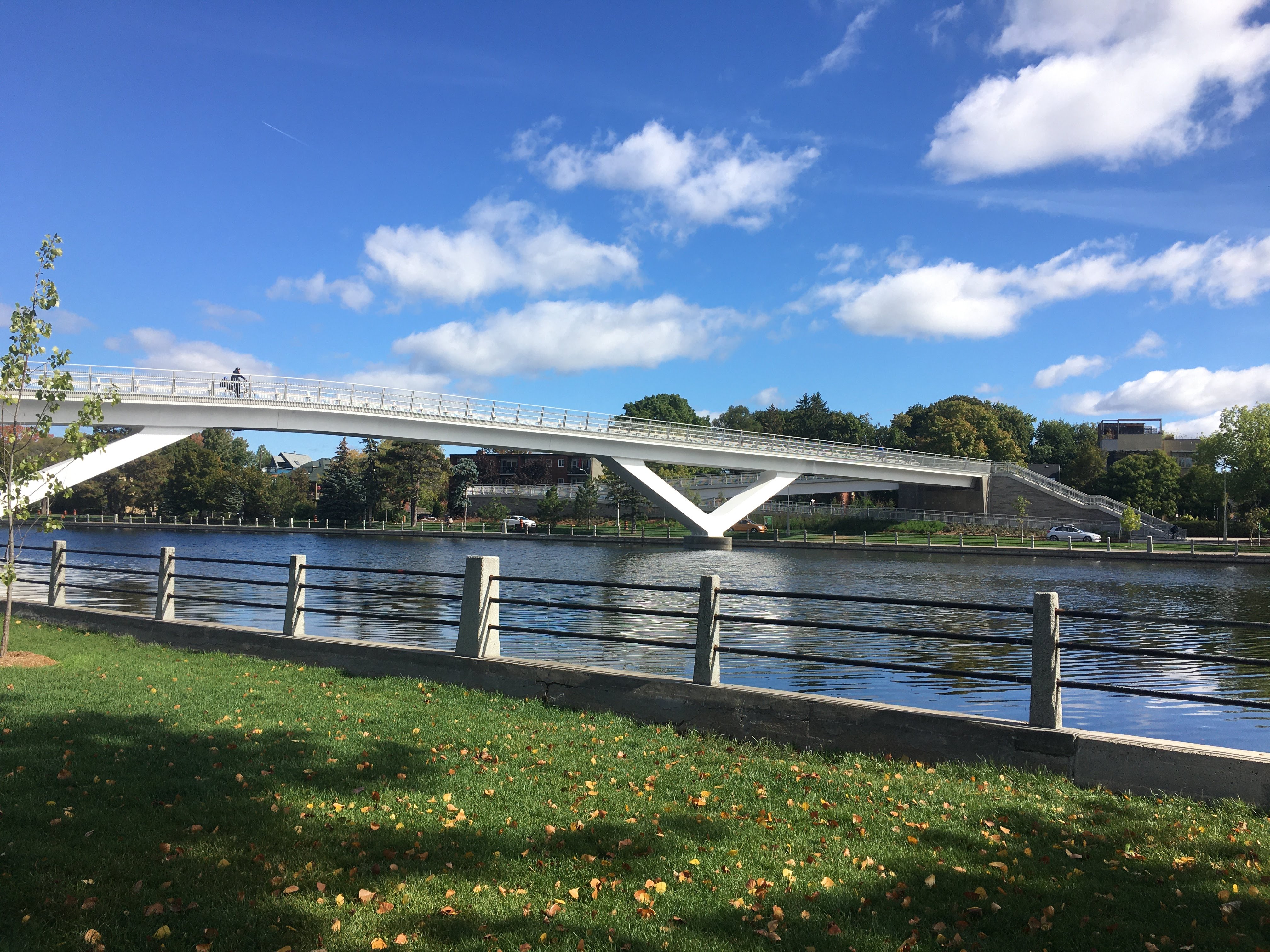
The Flora Footbridge, named after Flora MacDonald, is a pedestrian/cycling bridge in Ottawa, Ontario, Canada, that spans the Rideau Canal, connecting Clegg Street in Old Ottawa East to Fifth Avenue in the Glebe The Glebe is a neighbourhood in Ottawa, Ontario, Canada. It is located just south of Ottawa's downtown area in the Capital Ward. According to the Glebe Community Association, the neighbourhood is bounded on the north by the Queensway, on the .... It also crosses Colonel By Drive. The bridge is 5 m wide and 123 m long. Construction started in 2018. Originally scheduled to be completed in fall 2019, the bridge opened to the public ahead of schedule on June 28, 2019. References Bridges in Ottawa Pedestrian bridges in Canada Cyclist bridges in Canada Bridges completed in 2019 2019 establishments in Ontario {{Canada-bridge-struct-stub ... [...More Info...] [...Related Items...] OR: [Wikipedia] [Google] [Baidu] |
Flora MacDonald (politician)
Flora Isabel MacDonald, (June 3, 1926 – July 26, 2015) was a Canadian politician and humanitarian. Canada's first female foreign minister, she was also one of the first women to vie for leadership of a major Canadian political party, the Progressive Conservatives. She became a close ally of Prime Minister Joe Clark, serving in his cabinet from 1979 to 1980, as well as in the cabinet of Prime Minister Brian Mulroney from 1984 to 1988. In her later life, she was known for her humanitarian work abroad. The City of Ottawa recognised MacDonald on July 11, 2018 by naming a new bicycle and footbridge (opening 2019) over the Rideau Canal the Passerelle Flora Footbridge. Early life and career MacDonald was born in North Sydney, Nova Scotia, the daughter of Mary Isabel Royle and George Frederick MacDonald. She was of Scottish ancestry. Her grandfather had been a clipper ship captain who sailed around Africa and South America. Her father was in charge of North Sydney’s Western Un ... [...More Info...] [...Related Items...] OR: [Wikipedia] [Google] [Baidu] |
Ottawa
Ottawa (, ; Canadian French: ) is the capital city of Canada. It is located at the confluence of the Ottawa River and the Rideau River in the southern portion of the province of Ontario. Ottawa borders Gatineau, Quebec, and forms the core of the Ottawa–Gatineau census metropolitan area (CMA) and the National Capital Region (NCR). Ottawa had a city population of 1,017,449 and a metropolitan population of 1,488,307, making it the fourth-largest city and fourth-largest metropolitan area in Canada. Ottawa is the political centre of Canada and headquarters to the federal government. The city houses numerous foreign embassies, key buildings, organizations, and institutions of Canada's government, including the Parliament of Canada, the Supreme Court, the residence of Canada's viceroy, and Office of the Prime Minister. Founded in 1826 as Bytown, and incorporated as Ottawa in 1855, its original boundaries were expanded through numerous annexations and were ultimately ... [...More Info...] [...Related Items...] OR: [Wikipedia] [Google] [Baidu] |
Rideau Canal
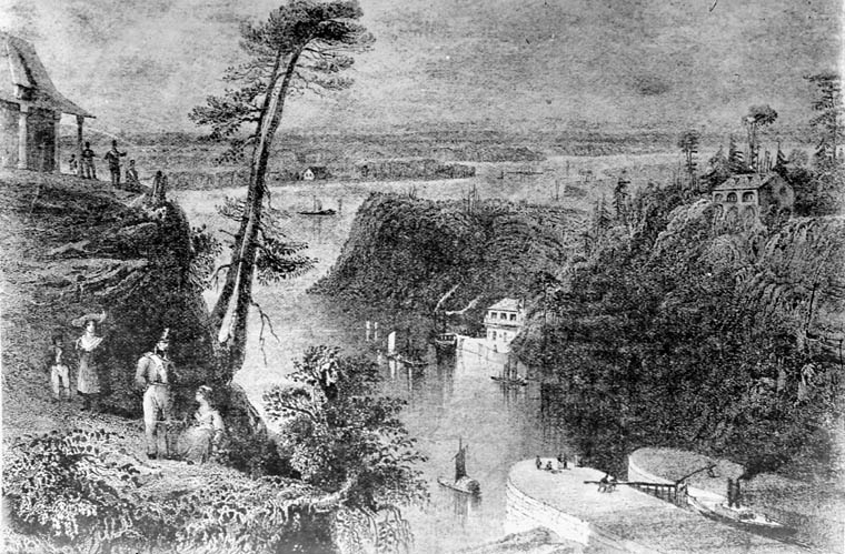
The Rideau Canal, also known unofficially as the Rideau Waterway, connects Canada's capital city of Ottawa, Ontario, to Lake Ontario and the Saint Lawrence River at Kingston. It is 202 kilometres long. The name ''Rideau'', French for "curtain", is derived from the curtain-like appearance of the Rideau River's twin waterfalls where they join the Ottawa River. The canal system uses sections of two rivers, the Rideau and the Cataraqui, as well as several lakes. Parks Canada operates the Rideau Canal. The canal was opened in 1832 as a precaution in case of war with the United States. It remains in use today primarily for pleasure boating, with most of its original structures intact. The locks on the system open for navigation in mid-May and close in mid-October. It is the oldest continuously operated canal system in North America. In 2007 it was registered as a UNESCO World Heritage Site. History Plan After the War of 1812, information was received about the United States' ... [...More Info...] [...Related Items...] OR: [Wikipedia] [Google] [Baidu] |
Old Ottawa East
Old Ottawa East or just Ottawa East (''Vieil Ottawa Est'' in French) is a neighbourhood in Capital Ward in central Ottawa, Ontario, Canada. It is located south of Nicholas Street and between the Rideau Canal and the Rideau River, with Avenue Road marking the southern border. To the south is the neighbourhood of Old Ottawa South and to the northeast is Sandy Hill. Old Ottawa East includes the Lees Avenue area. The Flora Footbridge, which opened to pedestrians in 2019, connects the community to The Glebe. According to the Canada 2011 Census, the population of the neighbourhood was 7,279. This small neighbourhood was originally the suburban community of Archville that was incorporated as the village of Ottawa East in 1888. In 1907 it was amalgamated with the growing community of Ottawa. Running through the centre of the neighbourhood is Main Street, which was the central road of Archville, but which is not particularly central to modern Ottawa. The neighbourhood is home ... [...More Info...] [...Related Items...] OR: [Wikipedia] [Google] [Baidu] |
The Glebe
The Glebe is a neighbourhood in Ottawa, Ontario, Canada. It is located just south of Ottawa's downtown area in the Capital Ward. According to the Glebe Community Association, the neighbourhood is bounded on the north by the Queensway, on the east and south by the Rideau Canal and on the west by LeBreton Street South, Carling Avenue and Dow's Lake. As of 2016, this area had a population of 13,055. This area includes the Glebe Annex, an area west of Bronson Avenue, north of Carling Avenue, east of LeBreton South Street and south of the Queensway, that maintains its own neighbourhood association - the Glebe Annex Community Association (GACA).. The Glebe also includes the Dow's Lake neighbourhood, an area north of the Rideau Canal, east of Dow's Lake, south of Carling Avenue and west of Bronson, that maintains its own neighbourhood association - the Dow's Lake Residents Association (DLRA). The Glebe has a strong community association which, in addition to running a large communi ... [...More Info...] [...Related Items...] OR: [Wikipedia] [Google] [Baidu] |
Colonel By Drive
Colonel By Drive (french: Promenade Colonel By) is an long scenic parkway in Ottawa, Ontario, Canada named after Colonel John By. It runs along the Rideau Canal from the end of Sussex Drive at Rideau Street. It then continues south and west to Hog's Back Road, winding through several residential areas and going past Dow's Lake and Carleton University. To the north, the road passes Department of National Defence Headquarters, the Ottawa Congress Centre and the Westin Hotel before ending at Wellington Street and Rideau Street. The rear door of the Government Conference Centre can be accessed from the street as well, after it passes under the Mackenzie King Bridge. It is named for Lieutenant-Colonel John By, who built the Rideau Canal. The winding two-lane road has a speed limit of . For many decades the area east of the canal had held Ottawa's main rail lines connecting to the Ottawa Train Station near the northern end of the canal. In the mid-1960s the train station was contro ... [...More Info...] [...Related Items...] OR: [Wikipedia] [Google] [Baidu] |
Bridges In Ottawa
A bridge is a structure built to span a physical obstacle (such as a body of water, valley, road, or rail) without blocking the way underneath. It is constructed for the purpose of providing passage over the obstacle, which is usually something that is otherwise difficult or impossible to cross. There are many different designs of bridges, each serving a particular purpose and applicable to different situations. Designs of bridges vary depending on factors such as the function of the bridge, the nature of the terrain where the bridge is constructed and anchored, and the material used to make it, and the funds available to build it. The earliest bridges were likely made with fallen trees and stepping stones. The Neolithic people built boardwalk bridges across marshland. The Arkadiko Bridge (dating from the 13th century BC, in the Peloponnese) is one of the oldest arch bridges still in existence and use. Etymology The ''Oxford English Dictionary'' traces the origin of the ... [...More Info...] [...Related Items...] OR: [Wikipedia] [Google] [Baidu] |
Pedestrian Bridges In Canada
A pedestrian is a person traveling on foot, whether walking or running. In modern times, the term usually refers to someone walking on a road or pavement, but this was not the case historically. The meaning of pedestrian is displayed with the morphemes ''ped-'' ('foot') and ''-ian'' ('characteristic of'). This word is derived from the Latin term ''pedester'' ('going on foot') and was first used (in English language) during the 18th century. It was originally used, and can still be used today, as an adjective meaning plain or dull. However, in this article it takes on its noun form and refers to someone who walks. The word pedestrian may have been used in middle French in the Recueil des Croniques et Anchiennes Istories de la Grant Bretaigne, à présent nommé Engleterre. In California the definition of a pedestrian has been broadened to include anyone on any human powered vehicle that is not a bicycle, as well as people operating self-propelled wheelchairs by reason of p ... [...More Info...] [...Related Items...] OR: [Wikipedia] [Google] [Baidu] |
Cyclist Bridges In Canada
Cycling, also, when on a two-wheeled bicycle, called bicycling or biking, is the use of Bicycle, cycles for transport, recreation, Physical exercise, exercise or sport. People engaged in cycling are referred to as "cyclists", "bicyclists", or "bikers". Apart from two-wheeled bicycles, "cycling" also includes the riding of unicycles, tricycles, quadricycles, recumbent bicycle, recumbent and similar human-powered transport, human-powered vehicles (HPVs). Bicycles were introduced in the 19th century and now number approximately one billion worldwide. They are the principal means of transportation in many parts of the world, especially in densely populated European cities. Cycling is widely regarded as an effective and efficient mode of transportation optimal for short to moderate distances. Bicycles provide numerous possible benefits in comparison with motor vehicles, including the sustained physical exercise involved in cycling, easier parking, increased maneuverability, and ... [...More Info...] [...Related Items...] OR: [Wikipedia] [Google] [Baidu] |
Bridges Completed In 2019
A bridge is a structure built to span a physical obstacle (such as a body of water, valley, road, or rail) without blocking the way underneath. It is constructed for the purpose of providing passage over the obstacle, which is usually something that is otherwise difficult or impossible to cross. There are many different designs of bridges, each serving a particular purpose and applicable to different situations. Designs of bridges vary depending on factors such as the function of the bridge, the nature of the terrain where the bridge is constructed and anchored, and the material used to make it, and the funds available to build it. The earliest bridges were likely made with fallen trees and stepping stones. The Neolithic people built boardwalk bridges across marshland. The Arkadiko Bridge (dating from the 13th century BC, in the Peloponnese) is one of the oldest arch bridges still in existence and use. Etymology The ''Oxford English Dictionary'' traces the origin of the wo ... [...More Info...] [...Related Items...] OR: [Wikipedia] [Google] [Baidu] |


