|
Flat Top Mountain (West Virginia)
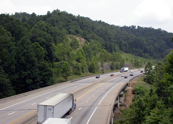
Flat Top Mountain is a mountain ridge within the Allegheny Mountains in Southern West Virginia, United States. Geology Its highest point is at Huff Knob near Flat Top, West Virginia. Other peaks include Bluff Mountain, Indian Grave Mountain, Bald Knob, Rich Knob, and Pilot Knob. Its summit contains a 40-square-mile tableland of Guyandotte sandstone, giving rise to its name. The mountain ridge locally forms the boundary between the Allegheny Plateau to the northwest and the Ridge-and-Valley Appalachians to the southeast. To the southeast, it descends steeply to the Bluestone River valley, while to the northwest it descends more slowly, with several rivers flowing to the Kanawha and Ohio Rivers. Beckley, West Virginia lies on its northwestern slopes. Beyond its northeastern end lies and then the New River Gorge, beyond which the Yew Mountains continue the Allegheny Plateau/Ridge-and-Valley border. At its southwestern end, Big Stone Ridge forms an extension of Flat Top M ... [...More Info...] [...Related Items...] OR: [Wikipedia] [Google] [Baidu] |
Interstate 77 In West Virginia
Interstate 77 (I-77) in the US state of West Virginia is a major north–south Interstate Highway. It extends for between Bluefield at the Virginia state line and Williamstown at the Ohio state line. The highway serves Charleston, the capital and largest city in West Virginia; it also serves the cities of Princeton, Beckley, and Parkersburg. I-77 follows the entire length of the West Virginia Turnpike, a toll road that runs between Princeton and Charleston, and it runs concurrently with I-64 between Beckley and Charleston. Historically, the West Virginia Turnpike was a two-lane road with treacherous curves and a tunnel (which has since been decommissioned). Construction began in 1952, several years before the Interstate Highway System was funded. It was only in 1987 that the entire length of the turnpike was upgraded to Interstate standards. Due to the difficulty and lives lost in construction, it has been called "88 miles of miracle". Route description Virginia to ... [...More Info...] [...Related Items...] OR: [Wikipedia] [Google] [Baidu] |
Big Stone Ridge
The Allegheny Mountain Range (; also spelled Alleghany or Allegany), informally the Alleghenies, is part of the vast Appalachian Mountain Range of the Eastern United States and Canada and posed a significant barrier to land travel in less developed eras. The Allegheny Mountains have a northeast–southwest orientation, running for about from north-central Pennsylvania, southward through western Maryland and eastern West Virginia. The Alleghenies comprise the rugged western-central portion of the Appalachians. They rise to approximately in northeastern West Virginia. In the east, they are dominated by a high, steep escarpment known as the Allegheny Front. In the west, they slope down into the closely associated Allegheny Plateau, which extends into Ohio and Kentucky. The principal settlements of the Alleghenies are Altoona, State College, and Johnstown, Pennsylvania; and Cumberland, Maryland. Name The name is derived from the Allegheny River, which drains only a small portion ... [...More Info...] [...Related Items...] OR: [Wikipedia] [Google] [Baidu] |
Camp Creek State Park
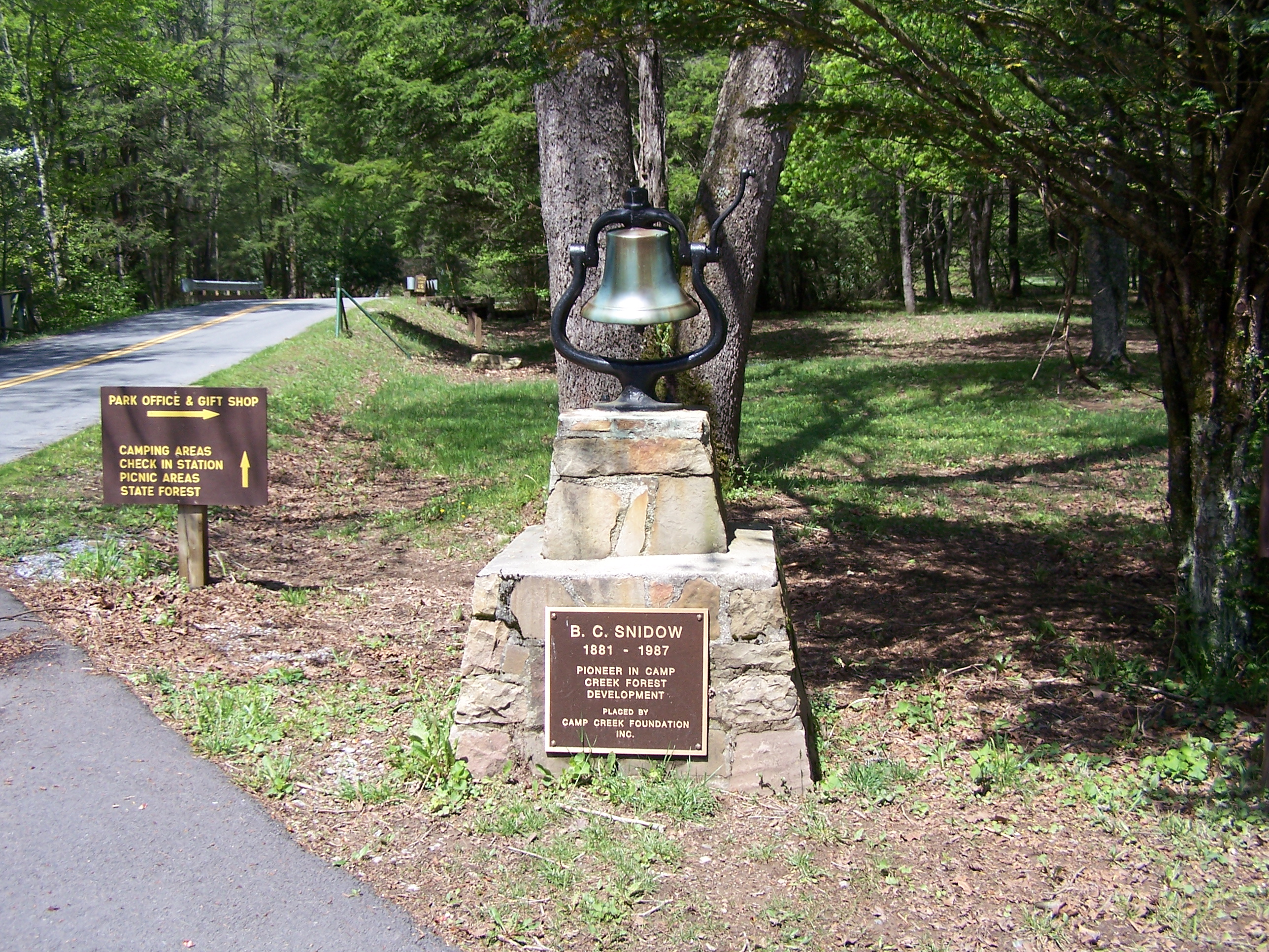
Camp Creek State Park was created in 1987 by dividing the area from Camp Creek State Forest. Camp Creek State Park is located about two miles (3 km) from the Camp Creek Exit (Exit 20) of I-77 in Mercer County, West Virginia. Features * 3 campgrounds ** Mash Fork - 26 camping sites for tents or trailers ** Blue Jay - 14 rustic sites ** Double "C" - Horse and Ride sites * Picnic area * Fishing * Hunting * Horseback riding See also *List of West Virginia state parks There are 37 state parks in the U.S. state of West Virginia . The West Virginia Division of Natural Resources (WVDNR) West Virginia Division of Natural Resources#Parks and Recreation Section, Parks and Recreation Section is the governing body ... * State park References External links * {{authority control Protected areas of Mercer County, West Virginia State parks of West Virginia Protected areas established in 1987 Campgrounds in West Virginia 1987 establishments in West Virginia ... [...More Info...] [...Related Items...] OR: [Wikipedia] [Google] [Baidu] |
Winterplace Ski Resort
Winterplace Ski Resort is a ski resort located in Ghent, West Virginia on Raleigh County's Flat Top Mountain. The southernmost ski resort in West Virginia, Winterplace is a popular attraction due to its proximity to Interstate 77. It operates in conjunction with ''The Resort at Glade Springs'', a four season golf resort and spa. History The first ski resort on Flat Top Mountain was established on the north slope of Bald Knob in 1958. Named Bald Knob Ski Slopes, the resort was the second commercial ski location in West Virginia, following the predecessors of Canaan Valley Ski Resort. It was founded by future West Virginia governor Hulett C. Smith and businessman John McKay, and designed by former Army officer Robert K. Potter. Operating with four tow ropes and a double chair, the resort's longest trail extended 2,800 feet. It was marketed as the southernmost ski resort in the Eastern United States. The resort closed in 1961; the site is now known as Old Winterplace. The c ... [...More Info...] [...Related Items...] OR: [Wikipedia] [Google] [Baidu] |
Christmas Tree Cultivation
Christmas tree cultivation is an agricultural, forestry, and horticulture, horticultural occupation which involves growing pine, spruce, and fir trees specifically for use as Christmas trees. The first Christmas tree farm was established in 1901, but most consumers continued to obtain their trees from forests until the 1930s and 1940s. Christmas tree farming was once seen only as a viable alternative for low-quality farmland, but that perception has changed within the agriculture industry. For optimum yield and quality, land should be flat or gently rolling and relatively free of debris and undergrowth. A wide variety of pine and fir species are grown as Christmas trees, although a handful of varieties stand out in popularity. In the United States, Douglas-fir, Scots pine and Fraser fir all sell well. Nordmann fir and Norway spruce sell well in the United Kingdom, the latter being popular throughout Europe. Like all conifers, Christmas trees are vulnerable to a range of pest (o ... [...More Info...] [...Related Items...] OR: [Wikipedia] [Google] [Baidu] |
Livestock
Livestock are the domesticated animals raised in an agricultural setting to provide labor and produce diversified products for consumption such as meat, eggs, milk, fur, leather, and wool. The term is sometimes used to refer solely to animals who are raised for consumption, and sometimes used to refer solely to farmed ruminants, such as cattle, sheep, goats and pigs. Horses are considered livestock in the United States. The USDA classifies pork, veal, beef, and lamb (mutton) as livestock, and all livestock as red meat. Poultry and fish are not included in the category. The breeding, maintenance, slaughter and general subjugation of livestock, called '' animal husbandry'', is a part of modern agriculture and has been practiced in many cultures since humanity's transition to farming from hunter-gatherer lifestyles. Animal husbandry practices have varied widely across cultures and time periods. It continues to play a major economic and cultural role in numerous communities. Lives ... [...More Info...] [...Related Items...] OR: [Wikipedia] [Google] [Baidu] |
Coal Mining
Coal mining is the process of extracting coal from the ground. Coal is valued for its energy content and since the 1880s has been widely used to generate electricity. Steel and cement industries use coal as a fuel for extraction of iron from iron ore and for cement production. In the United Kingdom and South Africa, a coal mine and its structures are a colliery, a coal mine is called a 'pit', and the above-ground structures are a 'pit head'. In Australia, "colliery" generally refers to an underground coal mine. Coal mining has had many developments in recent years, from the early days of men tunneling, digging and manually extracting the coal on carts to large open-cut and longwall mines. Mining at this scale requires the use of draglines, trucks, conveyors, hydraulic jacks and shearers. The coal mining industry has a long history of significant negative environmental impacts on local ecosystems, health impacts on local communities and workers, and contributes heavily to th ... [...More Info...] [...Related Items...] OR: [Wikipedia] [Google] [Baidu] |
Pocahontas Coalfield
Pocahontas Coalfield, which is also known as the Flat Top-Pocahontas Coalfield, is located in Mercer County/ McDowell County, West Virginia and Tazewell County, Virginia. The earliest mining of coal in the coalfield was in Pocahontas, Virginia in 1883 at Pocahontas Mine No. 1, now on the National Register of Historic Places. The coal seams—Pocahontas No. 3, No. 4, No. 6, and No. 11—are some of the best coal to be found in the world, and are rated at 15,000 Btu/ lb (35 MJ/kg). This operation, replete with beehive coke ovens, eventually spawned the Pocahontas Fuel Company, which operated mines in Virginia at Boissevain and Amonate, and in West Virginia at Jenkinjones, Bishop, and Itmann. History Later Pocahontas Fuel Company (formerly Pocahontas Consolidated) was absorbed into Consolidation Coal Company, which still mines coal at Amonate. The mines at Pocahontas were able to ship coal when the Norfolk & Western Railway bought the New River Railroad and e ... [...More Info...] [...Related Items...] OR: [Wikipedia] [Google] [Baidu] |
Summers County, West Virginia
Summers County is a county located in the U.S. state of West Virginia. As of the 2020 census, the population was 11,959. Its county seat is Hinton. The county was created by an act of the West Virginia Legislature on February 27, 1871, from parts of Fayette, Greenbrier, Mercer and Monroe counties and named in honor of George W. Summers (1804–68). Geography According to the United States Census Bureau, the county has a total area of , of which is land and (2.0%) is water. After gaining independence from Virginia in 1863, West Virginia's counties were divided into civil townships, with the intention of encouraging local government. This proved impractical in the heavily rural state, and in 1872 the townships were converted into magisterial districts. Summers County was initially divided into five townships: Forest Hill, Greenbrier, Green Sulphur, Jumping Branch, and Pipestem. Forest Hill consisted of territory received from Monroe County, where it had been part of a towns ... [...More Info...] [...Related Items...] OR: [Wikipedia] [Google] [Baidu] |
Mercer County, West Virginia
Mercer County is a county on the southeastern border of the U.S. state of West Virginia. At the 2020 census, the population was 59,664. Its county seat is Princeton. The county was originally established in the State of Virginia by act of its General Assembly on March 17, 1837, (WV County Etymology) using lands taken from Giles and Tazewell counties. Mercer County is part of the Bluefield, WV- VA Micropolitan Statistical Area. History * Battle of Clark's House (1862) Geography According to the United States Census Bureau, the county has a total area of , of which is land and (0.4%) is water. In 1863, West Virginia's counties were divided into civil townships, with the intention of encouraging local government. This proved impractical in the heavily rural state, and in 1872 the townships were converted into magisterial districts. Mercer County was divided into five districts: Beaver Pond, East River, Jumping Branch, Plymouth, and Rock. In the 1970s, Mercer County's ... [...More Info...] [...Related Items...] OR: [Wikipedia] [Google] [Baidu] |
McDowell County, West Virginia
McDowell County is a county in the U.S. state of West Virginia. As of the 2020 census, the population was 19,111. Its county seat is Welch. McDowell County is the southernmost county in the state. It was created in 1858 by the Virginia General Assembly and named for Virginia Governor James McDowell. It became a part of West Virginia in 1863, when several Union-affiliated counties seceded from the state of Virginia during the American Civil War. McDowell County is located in the Cumberland Mountains, part of the Appalachia region. Due mostly to a decline in employment in the coal mining industry, McDowell County's population has decreased from almost 100,000 in 1950 to less than 20,000 in 2020. The people of McDowell County suffer high rates of drug abuse and poverty, and have a life expectancy well below the national average. History On February 20, 1858, McDowell County was formed from the northern portion of Tazewell County. In 1861, as the nation lurched toward civil war ... [...More Info...] [...Related Items...] OR: [Wikipedia] [Google] [Baidu] |
Raleigh County, West Virginia
Raleigh County is a county in the U.S. state of West Virginia. As of the 2020 census, the population was 74,591. Its county seat is Beckley. The county was founded in 1850 and is named for Sir Walter Raleigh. Raleigh County is included in the Beckley, West Virginia Metropolitan Statistical Area. History Raleigh County and the surrounding area have long been home to many indigenous peoples. Early encounters describe the land as being the ancestral home of the Catawba-speaking Moneton people, who referred to the surrounding area as "okahok amai", and were allies of the Monacan people . The Moneton's Catawba speaking neighbors to the south, the Tutelo, (a tribe since absorbed into the Cayuga Nation) may have absorbed surviving Moneton communities, and claim the area as ancestral lands. Cherokee and Shawnee and Yuchi peoples also claim the area as part of their traditional lands. Waves of conflict and displacement connected to European settler-colonial conquest also resulted in va ... [...More Info...] [...Related Items...] OR: [Wikipedia] [Google] [Baidu] |


