|
Furnace End
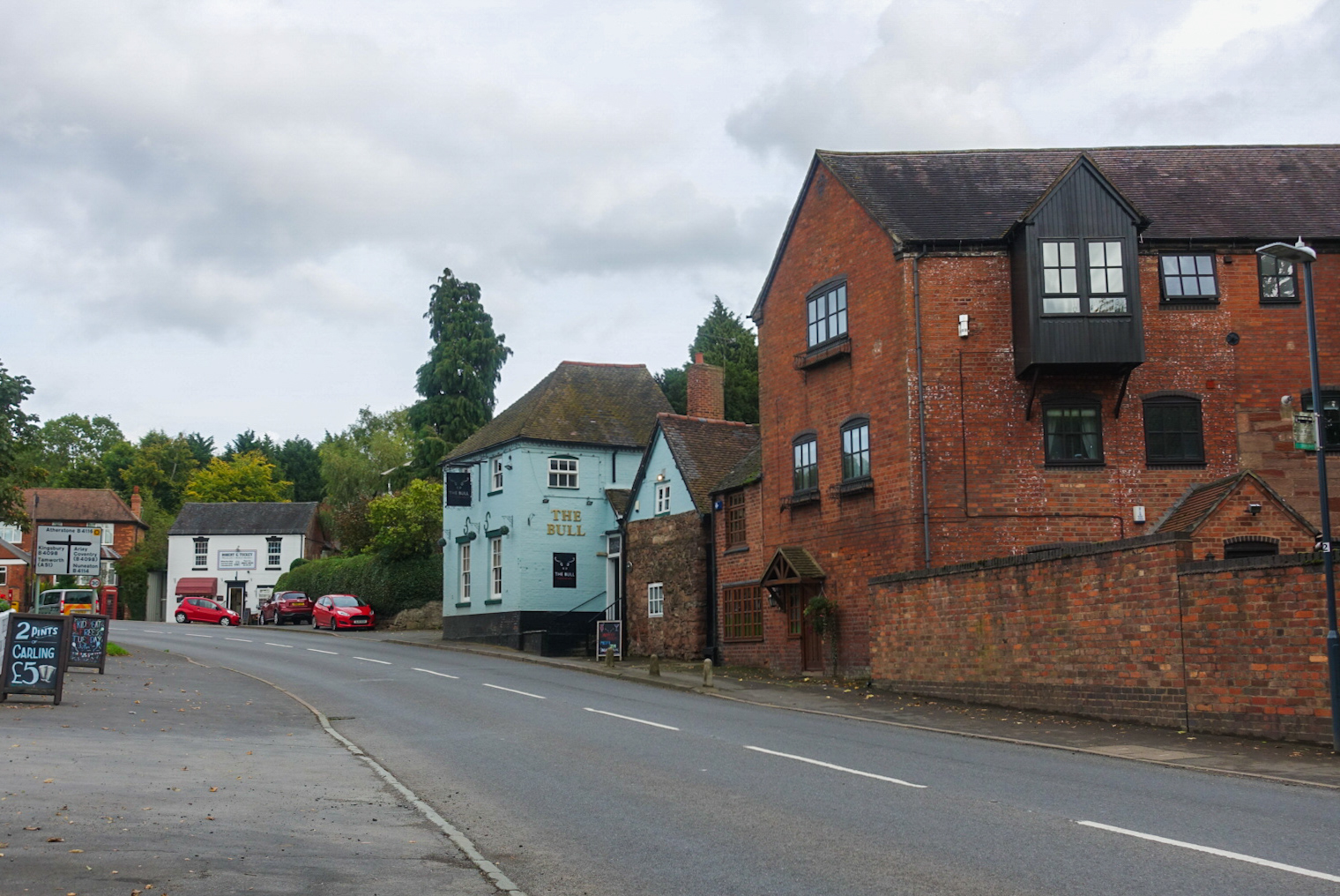
Furnace End is a large hamlet in the civil parish of Over Whitacre, and in the North Warwickshire district of Warwickshire, England. It is on the B4114 where the road intersects with the B4098 approximately midway between the market towns of Coleshill and Atherstone. The hamlet is believed to have acquired its name because of the iron smelting furnaces located there, which were owned by the Jennens family of nearby Nether Whitacre. Population statistics are part of Over Whitacre parish. Nearby settlements include Whitacre Heath, Shustoke, Kingsbury and Fillongley Fillongley is a village and civil parish in the North Warwickshire district of Warwickshire in England. The village is centred on the crossroads of the B4102 (which connects Solihull and Nuneaton) and the B4098 (connecting Coventry and Tamwort .... External links The Bull Furnace End6 miles from the (NEC) Villages in Warwickshire {{Warwickshire-geo-stub ... [...More Info...] [...Related Items...] OR: [Wikipedia] [Google] [Baidu] |
Atherstone, Warwickshire
Atherstone is a market town and civil parish in the North Warwickshire district of Warwickshire, England. Located in the far north of the county, Atherstone is on the A5 national route, and is adjacent to the border with Leicestershire which is here formed by the River Anker. It is only from Staffordshire. It lies between the larger towns of Tamworth and Nuneaton. Atherstone is the administrative centre of the North Warwickshire district, with the offices of North Warwickshire Borough Council located in the town. Atherstone is probably most well known for its tradition of holding an annual Shrove Tuesday Ball Game in the streets, which has been played almost continuously since the Middle Ages. In the 2021 census the population of the civil parish of Atherstone was at 9,212. The population of the larger built-up area which includes the adjoining village of Mancetter was 11,259. History Atherstone has a long history dating back to Roman times: The Roman road, the Watling ... [...More Info...] [...Related Items...] OR: [Wikipedia] [Google] [Baidu] |
Kingsbury, Warwickshire
Kingsbury is a large village and civil parish in the North Warwickshire district of the county of Warwickshire, in the West Midlands region of England. The civil parish population at the 2011 census was 7,652. The village is situated between Birmingham and Tamworth, which is to the north, and overlooks the River Tame. The A51 to Chester starts from here; as does the A4097, which runs through Curdworth and Minworth before joining the A38. This continues to Junction 6 of the M6 (Spaghetti Junction) giving access to the motorway network of the Midlands and the City of Birmingham. Kingsbury is notable for the Kingsbury Water Park, a shooting range and a large oil storage depot to the north-east. The church of Saint Peter and Saint Paul dates from the 12th century and is a grade II* listed building. History The name Kingsbury is derived from the Saxon ''Chinesburie'' meaning 'royal fortified house' or 'Kings Fort'. The 'bury' part of the name means 'fort' or 'defensive work' ... [...More Info...] [...Related Items...] OR: [Wikipedia] [Google] [Baidu] |
Shustoke
Shustoke is a village in the North Warwickshire district of the county of Warwickshire in England.OS Explorer Map 232 : Nuneaton & Tamworth: (1:25 000) : The population of the civil parish at the 2011 census was 549. It is situated 2.5 miles northeast of Coleshill (the nearest town), 7.5 miles southwest of Atherstone, 9.5 miles east of Nuneaton and 12.5 miles east-northeast of Birmingham. It includes the sub-village of Church End half-a-mile to the east, where the parish church of Saint Cuthbert's is situated. History Shustoke is an ancient village and it existed before the Domesday Book. In 1086 Shustoke was recorded as 'Scotescote' meaning Scots Cottage, as ''cote'' means cottage, dwelling or house. The parish church of St Cuthbert's was erected in 1307 on the site of an earlier church or chapel. Some remains of a Celtic-type churchyard cross and reused Norman masonry can be seen. The parish registers are some of the earliest in the country and date from the reign of Hen ... [...More Info...] [...Related Items...] OR: [Wikipedia] [Google] [Baidu] |
Whitacre Heath
Whitacre Heath is a small village in the North Warwickshire district of the county of Warwickshire in England. It is one of 'The Whitacres' - Whitacre Heath, Nether Whitacre and Over Whitacre. Whitacre Heath is actually the heath of Nether Whitacre and not a separate parish. Whitacre Heath is newer and of 19th-century origin. It stems from the early days of railways in the 1830s, and from later developments by Joseph Chamberlain and the Water Department of the City of Birmingham. The Stonebridge Railway was opened on 12 August 1839 to provide a link between the Birmingham and Derby Junction Railway (later the Midland Railway) and the London and Birmingham Railway at Hampton in Arden, via Stonebridge. The line became redundant in the 1930s and the track bed is now a footpath for walkers. There are Victorian brick buildings for the management of drinking water, at Whitacre water works, which were originally associated with public works by the City of Birmingham. The village is no ... [...More Info...] [...Related Items...] OR: [Wikipedia] [Google] [Baidu] |
Parish
A parish is a territorial entity in many Christian denominations, constituting a division within a diocese. A parish is under the pastoral care and clerical jurisdiction of a priest, often termed a parish priest, who might be assisted by one or more curates, and who operates from a parish church. Historically, a parish often covered the same geographical area as a manor. Its association with the parish church remains paramount. By extension the term ''parish'' refers not only to the territorial entity but to the people of its community or congregation as well as to church property within it. In England this church property was technically in ownership of the parish priest ''ex-officio'', vested in him on his institution to that parish. Etymology and use First attested in English in the late, 13th century, the word ''parish'' comes from the Old French ''paroisse'', in turn from la, paroecia, the latinisation of the grc, παροικία, paroikia, "sojourning in a foreign ... [...More Info...] [...Related Items...] OR: [Wikipedia] [Google] [Baidu] |
Nether Whitacre
Nether Whitacre is a small village and larger rural civil parish in North Warwickshire, Warwickshire, England. Topography It is one of 'The Whitacres': Nether Whitacre, Over Whitacre and Whitacre Heath which are in the upper valley of the River Tame, West Midlands, River Tame on its eastern side. The club nickname is "The Ducks" after the similarity of the Swan on the club logo to a Duck and also an incident in the club's history when the club became one of the first ever instances of a club being dismissed for 0 all out with 10 separate batsmen being dismissed for a Duck (cricket), Duck. The Club is affiliated with: *The England and Wales Cricket Board, ECB and is a Clubmark accredited club *The Warwickshire Cricket Board, and runs three senior men's teams on a Saturday within the Warwickshire Cricket League and various junior teams in the Warwickshire Warwickshire (; abbreviated Warks) is a county in the West Midlands region of England. The county town is Warwick, and ... [...More Info...] [...Related Items...] OR: [Wikipedia] [Google] [Baidu] |
Iron
Iron () is a chemical element with symbol Fe (from la, ferrum) and atomic number 26. It is a metal that belongs to the first transition series and group 8 of the periodic table. It is, by mass, the most common element on Earth, right in front of oxygen (32.1% and 30.1%, respectively), forming much of Earth's outer and inner core. It is the fourth most common element in the Earth's crust. In its metallic state, iron is rare in the Earth's crust, limited mainly to deposition by meteorites. Iron ores, by contrast, are among the most abundant in the Earth's crust, although extracting usable metal from them requires kilns or furnaces capable of reaching or higher, about higher than that required to smelt copper. Humans started to master that process in Eurasia during the 2nd millennium BCE and the use of iron tools and weapons began to displace copper alloys, in some regions, only around 1200 BCE. That event is considered the transition from the Bronze Age to the Iron A ... [...More Info...] [...Related Items...] OR: [Wikipedia] [Google] [Baidu] |
Coleshill, Warwickshire
Coleshill ( ) is a market town in the North Warwickshire district of Warwickshire, England, taking its name from the River Cole, on which it stands. It had a population of 6,481 in the 2011 Census and is situated east-northeast of Birmingham, southeast of Sutton Coldfield, south of Tamworth, northwest of Coventry by road and 13 miles (21km) west of Nuneaton. Location Coleshill is located on a ridge between the rivers Cole and Blythe which converge to the north with the River Tame. It is just to the east of the border with West Midlands county outside Birmingham. According to the 2001 Census statistics it is part of the West Midlands conurbation, despite gaps of open green belt land between Coleshill and the rest of the conurbation. The green belt narrows to approximately to the north near Water Orton, and to approximately at the southern tip of the settlement boundary where Coleshill becomes Coleshill Heath, but is in excess of wide at some points in between. Histor ... [...More Info...] [...Related Items...] OR: [Wikipedia] [Google] [Baidu] |
Hamlet (place)
A hamlet is a human settlement that is smaller than a town or village. Its size relative to a Parish (administrative division), parish can depend on the administration and region. A hamlet may be considered to be a smaller settlement or subdivision or satellite entity to a larger settlement. The word and concept of a hamlet has roots in the Anglo-Norman settlement of England, where the old French ' came to apply to small human settlements. Etymology The word comes from Anglo-Norman language, Anglo-Norman ', corresponding to Old French ', the diminutive of Old French ' meaning a little village. This, in turn, is a diminutive of Old French ', possibly borrowed from (West Germanic languages, West Germanic) Franconian languages. Compare with modern French ', Dutch language, Dutch ', Frisian languages, Frisian ', German ', Old English ' and Modern English ''home''. By country Afghanistan In Afghanistan, the counterpart of the hamlet is the Qila, qala (Dari language, Dari: ... [...More Info...] [...Related Items...] OR: [Wikipedia] [Google] [Baidu] |
Market Towns
A market town is a settlement most common in Europe that obtained by custom or royal charter, in the Middle Ages, a market right, which allowed it to host a regular market; this distinguished it from a village or city. In Britain, small rural towns with a hinterland of villages are still commonly called market towns, as sometimes reflected in their names (e.g. Downham Market, Market Rasen, or Market Drayton). Modern markets are often in special halls, but this is a recent development, and the rise of permanent retail establishments has reduced the need for periodic markets. Historically the markets were open-air, held in what is usually called (regardless of its actual shape) the market square (or "Market Place" etc), and centred on a market cross ( mercat cross in Scotland). They were and are typically open one or two days a week. History The primary purpose of a market town is the provision of goods and services to the surrounding locality. Although market towns were known ... [...More Info...] [...Related Items...] OR: [Wikipedia] [Google] [Baidu] |
B4098 Road
B roads are numbered routes in Great Britain of lesser importance than A roads. See the article Great Britain road numbering scheme The Great Britain road numbering scheme is a numbering scheme used to classify and identify all roads in Great Britain. Each road is given a single letter (which represents the road's category) and a subsequent number (between 1 and 4 digits). ... for the rationale behind the numbers allocated. 3 digits 4 digits (40xx) 4 digits (41xx) 4 digits (42xx) 4 digits (43xx) 4 digits (44xx) 4 digits (45xx) 4 digits (46xx) References {{DEFAULTSORT:B Roads in Zone 4 of the Great Britain Numbering Scheme 4 4 ... [...More Info...] [...Related Items...] OR: [Wikipedia] [Google] [Baidu] |


