|
Fuiay
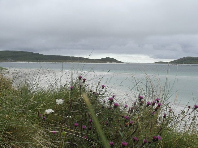
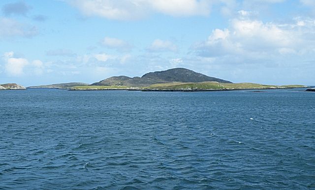
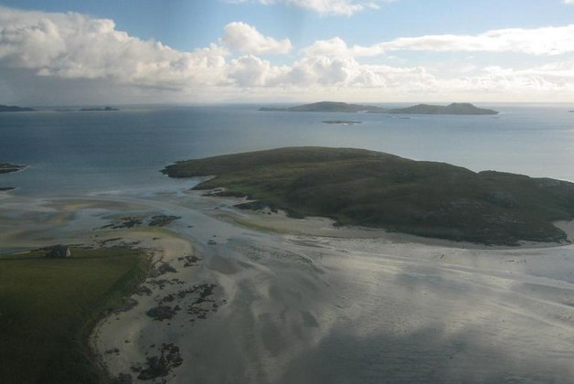
Fuiay ( gd, Fùidheigh) is an island in Scotland. It is one of ten islands in the Sound of Barra, a Site of Community Importance for conservation in the Outer Hebrides. Its area is 84 ha and the unnamed highest eminence reaches 107 m. It is located immediately to the west of Flodday and about 1.5 km southwest of Hellisay. Barra lies across the waters of North Bay. The island had six households located along a "street" at Rubh' an Aiseig (English: "ferry headland") in the north west at some point, probably in the early 19th century. It has been uninhabited since about 1850. There is a tidal inlet here that may have been an effective fish-trap. The name may be from the Norse for "house island" or possibly a mixture of the Gaelic ''bhuidhe'', meaning "yellow" and the Norse ''øy'' meaning "island". Fuiay is one of several uninhabited islands off the northeast coast of Barra and other islands in the vicinity include Orosay, Fuday and Gighay Gighay (Scottish Gae ... [...More Info...] [...Related Items...] OR: [Wikipedia] [Google] [Baidu] |
List Of Islands Of Scotland
This is a list of islands of Scotland, the mainland of which is part of the island of Great Britain. Also included are various other related tables and lists. The definition of an offshore island used in this list is "land that is surrounded by seawater on a daily basis, but not necessarily at all stages of the tide, excluding human devices such as bridges and causeways". Scotland has over 790 offshore islands, most of which are to be found in four main groups: Shetland, Orkney, and the Hebrides, sub-divided into the Inner Hebrides and Outer Hebrides. There are also clusters of islands in the Firth of Clyde, Firth of Forth, and Solway Firth, and numerous small islands within the many bodies of fresh water in Scotland including Loch Lomond and Loch Maree. The largest island is Lewis and Harris which extends to 2,179 square kilometres, and there are a further 200 islands which are greater than 40 hectares in area. Of the remainder, several such as Staffa and the Flannan Isles ... [...More Info...] [...Related Items...] OR: [Wikipedia] [Google] [Baidu] |
Fuday
Fuday (Scottish Gaelic: Fùideigh) is an uninhabited island of about and is one of ten islands in the Sound of Barra, a Site of Community Importance for conservation in the Outer Hebrides of Scotland. It lies just east of Scurrival Point on Barra and west of Eriskay Eriskay ( gd, Èirisgeigh), from the Old Norse for "Eric's Isle", is an island and community council area of the Outer Hebrides in northern Scotland with a population of 143, as of the 2011 census. It lies between South Uist and Barra and is .... Fuday is owned by the Scottish Government. Deserted since 1901, its peak population is recorded only as seven. It is still used for the summer grazing of cattle, and they used to be swum across the , but shallow, Caolas Fuideach (strait) to there from Eoligarry. When cattle were first introduced to the island, they were killed by dehydration. The crofters who left the cattle on the island failed to show the animals the location of the only drinkable source of wa ... [...More Info...] [...Related Items...] OR: [Wikipedia] [Google] [Baidu] |
List Of The Islands Of The Sound Of Barra
The Sound of Barra is a large ocean inlet or sound situated to the north of the island, isle of Barra and to the south of South Uist in the Outer Hebrides in Scotland. Since 2014 it has been designated as a Special Area of Conservation (SAC). The Sound of Barra is composed of 98.91% marine and inlet areas, 1.07% mudflats and other semi-submerged areas and 0.02% sea cliffs and islets. There are ten islands in the sound, with only Eriskay still being inhabited: * Calvay * Eriskay * Fiaraidh * Flodday (Sound of Barra), Flodday * Fuday * Fuiay * Gighay * Hellisay * Lingay, Fiaray, Lingay * Orosay There is a ferry service across the sound from Ardmore, Barra, Ardmore ( gd, Aird Mhòr) on Barra to Ceann a' Ghàraidh on the island of Eriskay. In 2000 it was proposed that the Sound of Barra should become a SAC. A 12-week consultation process was undertaken by NatureScot, Scottish Natural Heritage (SNH) on behalf of the Scottish Government in the autumn of 2011 with two public meetings h ... [...More Info...] [...Related Items...] OR: [Wikipedia] [Google] [Baidu] |
Sound Of Barra
The Sound of Barra is a large ocean inlet or sound situated to the north of the isle of Barra and to the south of South Uist in the Outer Hebrides in Scotland. Since 2014 it has been designated as a Special Area of Conservation (SAC). The Sound of Barra is composed of 98.91% marine and inlet areas, 1.07% mudflats and other semi-submerged areas and 0.02% sea cliffs and islets. There are ten islands in the sound, with only Eriskay still being inhabited: * Calvay * Eriskay * Fiaraidh * Flodday * Fuday * Fuiay * Gighay * Hellisay * Lingay * Orosay There is a ferry service across the sound from Ardmore ( gd, Aird Mhòr) on Barra to Ceann a' Ghàraidh on the island of Eriskay. In 2000 it was proposed that the Sound of Barra should become a SAC. A 12-week consultation process was undertaken by Scottish Natural Heritage (SNH) on behalf of the Scottish Government in the autumn of 2011 with two public meetings held in Castlebay on Barra and on Eriskay as well as inviting submissio ... [...More Info...] [...Related Items...] OR: [Wikipedia] [Google] [Baidu] |
Outer Hebrides
The Outer Hebrides () or Western Isles ( gd, Na h-Eileanan Siar or or ("islands of the strangers"); sco, Waster Isles), sometimes known as the Long Isle/Long Island ( gd, An t-Eilean Fada, links=no), is an island chain off the west coast of mainland Scotland. The islands are geographically coextensive with , one of the 32 unitary council areas of Scotland. They form part of the archipelago of the Hebrides, separated from the Scottish mainland and from the Inner Hebrides by the waters of the Minch, the Little Minch, and the Sea of the Hebrides. Scottish Gaelic is the predominant spoken language, although in a few areas English speakers form a majority. Most of the islands have a bedrock formed from ancient metamorphic rocks, and the climate is mild and oceanic. The 15 inhabited islands have a total population of and there are more than 50 substantial uninhabited islands. The distance from Barra Head to the Butt of Lewis is roughly . There are various important prehisto ... [...More Info...] [...Related Items...] OR: [Wikipedia] [Google] [Baidu] |
Gighay
Gighay (Scottish Gaelic Gioghaigh) an uninhabited island off the northeast coast of Barra. It is one of ten islands in the Sound of Barra, a Site of Community Importance for conservation in the Outer Hebrides of Scotland. Geography and geology Gighay lies in the Sound of Barra between Barra and Eriskay, southwest of Fuday. One of a string of islands between South Uist and Barra, Gighay is "locked" into its neighbour Hellisay, with a harbour between. It is mainly gneiss Gneiss ( ) is a common and widely distributed type of metamorphic rock. It is formed by high-temperature and high-pressure metamorphic processes acting on formations composed of igneous or sedimentary rocks. Gneiss forms at higher temperatures an ... with quartz veins. Gighay has an area of and rises steeply to . Gighay is owned by the Scottish Ministers (''i.e.'' the Scottish government). Notes and references Islands of the Sound of Barra Uninhabited islands of the Outer Hebrides {{Weste ... [...More Info...] [...Related Items...] OR: [Wikipedia] [Google] [Baidu] |
Orosay
Orosay ( gd, Orasaigh) is a small uninhabited tidal island in the Sound of Barra lying at the north end of Traigh Mhòr, the "big beach" on the north east coast of Barra. It is one of ten islands in the Sound of Barra, a Site of Community Importance for conservation in the Outer Hebrides of Scotland. It is about in extent and the highest point is . Geography and etymology Inland, the nearest settlement is Eoligarry, separated from the island by the strait of Caolas Orasaigh (English: "Sound of Orosay")."Orosay, Sound of" Gazetteer for Scotland. Retrieved 17 August 2009. The smaller beach of Tràigh Cille-bharra ("the beach of the church of Barra") lies to the north. The islands of Fuday, Greanamul, |
Old Norse
Old Norse, Old Nordic, or Old Scandinavian, is a stage of development of North Germanic languages, North Germanic dialects before their final divergence into separate Nordic languages. Old Norse was spoken by inhabitants of Scandinavia and their Viking expansion, overseas settlements and chronologically coincides with the Viking Age, the Christianization of Scandinavia and the consolidation of Scandinavian kingdoms from about the 7th to the 15th centuries. The Proto-Norse language developed into Old Norse by the 8th century, and Old Norse began to develop into the modern North Germanic languages in the mid-to-late 14th century, ending the language phase known as Old Norse. These dates, however, are not absolute, since written Old Norse is found well into the 15th century. Old Norse was divided into three dialects: Old West Norse, ''Old West Norse'' or ''Old West Nordic'' (often referred to as ''Old Norse''), Old East Norse, ''Old East Norse'' or ''Old East Nordic'', and ''Ol ... [...More Info...] [...Related Items...] OR: [Wikipedia] [Google] [Baidu] |
Gazetteer For Scotland
The ''Gazetteer for Scotland'' is a gazetteer covering the geography, history and people of Scotland. It was conceived in 1995 by Bruce Gittings of the University of Edinburgh and David Munro of the Royal Scottish Geographical Society, and contains 25,870 entries as of July 2019. It claims to be "the largest dedicated Scottish resource created for the web". The Gazetteer for Scotland provides a carefully researched and editorially validated resource widely used by students, researchers, tourists and family historians with interests in Scotland. Following on from a strong Scottish tradition of geographical publishing, the ''Gazetteer for Scotland'' is the first comprehensive gazetteer to be produced for the country since Francis Groome's ''Ordnance Gazetteer of Scotland'' (1882-6) (the text of which is incorporated into relevant entries). The aim is not to produce a travel guide, of which there are many, but to write a substantive and thoroughly edited description of the count ... [...More Info...] [...Related Items...] OR: [Wikipedia] [Google] [Baidu] |
Flodday, Sound Of Barra
Flodday or Flodaigh ( Scottish Gaelic), is a currently uninhabited island that lies to the north east of Barra and is one of ten islands in the Sound of Barra, a Site of Community Importance for conservation in the Outer Hebrides The Outer Hebrides () or Western Isles ( gd, Na h-Eileanan Siar or or ("islands of the strangers"); sco, Waster Isles), sometimes known as the Long Isle/Long Island ( gd, An t-Eilean Fada, links=no), is an island chain off the west coast ..., Scotland. Its name derives from the Old Norse for "flat island". Geography and geology The island is gneiss with fertile soil. A reef to the north ends in a drying islet, Snagaras. History Flodaigh supported one family until cleared in 1851. Notes and references Islands of the Sound of Barra Cleared places in the Outer Hebrides {{WesternIsles-geo-stub ... [...More Info...] [...Related Items...] OR: [Wikipedia] [Google] [Baidu] |
Barra
Barra (; gd, Barraigh or ; sco, Barra) is an island in the Outer Hebrides, Scotland, and the second southernmost inhabited island there, after the adjacent island of Vatersay to which it is connected by a short causeway. The island is named after Saint Finbarr of Cork. In 2011, the population was 1,174. Gaelic is widely spoken, and at the 2011 Census, there were 761 Gaelic speakers (62% of the population). Geology In common with the rest of the Western Isles, Barra is formed from the oldest rocks in Britain, the Lewisian gneiss, which dates from the Archaean eon. Some of the gneiss in the east of the island is noted as being pyroxene-bearing. Layered textures or foliation in this metamorphic rock is typically around 30° to the east or northeast. Palaeoproterozoic age metadiorites and metatonalites forming a part of the East Barra Meta-igneous Complex occur around Castlebay as they do on the neighbouring islands of Vatersay and Flodday. A few metabasic dykes intr ... [...More Info...] [...Related Items...] OR: [Wikipedia] [Google] [Baidu] |


