|
Fresno Dome
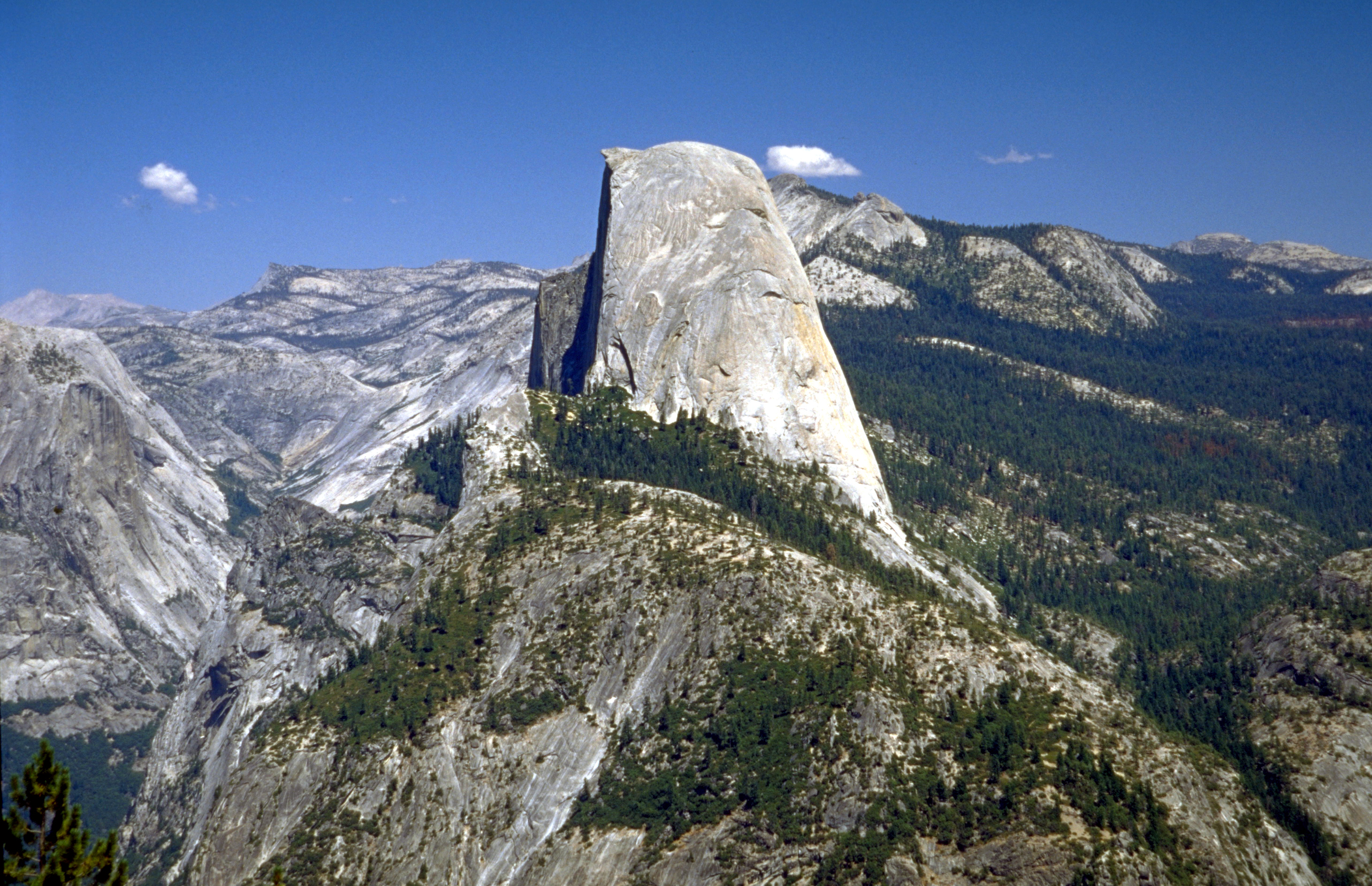
Fresno Dome is a dominant granite dome rising in isolation above the forest of Soquel Meadow in the Sierra National Forest in Madera County, California. The dome as known to the Mono Indians as "the greeting place" ("wah-me-yelo"). John Muir encountered Fresno Dome, calling it "Wamello", in the 1870s, and used its summit to locate Fresno Grove (now known as Nelder Grove). It is accessible by a trailhead which is a three-mile drive from the Sierra Vista Scenic Byway (part of the National Scenic Byway system). The nearest town is Bass Lake, California, to the south. At its base, sits the Fresno Dome campground, a backwoods campground accessible only by jeep trails. The campground is a favorite spot for deer hunters and is largely empty other than during deer season. The dome offers several technical free climbs rated or better, with "Guides in a Snowbank" rated at 5.10a. See also * Half Dome * Lembert Dome * Batholith * Geology of the Yosemite area References Granite dome ... [...More Info...] [...Related Items...] OR: [Wikipedia] [Google] [Baidu] |
Sierra National Forest
Sierra National Forest is a U.S. national forest located on the western slope of central Sierra Nevada in Central California and bounded on the northwest by Yosemite National Park and the south by Kings Canyon National Park. The forest is known for its mountain scenery and beautiful lakes. Forest headquarters are located in Clovis, California. There are local ranger district offices in North Fork and Prather. History Sierra National Forest was the second National Forest created in California and the largest at the time. It covered over six million acres (24,000 km2) of the Sierra Nevada and was about four times the average area of typical California National Forests. Originally it embraced parts of eight counties from Tuolumne on the north to Kern on the south and Mono and Inyo on the east. Initially its name was descriptive, but later when the Sierra was divided into different units this was no longer the case. President Harrison proclaimed the Sierra Forest Reserv ... [...More Info...] [...Related Items...] OR: [Wikipedia] [Google] [Baidu] |
Sierra Vista Scenic Byway
The Sierra Vista Scenic Byway is an route through the Sierra National Forest in the U.S. state of California. Many examples of the Sierra’s most distinctive granite domes, meadows and glacial valleys can be seen along the way. The Sierra Vista Scenic Byway begins two miles (3 km) north of the foothill community of North Fork, climbing the western slope of the Sierra Nevada mountain range until its crest, and finally dropping back down into the foothills near Oakhurst. Route description The byway begins on Forest Service Road 81 (FS 81) and continues north, loosely paralleling the San Joaquin River. The designation continues west on FS 7; the initial part of it is a dirt road. FS 7 eventually becomes paved again; however, the byway continues southwest onto Sky Ranch Road, which is FS 10 and is initially unpaved. The byway ends at SR 41. The route is generally open June through October and takes approximately 5 hours to drive. History It was designated a National Forest ... [...More Info...] [...Related Items...] OR: [Wikipedia] [Google] [Baidu] |
Mountains Of Madera County, California
A mountain is an elevated portion of the Earth's crust, generally with steep sides that show significant exposed bedrock. Although definitions vary, a mountain may differ from a plateau in having a limited summit area, and is usually higher than a hill, typically rising at least 300 metres (1,000 feet) above the surrounding land. A few mountains are isolated summits, but most occur in mountain ranges. Mountains are formed through tectonic forces, erosion, or volcanism, which act on time scales of up to tens of millions of years. Once mountain building ceases, mountains are slowly leveled through the action of weathering, through slumping and other forms of mass wasting, as well as through erosion by rivers and glaciers. High elevations on mountains produce colder climates than at sea level at similar latitude. These colder climates strongly affect the ecosystems of mountains: different elevations have different plants and animals. Because of the less hospitable terrain ... [...More Info...] [...Related Items...] OR: [Wikipedia] [Google] [Baidu] |
Granite Domes
Granite domes are domical hills composed of granite with bare rock exposed over most of the surface. Generally, domical features such as these are known as bornhardts. Bornhardts can form in any type of plutonic rock but are typically composed of granite and granitic gneiss. As granitic plutons cool kilometers below the Earth's surface, minerals in the rock crystallize under uniform confining pressure. Erosion brings the rock closer to Earth's surface and the pressure from above the rock decreases; as a result the rock fractures. These fractures are known as exfoliation joints, or sheet fractures, and form in onionlike patterns that are parallel to the land surface. These sheets of rock peel off the exposed surface and in certain conditions develop domical structures. Additional theories on the origin of granite domes involve scarp-retreat and tectonic uplift. Sheet fractures Sheet fractures are arcuate fractures defining slabs of rock that range from 0.5 to 10 meters thic ... [...More Info...] [...Related Items...] OR: [Wikipedia] [Google] [Baidu] |
Geology Of The Yosemite Area
The exposed geology of the Yosemite area includes primarily granitic rocks with some older metamorphic rock. The first rocks were laid down in Precambrian times, when the area around Yosemite National Park was on the edge of a very young North American continent. The sediment that formed the area first settled in the waters of a shallow sea, and compressive forces from a subduction zone in the mid-Paleozoic fused the seabed rocks and sediments, appending them to the continent. Heat generated from the subduction created island arcs of volcanoes that were also thrust into the area of the park. In time, the igneous and sedimentary rocks of the area were later heavily metamorphosed. Most of the rock now exposed in the park is granitic, having been formed 210 to 80 million years ago as igneous diapirs 6 miles (10 km) below the surface. Over time, most of the overlying rock was uplifted along with the rest of the Sierra Nevada and was removed from the area by erosion. This exposed t ... [...More Info...] [...Related Items...] OR: [Wikipedia] [Google] [Baidu] |
Batholith
A batholith () is a large mass of intrusive igneous rock (also called plutonic rock), larger than in area, that forms from cooled magma deep in Earth's crust. Batholiths are almost always made mostly of felsic or intermediate rock types, such as granite, quartz monzonite, or diorite (see also ''granite dome''). Formation Although they may appear uniform, batholiths are in fact structures with complex histories and compositions. They are composed of multiple masses, or ''plutons'', bodies of igneous rock of irregular dimensions (typically at least several kilometers) that can be distinguished from adjacent igneous rock by some combination of criteria including age, composition, texture, or mappable structures. Individual plutons are solidified from magma that traveled toward the surface from a zone of partial melting near the base of the Earth's crust. Traditionally, these plutons have been considered to form by ascent of relatively buoyant magma in large masses called ''p ... [...More Info...] [...Related Items...] OR: [Wikipedia] [Google] [Baidu] |
Lembert Dome
Lembert Dome is a granite dome rock formation in Yosemite National Park in the US state of California. The dome soars above Tuolumne Meadows and the Tuolumne River and can be hiked starting at the Tioga Road in the heart of Tuolumne Meadows, west of the Tioga Pass Entrance to Yosemite National Park. The landform is an example of a rôche moutonnée with clear lee and stoss slopes. Lembert Dome was named for Jean Baptiste Lembert, sometimes mistakenly referred to as John Lambert, who took up a homestead in a section of Tuolumne Meadows in 1865. By 1879 the Wheeler Survey referred to it as Soda Springs Dome. John Muir called it Glacier Rock. Lembert Dome is near Puppy Dome, is also close to Dog Dome. Rock climbers can scale the face from the parking lot just off the Tioga Road, but hiker Hiking is a long, vigorous walk, usually on trails or footpaths in the countryside. Walking for pleasure developed in Europe during the eighteenth century.AMATO, JOSEPH A. "Mind over Fo ... [...More Info...] [...Related Items...] OR: [Wikipedia] [Google] [Baidu] |
Half Dome
Half Dome is a granite dome at the eastern end of Yosemite Valley in Yosemite National Park, California. It is a well-known rock formation in the park, named for its distinct shape. One side is a sheer face while the other three sides are smooth and round, making it appear like a dome cut in half. The granite crest rises more than above the valley floor. Geology The impression from the valley floor that this is a round dome that has lost its northwest half, is just an illusion. From Washburn Point, Half Dome can be seen as a thin ridge of rock, an arête, that is oriented northeast–southwest, with its southeast side almost as steep as its northwest side except for the very top. Although the trend of this ridge, as well as that of Tenaya Canyon, is probably controlled by master joints, 80 percent of the northwest "half" of the original dome may well still be there. Ascents As late as the 1870s, Half Dome was described as "perfectly inaccessible" by Josiah Whitney of the Ca ... [...More Info...] [...Related Items...] OR: [Wikipedia] [Google] [Baidu] |
Bass Lake, California
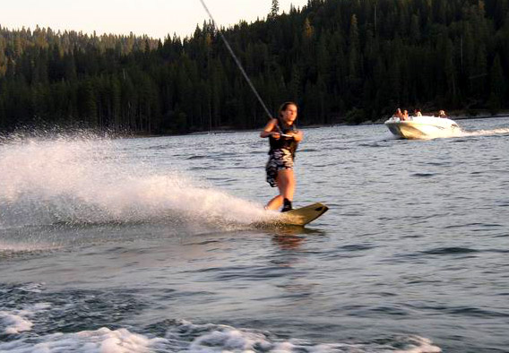
Bass Lake is a census-designated place in Madera County, California, United States. It is located southeast of Yosemite Forks, at an elevation of . The population was 575 at the 2020 census. Bass Lake is situated in the Sierra National Forest approximately from the south entrance of Yosemite National Park. Established in 1895 as "Bass Lake Village", the community grew up around the newly created Bass Lake reservoir that supplied the first hydroelectric generating project in Central California. Much of the community and the reservoir is devoted to the tourism industry. The original post office at Bass Lake opened in 1912. The ZIP Codes for Bass Lake are 93604 and 93669, and it is in the 559 area code. Geography According to the United States Census Bureau The United States Census Bureau (USCB), officially the Bureau of the Census, is a principal agency of the U.S. Federal Statistical System, responsible for producing data about the American people and economy. The C ... [...More Info...] [...Related Items...] OR: [Wikipedia] [Google] [Baidu] |
National Scenic Byway
A National Scenic Byway is a road recognized by the United States Department of Transportation for one or more of six "intrinsic qualities": archeological, cultural, historic, natural, recreational, and scenic. The program was established by Congress in 1991 to preserve and protect the nation's scenic but often less-traveled roads and promote tourism and economic development. The National Scenic Byways Program (NSBP) is administered by the Federal Highway Administration (FHWA). The most scenic byways are designated All-American Roads, which must meet two out of the six intrinsic qualities. The designation means they have features that do not exist elsewhere in the United States and are unique and important enough to be tourist destinations unto themselves. As of January 21, 2021, there are 184 National Scenic Byways located in 48 states (all except Hawaii and Texas). History The NSBP was established under the Intermodal Surface Transportation Efficiency Act of 1991, w ... [...More Info...] [...Related Items...] OR: [Wikipedia] [Google] [Baidu] |
Wilderness Press
Wilderness Press is a publisher of outdoor guidebooks and maps that was founded in Berkeley, California in 1967. Its first publication was ''Sierra North'' (1967/2005). Reissued in 2005, this is considered the authoritative guidebook for hikers and backpackers in the Northern Sierra Nevada. Since the debut of ''Sierra North'' in 1967, Wilderness Press has become well known for its outdoor titles, guidebooks, and maps.https://news.google.com/newspapers?id=RDwuAAAAIBAJ&sjid=WNcFAAAAIBAJ&pg=997,5780000&dq=wilderness-press&hl=en It has been owned by Keen Communications since 2008, and headquarters have moved to Birmingham, Alabama. Select bibliography *''Walking Brooklyn ''Walking Brooklyn: 30 Tours Exploring Historical Legacies, Neighborhood Culture, Side Streets, and Waterways'' is a book by Adrienne Onofri. It was published in June 2007 by Wilderness Press as one of the first titles in their urban trekking seri ...'' References External links * Book publishing companies b ... [...More Info...] [...Related Items...] OR: [Wikipedia] [Google] [Baidu] |
Madera County, California
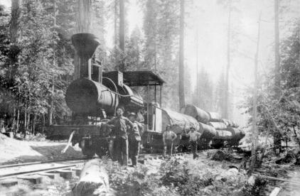
Madera County (), officially the County of Madera, is a county at the geographic center of the U.S. state of California. As of the 2020 census, the population was 156,255. The county seat is Madera. Madera County comprises the Madera, CA Metropolitan Statistical Area, which is included in the Fresno-Madera, CA Combined Statistical Area. It is located in the eastern San Joaquin Valley and the central Sierra Nevada. The southeasternmost part of Yosemite National Park is located in the county's northeast. History and etymology Madera County was formed in 1893 from Fresno County during a special election held in Fresno on May 16, 1893. Citizens residing in the area that was to become Madera County voted 1,179 to 358 for separation from Fresno County and the establishment of Madera County. Madera is the Spanish term for wood. The county derives its name from the town of Madera, named when the California Lumber Company built a log flume to carry lumber to the Central Pacific R ... [...More Info...] [...Related Items...] OR: [Wikipedia] [Google] [Baidu] |


