|
Franeker
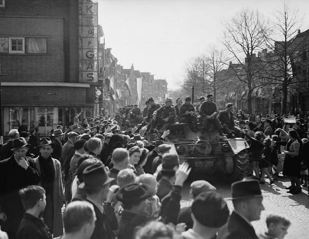
Franeker (; fry, Frjentsjer) is one of the eleven historical cities of Friesland and capital of the municipality of Waadhoeke. It is located north of the Van Harinxmakanaal and about 20 km west of Leeuwarden. As of 1 January 2014, it had 12,781 inhabitants. The Eise Eisinga Planetarium, established in 1781, is located in the city. History Franeker was founded around 800 as a Carolingian stronghold. The name probably derives from ''Froon-acker'', meaning "land of the lord/king"; the oldest street in the city is still called Froonacker. Beginning around the 11th century, Franeker developed into the administrative center Westergoa. Franeker received city rights in 1374. In the 15th century, Albert, Duke of Saxony established himself in Franeker. The city appeared for a time to be growing into the primary city of Friesland, but was eventually overshadowed in this role by Leeuwarden. During the period of the Dutch Revolt, the town sided early on with William I. From 158 ... [...More Info...] [...Related Items...] OR: [Wikipedia] [Google] [Baidu] |
Waadhoeke
Waadhoeke is a municipality of Friesland in the northern Netherlands. It was established 1 January 2018 and consists of the former municipalities of Franekeradeel, het Bildt, Menameradiel and parts of Littenseradiel, all four of which were dissolved on the same day. The municipality is located in the province of Friesland, in the north of the Netherlands. Waadhoeke is bordered by Harlingen, Terschelling, Ferwerderadiel, Leeuwarden and Súdwest-Fryslân. The population in January 2019 was 46,133. It is Friesland's sixth-most-populous municipality. The largest population centre (2018 population, 12,793) is Franeker. The residents speak Dutch, West Frisian or Bildts (a dialect in the former municipality het Bildt). Etymology The municipality is named after the Wadden Sea ( fry, Waadsee). The municipality is a part or corner ( fry, hoeke) of the province of Friesland. Population centres The municipality consists of 41 settlements of which Franeker is the sea ... [...More Info...] [...Related Items...] OR: [Wikipedia] [Google] [Baidu] |
Franekeradeel
Franekeradeel (; fry, Frentsjerteradiel) is a former municipality in the northern Netherlands. It was created in 1984 by combining an earlier Franekeradeel municipality with the city of Franeker and parts of the former municipality of Barradeel. On 1 January 2018 it merged with the municipalities of het Bildt, Menameradiel and parts of Littenseradiel to form the new municipality Waadhoeke. Population centres Achlum, Boer, Dongjum, Firdgum, Franeker, Herbaijum, Hitzum, Klooster-Lidlum, Oosterbierum, Peins, Pietersbierum, Ried, Schalsum, Sexbierum, Tzum, Tzummarum Tzummarum ( fry, Tsjummearum) is a village in Waadhoeke municipality in the province of Friesland, the Netherlands. It had a population of around 1,414 in January 2014. History The village was first mentioned in the 13th century as de Thumarentum, ..., Zweins. Topography ''Dutch Topographic map of the former municipality of Franekeradeel, June 2015'' References External links Official website Waadh ... [...More Info...] [...Related Items...] OR: [Wikipedia] [Google] [Baidu] |
University Of Franeker
The University of Franeker (1585–1811) was a university in Franeker, Friesland, the Netherlands. It was the second oldest university of the Netherlands, founded shortly after Leiden University. History Also known as ''Academia Franekerensis'' or the University of Friesland, it consisted of departments of Theology, Law, Medicine, Philosophy, Mathematics and Physics. Among its well-known students was Peter Stuyvesant, last director-general of the Dutch colony of New Netherland. Initially the university had an excellent reputation, attracting students from far and wide, but from 1700 its fortune changed. The university was disbanded by Napoleon in 1811, along with the Universities of Harderwijk and Utrecht. After the end of the French régime, the university was not restored. Instead, an ''Athenaeum illustre'' was founded, which did not have the right to issue doctoral degrees. In 1843, the ''Athenaeum'' itself was disbanded because of a lack of students. Today, Franeker has n ... [...More Info...] [...Related Items...] OR: [Wikipedia] [Google] [Baidu] |
Eise Eisinga Planetarium
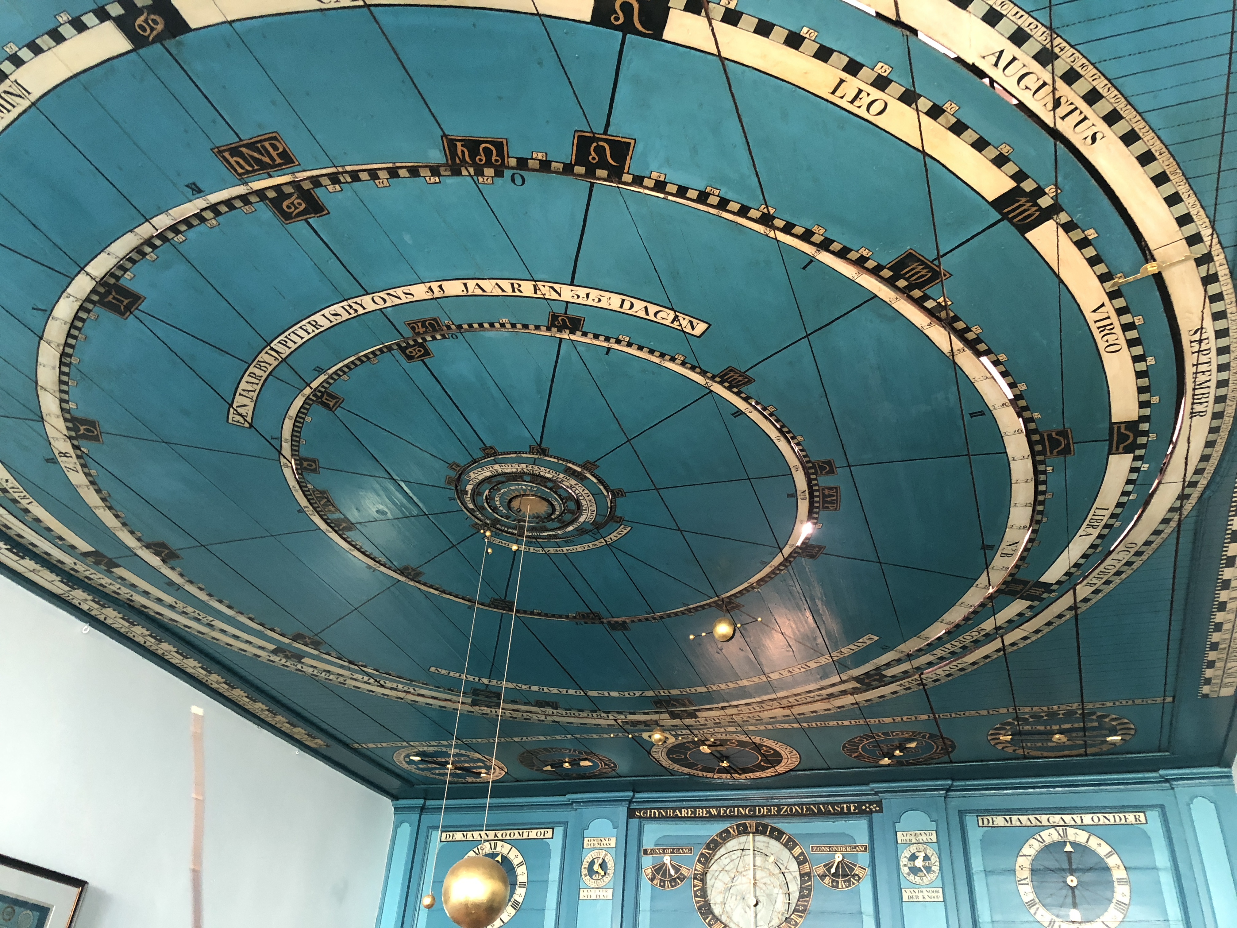
The Royal Eise Eisinga Planetarium ( nl, Koninklijk(e) Eise Eisinga Planetarium) is an 18th-century orrery in Franeker, Friesland, Netherlands. It is currently a museum and open to the public. The orrery has been on the top 100 Dutch heritage sites list since 1990 and in December 2011 was placed on a provisionary list of future UNESCO World Heritage Site candidates. It is the oldest working orrery in the world. History The orrery was built from 1774 to 1781 by Eise Eisinga, a wool comber and amateur astronomer. Eise Eisinga’s mechanical planetarium is built into the timber roof of the living room ceiling of his historic canal house. William I, Prince of Orange and the first King of the Netherlands was so impressed with the planetarium, he purchased the house and it became a royal planetarium. The museum consists of the planetarium room, a screening room where documentaries are shown, and special exhibits based on modern astronomy. Other parts on permanent display are Eising ... [...More Info...] [...Related Items...] OR: [Wikipedia] [Google] [Baidu] |
Arkens, Franeker
Arkens is a Hollow Post mill in Franeker, Friesland, Netherlands which has been restored to working order. The mill is listed as a Rijksmonument, number 15710. (Click on "Technische gegevens" to view.) History ''Arkens'' was originally built in 1835 at a site to the north of its current position. It was built to drain the Arkens polder. Prior to 1910, it was fitted with four Patent sails. Photographs show that one pair of the Patent sails were wider at the tip than they were at the heel, the other pair were of standard construction. These were replaced by millwright A millwright is a craftsperson or skilled tradesperson who installs, dismantles, maintains, repairs, reassembles, and moves machinery in factories, power plants, and construction sites. The term ''millwright'' (also known as ''industrial mecha ... Westra of Franeker with common sails which are wider at the tip than they are at the heel (''Vlinderwieken'' en, Butterfly sails). ''Arkens'' is the only windmill in ... [...More Info...] [...Related Items...] OR: [Wikipedia] [Google] [Baidu] |
Orrery
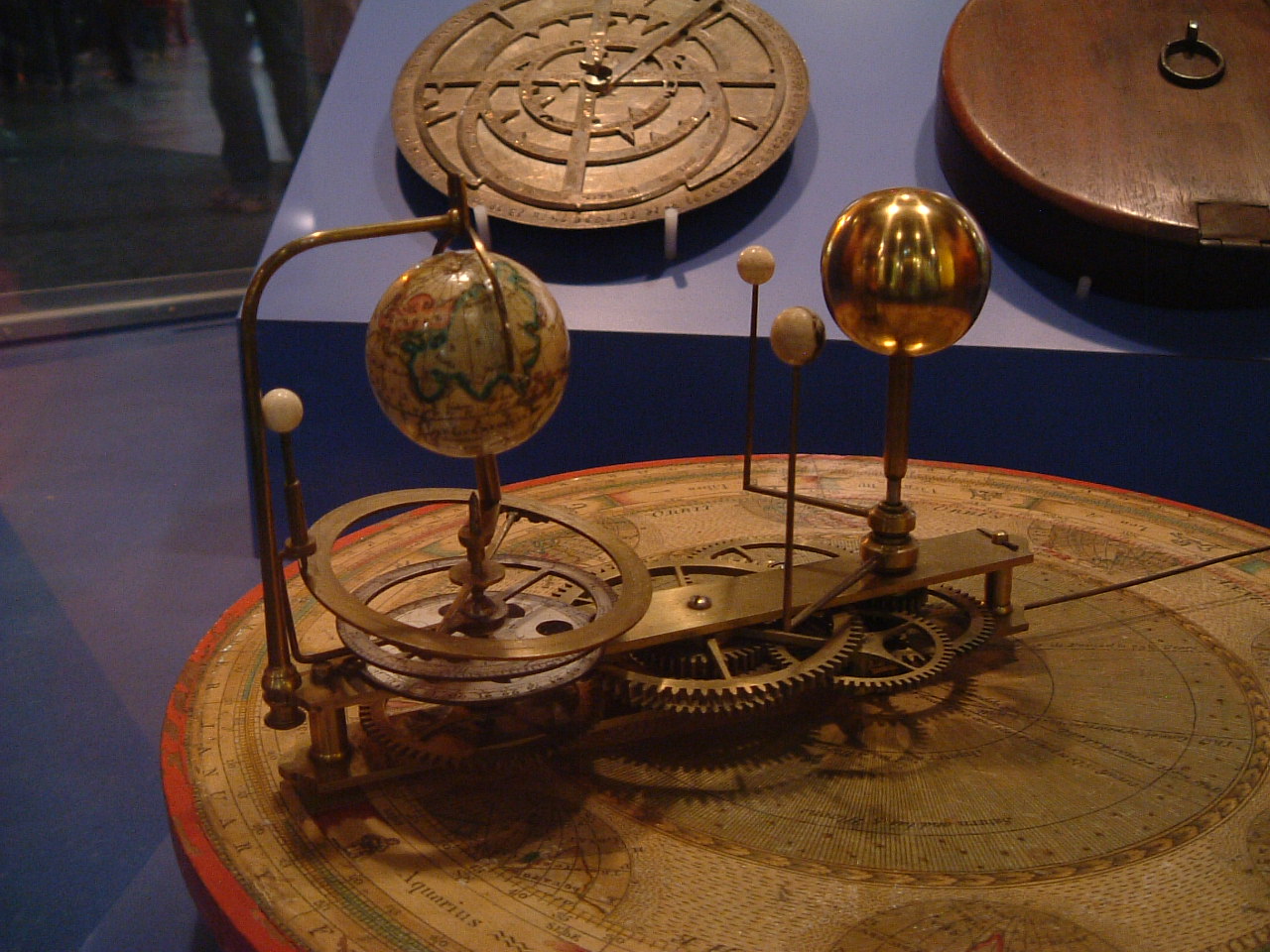
An orrery is a mechanical model of the Solar System that illustrates or predicts the relative positions and motions of the planets and moons, usually according to the heliocentric model. It may also represent the relative sizes of these bodies; however, since accurate scaling is often not practical due to the actual large ratio differences, a subdued approximation may be used instead. Though the Greeks had working planetaria, the first orrery that was a planetarium of the modern era was produced in 1704, and one was presented to Charles Boyle, 4th Earl of Orrery – hence the name. They are typically driven by a clockwork mechanism with a globe representing the Sun at the centre, and with a planet at the end of each of the arms. History Ancient versions The Antikythera mechanism, discovered in 1901 in a wreck off the Greek island of Antikythera in the Mediterranean Sea, (it now resides in the National Archaeological Museum of Athens) and extensively studied, exhibited the ... [...More Info...] [...Related Items...] OR: [Wikipedia] [Google] [Baidu] |
Westergoa
Westergoa was one of the seven sealands and one of the three that now lie within the borders of today's Dutch province of Friesland. Later it was one of the three goaen of Frisia. In the Middle Ages Westergoa most probably formed the political centre of the Frisian realm. Area On the eastern side Westergoa was bordered by the Middelsee, on the other side Eastergoa. On the south side it bordered with what originally was Bornegoa which was in the line with Terhernster Lake to the south of the coast, the eastern perimeter was with Doedingwerstal. All other borders were coastlines. 1200 Around 1200, Westergoa was divided into parts within the Westergoa area Franeker, Wildinge and Wymbrits, called the Fiefdielen (Five parts). Franeker and Wildinge have probably been the original Westergo. Wymbrits was added when begin 12th century when Sudergoa was no more. 1500 Around 1500 Het Bildt, was added to Westergoa but by the establishment of Sânwâlden, Gaasterland, Don ... [...More Info...] [...Related Items...] OR: [Wikipedia] [Google] [Baidu] |
Friesland
Friesland (, ; official fry, Fryslân ), historically and traditionally known as Frisia, is a province of the Netherlands located in the country's northern part. It is situated west of Groningen, northwest of Drenthe and Overijssel, north of Flevoland, northeast of North Holland, and south of the Wadden Sea. As of January 2020, the province had a population of 649,944 and a total area of . The province is divided into 18 municipalities. The capital and seat of the provincial government is the city of Leeuwarden (West Frisian: ''Ljouwert'', Liwwaddes: ''Liwwadde''), a city with 123,107 inhabitants. Other large municipalities in Friesland are Sneek (pop. 33,512), Heerenveen (pop. 50,257), and Smallingerland (includes city of Drachten, pop. 55,938). Since 2017, Arno Brok is the King's Commissioner in the province. A coalition of the Christian Democratic Appeal, the People's Party for Freedom and Democracy, the Labour Party, and the Frisian National Party forms the ... [...More Info...] [...Related Items...] OR: [Wikipedia] [Google] [Baidu] |
Van Harinxmakanaal
The van Harinxmakanaal is a major canal in western Frisland. It runs from the sea at Harlingen eastwards to Leeuwarden. Major places along the canal include Franeker, Dronrijp and Deinum. The canal is 37.5 kilometers long. It was named after Pieter Albert Vincent van Harinxma thoe Slooten in 1950 who was King's Commissioner to Friesland from 1909 to 1945. Prior to this date it was called Harlinger Trekvaart. However this was widened and deepened, and a few corners cut off in 1951. At Suawoude it joins the Prinses Margrietkanaal. The lock Tsjerk Hiddessluizen situated at the connection to the Harlingen harbour maintains the water level in the canal. The canal water level is connected to the water system called Friese boezem, consisting of lakes, waterways and canals in Friesland. See also * Dronrijp Reprisals The Dronrijp Reprisals were carried out by the Nazi Germany, German Sicherheitsdienst in the Netherlands, Dutch town of Dronrijp on 11 April 1945. 14 prisoners ... [...More Info...] [...Related Items...] OR: [Wikipedia] [Google] [Baidu] |
City Rights In The Netherlands
City rights are a feature of the medieval history of the Low Countries. A liege lord, usually a count, duke or similar member of the high nobility, granted to a town or village he owned certain town privileges that places without city rights did not have. In Belgium, Luxembourg, and the Netherlands, a town, often proudly, calls itself a city if it obtained a complete package of city rights at some point in its history. Its current population is not relevant, so there are some very small cities. The smallest is Staverden in the Netherlands, with 40 inhabitants. In Belgium, Durbuy is the smallest city, whilst the smallest in Luxembourg is Vianden. Overview When forced by financial problems, feudal landlords offered for sale privileges to settlements from around 1000. The total package of these comprises town privileges. Such sales raised (non-recurrent) revenue for the feudal lords, in exchange for the loss of power. Over time, the landlords sold more and more privileges. Thi ... [...More Info...] [...Related Items...] OR: [Wikipedia] [Google] [Baidu] |
Leeuwarden
Leeuwarden (; fy, Ljouwert, longname=yes /; Town Frisian: ''Liwwadden''; Leeuwarder dialect: ''Leewarden'') is a city and municipality in Friesland, Netherlands, with a population of 123,107 (2019). It is the provincial capital and seat of the Provincial Council of Friesland. It is located about 50 km west of Groningen and 110 km north east from the Dutch capital Amsterdam ( as the crow flies). The region has been continuously inhabited since the 10th century. It came to be known as Leeuwarden in the early 9th century AD and was granted city privileges in 1435. It is the main economic hub of Friesland, situated in a green and water-rich environment. Leeuwarden is a former royal residence and has a historic city centre, many historically relevant buildings, and a large shopping centre with squares and restaurants. Leeuwarden was awarded the title European Capital of Culture for 2018. The Elfstedentocht (Eleven Cities Tour), an ice skating tour passing the eleven cities o ... [...More Info...] [...Related Items...] OR: [Wikipedia] [Google] [Baidu] |
Telephone Numbers In The Netherlands
Telephone numbers in the Netherlands are administered by the Ministry of Economic Affairs, Agriculture and Innovation of the Netherlands and may be grouped into three general categories: geographical numbers, non-geographical numbers, and numbers for public services. Geographical telephone numbers are sequences of 9 digits (0-9) and consist of an area code of two or three digits and a subscriber number of seven or six digits, respectively. When dialled within the country, the number must be prefixed with the trunk access code 0, identifying a destination telephone line in the Dutch telephone network. Non-geographical numbers have no fixed length, but also required the dialling of the trunk access code (0). They are used for mobile telephone networks and other designated service types, such as toll-free dialling, Internet access, voice over IP, restricted audiences, and information resources. In addition, special service numbers exist for emergency response, directory assistanc ... [...More Info...] [...Related Items...] OR: [Wikipedia] [Google] [Baidu] |


