|
Fort De La Rivière Tremblante
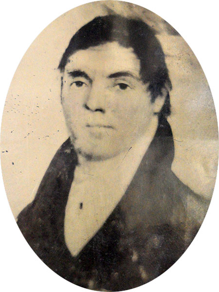
Fort de la Rivière Tremblante (also called "Fort Tremblante", "Aspin House" and "Grant's House") was a trading post of the North West Company on the Assiniboine River from 1791 to 1798. It was in prime fur country and produced most of the beaver and otter pelts in the Assiniboine district. Many of the furs likely came from the forested area to the east that is now Duck Mountain Provincial Park (Saskatchewan). It was founded by Robert Grant in 1791 and from 1793 to 1798 Cuthbert Grant Sr was in charge. His more famous son was born here in 1793. It was closed in 1798 and burned down in 1800. It was located about 9 miles south southeast of Kamsack, Saskatchewan and west of Togo, Saskatchewan Togo (Canada 2016 Census, 2016 population: ) is a village in the Provinces and territories of Canada, Canadian province of Saskatchewan within the Rural Municipality of Cote No. 271 and Division No. 9, Saskatchewan, Census Division No. 9. It is .... It was located 500 paces east of the Ass ... [...More Info...] [...Related Items...] OR: [Wikipedia] [Google] [Baidu] |
North West Company
The North West Company was a fur trading business headquartered in Montreal from 1779 to 1821. It competed with increasing success against the Hudson's Bay Company in what is present-day Western Canada and Northwestern Ontario. With great wealth at stake, tensions between the companies increased to the point where several minor armed skirmishes broke out, and the two companies were forced by the British government to merge. Before the Company After the French landed in Quebec in 1608, spread out and built a fur trade empire in the St. Lawrence basin. The French competed with the Dutch (from 1614) and English (1664) in New York and the English in Hudson Bay (1670). Unlike the French who travelled into the northern interior and traded with First Nations in their camps and villages, the English made bases at trading posts on Hudson Bay, inviting the indigenous people to trade. After 1731, pushed trade west beyond Lake Winnipeg. After the British conquest of New France in 1763 ... [...More Info...] [...Related Items...] OR: [Wikipedia] [Google] [Baidu] |
Assiniboine River
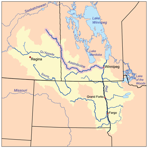
The Assiniboine River (''; french: Rivière Assiniboine'') is a river that runs through the prairies of Western Canada in Saskatchewan and Manitoba. It is a tributary of the Red River of the North, Red River. The Assiniboine is a typical meandering river with a single main channel embanked within a flat, shallow valley in some places and a steep valley in others. Its main tributaries are the Qu'Appelle River, Qu'Appelle, Souris River, Souris and Whitesand River, Saskatchewan, Whitesand Rivers. For early history and exploration see Assiniboine River fur trade. The river takes its name from the Assiniboine people, Assiniboine First Nations in Canada, First Nation. Robert Douglas of the Geographical Board of Canada (1933) made several comments as to its origin: "The name commemorates the Assiniboine natives called by La Vérendrye in 1730 'Assiniboils' and by Governor Knight in 1715 of the Hudson's Bay Company 'stone Indians.' Assiniboine is the name of an Indian tribe and is deri ... [...More Info...] [...Related Items...] OR: [Wikipedia] [Google] [Baidu] |
Duck Mountain Provincial Park (Saskatchewan)
Duck Mountain Provincial Park is a provincial park, located in the Canadian province of Saskatchewan 14 km east of the town of Kamsack and stretches about 12 kilometres eastward to the Saskatchewan / Manitoba boundary. The park covers approximately 150 square kilometres. Road access to the park is via Highway 57, which connects Saskatchewan Highway 5 to Manitoba Highway 83. Duck Mountain is a feature of the Manitoba Escarpment, and is a rise of forested land between the Saskatchewan prairie and the Manitoba lowlands. It is about 200m higher than the floor of the Assiniboine River valley to the west, and about 400m higher than the Manitoba lowlands to the east. The landscape is rolling, with numerous ponds and creek channels. The soils are stony and are underlain with glacial till. The area represents the southern limit of the boreal forest, in its transition zone to aspen parkland. The forest trees include white spruce, black spruce, tamarack larch, trembling aspe ... [...More Info...] [...Related Items...] OR: [Wikipedia] [Google] [Baidu] |
Cuthbert Grant
Cuthbert James Grant (1793 – July 15, 1854) was a prominent Métis people (Canada), Métis leader of the early 19th century. His father was also called Cuthbert Grant. Life Cuthbert James Grant was born in 1793 at Fort Tremblant, a North West Company trading post located near the present-day town of Togo, Saskatchewan, where his father was a manager. His father was Cuthbert Grant Sr., a North West Company partner, and his mother was Métis, Margaret Son-gabo-ki-che-ta Grant, Utinwassis Cree Woman. In 1801, at the age of 8, he was sent to be educated, perhaps to Scotland, though this is uncertain. It is not known exactly when he returned to Western Canada, but in 1812, he entered the service of the North West Company at the age of 19. He then travelled with the spring brigade to the ''Pays d'en Haut'', the "high country" of the northwest. He was recognized as a leader of the Métis people, and became involved in the bitter struggle between the Nor'westers and the Hudson's Bay ... [...More Info...] [...Related Items...] OR: [Wikipedia] [Google] [Baidu] |
Kamsack, Saskatchewan
Kamsack, Saskatchewan, Canada is a town in the Assiniboine River Valley, where the Whitesand River joins the Assiniboine River. It is northeast of Yorkton. Highway 8 and Highway 5 intersect in the town. Coté First Nation is located north and Keeseekoose First Nation is north of Kamsack on Highway 8. History In 1904, land was surrendered from the Coté First Nation for the Canadian Northern Railway station and the town site of Kamsack. Between 1905 and 1907 additional land was allocated, the northern sections of which were returned to Indian reserve status. In 1913 a further two-mile strip of land on the southern boundary was given, but returned in 1915 when it was identified the Coté people had lost too much of their best agricultural land. In 1963, further acres surrendered in 1905 were also reconstituted as reserve land. The interest in and surrender of land from the reserve’s southern boundary—nearest the Kamsack town site—resulted in part from speculation of its ... [...More Info...] [...Related Items...] OR: [Wikipedia] [Google] [Baidu] |
Togo, Saskatchewan
Togo (Canada 2016 Census, 2016 population: ) is a village in the Provinces and territories of Canada, Canadian province of Saskatchewan within the Rural Municipality of Cote No. 271 and Division No. 9, Saskatchewan, Census Division No. 9. It is west of the Manitoba border and approximately northeast of the City of Yorkton, Saskatchewan, Yorkton. In 1906, during the Russo-Japanese war, two names stood out: Tōgō Heihachirō, Admiral Togo of the Japanese fleet and Admiral Makaroff of Russia. In 1906 Pelly Siding was incorporated as a village and renamed Togo after the Japanese admiral, and the next community to the east on the CNR line (5 miles) was named Makaroff, Manitoba, Makaroff (Manitoba) in honour of the Russian admiral. Despite the small population, Togo has a post office, Lutheran church, curling/skating rink, drop-in centre. Besides farming, local activities include fishing (see: Lake of the Prairies) or playing ice hockey, hockey. There used to be several grain elev ... [...More Info...] [...Related Items...] OR: [Wikipedia] [Google] [Baidu] |
Assiniboine River Fur Trade
Fur trading on the Assiniboine River and the general area west of Lake Winnipeg began as early as 1731. Geography Lake Winnipeg was a major junction for the fur trade routes. See Canadian canoe routes (early). To the southeast the route ran to Grand Portage and the French center at Montreal. To the northeast the Hayes River led to the English base on Hudson Bay. To the northwest the Saskatchewan River led west to the Rocky Mountains. From this river another route led northwest to the even richer Athabasca Country. West of Lake Winnipeg is the chain of lakes that look like a single lake on large maps (Cedar Lake (Manitoba), Lake Winnipegosis and Lake Manitoba). West of this is the Assiniboine River. The Assiniboine flows southeast and then the east to Winnipeg, Manitoba where it meets the Red River of the North which flows north into Lake Winnipeg. Further west the Qu'Appelle River flows east to meet the Assiniboine. South of the Qu'Appelle is the Souris River which was not im ... [...More Info...] [...Related Items...] OR: [Wikipedia] [Google] [Baidu] |
North West Company Forts
North is one of the four compass points or cardinal directions. It is the opposite of south and is perpendicular to east and west. ''North'' is a noun, adjective, or adverb indicating direction or geography. Etymology The word ''north'' is related to the Old High German ''nord'', both descending from the Proto-Indo-European unit *''ner-'', meaning "left; below" as north is to left when facing the rising sun. Similarly, the other cardinal directions are also related to the sun's position. The Latin word ''borealis'' comes from the Greek '' boreas'' "north wind, north", which, according to Ovid, was personified as the wind-god Boreas, the father of Calais and Zetes. ''Septentrionalis'' is from ''septentriones'', "the seven plow oxen", a name of ''Ursa Major''. The Greek ἀρκτικός (''arktikós'') is named for the same constellation, and is the source of the English word ''Arctic''. Other languages have other derivations. For example, in Lezgian, ''kefer'' can mean b ... [...More Info...] [...Related Items...] OR: [Wikipedia] [Google] [Baidu] |
Forts In Saskatchewan
A fortification is a military construction or building designed for the defense of territories in warfare, and is also used to establish rule in a region during peacetime. The term is derived from Latin ''fortis'' ("strong") and ''facere'' ("to make"). From very early history to modern times, defensive walls have often been necessary for cities to survive in an ever-changing world of invasion and conquest. Some settlements in the Indus Valley civilization were the first small cities to be fortified. In ancient Greece, large stone walls had been built in Mycenaean Greece, such as the ancient site of Mycenae (famous for the huge stone blocks of its ' cyclopean' walls). A Greek '' phrourion'' was a fortified collection of buildings used as a military garrison, and is the equivalent of the Roman castellum or English fortress. These constructions mainly served the purpose of a watch tower, to guard certain roads, passes, and borders. Though smaller than a real fortress, ... [...More Info...] [...Related Items...] OR: [Wikipedia] [Google] [Baidu] |


